43:
366:
395:
154:
486:
168:
401:
1329:
406:
1324:
99:
937:
907:
447:– You must give appropriate credit, provide a link to the license, and indicate if changes were made. You may do so in any reasonable manner, but not in any way that suggests the licensor endorses you or your use.
145:
1359:
1299:
1001:
1269:
1184:
1244:
1106:
1508:
1284:
503:
65:
61:
57:
53:
47:
1156:
110:
981:
78:
954:== {{int:filedesc}} == {{Location|21|00|00|N|10|57|00|W|scale:7000000}} <br/> {{Information |Description={{en|Blank physical map of
1151:
1319:
501:; with no Invariant Sections, no Front-Cover Texts, and no Back-Cover Texts. A copy of the license is included in the section entitled
323:
493:
818:
748:
731:
695:
161:
936:
931:
1519:
This file contains additional information, probably added from the digital camera or scanner used to create or digitize it.
454:
615:
345:) as the author and distribute the copies and derivative works under the same license(s) that the one(s) stated below. A
838:
802:
679:
651:
636:
623:
608:
498:
1061:
768:
715:
581:
564:
976:
1259:
1224:
365:
346:
416:
1522:
If the file has been modified from its original state, some details may not fully reflect the modified file.
1264:
643:
1369:
1051:
972:
The following pages on the
English Knowledge (XXG) use this file (pages on other projects are not listed):
1249:
1199:
453:– If you remix, transform, or build upon the material, you must distribute your contributions under the
1046:
1474:
1016:
413:
906:
901:
69:
42:
1555:
1036:
118:
1116:
1066:
1026:
480:
1434:
491:
Permission is granted to copy, distribute and/or modify this document under the terms of the
1131:
1111:
1076:
1006:
1214:
658:
311:
1056:
1189:
1279:
1126:
1081:
986:
167:
1101:
1339:
1146:
1091:
1021:
388:
I, the copyright holder of this work, hereby publish it under the following licenses:
105:
1389:
1136:
1071:
1041:
996:
1479:
1309:
1294:
1289:
199:
1570:
1399:
1379:
1424:
1349:
1141:
1121:
1096:
1086:
955:
947:
917:
959:
211:
1219:
261:
307:
1499:
1011:
991:
151:
341:
Any use of this map can be made as long as you credit me (Eric Gaba –
1304:
1469:
1484:
874:
Click on a date/time to view the file as it appeared at that time.
1031:
958:, for geo-location purposes.}} {{fr|Carte physique vierge de la
831:
153:
136:
93:
1444:
342:
1419:
1464:
146:
21° 00′ 00″ N, 10° 57′ 00″ W
1459:
1384:
1234:
1002:
Ancient Ksour of
Ouadane, Chinguetti, Tichitt and Oualata
1494:
1475:
Antike Ksur von
Ouadane, Chinguetti, Tichitt und Oualata
1414:
1209:
1174:
349:
with a reply address would also be greatly appreciated.
1107:
List of fossiliferous stratigraphic units in
Mauritania
548:
Add a one-line explanation of what this file represents
1435:
Knowledge (XXG):Kartenwerkstatt/Positionskarten/Afrika
1429:
1439:
83:(1,283 × 1,384 pixels, file size: 257 KB, MIME type:
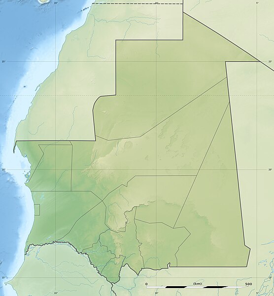
749:
Creative
Commons Attribution-ShareAlike 3.0 Unported
732:
497:, Version 1.2 or any later version published by the
182:
117:
Commons is a freely licensed media file repository.
1409:
1454:
1449:
1200:Módulu:Mapa de llocalización/datos/Mauritania/usu
464:https://creativecommons.org/licenses/by-sa/3.0
98:
1330:মডিউল:অবস্থান মানচিত্র/উপাত্ত/মৌরিতানিয়া/নথি
470:Creative Commons Attribution-Share Alike 3.0
394:
8:
1225:Qədim Uadan, Şinqetti, Tişit və Ualata ksarı
430:– to copy, distribute and transmit the work
1524:
876:
544:
529:You may select the license of your choice.
330:
1325:মডিউল:অবস্থান মানচিত্র/উপাত্ত/মৌরিতানিয়া
1167:The following other wikis use this file:
286:NGDC World Data Bank II (public domain);
1568:
1560:
1550:
1542:
1534:
1526:
1157:Module:Location map/data/Mauritania/doc
974:
852:
836:
816:
800:
782:
766:
746:
729:
713:
693:
677:
659:http://commons.wikimedia.org/User:Sting
595:
579:
562:
559:
540:
533:
361:
339:
220:Equirectangular projection, WGS84 datum
218:Scale: 1:4,400,000 (precision: 1,100 m)
139:
982:2008 Nouakchott Israeli embassy attack
160:View this and other nearby images on:
7:
1480:Liste von Kraftwerken in Mauretanien
509:http://www.gnu.org/copyleft/fdl.html
417:Attribution-Share Alike 3.0 Unported
335:Attribution and Share-Alike required
1400:Skabelon:Kortpositioner Mauretanien
1340:Šablon:Lokacijska karta Mauritanija
1300:Банк д'Арген (национален парк)
1152:Module:Location map/data/Mauritania
865:
405:
400:
1517:
1425:Vorlage:Positionskarte Mauretanien
553:
547:
528:
391:
387:
204:
192:
188:Mauritania relief location map.jpg
130:
76:
1350:Plantilya:Location map Mauritania
552:
839:coordinates of the point of view
538:
485:
484:
441:Under the following conditions:
412:This file is licensed under the
404:
399:
393:
364:
214:, destinée à la géolocalisation.
166:
152:
97:
31:
21:
1390:Národní park Banc d'Arguin
1215:Şablon:Yer xəritəsi Mavritaniya
535:
193:
14:
1370:داڕێژە:Location map Mauritania
534:
515:GNU Free Documentation License
504:GNU Free Documentation License
494:GNU Free Documentation License
205:
26:
1:
1220:Bank-d'Arqen Milli Parkı
819:original creation by uploader
371:Equivalent administrative map
343:Wikimedia Commons user: Sting
234:Geographic limits of the map:
36:
1360:Кеп:Меттиган карта Мавритани
609:object of statement has role
560:Items portrayed in this file
332:
294:Map Library (public domain).
225:Central meridian: 010° 57' W
210:Carte physique vierge de la
202:, for geo-location purposes.
1491:Usage on de.wikivoyage.org
1366:Usage on ckb.wikipedia.org
1346:Usage on ceb.wikipedia.org
1231:Usage on bar.wikipedia.org
1196:Usage on ast.wikipedia.org
1062:Friday Mosque of Nouakchott
854:21°0'0.000"N, 10°57'0.000"W
290:NGDC GSHHS (public domain);
1592:
1500:Modul:Location map data mr
1406:Usage on de.wikipedia.org
1396:Usage on da.wikipedia.org
1376:Usage on cs.wikipedia.org
1356:Usage on ce.wikipedia.org
1336:Usage on bs.wikipedia.org
1316:Usage on bn.wikipedia.org
1276:Usage on bg.wikipedia.org
1270:Шаблон:На карце/Маўрытанія
1256:Usage on be.wikipedia.org
1241:Usage on ba.wikipedia.org
1206:Usage on az.wikipedia.org
1185:قالب:خريطة مواقع موريتانيا
1181:Usage on ar.wikipedia.org
1171:Usage on af.wikipedia.org
977:2005 El Mreiti base attack
455:same or compatible license
1562:File change date and time
1380:Šablona:LocMap Mauritánie
1245:Ҡалып:ПозКарта Мавритания
866:
272:
16:
537:
499:Free Software Foundation
421:
229:Standard parallel: 21° N
104:This is a file from the
1470:Welterbe in Mauretanien
953:
932:13:47, 23 November 2009
923:
357:
318:
302:
267:
260:
257:
185:
108:. Information from its
1485:Nair (Arguin-Sandbank)
1052:Diawling National Park
198:Blank physical map of
172:21.000000; -10.950000
111:description page there
46:Size of this preview:
1536:Horizontal resolution
1285:Шаблон:ПК Мавритания
1017:Battle of Tabfarilla
70:1,283 × 1,384 pixels
1565:10:13, 19 July 2010
1556:Adobe Photoshop 7.0
1544:Vertical resolution
902:13:14, 19 July 2010
436:– to adapt the work
52:Other resolutions:
1047:Diadjibine Gandéga
1037:Dakhlet Nouadhibou
637:Wikimedia username
624:author name string
66:949 × 1,024 pixels
1579:
1578:
1509:more global usage
1163:Global file usage
1117:Nouadhibou Mosque
1067:Gogui, Mauritania
1027:Chinguetti Mosque
965:
716:copyright license
546:
526:
525:
378:
377:
353:
352:
327:
324:Reusing this file
251:Right: 004° 09' W
243:Bottom: 14° 09' N
177:
176:
126:
125:
106:Wikimedia Commons
32:Global file usage
1583:
1525:
1132:Richat Structure
1112:Marocaine Mosque
1077:Ibn Abass Mosque
1007:Atar, Mauritania
944:
914:
680:copyright status
661:
656:
646:
641:
631:
628:
618:
613:
522:
519:
516:
513:
510:
488:
487:
481:
477:
474:
471:
468:
465:
457:as the original.
414:Creative Commons
408:
407:
403:
402:
397:
396:
368:
331:
321:
278:Sources of data:
274:
263:
247:Left: 017° 45' W
209:
207:Français :
197:
189:
183:
173:
170:
156:
155:
149:
148:
137:
122:
101:
100:
94:
88:
86:
73:
62:712 × 768 pixels
58:445 × 480 pixels
54:222 × 240 pixels
48:556 × 600 pixels
1591:
1590:
1586:
1585:
1584:
1582:
1581:
1580:
1513:
1445:Arguin-Sandbank
1161:
1102:Lake R'Kiz
1057:Foum Gleita Dam
973:
966:
950:
942:
920:
912:
868:
867:
864:
863:
862:
861:
860:
859:
858:
857:
855:
845:
844:
843:
841:
830:
829:
828:
827:
826:
825:
824:
823:
821:
809:
808:
807:
805:
794:
793:
792:
791:
790:
789:
788:
787:
785:
775:
774:
773:
771:
760:
759:
758:
757:
756:
755:
754:
753:
751:
740:
739:
738:
737:
736:
734:
722:
721:
720:
718:
707:
706:
705:
704:
703:
702:
701:
700:
698:
686:
685:
684:
682:
671:
670:
669:
668:
667:
666:
665:
664:
663:
662:
657:
654:
648:
647:
642:
639:
633:
632:
629:
626:
620:
619:
614:
611:
602:
601:
600:
598:
588:
587:
586:
584:
573:
572:
571:
570:
569:
567:
551:
550:
549:
532:
531:
530:
520:
517:
514:
511:
508:
479:
478:
475:
472:
469:
466:
463:
462:
420:
409:
390:
389:
384:
379:
372:
369:
215:
203:
187:
171:
144:
143:
140:Camera location
135:
128:
127:
116:
115:
114:is shown below.
90:
84:
82:
75:
74:
51:
12:
11:
5:
1589:
1587:
1577:
1576:
1573:
1567:
1566:
1563:
1559:
1558:
1553:
1549:
1548:
1545:
1541:
1540:
1537:
1533:
1532:
1529:
1516:
1511:of this file.
1505:
1504:
1503:
1502:
1497:
1489:
1488:
1487:
1482:
1477:
1472:
1467:
1462:
1457:
1452:
1447:
1442:
1437:
1432:
1427:
1422:
1420:Ras Nouadhibou
1417:
1412:
1404:
1403:
1402:
1394:
1393:
1392:
1387:
1382:
1374:
1373:
1372:
1364:
1363:
1362:
1354:
1353:
1352:
1344:
1343:
1342:
1334:
1333:
1332:
1327:
1322:
1314:
1313:
1312:
1307:
1302:
1297:
1292:
1287:
1282:
1274:
1273:
1272:
1267:
1262:
1260:Сенегал (рака)
1254:
1253:
1252:
1247:
1239:
1238:
1237:
1229:
1228:
1227:
1222:
1217:
1212:
1204:
1203:
1202:
1194:
1193:
1192:
1187:
1179:
1178:
1177:
1165:
1164:
1160:
1159:
1154:
1149:
1144:
1139:
1134:
1129:
1127:Paul Soleillet
1124:
1119:
1114:
1109:
1104:
1099:
1094:
1089:
1084:
1082:Kediet ej Jill
1079:
1074:
1069:
1064:
1059:
1054:
1049:
1044:
1039:
1034:
1029:
1024:
1019:
1014:
1009:
1004:
999:
994:
989:
987:Agrour Amogjar
984:
979:
971:
970:
969:
964:
963:
952:
948:
945:
941:1,283 × 1,384
939:
934:
929:
926:
925:
922:
918:
915:
911:1,283 × 1,384
909:
904:
899:
895:
894:
891:
888:
885:
882:
879:
872:
871:
856:
853:
851:
850:
849:
848:
847:
846:
842:
837:
835:
834:
833:
832:
822:
817:
815:
814:
813:
812:
811:
810:
806:
803:source of file
801:
799:
798:
797:
796:
795:
786:
783:
781:
780:
779:
778:
777:
776:
772:
767:
765:
764:
763:
762:
761:
752:
747:
745:
744:
743:
742:
741:
735:
730:
728:
727:
726:
725:
724:
723:
719:
714:
712:
711:
710:
709:
708:
699:
694:
692:
691:
690:
689:
688:
687:
683:
678:
676:
675:
674:
673:
672:
650:
649:
635:
634:
622:
621:
607:
606:
605:
604:
603:
599:
596:
594:
593:
592:
591:
590:
589:
585:
580:
578:
577:
576:
575:
574:
568:
563:
561:
558:
557:
556:
555:
554:
543:
542:
539:
536:
527:
524:
523:
489:
461:
460:
459:
458:
448:
439:
438:
437:
431:
424:You are free:
411:
410:
392:
386:
385:
383:
380:
376:
375:
374:
373:
370:
363:
359:
358:Other versions
355:
354:
351:
350:
338:
337:
328:
316:
315:
304:
300:
299:
298:
297:
296:
295:
292:
288:
284:
269:
265:
264:
259:
255:
254:
253:
252:
249:
245:
241:
239:Top: 27° 51' N
232:
231:
227:
190:
181:
175:
174:
164:
158:
141:
134:
131:
129:
124:
123:
102:
92:
91:
45:
41:
40:
39:
34:
29:
24:
19:
13:
10:
9:
6:
4:
3:
2:
1588:
1574:
1572:
1569:
1564:
1561:
1557:
1554:
1552:Software used
1551:
1546:
1543:
1538:
1535:
1530:
1527:
1523:
1520:
1514:
1512:
1510:
1501:
1498:
1496:
1493:
1492:
1490:
1486:
1483:
1481:
1478:
1476:
1473:
1471:
1468:
1466:
1465:Kiaone-Inseln
1463:
1461:
1458:
1456:
1453:
1451:
1448:
1446:
1443:
1441:
1438:
1436:
1433:
1431:
1428:
1426:
1423:
1421:
1418:
1416:
1413:
1411:
1408:
1407:
1405:
1401:
1398:
1397:
1395:
1391:
1388:
1386:
1383:
1381:
1378:
1377:
1375:
1371:
1368:
1367:
1365:
1361:
1358:
1357:
1355:
1351:
1348:
1347:
1345:
1341:
1338:
1337:
1335:
1331:
1328:
1326:
1323:
1321:
1318:
1317:
1315:
1311:
1308:
1306:
1303:
1301:
1298:
1296:
1293:
1291:
1288:
1286:
1283:
1281:
1278:
1277:
1275:
1271:
1268:
1266:
1265:Адрар (плато)
1263:
1261:
1258:
1257:
1255:
1251:
1248:
1246:
1243:
1242:
1240:
1236:
1233:
1232:
1230:
1226:
1223:
1221:
1218:
1216:
1213:
1211:
1208:
1207:
1205:
1201:
1198:
1197:
1195:
1191:
1188:
1186:
1183:
1182:
1180:
1176:
1173:
1172:
1170:
1169:
1168:
1162:
1158:
1155:
1153:
1150:
1148:
1147:Tifoujar Pass
1145:
1143:
1140:
1138:
1135:
1133:
1130:
1128:
1125:
1123:
1120:
1118:
1115:
1113:
1110:
1108:
1105:
1103:
1100:
1098:
1095:
1093:
1090:
1088:
1085:
1083:
1080:
1078:
1075:
1073:
1070:
1068:
1065:
1063:
1060:
1058:
1055:
1053:
1050:
1048:
1045:
1043:
1040:
1038:
1035:
1033:
1030:
1028:
1025:
1023:
1022:Bay of Arguin
1020:
1018:
1015:
1013:
1010:
1008:
1005:
1003:
1000:
998:
995:
993:
990:
988:
985:
983:
980:
978:
975:
967:
961:
957:
951:
946:
940:
938:
935:
933:
930:
928:
927:
924:Color profile
921:
916:
910:
908:
905:
903:
900:
897:
896:
892:
889:
886:
883:
880:
878:
877:
875:
869:
840:
820:
804:
784:November 2009
770:
750:
733:
717:
697:
681:
660:
653:
645:
638:
625:
617:
610:
583:
566:
506:
505:
500:
496:
495:
490:
483:
482:
467:CC BY-SA 3.0
456:
452:
449:
446:
443:
442:
440:
435:
432:
429:
426:
425:
423:
422:
418:
415:
398:
381:
367:
362:
360:
356:
348:
344:
340:
336:
333:
329:
325:
320:
317:
313:
309:
305:
301:
293:
291:
289:
287:
285:
283:
281:
280:
279:
277:
276:
275:
270:
266:
262:November 2009
256:
250:
248:
246:
244:
242:
240:
238:
237:
236:
235:
230:
228:
226:
224:
223:
222:
221:
219:
216:
213:
208:
201:
196:
191:
184:
180:
179:
169:
165:
163:
162:OpenStreetMap
159:
157:
147:
142:
138:
132:
120:
113:
112:
107:
103:
96:
95:
89:
80:
79:Original file
71:
67:
63:
59:
55:
49:
44:
38:
35:
33:
30:
28:
25:
23:
20:
18:
15:
1575:Uncalibrated
1521:
1518:
1506:
1460:Kediet Ijill
1385:Kediet Ijill
1166:
1137:Saudi Mosque
1072:Gorgol River
1042:Dhar Tichitt
997:Amojjar Pass
873:
870:File history
616:photographer
502:
492:
450:
444:
433:
427:
334:
282:SRTM30 Plus;
271:
233:
217:
206:
194:
178:
119:You can help
109:
77:
22:File history
1571:Color space
1528:Orientation
1415:Mauretanien
1235:Mauretanien
1210:Ras-Naudibu
1175:Kaap Blanco
696:copyrighted
451:share alike
445:attribution
306:Eric Gaba (
186:Description
1495:Nouakchott
1320:নুওয়াকশুত
1250:Мавритания
1142:Ten Hamadi
1122:Nouakchott
1097:Lake Gabou
1092:Lac de Mâl
1087:Kouroudjel
968:File usage
960:Mauritanie
956:Mauritania
887:Dimensions
597:some value
319:Permission
212:Mauritanie
200:Mauritania
85:image/jpeg
27:File usage
1430:Aouelloul
884:Thumbnail
881:Date/Time
769:inception
382:Licensing
195:English:
1515:Metadata
1440:Tenoumer
1190:بحيرة كب
943:(256 KB)
913:(257 KB)
541:Captions
434:to remix
428:to share
419:license.
312:fr:Sting
273:Own work
37:Metadata
1280:Нуакшот
1012:Azougui
992:Amazmaz
898:current
893:Comment
582:creator
565:depicts
545:English
347:message
133:Summary
81:
1547:72 dpi
1539:72 dpi
1531:Normal
1410:Arguin
1310:Шинкит
1295:Зуерат
1290:Фдерик
303:Author
268:Source
150:
1507:View
1455:Tidra
1450:Kijji
1032:Dafor
949:Sting
919:Sting
644:Sting
630:Sting
308:Sting
1305:Кифа
890:User
521:true
518:true
512:GFDL
476:true
473:true
258:Date
17:File
652:URL
655::
640::
627::
612::
310:-
68:|
64:|
60:|
56:|
50:.
962:,
507:.
326:)
322:(
314:)
121:.
87:)
72:.
Text is available under the Creative Commons Attribution-ShareAlike License. Additional terms may apply.

