423:
357:
301:
231:
210:
194:
178:
162:
145:
441:
364:
316:
38:
308:
378:
330:
401:
447:
452:
86:
965:"}},"text\/plain":{"en":{"":"heading"}}},"{\"value\":{\"amount\":\"+292\",\"unit\":\"http:\\\/\\\/www.wikidata.org\\\/entity\\\/Q28390\"},\"type\":\"quantity\"}":{"text\/html":{"en":{"P7787":"292
1337:
961:
349:
502:– You must give appropriate credit, provide a link to the license, and indicate if changes were made. You may do so in any reasonable manner, but not in any way that suggests the licensor endorses you or your use.
52:
48:
42:
97:
65:
144:
356:
300:
230:
193:
962:
422:
209:
177:
161:
1336:
1331:
56:
37:
1281:
1082:
863:
754:
718:
371:
323:
883:
599:
582:
408:
827:
509:
653:
1247:
1210:
1173:
1136:
1102:
1066:
1032:
1003:
976:
891:
847:
785:
767:
702:
674:
661:
646:
1274:
934:
906:
876:
738:
619:
566:
811:
395:
255:
462:
1364:
The following pages on the
English Knowledge (XXG) use this file (pages on other projects are not listed):
249:
508:– If you remix, transform, or build upon the material, you must distribute your contributions under the
415:
on the
Geograph website for the photographer's contact details. The copyright on this image is owned by
1347:
459:
969:"}},"text\/plain":{"en":{"P7787":"292 degree"}}}}": -->
260:
242:
236:
223:
105:
272:
913:
898:
1368:
681:
261:
377:
329:
428:
92:
361:
267:
266:
313:
172:
1354:
Uploading geograph.org.uk image from https://www.geograph.org.uk/photo/2031878
188:
254:
417:
248:
237:
224:
204:
400:
412:
1304:
Click on a date/time to view the file as it appeared at that time.
243:
132:
Maldon from across the
Blackwater - geograph.org.uk - 2031878.jpg
363:
315:
340:
284:
80:
1025:
350:
51° 43′ 34.8″ N, 0° 41′ 36″ E
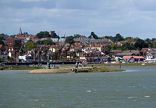
294:
51° 43′ 28.3″ N, 0° 42′ 17″ E
273:
126:
104:
Commons is a freely licensed media file repository.
1386:
755:
Creative
Commons Attribution-ShareAlike 2.0 Generic
70:(1,024 × 709 pixels, file size: 190 KB, MIME type:
519:https://creativecommons.org/licenses/by-sa/2.0
85:
525:Creative Commons Attribution-Share Alike 2.0
440:
8:
966:
485:– to copy, distribute and transmit the work
1306:
546:
421:
355:
299:
229:
208:
192:
176:
160:
143:
1379:The following other wikis use this file:
914:https://www.geograph.org.uk/photo/2031878
1263:3b09a5d5ddc232170cc22f74883ccbf58730b612
1366:
1261:
1245:
1224:
1208:
1187:
1171:
1150:
1134:
1116:
1100:
1080:
1064:
1046:
1030:
990:
974:
948:
932:
861:
845:
825:
809:
752:
736:
716:
700:
682:https://www.geograph.org.uk/profile/759
633:
617:
597:
580:
564:
561:
542:
535:
343:
287:
142:Maldon from across the Blackwater
370:View this and other nearby images on:
322:View this and other nearby images on:
7:
427:and is licensed for reuse under the
1295:
463:Attribution-Share Alike 2.0 Generic
451:
446:
431:Attribution-ShareAlike 2.0 license.
555:
549:
437:
406:
136:
117:
63:
775:Maldon from across the Blackwater
554:
550:Maldon from across the Blackwater
471:Maldon from across the Blackwater
977:coordinates of the point of view
540:
496:Under the following conditions:
458:This file is licensed under the
450:
445:
439:
399:
376:
362:
328:
314:
306:
84:
31:
21:
537:
14:
864:file available on the internet
536:
407:This image was taken from the
26:
1:
1033:coordinates of depicted place
305:
884:Geograph Britain and Ireland
647:object of statement has role
562:Items portrayed in this file
189:Geograph Britain and Ireland
1405:
1383:Usage on uz.wikipedia.org
777:
510:same or compatible license
1296:
1048:51°43'34.7"N, 0°41'35.9"E
992:51°43'28.2"N, 0°42'16.9"E
774:
16:
892:geograph.org.uk image ID
539:
476:
91:This is a file from the
1353:
200:
184:
171:
168:
129:
95:. Information from its
413:this photograph's page
382:51.726324; 0.693326
334:51.724534; 0.704660
98:description page there
41:Size of this preview:
473:by John Winfield
1275:determination method
1067:location of creation
491:– to adapt the work
47:Other resolutions:
1332:02:17, 21 May 2021
786:author name string
662:author name string
159:view, Maldon
57:1,024 × 709 pixels
1375:Global file usage
1357:
968:
739:copyright license
548:
436:
435:
411:collection. See
387:
386:
339:
338:
282:
281:
277:
217:Place of creation
113:
112:
93:Wikimedia Commons
32:Global file usage
1396:
1344:
1284:
1279:
1229:
1192:
1155:
1014:
1013:
1008:
916:
911:
907:described at URL
901:
896:
886:
881:
793:
790:
780:
779:
776:
772:
703:copyright status
684:
679:
669:
666:
656:
651:
532:
529:
526:
523:
520:
512:as the original.
474:
460:Creative Commons
454:
453:
449:
448:
443:
442:
429:Creative Commons
425:
409:Geograph project
403:
396:
392:
383:
380:
366:
365:
359:
353:
352:
341:
335:
332:
318:
317:
311:
310:
309:
303:
297:
296:
285:
275:
269:
263:
257:
251:
245:
239:
235:
233:
226:
212:
196:
180:
174:
164:
147:
141:
133:
127:
122:
109:
88:
87:
81:
75:
73:
60:
53:640 × 443 pixels
49:320 × 222 pixels
43:800 × 554 pixels
1404:
1403:
1399:
1398:
1397:
1395:
1394:
1393:
1373:
1369:Maldon District
1365:
1358:
1350:
1342:
1298:
1297:
1294:
1293:
1292:
1291:
1290:
1289:
1288:
1287:
1286:
1285:
1280:
1277:
1268:
1267:
1266:
1264:
1254:
1253:
1252:
1250:
1239:
1238:
1237:
1236:
1235:
1234:
1233:
1232:
1230:
1227:
1217:
1216:
1215:
1213:
1202:
1201:
1200:
1199:
1198:
1197:
1196:
1195:
1193:
1190:
1180:
1179:
1178:
1176:
1165:
1164:
1163:
1162:
1161:
1160:
1159:
1158:
1156:
1153:
1143:
1142:
1141:
1139:
1128:
1127:
1126:
1125:
1124:
1123:
1122:
1121:
1119:
1109:
1108:
1107:
1105:
1094:
1093:
1092:
1091:
1090:
1089:
1088:
1087:
1085:
1083:Heybridge Basin
1073:
1072:
1071:
1069:
1058:
1057:
1056:
1055:
1054:
1053:
1052:
1051:
1049:
1039:
1038:
1037:
1035:
1024:
1023:
1022:
1021:
1020:
1019:
1018:
1017:
1016:
1015:
1011:
1009:
1006:
997:
996:
995:
993:
983:
982:
981:
979:
960:
959:
958:
957:
956:
955:
954:
953:
951:
941:
940:
939:
937:
926:
925:
924:
923:
922:
921:
920:
919:
918:
917:
912:
909:
903:
902:
897:
894:
888:
887:
882:
879:
870:
869:
868:
866:
854:
853:
852:
850:
839:
838:
837:
836:
835:
834:
833:
832:
830:
818:
817:
816:
814:
803:
802:
801:
800:
799:
798:
797:
796:
795:
794:
791:
788:
782:
781:
773:
770:
761:
760:
759:
757:
745:
744:
743:
741:
730:
729:
728:
727:
726:
725:
724:
723:
721:
709:
708:
707:
705:
694:
693:
692:
691:
690:
689:
688:
687:
686:
685:
680:
677:
671:
670:
667:
664:
658:
657:
652:
649:
640:
639:
638:
636:
626:
625:
624:
622:
611:
610:
609:
608:
607:
606:
605:
604:
602:
591:
590:
589:
588:
587:
585:
573:
572:
571:
569:
553:
552:
551:
534:
533:
530:
527:
524:
521:
518:
517:
475:
469:
466:
455:
432:
394:
390:
381:
348:
347:
344:Object location
333:
307:
292:
291:
288:Camera location
283:
262:East of England
238:Heybridge Basin
225:Heybridge Basin
220:
156:
148:
137:
131:
124:
120:
115:
114:
103:
102:
101:is shown below.
77:
71:
69:
62:
61:
46:
12:
11:
5:
1402:
1400:
1392:
1391:
1390:
1389:
1377:
1376:
1372:
1371:
1363:
1362:
1361:
1356:
1355:
1352:
1348:
1345:
1339:
1334:
1329:
1325:
1324:
1321:
1318:
1315:
1312:
1309:
1302:
1301:
1273:
1272:
1271:
1270:
1269:
1265:
1262:
1260:
1259:
1258:
1257:
1256:
1255:
1251:
1246:
1244:
1243:
1242:
1241:
1240:
1231:
1225:
1223:
1222:
1221:
1220:
1219:
1218:
1214:
1209:
1207:
1206:
1205:
1204:
1203:
1194:
1188:
1186:
1185:
1184:
1183:
1182:
1181:
1177:
1172:
1170:
1169:
1168:
1167:
1166:
1157:
1151:
1149:
1148:
1147:
1146:
1145:
1144:
1140:
1135:
1133:
1132:
1131:
1130:
1129:
1120:
1117:
1115:
1114:
1113:
1112:
1111:
1110:
1106:
1101:
1099:
1098:
1097:
1096:
1095:
1086:
1081:
1079:
1078:
1077:
1076:
1075:
1074:
1070:
1065:
1063:
1062:
1061:
1060:
1059:
1050:
1047:
1045:
1044:
1043:
1042:
1041:
1040:
1036:
1031:
1029:
1028:
1027:
1026:
1002:
1001:
1000:
999:
998:
994:
991:
989:
988:
987:
986:
985:
984:
980:
975:
973:
972:
971:
970:
964:
952:
950:24 August 2010
949:
947:
946:
945:
944:
943:
942:
938:
933:
931:
930:
929:
928:
927:
905:
904:
890:
889:
875:
874:
873:
872:
871:
867:
862:
860:
859:
858:
857:
856:
855:
851:
848:source of file
846:
844:
843:
842:
841:
840:
831:
826:
824:
823:
822:
821:
820:
819:
815:
810:
808:
807:
806:
805:
804:
784:
783:
766:
765:
764:
763:
762:
758:
753:
751:
750:
749:
748:
747:
746:
742:
737:
735:
734:
733:
732:
731:
722:
717:
715:
714:
713:
712:
711:
710:
706:
701:
699:
698:
697:
696:
695:
673:
672:
660:
659:
645:
644:
643:
642:
641:
637:
634:
632:
631:
630:
629:
628:
627:
623:
618:
616:
615:
614:
613:
612:
603:
598:
596:
595:
594:
593:
592:
586:
581:
579:
578:
577:
576:
575:
574:
570:
565:
563:
560:
559:
558:
557:
556:
545:
544:
541:
538:
516:
515:
514:
513:
503:
494:
493:
492:
486:
479:You are free:
467:
457:
456:
438:
434:
433:
404:
393:
388:
385:
384:
374:
368:
345:
337:
336:
326:
320:
289:
280:
279:
274:United Kingdom
221:
218:
214:
213:
202:
198:
197:
186:
182:
181:
173:24 August 2010
170:
166:
165:
157:
154:
150:
149:
134:
125:
123:
118:
116:
111:
110:
89:
79:
78:
40:
36:
35:
34:
29:
24:
19:
13:
10:
9:
6:
4:
3:
2:
1401:
1388:
1385:
1384:
1382:
1381:
1380:
1374:
1370:
1367:
1359:
1351:
1346:
1340:
1338:
1335:
1333:
1330:
1327:
1326:
1322:
1319:
1316:
1313:
1310:
1308:
1307:
1305:
1299:
1283:
1276:
1249:
1212:
1175:
1138:
1104:
1084:
1068:
1034:
1005:
978:
936:
915:
908:
900:
893:
885:
878:
865:
849:
829:
813:
792:John Winfield
787:
769:
756:
740:
720:
704:
683:
676:
668:John Winfield
663:
655:
648:
621:
601:
584:
568:
522:CC BY-SA 2.0
511:
507:
504:
501:
498:
497:
495:
490:
487:
484:
481:
480:
478:
477:
472:
468:Attribution:
464:
461:
444:
430:
426:
424:
419:
418:John Winfield
414:
410:
405:
402:
398:
397:
389:
379:
375:
373:
372:OpenStreetMap
369:
367:
358:
351:
346:
342:
331:
327:
325:
324:OpenStreetMap
321:
319:
302:
295:
290:
286:
276:
270:
264:
258:
252:
246:
240:
232:
227:
222:
216:
215:
211:
206:
205:John Winfield
203:
199:
195:
190:
187:
183:
179:
167:
163:
158:
152:
151:
146:
140:
135:
128:
119:
107:
100:
99:
94:
90:
83:
82:
76:
67:
66:Original file
58:
54:
50:
44:
39:
33:
30:
28:
25:
23:
20:
18:
15:
1378:
1341:1,024 × 709
1303:
1300:File history
654:photographer
505:
499:
488:
482:
470:
416:
304:
138:
106:You can help
96:
64:
22:File history
1349:GeographBot
812:instance of
719:copyrighted
506:share alike
500:attribution
130:Description
1360:File usage
1317:Dimensions
1118:image/jpeg
1103:media type
828:photograph
635:some value
72:image/jpeg
27:File usage
1314:Thumbnail
1311:Date/Time
1137:data size
935:inception
778:(English)
391:Licensing
219:InfoField
155:InfoField
1343:(190 KB)
1248:checksum
1152:194,384
877:operator
543:Captions
489:to remix
483:to share
465:license.
139:English:
1328:current
1323:Comment
1004:heading
963:heading
899:2031878
620:creator
567:depicts
547:English
268:England
153:Depicts
121:Summary
68:
1387:Maldon
1226:1,024
1174:height
1012:degree
967:degree
600:Maldon
420:
360:
354:
312:
298:
244:Maldon
228:
207:
201:Author
191:
185:Source
175:
1282:SHA-1
1228:pixel
1211:width
1191:pixel
768:title
256:Essex
250:Essex
1320:User
1189:709
1154:byte
1010:292
583:view
531:true
528:true
169:Date
17:File
675:URL
1278::
1007::
910::
895::
880::
789::
771::
678::
665::
650::
55:|
51:|
45:.
278:)
271:→
265:→
259:→
253:→
247:→
241:→
234:(
108:.
74:)
59:.
Text is available under the Creative Commons Attribution-ShareAlike License. Additional terms may apply.
