218:
171:
224:
105:
67:
229:
560:
530:
500:
277:– You must give appropriate credit, provide a link to the license, and indicate if changes were made. You may do so in any reasonable manner, but not in any way that suggests the licensor endorses you or your use.
38:
647:
188:
131:
for more information. If an SVG form of this image is available, please upload it and afterwards replace this template with
324:
128:
186:; with no Invariant Sections, no Front-Cover Texts, and no Back-Cover Texts. A copy of the license is included in the section entitled
178:
445:
428:
392:
284:
376:
183:
148:
134:
412:
359:
78:
122:
46:
570:
559:
554:
529:
524:
238:
283:– If you remix, transform, or build upon the material, you must distribute your contributions under the
235:
578:
86:
165:
298:
176:
Permission is granted to copy, distribute and/or modify this document under the terms of the
118:
594:
540:
499:
494:
73:
37:
510:
692:
642:
632:
147:
It is recommended to name the SVG file “Map
Namjeju-gun.svg”—then the template
152:
467:
Click on a date/time to view the file as it appeared at that time.
612:
622:
297:
This licensing tag was added to this file as part of the GFDL
212:
99:
61:
682:
343:
Add a one-line explanation of what this file represents
677:
667:
657:
446:
Creative
Commons Attribution-ShareAlike 3.0 Unported
429:
182:, Version 1.2 or any later version published by the
85:
Commons is a freely licensed media file repository.
517:Reverted to version as of 16:59, 9 December 2004
51:(300 × 174 pixels, file size: 2 KB, MIME type:
304:http://creativecommons.org/licenses/by-sa/3.0/
66:
217:
8:
310:Creative Commons Attribution-Share Alike 3.0
260:– to copy, distribute and transmit the work
469:
339:
605:The following other wikis use this file:
127:. This has several advantages; see
592:
443:
426:
410:
390:
374:
357:
354:
335:
328:
7:
239:Attribution-Share Alike 3.0 Unported
194:http://www.gnu.org/copyleft/fdl.html
590:The following page uses this file:
458:
228:
223:
348:
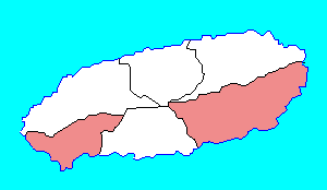
342:
110:
98:
44:
347:
333:
271:Under the following conditions:
234:This file is licensed under the
227:
222:
216:
170:
169:
103:
65:
31:
21:
330:
41:No higher resolution available.
14:
329:
200:GNU Free Documentation License
189:GNU Free Documentation License
179:GNU Free Documentation License
26:
1:
355:Items portrayed in this file
711:
689:Usage on zh.wikipedia.org
674:Usage on www.wikidata.org
664:Usage on vi.wikipedia.org
654:Usage on sv.wikipedia.org
639:Usage on ko.wikipedia.org
629:Usage on ja.wikipedia.org
619:Usage on id.wikipedia.org
609:Usage on fr.wikipedia.org
285:same or compatible license
115:image could be re-created
459:
243:
215:
129:Commons:Media for cleanup
16:
332:
184:Free Software Foundation
149:Vector version available
135:vector version available
72:This is a file from the
576:
546:
516:
76:. Information from its
555:16:59, 9 December 2004
79:description page there
572:Cinnamon~commonswiki
547:color and form match
155:) does not need the
613:District de Namjeju
525:16:20, 25 June 2011
495:22:58, 18 July 2011
266:– to adapt the work
47:Map_Namjeju-gun.png
577:{{GFDL}}made from
623:Kabupaten Namjeju
601:Global file usage
583:
413:copyright license
341:
321:
320:
211:
210:
164:
163:
94:
93:
74:Wikimedia Commons
32:Global file usage
702:
567:
537:
507:
377:copyright status
317:
314:
311:
308:
305:
302:
299:licensing update
287:as the original.
236:Creative Commons
231:
230:
226:
225:
220:
219:
213:
207:
204:
201:
198:
195:
173:
172:
166:
142:
107:
106:
100:
90:
69:
68:
62:
56:
54:
710:
709:
705:
704:
703:
701:
700:
699:
648:위키백과:대한민국 지도 목록
599:
584:
573:
565:
543:
535:
513:
505:
461:
460:
457:
456:
455:
454:
453:
452:
451:
450:
448:
437:
436:
435:
434:
433:
431:
419:
418:
417:
415:
404:
403:
402:
401:
400:
399:
398:
397:
395:
383:
382:
381:
379:
368:
367:
366:
365:
364:
362:
346:
345:
344:
315:
312:
309:
306:
303:
296:
205:
202:
199:
196:
193:
160:
132:
119:vector graphics
104:
96:
95:
84:
83:
82:is shown below.
58:
52:
50:
43:
42:
12:
11:
5:
708:
706:
698:
697:
696:
695:
687:
686:
685:
680:
672:
671:
670:
662:
661:
660:
652:
651:
650:
645:
637:
636:
635:
627:
626:
625:
617:
616:
615:
603:
602:
598:
597:
595:Namjeju County
588:
587:
582:
581:
575:
571:
568:
562:
557:
552:
549:
548:
545:
541:
538:
532:
527:
522:
519:
518:
515:
511:
508:
502:
497:
492:
488:
487:
484:
481:
478:
475:
472:
465:
464:
449:
444:
442:
441:
440:
439:
438:
432:
427:
425:
424:
423:
422:
421:
420:
416:
411:
409:
408:
407:
406:
405:
396:
391:
389:
388:
387:
386:
385:
384:
380:
375:
373:
372:
371:
370:
369:
363:
358:
356:
353:
352:
351:
350:
349:
338:
337:
334:
331:
319:
318:
293:
292:
291:
290:
289:
288:
278:
269:
268:
267:
261:
254:You are free:
249:
248:
245:
244:
242:
232:
209:
208:
174:
162:
161:
157:new image name
139:new image name
108:
97:
92:
91:
70:
60:
59:
40:
36:
35:
34:
29:
24:
19:
13:
10:
9:
6:
4:
3:
2:
707:
694:
691:
690:
688:
684:
681:
679:
676:
675:
673:
669:
666:
665:
663:
659:
656:
655:
653:
649:
646:
644:
641:
640:
638:
634:
631:
630:
628:
624:
621:
620:
618:
614:
611:
610:
608:
607:
606:
600:
596:
593:
591:
585:
580:
579:Maps of Korea
574:
569:
563:
561:
558:
556:
553:
551:
550:
544:
539:
533:
531:
528:
526:
523:
521:
520:
514:
509:
503:
501:
498:
496:
493:
490:
489:
485:
482:
479:
476:
473:
471:
470:
468:
462:
447:
430:
414:
394:
378:
361:
327:
326:
325:Maps of Korea
300:
295:
294:
286:
282:
279:
276:
273:
272:
270:
265:
262:
259:
256:
255:
253:
252:
251:
250:
247:
246:
240:
237:
233:
221:
214:
191:
190:
185:
181:
180:
175:
168:
167:
158:
154:
150:
146:
145:
140:
136:
130:
126:
124:
120:
114:
109:
102:
101:
88:
81:
80:
75:
71:
64:
63:
57:
48:
39:
33:
30:
28:
25:
23:
20:
18:
15:
604:
589:
466:
463:File history
322:
307:CC BY-SA 3.0
280:
274:
263:
257:
187:
177:
156:
144:
138:
116:
112:
87:You can help
77:
45:
22:File history
683:User:SR5/KR
393:copyrighted
281:share alike
275:attribution
113:locator map
586:File usage
564:300 × 174
534:300 × 174
504:300 × 174
480:Dimensions
323:made from
159:parameter.
27:File usage
477:Thumbnail
474:Date/Time
241:license.
53:image/png
542:Asfreeas
336:Captions
264:to remix
258:to share
678:Q490828
668:Namjeju
658:Namjeju
512:Hyolee2
491:current
486:Comment
360:depicts
340:English
49:
566:(2 KB)
536:(3 KB)
506:(2 KB)
121:as an
117:using
111:This
693:南濟州郡
643:남제주군
633:南済州郡
483:User
316:true
313:true
206:true
203:true
197:GFDL
151:(or
125:file
17:File
153:Vva
123:SVG
141:}}
133:{{
301:.
192:.
143:.
137:|
89:.
55:)
Text is available under the Creative Commons Attribution-ShareAlike License. Additional terms may apply.