203:
156:
209:
62:
214:
527:
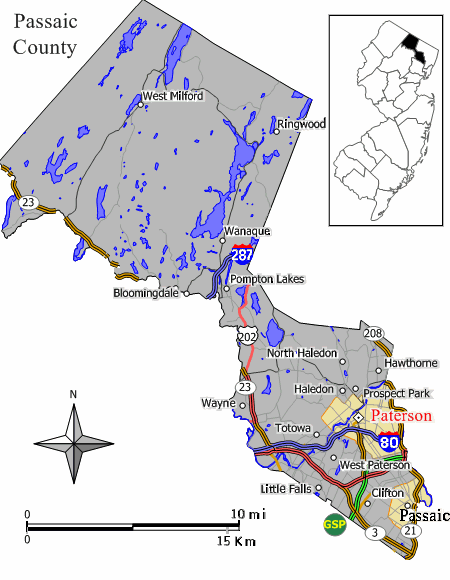
349:== Summary == Closeup view of Map of Paterson in ] (extracted from original map work by Jim Irwin, December 2005), with distance scale in miles/kilometers, Interstate-icons enlarged 50%, town names clarified, and edges cropped
262:– You must give appropriate credit, provide a link to the license, and indicate if changes were made. You may do so in any reasonable manner, but not in any way that suggests the licensor endorses you or your use.
114:(extracted from original map work by Jim Irwin, December 2005), with distance scale in miles/kilometers, Interstate-icons enlarged 50%, town names clarified, and edges cropped 130px (width 450px had been 580px).
33:
173:
73:
41:
171:; with no Invariant Sections, no Front-Cover Texts, and no Back-Cover Texts. A copy of the license is included in the section entitled
163:
472:
455:
419:
269:
403:
168:
439:
386:
111:
223:
558:
The following pages on the
English Knowledge (XXG) use this file (pages on other projects are not listed):
268:– If you remix, transform, or build upon the material, you must distribute your contributions under the
122:
562:
220:
526:
521:
32:
81:
150:
545:
283:
161:
Permission is granted to copy, distribute and/or modify this document under the terms of the
133:
343:
137:
68:
125:(cropped and magnified 30%, adding kilometer scale, and enlarging names/icons).
537:
494:
Click on a date/time to view the file as it appeared at that time.
282:
This licensing tag was added to this file as part of the GFDL
197:
56:
370:
Add a one-line explanation of what this file represents
314:
473:
Creative
Commons Attribution-ShareAlike 3.0 Unported
456:
167:, Version 1.2 or any later version published by the
100:
80:
Commons is a freely licensed media file repository.
317:. All following user names refer to en.wikipedia.
46:(450 × 580 pixels, file size: 40 KB, MIME type:
289:http://creativecommons.org/licenses/by-sa/3.0/
61:
202:
8:
295:Creative Commons Attribution-Share Alike 3.0
245:– to copy, distribute and transmit the work
496:
366:
319:
560:
470:
453:
437:
417:
401:
384:
381:
362:
355:
7:
224:Attribution-Share Alike 3.0 Unported
179:http://www.gnu.org/copyleft/fdl.html
485:
213:
208:
110:Closeup view of Map of Paterson in
375:
369:
313:The original description page was
312:
106:Map Passaic County Paterson NJ.gif
93:
42:Map_Passaic_County_Paterson_NJ.gif
39:
374:
360:
256:Under the following conditions:
219:This file is licensed under the
212:
207:
201:
155:
154:
60:
21:
544:Transferred from en.wikipedia (
357:
36:No higher resolution available.
14:
356:
185:GNU Free Documentation License
174:GNU Free Documentation License
164:GNU Free Documentation License
26:
1:
382:Items portrayed in this file
112:w:Passaic County, New Jersey
579:
270:same or compatible license
486:
228:
200:
16:
359:
169:Free Software Foundation
67:This is a file from the
543:
129:
118:
103:
71:. Information from its
522:23:38, 29 October 2018
123:w:File:Paterson nj.png
74:description page there
563:Paterson, New Jersey
337:2007-08-19 07:16:24
309:Original upload log
251:– to adapt the work
551:
440:copyright license
368:
354:
353:
306:
305:
196:
195:
143:
142:
89:
88:
69:Wikimedia Commons
570:
534:
404:copyright status
320:
302:
299:
296:
293:
290:
287:
284:licensing update
272:as the original.
221:Creative Commons
216:
215:
211:
210:
205:
204:
198:
192:
189:
186:
183:
180:
158:
157:
151:
107:
101:
85:
64:
63:
57:
51:
49:
578:
577:
573:
572:
571:
569:
568:
567:
559:
552:
540:
532:
488:
487:
484:
483:
482:
481:
480:
479:
478:
477:
475:
464:
463:
462:
461:
460:
458:
446:
445:
444:
442:
431:
430:
429:
428:
427:
426:
425:
424:
422:
410:
409:
408:
406:
395:
394:
393:
392:
391:
389:
373:
372:
371:
318:
311:
300:
297:
294:
291:
288:
281:
190:
187:
184:
181:
178:
149:
144:
105:
98:
91:
90:
79:
78:
77:is shown below.
53:
47:
45:
38:
37:
12:
11:
5:
576:
574:
566:
565:
557:
556:
555:
550:
549:
542:
538:
535:
529:
524:
519:
515:
514:
511:
508:
505:
502:
499:
492:
491:
476:
471:
469:
468:
467:
466:
465:
459:
454:
452:
451:
450:
449:
448:
447:
443:
438:
436:
435:
434:
433:
432:
423:
418:
416:
415:
414:
413:
412:
411:
407:
402:
400:
399:
398:
397:
396:
390:
385:
383:
380:
379:
378:
377:
376:
365:
364:
361:
358:
352:
351:
346:
341:
338:
334:
333:
330:
327:
324:
310:
307:
304:
303:
278:
277:
276:
275:
274:
273:
263:
254:
253:
252:
246:
239:You are free:
234:
233:
230:
229:
227:
217:
194:
193:
159:
148:
145:
141:
140:
131:
127:
126:
120:
116:
115:
108:
99:
97:
94:
92:
87:
86:
65:
55:
54:
35:
31:
30:
29:
24:
19:
13:
10:
9:
6:
4:
3:
2:
575:
564:
561:
553:
547:
541:
536:
530:
528:
525:
523:
520:
517:
516:
512:
509:
506:
503:
500:
498:
497:
495:
489:
474:
457:
441:
421:
405:
388:
350:
347:
345:
342:
339:
336:
335:
331:
328:
325:
322:
321:
316:
308:
285:
280:
279:
271:
267:
264:
261:
258:
257:
255:
250:
247:
244:
241:
240:
238:
237:
236:
235:
232:
231:
225:
222:
218:
206:
199:
176:
175:
170:
166:
165:
160:
153:
152:
146:
139:
135:
132:
128:
124:
121:
117:
113:
109:
102:
95:
83:
76:
75:
70:
66:
59:
58:
52:
43:
34:
28:
25:
23:
20:
18:
15:
493:
490:File history
348:
292:CC BY-SA 3.0
265:
259:
248:
242:
172:
162:
82:You can help
72:
40:
22:File history
420:copyrighted
266:share alike
260:attribution
104:Description
554:File usage
531:450 × 580
507:Dimensions
326:Dimensions
27:File usage
548:) (1.1.1)
504:Thumbnail
501:Date/Time
340:450 × 580
323:Date/Time
226:license.
147:Licensing
48:image/gif
363:Captions
332:Comment
249:to remix
243:to share
134:JimIrwin
533:(40 KB)
518:current
513:Comment
387:depicts
367:English
344:Wikid77
138:Wikid77
96:Summary
44:
130:Author
119:Source
539:FSock
546:MTC!
510:User
329:User
315:here
301:true
298:true
191:true
188:true
182:GFDL
17:File
136:,
286:.
177:.
84:.
50:)
Text is available under the Creative Commons Attribution-ShareAlike License. Additional terms may apply.