257:
193:
301:
86:
38:
348:
This map is published by the Kansas
Department of Transportation and is distributed to the public free of charge. KDOT makes no warranties, guarantees, or representations for accuracy of this information and assumes no liability for errors or omissions. Maps produced using tax payer dollars are
576:
256:
710:
197:
215:
The
Wikimedia Foundation has received an e-mail confirming that the copyright holder has approved publication under the terms mentioned on this page. This correspondence has been
730:
775:
880:
870:
805:
860:
755:
650:
160:
231:
487:
52:
48:
42:
690:
240:
65:
97:
209:
180:
670:
451:
415:
471:
399:
660:
247:
507:
435:
382:
226:
222:
665:
213:, you do not need to request permission as long as you follow any licensing requirements mentioned on this page.
885:
135:
612:
575:
570:
56:
37:
248:
https://ticket.wikimedia.org/otrs/index.pl?Action=AgentTicketZoom&TicketNumber=2013040310012673
105:
680:
632:
308:
204:
627:
617:
607:
622:
586:
92:
745:
138:, USA, is copied at a resolution of 300 pixels/inch from the original PDF file.
323:
Kansas
Department of Transportation grants anyone the right to use this work
146:
720:
239:
If you have questions about the archived correspondence, please use the
840:
765:
795:
327:, without any conditions, unless such conditions are required by law.
785:
740:
700:
543:
Click on a date/time to view the file as it appeared at that time.
171:
Designed and published by the Kansas
Department of Transportation.
845:
157:
850:
416:
copyrighted, dedicated to the public domain by copyright holder
593:
295:
187:
80:
825:
820:
830:
229:. The correspondence is available to trusted volunteers as
815:
319:
In some countries this may not be legally possible; if so:
207:
and may be used by anyone for any purpose. If you wish to
452:
released into the public domain by the copyright holder
366:
Add a one-line explanation of what this file represents
895:
124:
104:
Commons is a freely licensed media file repository.
681:Edwards County (kondado sa Tinipong Bansa, Kansas)
70:(814 × 698 pixels, file size: 124 KB, MIME type:
85:
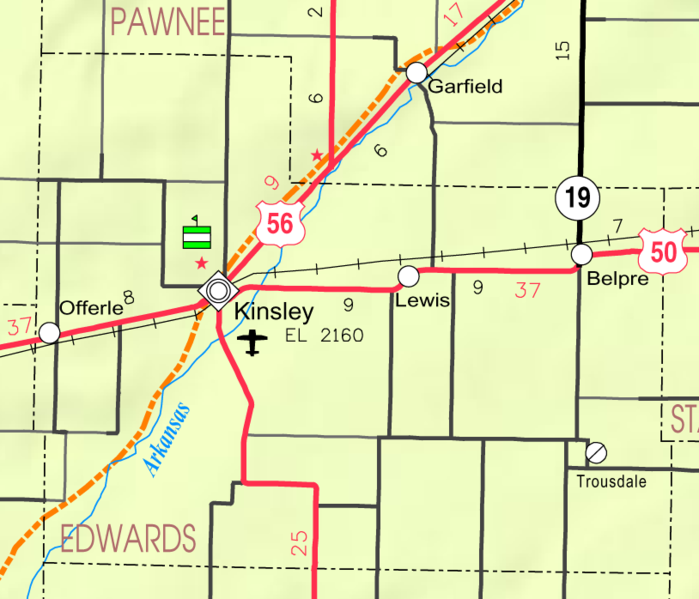
156:Kansas 2005–2006 Official Transportation Map
8:
545:
362:
275:
643:The following other wikis use this file:
605:
521:
505:
485:
469:
449:
433:
413:
397:
380:
377:
358:
351:
253:Find other files from the same ticket:
603:The following 6 pages use this file:
306:This work has been released into the
300:
192:
7:
223:Volunteer Response Team (VRT) member
534:
314:Kansas Department of Transportation
217:
371:
365:
117:
63:
370:
356:
299:
255:
191:
84:
31:
21:
353:
14:
837:Usage on simple.wikipedia.org
352:
130:Map of Edwards Co, Ks, USA.png
26:
1:
711:Κομητεία Έντουαρντς (Κάνσας)
472:Wikimedia VRTS ticket number
378:Items portrayed in this file
772:Usage on mzn.wikipedia.org
727:Usage on glk.wikipedia.org
721:Condado de Edwards (Kansas)
677:Usage on ceb.wikipedia.org
657:Usage on azb.wikipedia.org
914:
892:Usage on www.wikidata.org
877:Usage on ur.wikipedia.org
867:Usage on tt.wikipedia.org
857:Usage on sr.wikipedia.org
812:Usage on sh.wikipedia.org
802:Usage on ru.wikipedia.org
792:Usage on pl.wikipedia.org
782:Usage on no.wikipedia.org
766:Contea di Edwards (Kansas)
762:Usage on it.wikipedia.org
752:Usage on hy.wikipedia.org
737:Usage on hu.wikipedia.org
731:ادواردز ٚ شأرستان (کانزاس)
717:Usage on es.wikipedia.org
707:Usage on el.wikipedia.org
697:Usage on cy.wikipedia.org
687:Usage on ce.wikipedia.org
647:Usage on ar.wikipedia.org
796:Hrabstwo Edwards (Kansas)
535:
316:. This applies worldwide.
16:
776:ادواردز شهرستان (کانزاس)
746:Kansas megyéinek listája
355:
232:ticket #2013040310012673
190:
91:This is a file from the
871:Эдвардс (округ, Канзас)
806:Эдуардс (округ, Канзас)
786:Edwards County (Kansas)
592:
175:
167:
152:
145:
142:
127:
95:. Information from its
861:Округ Едвардс (Канзас)
841:Edwards County, Kansas
756:Էդվարդս շրջան (Կանզաս)
741:Edwards megye (Kansas)
701:Edwards County, Kansas
651:مقاطعة أدوردز (كانساس)
613:Edwards County, Kansas
136:Edwards County, Kansas
98:description page there
41:Size of this preview:
881:ایڈورڈز کاؤنٹی، کنساس
691:Эдвардс (гуо, Канзас)
349:free for public use.
571:04:59, 22 March 2006
47:Other resolutions:
227:permission archive
225:and stored in our
639:Global file usage
633:Trousdale, Kansas
596:
436:copyright license
364:
346:
345:
320:
294:
293:
268:
267:
264:
263:
254:
250:
244:
184:
181:Reusing this file
113:
112:
93:Wikimedia Commons
32:Global file usage
905:
583:
488:2013040310012673
400:copyright status
341:
338:
335:
332:
318:
303:
302:
296:
290:
287:
284:
281:
276:
259:
252:
245:
238:
219:
210:use this content
199:
195:
194:
188:
178:
148:
131:
125:
109:
88:
87:
81:
75:
73:
60:
57:814 × 698 pixels
53:560 × 480 pixels
49:280 × 240 pixels
43:699 × 599 pixels
913:
912:
908:
907:
906:
904:
903:
902:
846:Kinsley, Kansas
826:Offerle, Kansas
821:Kinsley, Kansas
671:کینزلئی، کانزاس
637:
628:Offerle, Kansas
618:Kinsley, Kansas
597:
589:
581:
537:
536:
533:
532:
531:
530:
529:
528:
527:
526:
524:
514:
513:
512:
510:
499:
498:
497:
496:
495:
494:
493:
492:
490:
478:
477:
476:
474:
463:
462:
461:
460:
459:
458:
457:
456:
454:
442:
441:
440:
438:
427:
426:
425:
424:
423:
422:
421:
420:
418:
406:
405:
404:
402:
391:
390:
389:
388:
387:
385:
369:
368:
367:
339:
336:
333:
330:
325:for any purpose
312:by its author,
288:
285:
282:
279:
274:
269:
241:VRT noticeboard
129:
122:
115:
114:
103:
102:
101:is shown below.
77:
71:
69:
62:
61:
46:
12:
11:
5:
911:
909:
901:
900:
899:
898:
890:
889:
888:
883:
875:
874:
873:
865:
864:
863:
855:
854:
853:
851:Belpre, Kansas
848:
843:
835:
834:
833:
831:Belpre, Kansas
828:
823:
818:
810:
809:
808:
800:
799:
798:
790:
789:
788:
780:
779:
778:
770:
769:
768:
760:
759:
758:
750:
749:
748:
743:
735:
734:
733:
725:
724:
723:
715:
714:
713:
705:
704:
703:
695:
694:
693:
685:
684:
683:
675:
674:
673:
668:
663:
655:
654:
653:
641:
640:
636:
635:
630:
625:
620:
615:
610:
608:Belpre, Kansas
601:
600:
595:
594:
591:
587:
584:
578:
573:
568:
564:
563:
560:
557:
554:
551:
548:
541:
540:
525:
522:
520:
519:
518:
517:
516:
515:
511:
506:
504:
503:
502:
501:
500:
491:
486:
484:
483:
482:
481:
480:
479:
475:
470:
468:
467:
466:
465:
464:
455:
450:
448:
447:
446:
445:
444:
443:
439:
434:
432:
431:
430:
429:
428:
419:
414:
412:
411:
410:
409:
408:
407:
403:
398:
396:
395:
394:
393:
392:
386:
381:
379:
376:
375:
374:
373:
372:
361:
360:
357:
354:
344:
343:
304:
292:
291:
273:
270:
266:
265:
262:
261:
201:
185:
173:
172:
169:
165:
164:
154:
150:
149:
144:
140:
139:
132:
123:
121:
118:
116:
111:
110:
89:
79:
78:
40:
36:
35:
34:
29:
24:
19:
13:
10:
9:
6:
4:
3:
2:
910:
897:
894:
893:
891:
887:
884:
882:
879:
878:
876:
872:
869:
868:
866:
862:
859:
858:
856:
852:
849:
847:
844:
842:
839:
838:
836:
832:
829:
827:
824:
822:
819:
817:
816:Lewis, Kansas
814:
813:
811:
807:
804:
803:
801:
797:
794:
793:
791:
787:
784:
783:
781:
777:
774:
773:
771:
767:
764:
763:
761:
757:
754:
753:
751:
747:
744:
742:
739:
738:
736:
732:
729:
728:
726:
722:
719:
718:
716:
712:
709:
708:
706:
702:
699:
698:
696:
692:
689:
688:
686:
682:
679:
678:
676:
672:
669:
667:
664:
662:
661:اوفرل، کانزاس
659:
658:
656:
652:
649:
648:
646:
645:
644:
638:
634:
631:
629:
626:
624:
623:Lewis, Kansas
621:
619:
616:
614:
611:
609:
606:
604:
598:
590:
585:
579:
577:
574:
572:
569:
566:
565:
561:
558:
555:
552:
549:
547:
546:
544:
538:
523:February 2005
509:
489:
473:
453:
437:
417:
401:
384:
350:
342:
334:Public domain
331:Public domain
328:
326:
321:
317:
315:
311:
310:
309:public domain
305:
298:
297:
283:Public domain
280:Public domain
278:
277:
271:
260:
258:
251:
249:
246:Ticket link:
242:
236:
234:
233:
228:
224:
220:
212:
211:
206:
203:This work is
202:
200:
189:
186:
182:
177:
174:
170:
166:
162:
158:
155:
151:
147:February 2005
141:
137:
133:
126:
119:
107:
100:
99:
94:
90:
83:
82:
76:
67:
66:Original file
58:
54:
50:
44:
39:
33:
30:
28:
25:
23:
20:
18:
15:
886:لوئیس، کنساس
666:بلپر، کانزاس
642:
602:
542:
539:File history
347:
329:
324:
322:
313:
307:
237:
230:
216:
214:
208:
196:
134:This map of
106:You can help
96:
64:
22:File history
128:Description
599:File usage
580:814 × 698
556:Dimensions
176:Permission
161:map legend
27:File usage
553:Thumbnail
550:Date/Time
508:inception
272:Licensing
72:image/png
588:Moverton
582:(124 KB)
359:Captions
218:reviewed
896:Q376764
567:current
562:Comment
383:depicts
363:English
120:Summary
68:
198:
168:Author
153:Source
340:false
337:false
289:false
286:false
221:by a
559:User
205:free
143:Date
17:File
235:.
55:|
51:|
45:.
243:.
183:)
179:(
163:)
159:(
108:.
74:)
59:.
Text is available under the Creative Commons Attribution-ShareAlike License. Additional terms may apply.
