261:
197:
305:
90:
38:
352:
This map is published by the Kansas
Department of Transportation and is distributed to the public free of charge. KDOT makes no warranties, guarantees, or representations for accuracy of this information and assumes no liability for errors or omissions. Maps produced using tax payer dollars are
260:
580:
201:
219:
The
Wikimedia Foundation has received an e-mail confirming that the copyright holder has approved publication under the terms mentioned on this page. This correspondence has been
714:
164:
235:
491:
56:
52:
48:
42:
664:
699:
244:
69:
213:
184:
101:
684:
679:
689:
455:
419:
475:
403:
669:
251:
704:
511:
439:
386:
764:
230:
226:
674:
217:, you do not need to request permission as long as you follow any licensing requirements mentioned on this page.
759:
607:
The following pages on the
English Knowledge (XXG) use this file (pages on other projects are not listed):
139:
646:
616:
579:
574:
252:
https://ticket.wikimedia.org/otrs/index.pl?Action=AgentTicketZoom&TicketNumber=2013040310012673
60:
37:
109:
641:
631:
621:
312:
208:
636:
626:
611:
590:
96:
142:, USA, is copied at a resolution of 300 pixels/inch from the original PDF file.
327:
Kansas
Department of Transportation grants anyone the right to use this work
150:
243:
If you have questions about the archived correspondence, please use the
739:
331:, without any conditions, unless such conditions are required by law.
724:
547:
Click on a date/time to view the file as it appeared at that time.
744:
734:
175:
Designed and published by the Kansas
Department of Transportation.
161:
420:
copyrighted, dedicated to the public domain by copyright holder
749:
597:
299:
191:
84:
233:. The correspondence is available to trusted volunteers as
323:
In some countries this may not be legally possible; if so:
211:
and may be used by anyone for any purpose. If you wish to
456:
released into the public domain by the copyright holder
370:
Add a one-line explanation of what this file represents
128:
108:
Commons is a freely licensed media file repository.
74:(1,070 × 830 pixels, file size: 295 KB, MIME type:
89:
160:Kansas 2005–2006 Official Transportation Map
8:
549:
366:
279:
657:The following other wikis use this file:
609:
525:
509:
489:
473:
453:
437:
417:
401:
384:
381:
362:
355:
257:Find other files from the same ticket:
310:This work has been released into the
304:
196:
7:
227:Volunteer Response Team (VRT) member
538:
318:Kansas Department of Transportation
221:
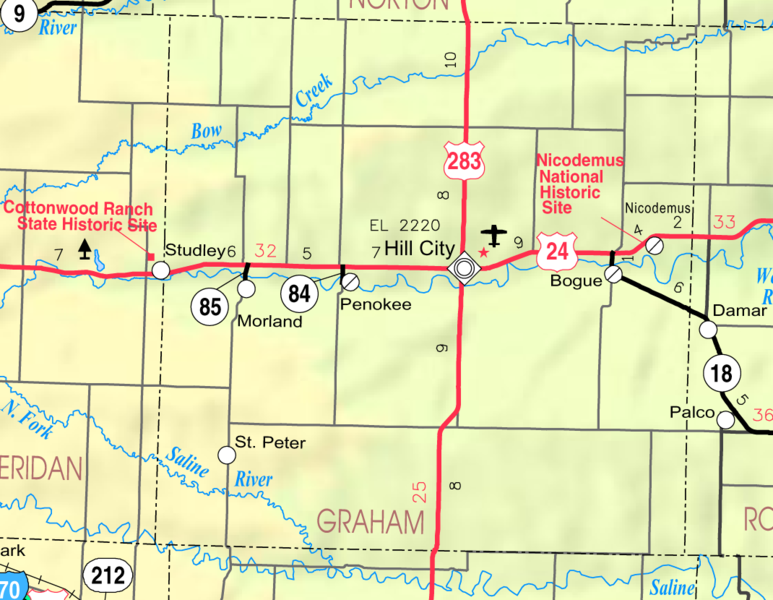
375:
369:
121:
67:
374:
360:
303:
259:
195:
88:
31:
21:
357:
14:
731:Usage on simple.wikipedia.org
356:
26:
1:
134:Map of Graham Co, Ks, USA.png
476:Wikimedia VRTS ticket number
382:Items portrayed in this file
661:Usage on azb.wikipedia.org
783:
756:Usage on zh.wikipedia.org
721:Usage on nl.wikipedia.org
711:Usage on mr.wikipedia.org
696:Usage on fa.wikipedia.org
539:
320:. This applies worldwide.
16:
359:
236:ticket #2013040310012673
194:
95:This is a file from the
596:
179:
171:
156:
149:
146:
131:
99:. Information from its
725:Graham County (Kansas)
102:description page there
41:Size of this preview:
740:Graham County, Kansas
647:User:Cataldoc/sandbox
617:Graham County, Kansas
353:free for public use.
140:Graham County, Kansas
575:05:55, 22 March 2006
47:Other resolutions:
231:permission archive
229:and stored in our
61:1,070 × 830 pixels
745:Hill City, Kansas
735:Nicodemus, Kansas
715:हिल सिटी (कॅन्सस)
700:نیکادیموس، کانزاس
685:ایست. پتر، کانزاس
665:نیکادیموس، کانزاس
653:Global file usage
642:St. Peter, Kansas
632:Nicodemus, Kansas
622:Hill City, Kansas
600:
440:copyright license
368:
350:
349:
324:
298:
297:
272:
271:
268:
267:
258:
254:
248:
188:
185:Reusing this file
117:
116:
97:Wikimedia Commons
32:Global file usage
774:
680:هیل سیتی، کانزاس
587:
492:2013040310012673
404:copyright status
345:
342:
339:
336:
322:
307:
306:
300:
294:
291:
288:
285:
280:
263:
256:
249:
242:
223:
214:use this content
203:
199:
198:
192:
182:
152:
135:
129:
113:
92:
91:
85:
79:
77:
64:
57:990 × 768 pixels
53:619 × 480 pixels
49:310 × 240 pixels
43:773 × 600 pixels
782:
781:
777:
776:
775:
773:
772:
771:
765:Talk:希爾城 (堪薩斯州)
690:مورلاند، کانزاس
651:
637:Penokee, Kansas
627:Morland, Kansas
608:
601:
593:
585:
541:
540:
537:
536:
535:
534:
533:
532:
531:
530:
528:
518:
517:
516:
514:
503:
502:
501:
500:
499:
498:
497:
496:
494:
482:
481:
480:
478:
467:
466:
465:
464:
463:
462:
461:
460:
458:
446:
445:
444:
442:
431:
430:
429:
428:
427:
426:
425:
424:
422:
410:
409:
408:
406:
395:
394:
393:
392:
391:
389:
373:
372:
371:
343:
340:
337:
334:
329:for any purpose
316:by its author,
292:
289:
286:
283:
278:
273:
245:VRT noticeboard
133:
126:
119:
118:
107:
106:
105:is shown below.
81:
75:
73:
66:
65:
46:
12:
11:
5:
780:
778:
770:
769:
768:
767:
762:
754:
753:
752:
747:
742:
737:
729:
728:
727:
719:
718:
717:
709:
708:
707:
702:
694:
693:
692:
687:
682:
677:
672:
667:
655:
654:
650:
649:
644:
639:
634:
629:
624:
619:
614:
606:
605:
604:
599:
598:
595:
591:
588:
582:
577:
572:
568:
567:
564:
561:
558:
555:
552:
545:
544:
529:
526:
524:
523:
522:
521:
520:
519:
515:
510:
508:
507:
506:
505:
504:
495:
490:
488:
487:
486:
485:
484:
483:
479:
474:
472:
471:
470:
469:
468:
459:
454:
452:
451:
450:
449:
448:
447:
443:
438:
436:
435:
434:
433:
432:
423:
418:
416:
415:
414:
413:
412:
411:
407:
402:
400:
399:
398:
397:
396:
390:
385:
383:
380:
379:
378:
377:
376:
365:
364:
361:
358:
348:
347:
308:
296:
295:
277:
274:
270:
269:
266:
265:
205:
189:
177:
176:
173:
169:
168:
158:
154:
153:
148:
144:
143:
136:
127:
125:
122:
120:
115:
114:
93:
83:
82:
40:
36:
35:
34:
29:
24:
19:
13:
10:
9:
6:
4:
3:
2:
779:
766:
763:
761:
758:
757:
755:
751:
750:Bogue, Kansas
748:
746:
743:
741:
738:
736:
733:
732:
730:
726:
723:
722:
720:
716:
713:
712:
710:
706:
705:پنوکی، کانزاس
703:
701:
698:
697:
695:
691:
688:
686:
683:
681:
678:
676:
673:
671:
670:پنوکی، کانزاس
668:
666:
663:
662:
660:
659:
658:
652:
648:
645:
643:
640:
638:
635:
633:
630:
628:
625:
623:
620:
618:
615:
613:
612:Bogue, Kansas
610:
602:
594:
589:
583:
581:
578:
576:
573:
570:
569:
565:
562:
559:
556:
553:
551:
550:
548:
542:
527:February 2005
513:
493:
477:
457:
441:
421:
405:
388:
354:
346:
338:Public domain
335:Public domain
332:
330:
325:
321:
319:
315:
314:
313:public domain
309:
302:
301:
287:Public domain
284:Public domain
282:
281:
275:
264:
262:
255:
253:
250:Ticket link:
246:
240:
238:
237:
232:
228:
224:
216:
215:
210:
207:This work is
206:
204:
193:
190:
186:
181:
178:
174:
170:
166:
162:
159:
155:
151:February 2005
145:
141:
137:
130:
123:
111:
104:
103:
98:
94:
87:
86:
80:
71:
70:Original file
62:
58:
54:
50:
44:
39:
33:
30:
28:
25:
23:
20:
18:
15:
675:بوقو، کانزاس
656:
584:1,070 × 830
546:
543:File history
351:
333:
328:
326:
317:
311:
241:
234:
220:
218:
212:
200:
138:This map of
110:You can help
100:
68:
22:File history
132:Description
760:希爾城 (堪薩斯州)
603:File usage
560:Dimensions
180:Permission
165:map legend
27:File usage
557:Thumbnail
554:Date/Time
512:inception
276:Licensing
76:image/png
592:Moverton
586:(295 KB)
363:Captions
222:reviewed
571:current
566:Comment
387:depicts
367:English
124:Summary
72:
202:
172:Author
157:Source
344:false
341:false
293:false
290:false
225:by a
563:User
209:free
147:Date
17:File
239:.
59:|
55:|
51:|
45:.
247:.
187:)
183:(
167:)
163:(
112:.
78:)
63:.
Text is available under the Creative Commons Attribution-ShareAlike License. Additional terms may apply.
