43:
207:
213:
218:
87:
486:
503:{{Information |Description={{en|Map of the municipal and township boundaries of {{w|Lorain County, Ohio|Lorain County}}, {{w|Ohio}}, {{w|United States}}, as of the 2000 census, with the location of {{w|Carlisle Township, Lorain County, Ohio|Carlisle To...
545:
259:– You must give appropriate credit, provide a link to the license, and indicate if changes were made. You may do so in any reasonable manner, but not in any way that suggests the licensor endorses you or your use.
53:
47:
98:
66:
171:
152:
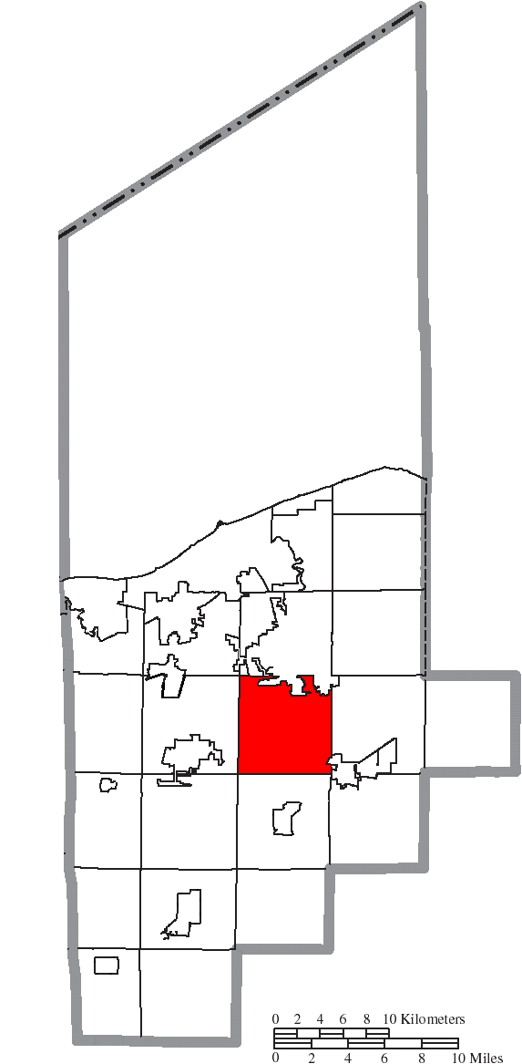
highlighted. Township borders are shown only in unincorporated areas in order to differentiate incorporated and unincorporated areas more clearly.
149:
565:
196:
397:
361:
485:
480:
57:
42:
578:
This file contains additional information, probably added from the digital camera or scanner used to create or digitize it.
266:
345:
417:
381:
328:
228:
581:
If the file has been modified from its original state, some details may not fully reflect the modified file.
517:
513:
The following pages on the
English Knowledge (XXG) use this file (pages on other projects are not listed):
265:– If you remix, transform, or build upon the material, you must distribute your contributions under the
225:
137:
566:
User:Addis-Bot/township/Category:Townships in Ohio by county/Carlisle
Township, Lorain County, Ohio
106:
181:
535:
145:
185:
93:
496:
161:
172:
File:Map of Lorain County Ohio With
Municipal and Township Labels.PNG
453:
Click on a date/time to view the file as it appeared at that time.
141:
81:
126:
Map of Lorain County Ohio
Highlighting Carlisle Township.png
312:
Add a one-line explanation of what this file represents
555:
398:
Creative
Commons Attribution-ShareAlike 3.0 Unported
120:
105:
Commons is a freely licensed media file repository.
71:(573 × 1,167 pixels, file size: 44 KB, MIME type:
136:Map of the municipal and township boundaries of
276:https://creativecommons.org/licenses/by-sa/3.0
148:, as of the 2000 census, with the location of
86:
282:Creative Commons Attribution-Share Alike 3.0
206:
8:
536:Carlisle udalerria, Lorain konderria (Ohio)
242:– to copy, distribute and transmit the work
583:
455:
308:
528:The following other wikis use this file:
593:
585:
515:
431:
415:
395:
379:
359:
343:
326:
323:
304:
297:
7:
229:Attribution-Share Alike 3.0 Unported
546:بخش کارلایل، شهرستان لوراین، اوهایو
444:
217:
212:
576:
317:
311:
203:
130:
118:
64:
316:
302:
253:Under the following conditions:
224:This file is licensed under the
216:
211:
205:
85:
31:
21:
299:
131:
14:
298:
26:
1:
36:
324:Items portrayed in this file
615:
562:Usage on zh.wikipedia.org
552:Usage on www.wikidata.org
542:Usage on fa.wikipedia.org
532:Usage on eu.wikipedia.org
267:same or compatible license
445:
16:
301:
233:
92:This is a file from the
518:Carlisle Township, Ohio
502:
191:
177:
167:
160:
157:
123:
96:. Information from its
99:description page there
46:Size of this preview:
587:Horizontal resolution
481:00:30, 17 August 2015
595:Vertical resolution
248:– to adapt the work
52:Other resolutions:
58:573 × 1,167 pixels
602:
601:
524:Global file usage
506:
382:copyright license
310:
295:
294:
200:
197:Reusing this file
150:Carlisle Township
114:
113:
94:Wikimedia Commons
32:Global file usage
606:
584:
493:
346:copyright status
289:
286:
283:
280:
277:
269:as the original.
226:Creative Commons
220:
219:
215:
214:
209:
208:
194:
163:
135:
127:
121:
110:
89:
88:
82:
76:
74:
61:
54:118 × 240 pixels
48:294 × 599 pixels
614:
613:
609:
608:
607:
605:
604:
603:
572:
522:
514:
507:
499:
491:
447:
446:
443:
442:
441:
440:
439:
438:
437:
436:
434:
424:
423:
422:
420:
409:
408:
407:
406:
405:
404:
403:
402:
400:
388:
387:
386:
384:
373:
372:
371:
370:
369:
368:
367:
366:
364:
352:
351:
350:
348:
337:
336:
335:
334:
333:
331:
315:
314:
313:
296:
291:
290:
287:
284:
281:
278:
275:
274:
232:
221:
153:
125:
116:
115:
104:
103:
102:is shown below.
78:
72:
70:
63:
62:
51:
12:
11:
5:
612:
610:
600:
599:
596:
592:
591:
588:
575:
571:
570:
569:
568:
560:
559:
558:
550:
549:
548:
540:
539:
538:
526:
525:
521:
520:
512:
511:
510:
505:
504:
501:
497:
494:
488:
483:
478:
474:
473:
470:
467:
464:
461:
458:
451:
450:
435:
432:
430:
429:
428:
427:
426:
425:
421:
416:
414:
413:
412:
411:
410:
401:
396:
394:
393:
392:
391:
390:
389:
385:
380:
378:
377:
376:
375:
374:
365:
360:
358:
357:
356:
355:
354:
353:
349:
344:
342:
341:
340:
339:
338:
332:
327:
325:
322:
321:
320:
319:
318:
307:
306:
303:
300:
293:
292:
273:
272:
271:
270:
260:
251:
250:
249:
243:
236:You are free:
223:
222:
204:
201:
189:
188:
179:
175:
174:
169:
165:
164:
159:
155:
154:
128:
119:
117:
112:
111:
90:
80:
79:
45:
41:
40:
39:
34:
29:
24:
19:
13:
10:
9:
6:
4:
3:
2:
611:
597:
594:
589:
586:
582:
579:
573:
567:
564:
563:
561:
557:
554:
553:
551:
547:
544:
543:
541:
537:
534:
533:
531:
530:
529:
523:
519:
516:
508:
500:
495:
489:
487:
484:
482:
479:
476:
475:
471:
468:
465:
462:
459:
457:
456:
454:
448:
433:8 August 2015
419:
399:
383:
363:
347:
330:
279:CC BY-SA 3.0
268:
264:
261:
258:
255:
254:
252:
247:
244:
241:
238:
237:
235:
234:
230:
227:
210:
202:
198:
193:
190:
187:
183:
180:
176:
173:
170:
166:
162:8 August 2015
156:
151:
147:
146:United States
143:
139:
138:Lorain County
134:
129:
122:
108:
101:
100:
95:
91:
84:
83:
77:
68:
67:Original file
59:
55:
49:
44:
38:
35:
33:
30:
28:
25:
23:
20:
18:
15:
580:
577:
527:
490:573 × 1,167
452:
449:File history
262:
256:
245:
239:
132:
107:You can help
97:
65:
22:File history
362:copyrighted
263:share alike
257:attribution
124:Description
509:File usage
466:Dimensions
192:Permission
27:File usage
463:Thumbnail
460:Date/Time
418:inception
182:Ruhrfisch
133:English:
73:image/png
598:37.8 dpc
590:37.8 dpc
574:Metadata
556:Q5041414
305:Captions
246:to remix
240:to share
231:license.
37:Metadata
498:Nyttend
492:(44 KB)
477:current
472:Comment
329:depicts
309:English
186:Nyttend
69:
178:Author
168:Source
469:User
288:true
285:true
184:and
158:Date
142:Ohio
17:File
144:,
140:,
56:|
50:.
199:)
195:(
109:.
75:)
60:.
Text is available under the Creative Commons Attribution-ShareAlike License. Additional terms may apply.