43:
277:
424:
213:
430:
172:
435:
95:
823:
276:
840:{{Information |Description=*Location maps for the 441 municipalities in the Netherlands. Boundaries 1/1/2009 *Automatically generated with script *File name contains "Municipality code" (CBS-code) as specified in: [http://www.cbs.nl/nl-NL/menu/methoden/c
476:– You must give appropriate credit, provide a link to the license, and indicate if changes were made. You may do so in any reasonable manner, but not in any way that suggests the licensor endorses you or your use.
217:
1032:
69:
65:
61:
235:
The
Wikimedia Foundation has received an e-mail confirming that the copyright holder has approved publication under the terms mentioned on this page. This correspondence has been
57:
53:
47:
152:
902:
78:
106:
251:
713:
887:
1002:
260:
147:
407:
229:
854:
677:
660:
593:
573:
151:
Created in svg using coordinate data derived from ESRI data published by
Centraal Bureau voor de Statistiek, Voorburg/Heerlen. (
185:
the copyright holder is properly attributed. Redistribution, derivative work, commercial use, and all other use is permitted.
1060:
This file contains additional information, probably added from the digital camera or scanner used to create or digitize it.
733:
623:
608:
483:
697:
616:
557:
267:
754:
726:
644:
601:
586:
540:
321:
Bij visualisering van gegevens met behulp van het digitale bestand Wijk- en buurtkaart 2005 dient te worden vermeld:
345:
Bij visualisering van gegevens met behulp van het digitale bestand "Bevolkingskernen 2001" dient te worden vermeld:
246:
242:
822:
817:
42:
233:, you do not need to request permission as long as you follow any licensing requirements mentioned on this page.
932:
445:
357:
Unless otherwise specified, data on waterways and lakes are from the public domain
Digital Chart of the World.
1063:
If the file has been modified from its original state, some details may not fully reflect the modified file.
333:
Bij visualisering van gegevens met behulp van het digitale bestand CBS/TOPgrenzen dient te worden vermeld:
482:– If you remix, transform, or build upon the material, you must distribute your contributions under the
442:
1042:
268:
https://ticket.wikimedia.org/otrs/index.pl?Action=AgentTicketZoom&TicketNumber=2007041210008226
114:
393:
833:
339:
Grenzen ondergrond: © 2003, Centraal Bureau voor de
Statistiek/Topografische Dienst Kadaster
289:
This image is (in part or entirely) based on geographical data from
Statistics Netherlands (
224:
942:
157:
Color coding and original design (slightly adpated by me) by user Mtcv (2006/2007) (
389:
101:
1047:
907:
892:
992:
327:
Bron: © 2006, Centraal Bureau voor de
Statistiek / Topografische Dienst Kadaster
140:
Location maps for the 441 municipalities in the
Netherlands. Boundaries 1/1/2009
293:). Digital geometry files in ESRI format can be downloaded from their website
166:
298:
In particular, boundary data of statistical districts is based on either the
158:
987:
927:
917:
859:
371:
1022:
967:
259:
If you have questions about the archived correspondence, please use the
957:
790:
Click on a date/time to view the file as it appeared at that time.
146:
File name contains "Municipality code" (CBS-code) as specified in:
207:
89:
249:. The correspondence is available to trusted volunteers as
227:
and may be used by anyone for any purpose. If you wish to
83:(SVG file, nominally 300 × 160 pixels, file size: 531 KB)
1012:
524:
Add a one-line explanation of what this file represents
977:
952:
877:
294:
193:
178:
678:
Creative
Commons Attribution-ShareAlike 3.0 Unported
128:
113:
Commons is a freely licensed media file repository.
351:Bron: © 2005, Centraal Bureau voor de Statistiek
493:https://creativecommons.org/licenses/by-sa/3.0
94:
499:Creative Commons Attribution-Share Alike 3.0
423:
8:
134:Map - NL - Municipality code 0569 (2009).svg
459:– to copy, distribute and transmit the work
46:Size of this PNG preview of this SVG file:
1065:
792:
520:
285:
933:Hollandia önkormányzatai népesség alapján
870:The following other wikis use this file:
306:("CBS/TOPgrenzen"). Data on localities (
1075:
1067:
852:
768:
752:
711:
695:
675:
658:
642:
571:
555:
538:
535:
516:
509:
273:Find other files from the same ticket:
850:The following 2 pages use this file:
212:
7:
446:Attribution-Share Alike 3.0 Unported
243:Volunteer Response Team (VRT) member
993:Tabel van gemeenten in Zuid-Holland
781:
434:
429:
237:
177:The copyright holder of this file,
143:Automatically generated with script
1058:
529:
523:
420:
312:Bevolkingskernen in Nederland 2001
291:Centraal Bureau voor de Statistiek
194:Centraal Bureau voor de Statistiek
179:Centraal Bureau voor de Statistiek
126:
76:
855:Municipalities of the Netherlands
528:
514:
470:Under the following conditions:
441:This file is licensed under the
433:
428:
422:
275:
211:
170:
93:
31:
21:
988:Lijst van Nederlandse gemeenten
918:Liste des communes des Pays-Bas
511:
14:
1072:Nederlandse gemeente Nieuwkoop
510:
398:) 22:59, 24 January 2009 (UTC)
317:Conditions of use (in Dutch):
183:for any purpose, provided that
26:
1:
1023:Hollanda belediyeleri listesi
36:
968:Index communium Nederlandiae
698:Wikimedia VRTS ticket number
536:Items portrayed in this file
1080:Database fields = "GM_NAAM"
1009:Usage on stq.wikipedia.org
310:) are from the publication
1097:
1039:Usage on zh.wikipedia.org
1033:Муніципалітет (Нідерланди)
1029:Usage on uk.wikipedia.org
1019:Usage on tr.wikipedia.org
999:Usage on ru.wikipedia.org
984:Usage on nl.wikipedia.org
974:Usage on ms.wikipedia.org
964:Usage on la.wikipedia.org
949:Usage on it.wikipedia.org
939:Usage on hy.wikipedia.org
928:Szerkesztő:B.Zsolt/holland
924:Usage on hu.wikipedia.org
914:Usage on fr.wikipedia.org
899:Usage on fa.wikipedia.org
884:Usage on ar.wikipedia.org
874:Usage on af.wikipedia.org
484:same or compatible license
414:Attribution ShareAlike 3.0
181:, allows anyone to use it
782:
381:own work , using CBS data
171:
169:
16:
661:attribution only license
594:attribution only license
513:
450:
304:Wijk- en buurtkaart 2003
300:Wijk- en buurtkaart 2005
252:ticket #2007041210008226
210:
100:This is a file from the
839:
402:
385:
377:
370:
367:
131:
104:. Information from its
958:Comuni dei Paesi Bassi
903:فهرست شهرستانهای هلند
818:22:59, 24 January 2009
624:Statistics Netherlands
107:description page there
70:2,560 × 1,365 pixels
888:قائمة بلديات هولندا
465:– to adapt the work
52:Other resolutions:
1003:Общины Нидерландов
247:permission archive
245:and stored in our
66:1,280 × 683 pixels
62:1,024 × 546 pixels
1084:
1083:
866:Global file usage
843:
645:copyright license
587:copyright license
522:
418:
417:
411:
408:Reusing this file
363:
362:
358:
284:
283:
274:
270:
264:
206:
205:
122:
121:
102:Wikimedia Commons
32:Global file usage
1088:
1066:
830:
736:
731:
714:2007041210008226
626:
621:
617:copyright holder
611:
606:
596:
591:
558:copyright status
506:
503:
500:
497:
494:
486:as the original.
443:Creative Commons
437:
436:
432:
431:
426:
425:
405:
396:
373:
356:
308:bevolkingskernen
286:
279:
272:
265:
258:
239:
230:use this content
219:
215:
214:
208:
201:
174:
173:
167:
135:
129:
118:
97:
96:
90:
84:
73:
58:640 × 341 pixels
54:320 × 171 pixels
48:300 × 160 pixels
1096:
1095:
1091:
1090:
1089:
1087:
1086:
1085:
1054:
864:
844:
836:
828:
784:
783:
780:
779:
778:
777:
776:
775:
774:
773:
771:
761:
760:
759:
757:
746:
745:
744:
743:
742:
741:
740:
739:
738:
737:
734:geographic data
732:
729:
727:applies to part
720:
719:
718:
716:
704:
703:
702:
700:
689:
688:
687:
686:
685:
684:
683:
682:
680:
669:
668:
667:
666:
665:
663:
651:
650:
649:
647:
636:
635:
634:
633:
632:
631:
630:
629:
628:
627:
622:
619:
613:
612:
609:geographic data
607:
604:
602:applies to part
598:
597:
592:
589:
580:
579:
578:
576:
564:
563:
562:
560:
549:
548:
547:
546:
545:
543:
527:
526:
525:
508:
507:
504:
501:
498:
495:
492:
491:
449:
438:
419:
394:
261:VRT noticeboard
199:
197:
196:
133:
124:
123:
112:
111:
110:is shown below.
86:
82:
75:
74:
51:
12:
11:
5:
1094:
1092:
1082:
1081:
1078:
1074:
1073:
1070:
1057:
1053:
1052:
1051:
1050:
1045:
1037:
1036:
1035:
1027:
1026:
1025:
1017:
1016:
1015:
1007:
1006:
1005:
997:
996:
995:
990:
982:
981:
980:
972:
971:
970:
962:
961:
960:
955:
947:
946:
945:
937:
936:
935:
930:
922:
921:
920:
912:
911:
910:
905:
897:
896:
895:
890:
882:
881:
880:
868:
867:
863:
862:
857:
848:
847:
842:
841:
838:
834:
831:
825:
820:
815:
811:
810:
807:
804:
801:
798:
795:
788:
787:
772:
769:
767:
766:
765:
764:
763:
762:
758:
753:
751:
750:
749:
748:
747:
725:
724:
723:
722:
721:
717:
712:
710:
709:
708:
707:
706:
705:
701:
696:
694:
693:
692:
691:
690:
681:
676:
674:
673:
672:
671:
670:
664:
659:
657:
656:
655:
654:
653:
652:
648:
643:
641:
640:
639:
638:
637:
615:
614:
600:
599:
585:
584:
583:
582:
581:
577:
572:
570:
569:
568:
567:
566:
565:
561:
556:
554:
553:
552:
551:
550:
544:
539:
537:
534:
533:
532:
531:
530:
519:
518:
515:
512:
490:
489:
488:
487:
477:
468:
467:
466:
460:
453:You are free:
440:
439:
421:
416:
415:
412:
400:
399:
387:
383:
382:
379:
375:
374:
369:
365:
364:
361:
360:
354:
353:
347:
346:
342:
341:
335:
334:
330:
329:
323:
322:
282:
281:
221:
204:
203:
192:
190:
187:
186:
175:
162:
161:
155:
149:
144:
141:
136:
127:
125:
120:
119:
98:
88:
87:
45:
41:
40:
39:
34:
29:
24:
19:
13:
10:
9:
6:
4:
3:
2:
1093:
1079:
1076:
1071:
1068:
1064:
1061:
1055:
1049:
1046:
1044:
1041:
1040:
1038:
1034:
1031:
1030:
1028:
1024:
1021:
1020:
1018:
1014:
1011:
1010:
1008:
1004:
1001:
1000:
998:
994:
991:
989:
986:
985:
983:
979:
976:
975:
973:
969:
966:
965:
963:
959:
956:
954:
951:
950:
948:
944:
941:
940:
938:
934:
931:
929:
926:
925:
923:
919:
916:
915:
913:
909:
906:
904:
901:
900:
898:
894:
891:
889:
886:
885:
883:
879:
876:
875:
873:
872:
871:
865:
861:
858:
856:
853:
851:
845:
837:
832:
826:
824:
821:
819:
816:
813:
812:
808:
805:
802:
799:
796:
794:
793:
791:
785:
756:
735:
728:
715:
699:
679:
662:
646:
625:
618:
610:
603:
595:
588:
575:
559:
542:
496:CC BY-SA 3.0
485:
481:
478:
475:
472:
471:
469:
464:
461:
458:
455:
454:
452:
451:
447:
444:
427:
413:
409:
404:
401:
397:
391:
388:
384:
380:
376:
366:
359:
352:
349:
348:
344:
343:
340:
337:
336:
332:
331:
328:
325:
324:
320:
319:
318:
315:
313:
309:
305:
301:
295:
292:
288:
287:
280:
278:
271:
269:
266:Ticket link:
262:
256:
254:
253:
248:
244:
240:
232:
231:
226:
223:This work is
222:
220:
209:
202:
195:
191:Attribution:
189:
188:
184:
180:
176:
168:
165:
164:
159:
156:
153:
150:
148:
145:
142:
139:
138:
137:
130:
116:
109:
108:
103:
99:
92:
91:
85:
80:
79:Original file
71:
67:
63:
59:
55:
49:
44:
38:
35:
33:
30:
28:
25:
23:
20:
18:
15:
1062:
1059:
869:
849:
789:
786:File history
770:January 2009
479:
473:
462:
456:
372:January 2009
355:
350:
338:
326:
316:
311:
307:
303:
299:
297:
290:
257:
250:
236:
234:
228:
216:
198:
182:
163:
115:You can help
105:
77:
22:File history
1077:Image title
1069:Short title
835:Michiel1972
574:copyrighted
480:share alike
474:attribution
390:Michiel1972
200:Attribution
132:Description
846:File usage
827:300 × 160
803:Dimensions
403:Permission
27:File usage
1013:Nieuwkoop
978:Nieuwkoop
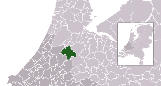
953:Nieuwkoop
878:Nieuwkoop
860:Nieuwkoop
800:Thumbnail
797:Date/Time
755:inception
302:, or the
1056:Metadata
829:(531 KB)
517:Captions
463:to remix
457:to share
448:license.
238:reviewed
37:Metadata
943:Նիուկոպ
814:current
809:Comment
541:depicts
521:English
81:
1043:荷兰市镇列表
908:نیوکوپ
893:نيوكوب
386:Author
378:Source
218:
241:by a
1048:尼乌科普
806:User
505:true
502:true
395:talk
368:Date
225:free
17:File
730::
620::
605::
590::
314:.
296:.
255:.
68:|
64:|
60:|
56:|
50:.
410:)
406:(
392:(
263:.
160:)
154:)
117:.
72:.
Text is available under the Creative Commons Attribution-ShareAlike License. Additional terms may apply.

.svg)