376:
309:
259:
301:
251:
323:
273:
344:
382:
387:
62:
907:"}},"text\/plain":{"en":{"":"heading"}}},"{\"value\":{\"amount\":\"+270\",\"unit\":\"http:\\\/\\\/www.wikidata.org\\\/entity\\\/Q28390\"},\"type\":\"quantity\"}":{"text\/html":{"en":{"P7787":"270
807:"}},"text\/plain":{"en":{"":"heading"}}},"{\"value\":{\"amount\":\"+270\",\"unit\":\"http:\\\/\\\/www.wikidata.org\\\/entity\\\/Q28390\"},\"type\":\"quantity\"}":{"text\/html":{"en":{"P7787":"270
803:
292:
242:
33:
434:– You must give appropriate credit, provide a link to the license, and indicate if changes were made. You may do so in any reasonable manner, but not in any way that suggests the licensor endorses you or your use.
41:
73:
1074:
904:
804:
179:
705:
669:
633:
514:
316:
266:
890:
755:
351:
1042:
1037:
441:
32:
596:
974:
945:
918:
874:
845:
818:
718:
689:
617:
589:
574:
561:
776:
748:
733:
653:
534:
498:
338:
397:
440:– If you remix, transform, or build upon the material, you must distribute your contributions under the
358:
on the
Geograph website for the photographer's contact details. The copyright on this image is owned by
394:
105:
911:"}},"text\/plain":{"en":{"P7787":"270 degree"}}}}": -->
811:"}},"text\/plain":{"en":{"P7787":"270 degree"}}}}": -->
81:
100:
740:
725:
581:
195:
322:
272:
1053:
363:
68:
211:
256:
306:
147:
158:
168:
343:
355:
1010:
Click on a date/time to view the file as it appeared at that time.
308:
258:
283:
233:
56:
293:
51° 27′ 40.4″ N, 2° 19′ 00″ W
243:
51° 27′ 40.4″ N, 2° 18′ 59″ W
482:
Add a one-line explanation of what this file represents
186:
Creative
Commons Attribution Share-alike license 2.0
122:
94:
80:
Commons is a freely licensed media file repository.
1075:
670:
Creative
Commons Attribution-ShareAlike 2.0 Generic
128:
Marshfield House, Marshfield (geograph 4845730).jpg
42:
Marshfield_House,_Marshfield_(geograph_4845730).jpg
46:(640 × 480 pixels, file size: 120 KB, MIME type:
451:https://creativecommons.org/licenses/by-sa/2.0
61:
457:Creative Commons Attribution-Share Alike 2.0
375:
8:
908:
808:
417:– to copy, distribute and transmit the work
1012:
478:
741:https://www.geograph.org.uk/photo/4845730
582:https://www.geograph.org.uk/profile/4582
1072:
988:
972:
932:
916:
888:
872:
832:
816:
790:
774:
703:
687:
667:
651:
631:
615:
548:
532:
512:
496:
493:
474:
467:
286:
236:
1060:Transferred from geograph.co.uk using
315:View this and other nearby images on:
265:View this and other nearby images on:
7:
362:and is licensed for reuse under the
1070:The following page uses this file:
1001:
398:Attribution-Share Alike 2.0 Generic
386:
381:
366:Attribution-ShareAlike 2.0 license.
487:
481:
372:
349:
132:
98:
93:
39:
486:
819:coordinates of the point of view
472:
428:Under the following conditions:
393:This file is licensed under the
385:
380:
374:
342:
321:
307:
299:
271:
257:
249:
60:
21:
469:
133:
36:No higher resolution available.
14:
706:file available on the internet
468:
350:This image was taken from the
26:
1:
919:coordinates of depicted place
834:51°27'40.381"N, 2°18'58.788"W
756:Geograph Britain and Ireland
590:object of statement has role
494:Items portrayed in this file
298:
248:
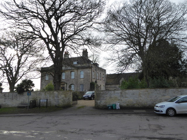
226:Marshfield House, Marshfield
207:Marshfield House, Marshfield
138:Marshfield House, Marshfield
1091:
934:51°27'40.39"N, 2°19'0.34"W
442:same or compatible license
1002:
224:Eirian Evans /
205:Eirian Evans /
16:
1038:23:48, 23 September 2018
719:geograph.org.uk image ID
471:
408:
67:This is a file from the
1059:
196:required by the license
174:
164:
153:
146:
143:
125:
71:. Information from its
356:this photograph's page
327:51.461220; -2.316760
277:51.461217; -2.316330
74:description page there
891:South Gloucestershire
875:location of creation
423:– to adapt the work
99:This is a photo of
562:author name string
1063:
910:
810:
654:copyright license
480:
371:
370:
354:collection. See
332:
331:
282:
281:
231:
230:
199:
183:
180:Reusing this file
115:
114:
89:
88:
69:Wikimedia Commons
1082:
1050:
956:
955:
950:
856:
855:
850:
758:
753:
743:
738:
734:described at URL
728:
723:
618:copyright status
599:
594:
584:
579:
569:
566:
515:Marshfield House
464:
461:
458:
455:
452:
444:as the original.
406:
395:Creative Commons
389:
388:
384:
383:
378:
377:
364:Creative Commons
352:Geograph project
346:
339:
328:
325:
311:
310:
304:
303:
302:
296:
295:
284:
278:
275:
261:
260:
254:
253:
252:
246:
245:
234:
193:
177:
149:
137:
129:
123:
108:
95:
85:
64:
63:
57:
51:
49:
1090:
1089:
1085:
1084:
1083:
1081:
1080:
1079:
1064:
1056:
1048:
1004:
1003:
1000:
999:
998:
997:
996:
995:
994:
993:
991:
981:
980:
979:
977:
966:
965:
964:
963:
962:
961:
960:
959:
958:
957:
953:
951:
948:
939:
938:
937:
935:
925:
924:
923:
921:
902:
901:
900:
899:
898:
897:
896:
895:
893:
881:
880:
879:
877:
866:
865:
864:
863:
862:
861:
860:
859:
858:
857:
853:
851:
848:
839:
838:
837:
835:
825:
824:
823:
821:
802:
801:
800:
799:
798:
797:
796:
795:
793:
792:1 February 2016
783:
782:
781:
779:
768:
767:
766:
765:
764:
763:
762:
761:
760:
759:
754:
751:
745:
744:
739:
736:
730:
729:
724:
721:
712:
711:
710:
708:
696:
695:
694:
692:
681:
680:
679:
678:
677:
676:
675:
674:
672:
660:
659:
658:
656:
645:
644:
643:
642:
641:
640:
639:
638:
636:
624:
623:
622:
620:
609:
608:
607:
606:
605:
604:
603:
602:
601:
600:
595:
592:
586:
585:
580:
577:
571:
570:
567:
564:
555:
554:
553:
551:
541:
540:
539:
537:
526:
525:
524:
523:
522:
521:
520:
519:
517:
505:
504:
503:
501:
485:
484:
483:
466:
465:
462:
459:
456:
453:
450:
449:
407:
404:
401:
390:
367:
337:
326:
300:
291:
290:
287:Object location
276:
250:
241:
240:
237:Camera location
232:
221:
214:
202:
159:geograph.org.uk
148:1 February 2016
139:
127:
120:
110:
104:
101:listed building
91:
90:
79:
78:
77:is shown below.
53:
47:
45:
38:
37:
12:
11:
5:
1088:
1086:
1078:
1077:
1068:
1067:
1062:
1061:
1058:
1054:
1051:
1045:
1040:
1035:
1031:
1030:
1027:
1024:
1021:
1018:
1015:
1008:
1007:
992:
989:
987:
986:
985:
984:
983:
982:
978:
973:
971:
970:
969:
968:
967:
944:
943:
942:
941:
940:
936:
933:
931:
930:
929:
928:
927:
926:
922:
917:
915:
914:
913:
912:
906:
894:
889:
887:
886:
885:
884:
883:
882:
878:
873:
871:
870:
869:
868:
867:
844:
843:
842:
841:
840:
836:
833:
831:
830:
829:
828:
827:
826:
822:
817:
815:
814:
813:
812:
806:
794:
791:
789:
788:
787:
786:
785:
784:
780:
775:
773:
772:
771:
770:
769:
747:
746:
732:
731:
717:
716:
715:
714:
713:
709:
704:
702:
701:
700:
699:
698:
697:
693:
690:source of file
688:
686:
685:
684:
683:
682:
673:
668:
666:
665:
664:
663:
662:
661:
657:
652:
650:
649:
648:
647:
646:
637:
632:
630:
629:
628:
627:
626:
625:
621:
616:
614:
613:
612:
611:
610:
588:
587:
573:
572:
560:
559:
558:
557:
556:
552:
549:
547:
546:
545:
544:
543:
542:
538:
533:
531:
530:
529:
528:
527:
518:
513:
511:
510:
509:
508:
507:
506:
502:
497:
495:
492:
491:
490:
489:
488:
477:
476:
473:
470:
448:
447:
446:
445:
435:
426:
425:
424:
418:
411:You are free:
402:
392:
391:
373:
369:
368:
347:
336:
333:
330:
329:
319:
313:
288:
280:
279:
269:
263:
238:
229:
228:
222:
219:
216:
215:
210:
203:
200:
188:
187:
184:
172:
171:
166:
162:
161:
155:
151:
150:
145:
141:
140:
130:
121:
119:
116:
113:
112:
92:
87:
86:
65:
55:
54:
35:
31:
30:
29:
24:
19:
13:
10:
9:
6:
4:
3:
2:
1087:
1076:
1073:
1071:
1065:
1057:
1052:
1046:
1044:
1041:
1039:
1036:
1033:
1032:
1028:
1025:
1022:
1019:
1016:
1014:
1013:
1011:
1005:
976:
947:
920:
892:
876:
847:
820:
778:
757:
750:
742:
735:
727:
720:
707:
691:
671:
655:
635:
619:
598:
591:
583:
576:
563:
536:
516:
500:
454:CC BY-SA 2.0
443:
439:
436:
433:
430:
429:
427:
422:
419:
416:
413:
412:
410:
409:
403:Attribution:
399:
396:
379:
365:
361:
357:
353:
348:
345:
341:
340:
334:
324:
320:
318:
317:OpenStreetMap
314:
312:
294:
289:
285:
274:
270:
268:
267:OpenStreetMap
264:
262:
244:
239:
235:
227:
223:
218:
217:
213:
209: /
208:
204:
197:
192:
190:
189:
185:
181:
176:
173:
170:
167:
163:
160:
156:
152:
142:
136:
131:
124:
117:
111:
107:
102:
97:
96:
83:
76:
75:
70:
66:
59:
58:
52:
43:
34:
28:
25:
23:
20:
18:
15:
1069:
1009:
1006:File history
597:photographer
568:Eirian Evans
437:
431:
420:
414:
405:Eirian Evans
360:Eirian Evans
359:
297:
247:
225:
212:CC BY-SA 2.0
206:
169:Eirian Evans
134:
82:You can help
72:
40:
22:File history
634:copyrighted
438:share alike
432:attribution
191:Attribution
126:Description
1066:File usage
1047:640 × 480
1023:Dimensions
990:image/jpeg
975:media type
550:some value
175:Permission
48:image/jpeg
27:File usage
1020:Thumbnail
1017:Date/Time
777:inception
335:Licensing
220:InfoField
201:InfoField
135:English:
1055:Plucas58
1049:(120 KB)
749:operator
475:Captions
421:to remix
415:to share
400:license.
1034:current
1029:Comment
946:heading
905:heading
846:heading
805:heading
726:4845730
535:creator
499:depicts
479:English
118:Summary
106:1302595
103:number
44:
954:degree
909:degree
854:degree
809:degree
305:
255:
165:Author
154:Source
157:From
1026:User
952:270
852:270
463:true
460:true
144:Date
17:File
575:URL
949::
849::
752::
737::
722::
593::
578::
565::
198:)
194:(
182:)
178:(
109:.
84:.
50:)
Text is available under the Creative Commons Attribution-ShareAlike License. Additional terms may apply.
.jpg)
.jpg¶ms=051.461217_N_-002.316330_E_globe:Earth_type:camera_source:geograph-osgb36(ST78127363)_heading:270.00&language=en)
.jpg¶ms=051.461220_N_-002.316760_E_globe:Earth_class:object_type:object_source:geograph-osgb36(ST78097363)_heading:270.00&language=en)
