43:
356:
238:
205:
432:
314:
219:
362:
244:
103:
1148:
403:– You must give appropriate credit, provide a link to the license, and indicate if changes were made. You may do so in any reasonable manner, but not in any way that suggests the licensor endorses you or your use.
285:– You must give appropriate credit, provide a link to the license, and indicate if changes were made. You may do so in any reasonable manner, but not in any way that suggests the licensor endorses you or your use.
196:
69:
65:
61:
57:
53:
47:
114:
82:
1165:{{Information |Description=Maryhill Loop Road |Source= |Date=2007-07-08 09:29 |Author= |Permission= |other_versions= }} {{Location dec
843:
703:
667:
212:
807:
1235:
This file contains additional information, probably added from the digital camera or scanner used to create or digitize it.
1057:
863:
612:
1077:
1007:
970:
936:
899:
827:
791:
757:
651:
596:
570:
555:
540:
871:
856:
723:
687:
625:
513:
496:
1041:
1238:
If the file has been modified from its original state, some details may not fully reflect the modified file.
1388:
372:
254:
1158:
369:
251:
1424:
1179:
878:
1147:
1142:
1093:
122:
73:
42:
562:
1529:
1357:
1247:
547:
444:
326:
450:
332:
218:
1492:
1406:
1264:
159:
109:
1539:
1502:
1304:
202:
169:
1458:
1184:
1284:
179:
1257:
1549:
1274:
439:
321:
1115:
Click on a date/time to view the file as it appeared at that time.
750:
455:
and was confirmed to be licensed under the terms of the cc-by-2.0.
337:
and was confirmed to be licensed under the terms of the cc-by-2.0.
197:
45° 43′ 22.22″ N, 120° 48′ 22.55″ W
204:
187:
97:
1212:
1202:
480:
Add a one-line explanation of what this file represents
87:(2,848 × 2,613 pixels, file size: 2.26 MB, MIME type:
1222:
445:
https://www.flickr.com/photos/28585409@N04/3717503753
327:
https://www.flickr.com/photos/28585409@N04/3717503753
141:
121:
Commons is a freely licensed media file repository.
879:https://www.flickr.com/photos/sbeebe/3717503753/
102:
355:
237:
8:
410:https://creativecommons.org/licenses/by/2.0
386:– to copy, distribute and transmit the work
292:https://creativecommons.org/licenses/by/2.0
268:– to copy, distribute and transmit the work
1240:
1117:
548:https://www.flickr.com/photos/28585409@N04
476:
1195:The following other wikis use this file:
447:. It was reviewed on 6 September 2010 by
329:. It was reviewed on 6 September 2010 by
704:Creative Commons Attribution 2.0 Generic
1597:
1589:
1581:
1573:
1565:
1557:
1547:
1537:
1527:
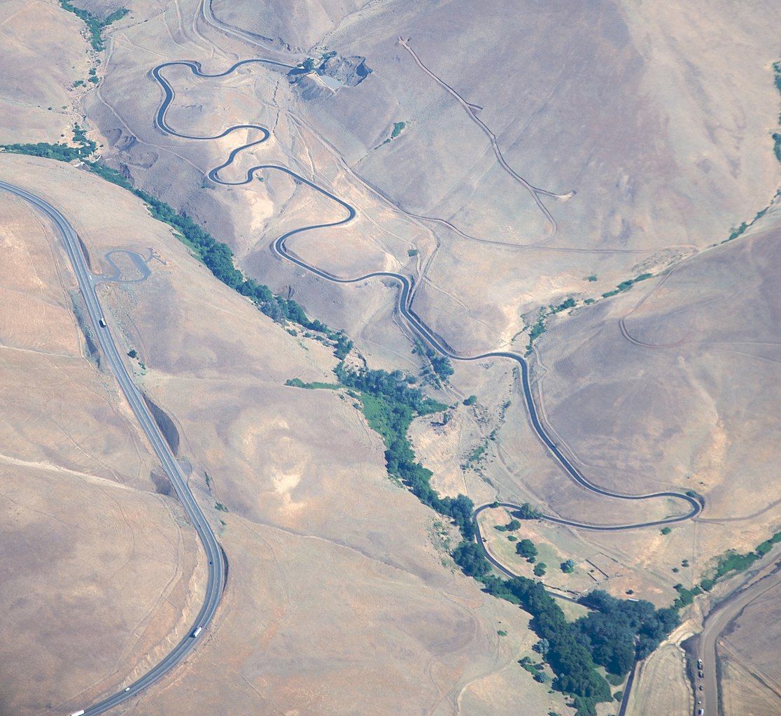
1519:
1511:
1500:
1490:
1482:
1474:
1466:
1456:
1448:
1440:
1432:
1422:
1414:
1404:
1396:
1386:
1378:
1370:
1362:
1352:
1344:
1336:
1328:
1320:
1312:
1301:
1293:
1282:
1272:
1262:
1252:
1177:
1091:
1075:
1055:
1039:
1021:
1005:
984:
968:
950:
934:
913:
897:
841:
825:
805:
789:
771:
755:
737:
721:
701:
685:
665:
649:
610:
594:
527:
511:
494:
491:
472:
465:
190:
211:View this and other nearby images on:
1242:
1175:The following 2 pages use this file:
7:
437:This image was originally posted to
426:
319:This image was originally posted to
308:
1106:
361:
243:
1233:
485:
479:
377:
352:
259:
234:
134:
80:
484:
416:Creative Commons Attribution 2.0
298:Creative Commons Attribution 2.0
1591:Reference for direction of image
1295:Date and time of data generation
758:coordinates of the point of view
470:
430:
397:Under the following conditions:
368:This file is licensed under the
360:
354:
312:
279:Under the following conditions:
250:This file is licensed under the
242:
236:
217:
203:
101:
31:
21:
1583:Satellites used for measurement
773:45°43'22.220"N, 120°48'22.550"W
467:
147:Maryhill Loop Road from air.jpg
14:
844:file available on the internet
466:
26:
1:
1429:Flash did not fire, auto mode
36:
1450:DateTimeDigitized subseconds
1317:2,590 meters above sea level
492:Items portrayed in this file
1442:DateTimeOriginal subseconds
1380:Date and time of digitizing
1199:Usage on en.wikivoyage.org
443:by Sam Beebe / Ecotrust at
325:by Sam Beebe / Ecotrust at
1619:
1513:Focal length in 35 mm film
1471:One-chip color area sensor
1219:Usage on www.wikidata.org
1209:Usage on es.wikipedia.org
1364:File change date and time
1107:
16:
469:
108:This is a file from the
1567:North or south latitude
1476:Custom image processing
1164:
1143:00:11, 6 September 2010
373:Attribution 2.0 Generic
255:Attribution 2.0 Generic
175:
165:
158:
155:
144:
112:. Information from its
1575:East or west longitude
1559:Subject distance range
223:45.722839; -120.806264
115:description page there
46:Size of this preview:
1398:Maximum land aperture
1338:Horizontal resolution
74:2,848 × 2,613 pixels
70:2,232 × 2,048 pixels
66:1,116 × 1,024 pixels
1434:DateTime subseconds
1346:Vertical resolution
1269:1/800 sec (0.00125)
1244:Camera manufacturer
1180:Maryhill Loops Road
392:– to adapt the work
274:– to adapt the work
52:Other resolutions:
1599:Direction of image
1594:Magnetic direction
1521:Scene capture type
1497:Auto white balance
1383:09:29, 8 July 2007
1367:09:29, 8 July 2007
1298:09:29, 8 July 2007
571:author name string
170:Maryhill Loop Road
160:8 July 2007, 09:29
151:Maryhill Loop Road
1606:
1605:
1322:Pixel composition
1248:NIKON CORPORATION
1191:Global file usage
1168:
688:copyright license
478:
459:
458:
341:
340:
228:
227:
185:
184:
130:
129:
110:Wikimedia Commons
32:Global file usage
1610:
1372:Exposure Program
1241:
1155:
1078:Flickr photo ID
989:
918:
881:
876:
872:described at URL
866:
861:
652:copyright status
633:
630:
626:publication date
578:
575:
565:
560:
550:
545:
463:
462:6 September 2010
453:
434:
433:
427:
423:
420:
417:
414:
411:
370:Creative Commons
364:
363:
358:
357:
345:
344:6 September 2010
335:
316:
315:
309:
305:
302:
299:
296:
293:
252:Creative Commons
246:
245:
240:
239:
224:
221:
207:
206:
200:
199:
188:
161:
148:
142:
126:
105:
104:
98:
92:
90:
77:
62:837 × 768 pixels
58:523 × 480 pixels
54:262 × 240 pixels
48:653 × 599 pixels
1618:
1617:
1613:
1612:
1611:
1609:
1608:
1607:
1401:5 APEX (f/5.66)
1229:
1189:
1169:
1161:
1160:Dennis Bratland
1153:
1109:
1108:
1105:
1104:
1103:
1102:
1101:
1100:
1099:
1098:
1096:
1084:
1083:
1082:
1080:
1069:
1068:
1067:
1066:
1065:
1064:
1063:
1062:
1060:
1048:
1047:
1046:
1044:
1033:
1032:
1031:
1030:
1029:
1028:
1027:
1026:
1024:
1014:
1013:
1012:
1010:
999:
998:
997:
996:
995:
994:
993:
992:
990:
987:
977:
976:
975:
973:
962:
961:
960:
959:
958:
957:
956:
955:
953:
943:
942:
941:
939:
928:
927:
926:
925:
924:
923:
922:
921:
919:
916:
906:
905:
904:
902:
891:
890:
889:
888:
887:
886:
885:
884:
883:
882:
877:
874:
868:
867:
862:
859:
850:
849:
848:
846:
834:
833:
832:
830:
819:
818:
817:
816:
815:
814:
813:
812:
810:
798:
797:
796:
794:
783:
782:
781:
780:
779:
778:
777:
776:
774:
764:
763:
762:
760:
749:
748:
747:
746:
745:
744:
743:
742:
740:
730:
729:
728:
726:
715:
714:
713:
712:
711:
710:
709:
708:
706:
694:
693:
692:
690:
679:
678:
677:
676:
675:
674:
673:
672:
670:
658:
657:
656:
654:
643:
642:
641:
640:
639:
638:
637:
636:
635:
634:
631:
628:
619:
618:
617:
615:
603:
602:
601:
599:
588:
587:
586:
585:
584:
583:
582:
581:
580:
579:
576:
573:
567:
566:
561:
558:
552:
551:
546:
543:
534:
533:
532:
530:
520:
519:
518:
516:
505:
504:
503:
502:
501:
499:
483:
482:
481:
461:
449:
431:
425:
424:
421:
418:
415:
412:
409:
408:
376:
365:
351:
343:
331:
313:
307:
306:
303:
300:
297:
294:
291:
290:
258:
247:
233:
222:
195:
194:
191:Camera location
186:
146:
139:
132:
131:
120:
119:
118:is shown below.
94:
88:
86:
79:
78:
51:
12:
11:
5:
1616:
1614:
1604:
1603:
1600:
1596:
1595:
1592:
1588:
1587:
1584:
1580:
1579:
1578:West longitude
1576:
1572:
1571:
1570:North latitude
1568:
1564:
1563:
1560:
1556:
1555:
1552:
1546:
1545:
1542:
1536:
1535:
1532:
1526:
1525:
1522:
1518:
1517:
1514:
1510:
1509:
1506:
1499:
1498:
1495:
1489:
1488:
1485:
1481:
1480:
1479:Normal process
1477:
1473:
1472:
1469:
1468:Sensing method
1465:
1464:
1461:
1455:
1454:
1451:
1447:
1446:
1443:
1439:
1438:
1435:
1431:
1430:
1427:
1421:
1420:
1417:
1413:
1412:
1409:
1403:
1402:
1399:
1395:
1394:
1391:
1385:
1384:
1381:
1377:
1376:
1373:
1369:
1368:
1365:
1361:
1360:
1355:
1351:
1350:
1347:
1343:
1342:
1339:
1335:
1334:
1331:
1327:
1326:
1323:
1319:
1318:
1315:
1311:
1310:
1307:
1300:
1299:
1296:
1292:
1291:
1288:
1281:
1280:
1277:
1271:
1270:
1267:
1261:
1260:
1255:
1251:
1250:
1245:
1232:
1228:
1227:
1226:
1225:
1217:
1216:
1215:
1207:
1206:
1205:
1193:
1192:
1188:
1187:
1182:
1173:
1172:
1167:
1166:
1163:
1159:
1156:
1152:2,848 × 2,613
1150:
1145:
1140:
1136:
1135:
1132:
1129:
1126:
1123:
1120:
1113:
1112:
1097:
1092:
1090:
1089:
1088:
1087:
1086:
1085:
1081:
1076:
1074:
1073:
1072:
1071:
1070:
1061:
1056:
1054:
1053:
1052:
1051:
1050:
1049:
1045:
1040:
1038:
1037:
1036:
1035:
1034:
1025:
1022:
1020:
1019:
1018:
1017:
1016:
1015:
1011:
1006:
1004:
1003:
1002:
1001:
1000:
991:
985:
983:
982:
981:
980:
979:
978:
974:
969:
967:
966:
965:
964:
963:
954:
951:
949:
948:
947:
946:
945:
944:
940:
935:
933:
932:
931:
930:
929:
920:
914:
912:
911:
910:
909:
908:
907:
903:
898:
896:
895:
894:
893:
892:
870:
869:
855:
854:
853:
852:
851:
847:
842:
840:
839:
838:
837:
836:
835:
831:
828:source of file
826:
824:
823:
822:
821:
820:
811:
806:
804:
803:
802:
801:
800:
799:
795:
790:
788:
787:
786:
785:
784:
775:
772:
770:
769:
768:
767:
766:
765:
761:
756:
754:
753:
752:
751:
741:
738:
736:
735:
734:
733:
732:
731:
727:
722:
720:
719:
718:
717:
716:
707:
702:
700:
699:
698:
697:
696:
695:
691:
686:
684:
683:
682:
681:
680:
671:
666:
664:
663:
662:
661:
660:
659:
655:
650:
648:
647:
646:
645:
644:
624:
623:
622:
621:
620:
616:
611:
609:
608:
607:
606:
605:
604:
600:
595:
593:
592:
591:
590:
589:
569:
568:
556:Flickr user ID
554:
553:
539:
538:
537:
536:
535:
531:
528:
526:
525:
524:
523:
522:
521:
517:
512:
510:
509:
508:
507:
506:
500:
495:
493:
490:
489:
488:
487:
486:
475:
474:
471:
468:
457:
456:
435:
407:
406:
405:
404:
395:
394:
393:
387:
380:You are free:
367:
366:
353:
350:
347:
339:
338:
317:
289:
288:
287:
286:
277:
276:
275:
269:
262:You are free:
249:
248:
235:
232:
229:
226:
225:
215:
209:
192:
183:
182:
177:
173:
172:
167:
163:
162:
157:
153:
152:
149:
140:
138:
135:
133:
128:
127:
106:
96:
95:
45:
41:
40:
39:
34:
29:
24:
19:
13:
10:
9:
6:
4:
3:
2:
1615:
1601:
1598:
1593:
1590:
1585:
1582:
1577:
1574:
1569:
1566:
1561:
1558:
1553:
1551:
1548:
1543:
1541:
1538:
1533:
1531:
1528:
1523:
1520:
1515:
1512:
1507:
1504:
1501:
1496:
1494:
1493:White balance
1491:
1487:Auto exposure
1486:
1484:Exposure mode
1483:
1478:
1475:
1470:
1467:
1462:
1460:
1457:
1452:
1449:
1444:
1441:
1436:
1433:
1428:
1426:
1423:
1418:
1415:
1410:
1408:
1407:Metering mode
1405:
1400:
1397:
1392:
1390:
1389:Exposure bias
1387:
1382:
1379:
1374:
1371:
1366:
1363:
1359:
1356:
1354:Software used
1353:
1348:
1345:
1340:
1337:
1332:
1329:
1324:
1321:
1316:
1313:
1308:
1306:
1302:
1297:
1294:
1289:
1286:
1283:
1278:
1276:
1273:
1268:
1266:
1265:Exposure time
1263:
1259:
1256:
1253:
1249:
1246:
1243:
1239:
1236:
1230:
1224:
1221:
1220:
1218:
1214:
1211:
1210:
1208:
1204:
1201:
1200:
1198:
1197:
1196:
1190:
1186:
1183:
1181:
1178:
1176:
1170:
1162:
1157:
1151:
1149:
1146:
1144:
1141:
1138:
1137:
1133:
1130:
1127:
1124:
1121:
1119:
1118:
1116:
1110:
1095:
1079:
1059:
1043:
1009:
972:
938:
901:
900:exposure time
880:
873:
865:
858:
845:
829:
809:
793:
792:captured with
759:
725:
705:
689:
669:
653:
627:
614:
598:
572:
564:
557:
549:
542:
515:
498:
464:
454:
452:
446:
442:
441:
436:
429:
428:
402:
399:
398:
396:
391:
388:
385:
382:
381:
379:
378:
374:
371:
359:
348:
346:
336:
334:
328:
324:
323:
318:
311:
310:
284:
281:
280:
278:
273:
270:
267:
264:
263:
261:
260:
256:
253:
241:
230:
220:
216:
214:
213:OpenStreetMap
210:
208:
198:
193:
189:
181:
178:
174:
171:
168:
164:
154:
150:
143:
136:
124:
117:
116:
111:
107:
100:
99:
93:
84:
83:Original file
75:
71:
67:
63:
59:
55:
49:
44:
38:
35:
33:
30:
28:
25:
23:
20:
18:
15:
1503:Digital zoom
1416:Light source
1305:focal length
1254:Camera model
1237:
1234:
1194:
1174:
1114:
1111:File history
971:focal length
632:13 July 2009
597:published in
563:28585409@N04
460:
451:FlickreviewR
448:
438:
400:
389:
383:
342:
333:FlickreviewR
330:
320:
282:
271:
265:
123:You can help
113:
81:
22:File history
1459:Color space
1375:Not defined
1330:Orientation
1213:Samuel Hill
1185:Samuel Hill
1042:instance of
739:8 July 2007
668:copyrighted
401:attribution
283:attribution
145:Description
1540:Saturation
1203:Goldendale
1171:File usage
1128:Dimensions
1094:3717503753
1058:photograph
988:millimetre
529:some value
413:CC BY 2.0
295:CC BY 2.0
89:image/jpeg
27:File usage
1550:Sharpness
1358:Ver.1.00
1285:ISO speed
1258:NIKON D90
1154:(2.26 MB)
1125:Thumbnail
1122:Date/Time
1008:ISO speed
808:Nikon D90
724:inception
577:Sam Beebe
349:Licensing
231:Licensing
180:Sam Beebe
1530:Contrast
1524:Standard
1314:Altitude
1275:F-number
1231:Metadata
1223:Q6781198
937:f-number
915:0.00125
857:operator
473:Captions
390:to remix
384:to share
375:license.
272:to remix
266:to share
257:license.
37:Metadata
1562:Unknown
1419:Unknown
1411:Pattern
1139:current
1134:Comment
514:creator
497:depicts
477:English
137:Summary
85:
1554:Normal
1544:Normal
1534:Normal
1516:127 mm
1349:72 dpi
1341:72 dpi
1333:Normal
1287:rating
917:second
864:Flickr
613:Flickr
440:Flickr
322:Flickr
201:
176:Author
166:Source
1602:101.1
1505:ratio
1425:Flash
1309:85 mm
1303:Lens
1279:f/5.6
1463:sRGB
1131:User
422:true
419:true
304:true
301:true
156:Date
17:File
1325:RGB
1290:200
1023:200
986:85
952:5.6
541:URL
1586:07
1453:00
1445:00
1437:00
875::
860::
629::
574::
559::
544::
72:|
68:|
64:|
60:|
56:|
50:.
1508:1
1393:0
125:.
91:)
76:.
Text is available under the Creative Commons Attribution-ShareAlike License. Additional terms may apply.
