38:
190:
350:
272:
364:
196:
94:
912:
341:
243:– You must give appropriate credit, provide a link to the license, and indicate if changes were made. You may do so in any reasonable manner, but not in any way that suggests the licensor endorses you or your use.
929:== {{int:filedesc}} == {{Information |description=Menara Condong Teluk Intan |date={{Taken on|2011-08-11}} |source=http://www.panoramio.com/photo/57215774 |author= |permission={{cc-by...
60:
56:
52:
48:
42:
105:
73:
503:
168:
179:
715:
680:
576:
540:
357:
421:
1061:
954:
This file contains additional information, probably added from the digital camera or scanner used to create or digitize it.
823:
700:
475:
943:
843:
773:
736:
664:
630:
524:
496:
483:
468:
708:
693:
596:
560:
441:
405:
158:
807:
922:
957:
If the file has been modified from its original state, some details may not fully reflect the modified file.
911:
906:
64:
37:
939:
The following pages on the
English Knowledge (XXG) use this file (pages on other projects are not listed):
206:
504:
https://web.archive.org/web/20161022002425/http://www.panoramio.com/user/6148113?with_photo_id=57215774
287:
203:
113:
291:, who confirmed that it was available on Panoramio under the above license on that date.
363:
100:
1003:
716:
https://web.archive.org/web/20161022002424/http://www.panoramio.com/photo/57215774
159:
https://web.archive.org/web/20161022002424/http://www.panoramio.com/photo/57215774
347:
1109:
280:
983:
976:
879:
Click on a date/time to view the file as it appeared at that time.
623:
349:
342:
4° 01′ 30.59″ N, 101° 01′ 09.69″ E
966:
332:
266:
88:
389:
Add a one-line explanation of what this file represents
78:(1,952 × 3,264 pixels, file size: 1.54 MB, MIME type:
132:
112:
Commons is a freely licensed media file repository.
285:, was automatically reviewed on 7 December 2016 by
93:
189:
8:
277:This image, which was originally posted to
250:https://creativecommons.org/licenses/by/3.0
226:– to copy, distribute and transmit the work
959:
881:
385:
138:Menara Condong Teluk Intan - panoramio.jpg
577:Creative Commons Attribution 3.0 Unported
1141:
1133:
1125:
1117:
1107:
1099:
1078:
1070:
1059:
1051:
1043:
1035:
1027:
1019:
1011:
1000:
992:
981:
971:
941:
857:
841:
821:
805:
787:
771:
750:
734:
678:
662:
644:
628:
610:
594:
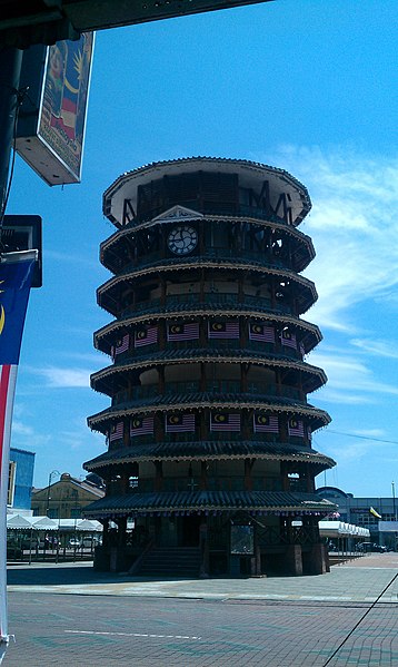
574:
558:
538:
522:
455:
439:
419:
403:
400:
381:
374:
335:
356:View this and other nearby images on:
961:
7:
870:
279:
195:
952:
394:
388:
217:
186:
125:
71:
393:
256:Creative Commons Attribution 3.0
994:Date and time of data generation
631:coordinates of the point of view
379:
362:
348:
270:
237:Under the following conditions:
202:This file is licensed under the
194:
188:
92:
21:
376:
14:
681:file available on the internet
375:
26:
1:
31:
944:Leaning Tower of Teluk Intan
469:object of statement has role
422:Leaning Tower of Teluk Intan
401:Items portrayed in this file
150:Taken on 11 August 2011
1072:Date and time of digitizing
646:4°1'30.587"N, 101°1'9.692"E
302:(from Panoramio photo page)
1163:
1101:Supported Flashpix version
142:Menara Condong Teluk Intan
1127:Geodetic survey data used
1080:Meaning of each component
871:
16:
1032:0 meters above sea level
378:
207:Attribution 3.0 Unported
99:This is a file from the
1119:GPS time (atomic clock)
928:
174:
164:
154:
149:
146:
135:
103:. Information from its
907:02:43, 7 December 2016
106:description page there
41:Size of this preview:
1075:11:46, 11 August 2011
1037:Horizontal resolution
997:11:46, 11 August 2011
368:4.025163; 101.019359
924:Panoramio upload bot
288:Panoramio upload bot
65:1,952 × 3,264 pixels
1053:Y and C positioning
1045:Vertical resolution
963:Camera manufacturer
232:– to adapt the work
47:Other resolutions:
484:author name string
325:Tourist Attraction
61:612 × 1,024 pixels
1150:
1149:
932:
561:copyright license
387:
373:
372:
330:
329:
295:
294:
183:
180:Reusing this file
121:
120:
101:Wikimedia Commons
1154:
960:
919:
755:
718:
713:
709:described at URL
703:
698:
525:copyright status
506:
501:
491:
488:
478:
473:
369:
366:
352:
351:
345:
344:
333:
326:
322:
318:
314:
310:
283:
274:
273:
267:
263:
260:
257:
254:
251:
215:
204:Creative Commons
198:
197:
192:
191:
177:
139:
133:
117:
96:
95:
89:
83:
81:
68:
57:459 × 768 pixels
53:287 × 480 pixels
49:143 × 240 pixels
43:358 × 599 pixels
1162:
1161:
1157:
1156:
1155:
1153:
1152:
1151:
1143:GPS tag version
1024:101° 1′ 12.8″ E
948:
940:
933:
925:
917:
873:
872:
869:
868:
867:
866:
865:
864:
863:
862:
860:
850:
849:
848:
846:
835:
834:
833:
832:
831:
830:
829:
828:
826:
814:
813:
812:
810:
799:
798:
797:
796:
795:
794:
793:
792:
790:
780:
779:
778:
776:
765:
764:
763:
762:
761:
760:
759:
758:
756:
753:
743:
742:
741:
739:
728:
727:
726:
725:
724:
723:
722:
721:
720:
719:
714:
711:
705:
704:
699:
696:
687:
686:
685:
683:
671:
670:
669:
667:
656:
655:
654:
653:
652:
651:
650:
649:
647:
637:
636:
635:
633:
622:
621:
620:
619:
618:
617:
616:
615:
613:
603:
602:
601:
599:
588:
587:
586:
585:
584:
583:
582:
581:
579:
567:
566:
565:
563:
552:
551:
550:
549:
548:
547:
546:
545:
543:
531:
530:
529:
527:
516:
515:
514:
513:
512:
511:
510:
509:
508:
507:
502:
499:
493:
492:
489:
486:
480:
479:
474:
471:
462:
461:
460:
458:
448:
447:
446:
444:
433:
432:
431:
430:
429:
428:
427:
426:
424:
412:
411:
410:
408:
392:
391:
390:
367:
340:
339:
336:Camera location
331:
324:
320:
316:
312:
308:
305:
271:
265:
264:
261:
258:
255:
252:
249:
248:
216:
213:
210:
199:
137:
130:
123:
122:
111:
110:
109:is shown below.
85:
79:
77:
70:
69:
46:
12:
11:
5:
1160:
1158:
1148:
1147:
1144:
1140:
1139:
1138:11 August 2011
1136:
1132:
1131:
1128:
1124:
1123:
1120:
1116:
1115:
1112:
1106:
1105:
1102:
1098:
1097:
1096:
1095:
1094:does not exist
1092:
1089:
1086:
1081:
1077:
1076:
1073:
1069:
1068:
1065:
1058:
1057:
1054:
1050:
1049:
1046:
1042:
1041:
1038:
1034:
1033:
1030:
1026:
1025:
1022:
1018:
1017:
1014:
1010:
1009:
1006:
999:
998:
995:
991:
990:
987:
980:
979:
974:
970:
969:
964:
951:
947:
946:
938:
937:
936:
931:
930:
927:
923:
920:
916:1,952 × 3,264
914:
909:
904:
900:
899:
896:
893:
890:
887:
884:
877:
876:
861:
858:
856:
855:
854:
853:
852:
851:
847:
842:
840:
839:
838:
837:
836:
827:
822:
820:
819:
818:
817:
816:
815:
811:
806:
804:
803:
802:
801:
800:
791:
788:
786:
785:
784:
783:
782:
781:
777:
772:
770:
769:
768:
767:
766:
757:
751:
749:
748:
747:
746:
745:
744:
740:
735:
733:
732:
731:
730:
729:
707:
706:
692:
691:
690:
689:
688:
684:
679:
677:
676:
675:
674:
673:
672:
668:
665:source of file
663:
661:
660:
659:
658:
657:
648:
645:
643:
642:
641:
640:
639:
638:
634:
629:
627:
626:
625:
624:
614:
612:11 August 2011
611:
609:
608:
607:
606:
605:
604:
600:
595:
593:
592:
591:
590:
589:
580:
575:
573:
572:
571:
570:
569:
568:
564:
559:
557:
556:
555:
554:
553:
544:
539:
537:
536:
535:
534:
533:
532:
528:
523:
521:
520:
519:
518:
517:
495:
494:
482:
481:
467:
466:
465:
464:
463:
459:
456:
454:
453:
452:
451:
450:
449:
445:
440:
438:
437:
436:
435:
434:
425:
420:
418:
417:
416:
415:
414:
413:
409:
404:
402:
399:
398:
397:
396:
395:
384:
383:
380:
377:
371:
370:
360:
354:
337:
328:
327:
306:
303:
297:
296:
293:
292:
275:
247:
246:
245:
244:
235:
234:
233:
227:
220:You are free:
211:
201:
200:
187:
184:
172:
171:
166:
162:
161:
156:
152:
151:
148:
144:
143:
140:
131:
129:
126:
124:
119:
118:
97:
87:
86:
40:
36:
35:
34:
29:
24:
19:
13:
10:
9:
6:
4:
3:
2:
1159:
1145:
1142:
1137:
1134:
1129:
1126:
1121:
1118:
1113:
1111:
1108:
1103:
1100:
1093:
1090:
1087:
1084:
1083:
1082:
1079:
1074:
1071:
1066:
1063:
1060:
1055:
1052:
1047:
1044:
1039:
1036:
1031:
1028:
1023:
1020:
1016:4° 1′ 17.7″ N
1015:
1012:
1007:
1005:
1001:
996:
993:
988:
985:
982:
978:
975:
972:
968:
965:
962:
958:
955:
949:
945:
942:
934:
926:
921:
915:
913:
910:
908:
905:
902:
901:
897:
894:
891:
888:
885:
883:
882:
880:
874:
845:
825:
809:
775:
738:
717:
710:
702:
695:
682:
666:
632:
598:
578:
562:
542:
526:
505:
498:
485:
477:
470:
443:
423:
407:
365:
361:
359:
358:OpenStreetMap
355:
353:
343:
338:
334:
307:
301:
299:
298:
290:
289:
284:
282:
276:
269:
268:
242:
239:
238:
236:
231:
228:
225:
222:
221:
219:
218:
212:Attribution:
208:
205:
193:
185:
181:
176:
173:
170:
167:
163:
160:
157:
153:
145:
141:
134:
127:
115:
108:
107:
102:
98:
91:
90:
84:
75:
74:Original file
66:
62:
58:
54:
50:
44:
39:
33:
30:
28:
25:
23:
20:
18:
15:
1004:focal length
973:Camera model
956:
953:
878:
875:File history
737:focal length
476:photographer
286:
278:
240:
229:
223:
114:You can help
104:
72:
22:File history
1110:Color space
808:instance of
541:copyrighted
309:Teluk Intan
241:attribution
136:Description
935:File usage
892:Dimensions
859:image/jpeg
844:media type
824:photograph
754:millimetre
457:some value
253:CC BY 3.0
175:Permission
80:image/jpeg
27:File usage
1021:Longitude
984:ISO speed
977:Desire HD
918:(1.54 MB)
889:Thumbnail
886:Date/Time
774:ISO speed
701:Panoramio
597:inception
304:InfoField
281:Panoramio
1135:GPS date
1056:Centered
1029:Altitude
1013:Latitude
950:Metadata
694:operator
382:Captions
317:Malaysia
230:to remix
224:to share
209:license.
32:Metadata
1064:version
1008:4.92 mm
903:current
898:Comment
442:creator
406:depicts
386:English
128:Summary
76:
1130:WGS-84
1048:72 dpi
1040:72 dpi
986:rating
490:CK Tan
346:
214:CK Tan
169:CK Tan
165:Author
155:Source
1146:2.2.0
1122:03:46
1002:Lens
752:4.92
321:Perak
1114:sRGB
1062:Exif
895:User
313:2011
300:Tags
262:true
259:true
147:Date
17:File
1067:2.2
989:119
967:HTC
789:119
497:URL
1091:Cr
1088:Cb
712::
697::
500::
487::
472::
323:,
319:,
315:,
311:,
63:|
59:|
55:|
51:|
45:.
1104:1
1085:Y
182:)
178:(
116:.
82:)
67:.
Text is available under the Creative Commons Attribution-ShareAlike License. Additional terms may apply.
