38:
242:
248:
253:
94:
946:
538:
841:
736:
300:– You must give appropriate credit, provide a link to the license, and indicate if changes were made. You may do so in any reasonable manner, but not in any way that suggests the licensor endorses you or your use.
559:, UK. Equirectangular map projection on WGS 84 datum, with N/S stretched 165% Geographic limits: *West: 3.24W *East: 2.54W *North: 53.72N *South: 53.27N |Source=[[w:Ordnance Survey|Ordn
698:
693:
811:
683:
60:
56:
52:
48:
42:
105:
821:
73:
971:
658:
340:
801:
688:
231:
796:
449:
413:
936:
307:
648:
643:
633:
578:
583:
573:
397:
931:
673:
469:
433:
380:
663:
628:
608:
202:
263:
716:
598:
593:
588:
569:
The following pages on the
English Knowledge (XXG) use this file (pages on other projects are not listed):
618:
306:– If you remix, transform, or build upon the material, you must distribute your contributions under the
886:
537:
532:
64:
37:
260:
911:
881:
846:
185:
678:
623:
113:
901:
746:
726:
966:
956:
791:
638:
182:
776:
761:
731:
668:
548:
603:
100:
613:
921:
219:
906:
139:
206:
171:
556:
831:
871:
856:
653:
891:
145:
Equirectangular map projection on WGS 84 datum, with N/S stretched 165%
766:
781:
195:
Administrative borders and coastline data from
Boundary-Line product.
505:
Click on a date/time to view the file as it appeared at that time.
271:
Contains
Ordnance Survey data © Crown copyright and database right
756:
88:
937:
Modül:Konum haritası/veri/Birleşik Krallık
Merseyside/belge
861:
364:
Add a one-line explanation of what this file represents
912:
Module:Location map/data/United
Kingdom Merseyside/doc
887:
Module:Location map/data/United
Kingdom Merseyside/doc
699:
Module:Location map/data/United
Kingdom Merseyside/doc
932:
Modül:Konum haritası/veri/Birleşik Krallık
Merseyside
802:モジュール:Location map/data/United Kingdom Merseyside/doc
78:(1,999 × 2,122 pixels, file size: 278 KB, MIME type:
450:
Creative
Commons Attribution-ShareAlike 3.0 Unported
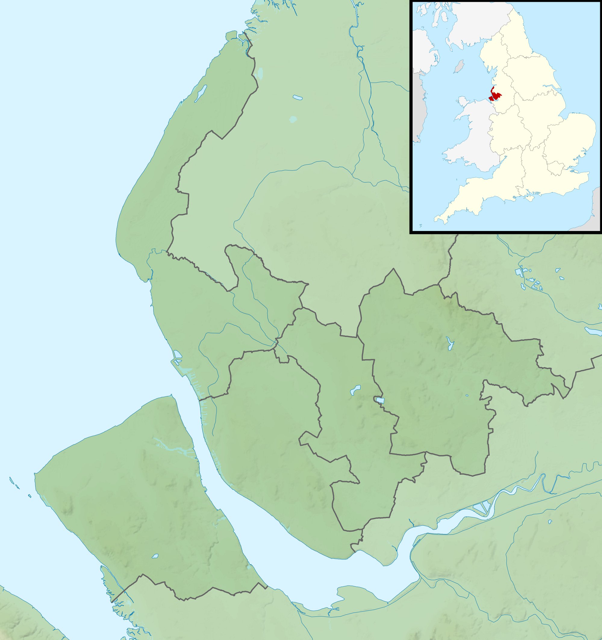
127:
112:
Commons is a freely licensed media file repository.
947:Шаблон:Карта розташування Велика Британія Мерсісайд
902:Module:Location map/data/United Kingdom Merseyside
882:Module:Location map/data/United Kingdom Merseyside
694:Module:Location map/data/United Kingdom Merseyside
198:All other geographic data from Meridian 2 product.
797:モジュール:Location map/data/United Kingdom Merseyside
812:ಟೆಂಪ್ಲೇಟು:Location map United Kingdom Merseyside
747:Plantilya:Location map United Kingdom Merseyside
967:Template:Location map United Kingdom Merseyside
792:Template:Location map United Kingdom Merseyside
684:File talk:Merseyside UK relief location map.jpg
957:Batakan:Location map United Kingdom Merseyside
777:Templat:Location map United Kingdom Merseyside
317:https://creativecommons.org/licenses/by-sa/3.0
93:
323:Creative Commons Attribution-Share Alike 3.0
241:
8:
192:Relief data from Land-Form Panorama product.
717:قالب:Location map United Kingdom Merseyside
341:File:Merseyside UK district map (blank).svg
283:– to copy, distribute and transmit the work
507:
360:
709:The following other wikis use this file:
659:Southport & District Reform Synagogue
555:{{Information |Description=Relief map of
571:
483:
467:
447:
431:
411:
395:
378:
375:
356:
349:
842:Хуызæг:ПозКартæ Стыр Британи Мерсисайд
133:Merseyside UK relief location map.jpg
7:
922:Mall:Kartposition England Merseyside
264:Attribution-Share Alike 3.0 Unported
222:, created using Ordnance Survey data
907:Module:Location map/data/Merseyside
689:Module:Location map/data/Merseyside
496:
252:
247:
737:Шаблон:ПК Великобритания Мърсисайд
369:
363:
238:
125:
71:
762:Modèle:Géolocalisation/Merseyside
368:
832:Sjabloon:Positiekaart Merseyside
354:
294:Under the following conditions:
259:This file is licensed under the
251:
246:
240:
92:
31:
21:
351:
14:
878:Usage on simple.wikipedia.org
584:2014 Women's British Open
574:2005 Women's British Open
350:
26:
1:
822:Шаблон:Location map Мерсисајд
649:New Brighton Lifeboat Station
644:Merseyside International Open
634:Lawrence Batley International
579:2013 Senior Open Championship
376:Items portrayed in this file
953:Usage on war.wikipedia.org
743:Usage on ceb.wikipedia.org
674:West Kirby Lifeboat Station
990:
963:Usage on zh.wikipedia.org
943:Usage on uk.wikipedia.org
928:Usage on tr.wikipedia.org
918:Usage on sv.wikipedia.org
898:Usage on si.wikipedia.org
872:Moduł:Mapa/dane/Merseyside
868:Usage on pl.wikibooks.org
857:Moduł:Mapa/dane/Merseyside
853:Usage on pl.wikipedia.org
838:Usage on os.wikipedia.org
828:Usage on nl.wikipedia.org
818:Usage on mk.wikipedia.org
808:Usage on kn.wikipedia.org
788:Usage on ja.wikipedia.org
773:Usage on id.wikipedia.org
767:Port marchand de Liverpool
753:Usage on fr.wikipedia.org
723:Usage on bg.wikipedia.org
713:Usage on ar.wikipedia.org
664:Southport Lifeboat Station
308:same or compatible license
497:
16:
782:Penikaman Southport 2024
629:Hoylake Lifeboat Station
609:Bob Hope British Classic
353:
274:
203:England location map.svg
99:This is a file from the
892:2024 Southport stabbing
599:2024 Southport stabbing
554:
533:01:45, 29 November 2011
336:
226:
215:
177:
170:
167:
130:
103:. Information from its
757:Circuit d'Aintree
594:2023 Open Championship
589:2017 Open Championship
106:description page there
41:Size of this preview:
619:Formby Hall Challenge
65:1,999 × 2,122 pixels
289:– to adapt the work
201:Inset derived from
148:Geographic limits:
47:Other resolutions:
679:Williamson Tunnels
624:Hillside Golf Club
61:965 × 1,024 pixels
705:Global file usage
562:
434:copyright license
362:
347:
346:
235:
232:Reusing this file
121:
120:
101:Wikimedia Commons
32:Global file usage
981:
639:Liverpool Waters
545:
485:29 November 2010
398:copyright status
330:
327:
324:
321:
318:
310:as the original.
272:
261:Creative Commons
255:
254:
250:
249:
244:
243:
229:
173:
172:29 November 2010
134:
128:
117:
96:
95:
89:
83:
81:
68:
57:723 × 768 pixels
53:452 × 480 pixels
49:226 × 240 pixels
43:565 × 600 pixels
989:
988:
984:
983:
982:
980:
979:
978:
972:2024年紹斯波特持刀襲擊事件
703:
570:
563:
551:
543:
499:
498:
495:
494:
493:
492:
491:
490:
489:
488:
486:
476:
475:
474:
472:
461:
460:
459:
458:
457:
456:
455:
454:
452:
440:
439:
438:
436:
425:
424:
423:
422:
421:
420:
419:
418:
416:
404:
403:
402:
400:
389:
388:
387:
386:
385:
383:
367:
366:
365:
348:
332:
331:
328:
325:
322:
319:
316:
315:
273:
270:
267:
256:
183:Ordnance Survey
132:
123:
122:
111:
110:
109:is shown below.
85:
79:
77:
70:
69:
46:
12:
11:
5:
987:
985:
977:
976:
975:
974:
969:
961:
960:
959:
951:
950:
949:
941:
940:
939:
934:
926:
925:
924:
916:
915:
914:
909:
904:
896:
895:
894:
889:
884:
876:
875:
874:
866:
865:
864:
859:
851:
850:
849:
844:
836:
835:
834:
826:
825:
824:
816:
815:
814:
806:
805:
804:
799:
794:
786:
785:
784:
779:
771:
770:
769:
764:
759:
751:
750:
749:
741:
740:
739:
734:
729:
721:
720:
719:
707:
706:
702:
701:
696:
691:
686:
681:
676:
671:
669:Southport Pier
666:
661:
656:
651:
646:
641:
636:
631:
626:
621:
616:
611:
606:
601:
596:
591:
586:
581:
576:
568:
567:
566:
561:
560:
553:
549:
546:
542:1,999 × 2,122
540:
535:
530:
526:
525:
522:
519:
516:
513:
510:
503:
502:
487:
484:
482:
481:
480:
479:
478:
477:
473:
468:
466:
465:
464:
463:
462:
453:
448:
446:
445:
444:
443:
442:
441:
437:
432:
430:
429:
428:
427:
426:
417:
412:
410:
409:
408:
407:
406:
405:
401:
396:
394:
393:
392:
391:
390:
384:
379:
377:
374:
373:
372:
371:
370:
359:
358:
355:
352:
345:
344:
338:
337:Other versions
334:
333:
314:
313:
312:
311:
301:
292:
291:
290:
284:
277:You are free:
268:
258:
257:
239:
236:
224:
223:
217:
213:
212:
211:
210:
199:
196:
193:
179:
175:
174:
169:
165:
164:
163:
162:
159:
156:
153:
138:Relief map of
135:
126:
124:
119:
118:
97:
87:
86:
40:
36:
35:
34:
29:
24:
19:
13:
10:
9:
6:
4:
3:
2:
986:
973:
970:
968:
965:
964:
962:
958:
955:
954:
952:
948:
945:
944:
942:
938:
935:
933:
930:
929:
927:
923:
920:
919:
917:
913:
910:
908:
905:
903:
900:
899:
897:
893:
890:
888:
885:
883:
880:
879:
877:
873:
870:
869:
867:
863:
860:
858:
855:
854:
852:
848:
845:
843:
840:
839:
837:
833:
830:
829:
827:
823:
820:
819:
817:
813:
810:
809:
807:
803:
800:
798:
795:
793:
790:
789:
787:
783:
780:
778:
775:
774:
772:
768:
765:
763:
760:
758:
755:
754:
752:
748:
745:
744:
742:
738:
735:
733:
730:
728:
725:
724:
722:
718:
715:
714:
712:
711:
710:
704:
700:
697:
695:
692:
690:
687:
685:
682:
680:
677:
675:
672:
670:
667:
665:
662:
660:
657:
655:
652:
650:
647:
645:
642:
640:
637:
635:
632:
630:
627:
625:
622:
620:
617:
615:
612:
610:
607:
605:
604:Billinge Hill
602:
600:
597:
595:
592:
590:
587:
585:
582:
580:
577:
575:
572:
564:
558:
552:
547:
541:
539:
536:
534:
531:
528:
527:
523:
520:
517:
514:
511:
509:
508:
506:
500:
471:
451:
435:
415:
399:
382:
342:
339:
335:
320:CC BY-SA 3.0
309:
305:
302:
299:
296:
295:
293:
288:
285:
282:
279:
278:
276:
275:
269:Attribution:
265:
262:
245:
237:
233:
228:
225:
221:
218:
214:
208:
204:
200:
197:
194:
191:
190:
189:
187:
184:
180:
176:
166:
161:South: 53.27N
160:
158:North: 53.72N
157:
154:
151:
150:
149:
146:
143:
141:
136:
129:
115:
108:
107:
102:
98:
91:
90:
84:
75:
74:Original file
66:
62:
58:
54:
50:
44:
39:
33:
30:
28:
25:
23:
20:
18:
15:
708:
614:English Open
504:
501:File history
303:
297:
286:
280:
181:
147:
144:
137:
114:You can help
104:
72:
22:File history
862:Alt (rzeka)
414:copyrighted
343:- Blank map
304:share alike
298:attribution
155:East: 2.54W
152:West: 3.24W
131:Description
565:File usage
557:Merseyside
518:Dimensions
227:Permission
140:Merseyside
80:image/jpeg
27:File usage
847:Мерсисайд
654:River Alt
550:Nilfanion
515:Thumbnail
512:Date/Time
470:inception
220:Nilfanion
727:Ливърпул
544:(278 KB)
357:Captions
287:to remix
281:to share
266:license.
207:Spischot
186:OpenData
732:Рейнхил
529:current
524:Comment
381:depicts
361:English
76:
216:Author
178:Source
142:, UK.
521:User
329:true
326:true
168:Date
17:File
205:by
188:.
63:|
59:|
55:|
51:|
45:.
234:)
230:(
209:.
116:.
82:)
67:.
Text is available under the Creative Commons Attribution-ShareAlike License. Additional terms may apply.
.svg)