38:
378:
311:
261:
303:
253:
325:
275:
346:
384:
389:
1018:
86:
916:"}},"text\/plain":{"en":{"":"heading"}}},"{\"value\":{\"amount\":\"+22\",\"unit\":\"http:\\\/\\\/www.wikidata.org\\\/entity\\\/Q28390\"},\"type\":\"quantity\"}":{"text\/html":{"en":{"P7787":"22
816:"}},"text\/plain":{"en":{"":"heading"}}},"{\"value\":{\"amount\":\"+22\",\"unit\":\"http:\\\/\\\/www.wikidata.org\\\/entity\\\/Q28390\"},\"type\":\"quantity\"}":{"text\/html":{"en":{"P7787":"22
812:
244:
52:
48:
42:
65:
97:
436:– You must give appropriate credit, provide a link to the license, and indicate if changes were made. You may do so in any reasonable manner, but not in any way that suggests the licensor endorses you or your use.
913:
813:
1017:
1012:
56:
37:
181:
714:
678:
642:
318:
268:
734:
523:
1200:
353:
1063:
This file contains additional information, probably added from the digital camera or scanner used to create or digitize it.
443:
1028:
899:
577:
954:
927:
883:
854:
827:
742:
698:
626:
598:
585:
570:
785:
757:
727:
662:
543:
507:
340:
1052:
399:
1066:
If the file has been modified from its original state, some details may not fully reflect the modified file.
1048:
The following pages on the
English Knowledge (XXG) use this file (pages on other projects are not listed):
1258:
442:– If you remix, transform, or build upon the material, you must distribute your contributions under the
360:
on the
Geograph website for the photographer's contact details. The copyright on this image is owned by
396:
1278:
920:"}},"text\/plain":{"en":{"P7787":"22 degree"}}}}": -->
820:"}},"text\/plain":{"en":{"P7787":"22 degree"}}}}": -->
105:
213:
764:
749:
605:
197:
1075:
324:
274:
1268:
1240:
1100:
1085:
365:
92:
1140:
258:
149:
1169:
1120:
1036:
308:
130:
Merseyrail Class 507, 507016, Old Roan railway station (geograph 3786839).jpg
170:
160:
1110:
345:
357:
985:
Click on a date/time to view the file as it appeared at that time.
310:
260:
245:
53° 29′ 12.51″ N, 2° 57′ 02.22″ W
285:
235:
80:
295:
53° 29′ 13.3″ N, 2° 57′ 02″ W
491:
Add a one-line explanation of what this file represents
228:
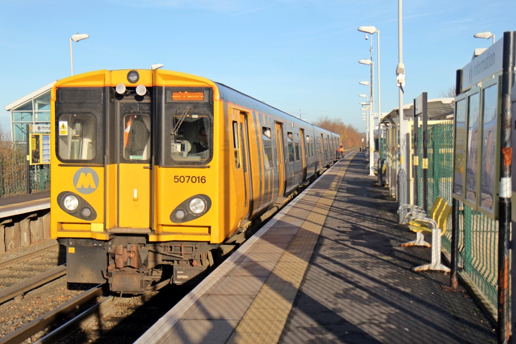
Merseyrail Class 507, 507016, Old Roan railway station
209:
Merseyrail Class 507, 507016, Old Roan railway station
140:
Merseyrail Class 507, 507016, Old Roan railway station
188:
Creative
Commons Attribution Share-alike license 2.0
124:
104:
Commons is a freely licensed media file repository.
679:
Creative
Commons Attribution-ShareAlike 2.0 Generic
70:(1,024 × 683 pixels, file size: 196 KB, MIME type:
1283:Flash did not fire, compulsory flash suppression
453:https://creativecommons.org/licenses/by-sa/2.0
85:
459:Creative Commons Attribution-Share Alike 2.0
377:
8:
917:
817:
419:– to copy, distribute and transmit the work
1068:
987:
487:
765:https://www.geograph.org.uk/photo/3786839
606:https://www.geograph.org.uk/profile/38853
1286:
1276:
1266:
1256:
1248:
1238:
1217:
1209:
1198:
1190:
1182:
1174:
1164:
1156:
1148:
1137:
1129:
1118:
1108:
1098:
1090:
1080:
1050:
941:
925:
897:
881:
841:
825:
799:
783:
712:
696:
676:
660:
640:
624:
557:
541:
521:
505:
502:
483:
476:
288:
238:
317:View this and other nearby images on:
267:View this and other nearby images on:
1070:
7:
364:and is licensed for reuse under the
976:
400:Attribution-Share Alike 2.0 Generic
388:
383:
368:Attribution-ShareAlike 2.0 license.
1061:
496:
490:
374:
351:
134:
117:
63:
495:
1131:Date and time of data generation
828:coordinates of the point of view
481:
430:Under the following conditions:
395:This file is licensed under the
387:
382:
376:
344:
323:
309:
301:
273:
259:
251:
84:
21:
1030:File Upload Bot (Magnus Manske)
478:
135:
14:
715:file available on the internet
477:
352:This image was taken from the
26:
1:
1035:Transferred from Geograph by
928:coordinates of depicted place
31:
843:53°29'12.505"N, 2°57'2.221"W
735:Geograph Britain and Ireland
571:object of statement has role
503:Items portrayed in this file
1211:Date and time of digitizing
300:
250:
1308:
943:53°29'13.31"N, 2°57'1.80"W
444:same or compatible license
1219:Meaning of each component
1176:File change date and time
977:
16:
1053:Old Roan railway station
743:geograph.org.uk image ID
480:
410:
91:This is a file from the
1214:13:07, 30 November 2013
1179:13:07, 30 November 2013
1134:13:07, 30 November 2013
1034:
1013:16:42, 23 December 2013
226:El Pollock /
207:El Pollock /
198:required by the license
176:
166:
155:
148:
145:
127:
95:. Information from its
524:British Rail Class 507
358:this photograph's page
329:53.487030; -2.950500
279:53.486807; -2.950617
98:description page there
41:Size of this preview:
1150:Horizontal resolution
1184:Y and C positioning
1158:Vertical resolution
1105:1/800 sec (0.00125)
1072:Camera manufacturer
425:– to adapt the work
47:Other resolutions:
586:author name string
57:1,024 × 683 pixels
1295:
1294:
1288:Rating (out of 5)
1195:Aperture priority
1041:
919:
819:
663:copyright license
489:
373:
372:
356:collection. See
334:
333:
284:
283:
233:
232:
201:
185:
182:Reusing this file
113:
112:
93:Wikimedia Commons
1299:
1192:Exposure Program
1069:
1025:
965:
964:
959:
865:
864:
859:
801:30 November 2013
767:
762:
758:described at URL
752:
747:
737:
732:
627:copyright status
608:
603:
593:
590:
580:
575:
466:
463:
460:
457:
454:
446:as the original.
408:
397:Creative Commons
391:
390:
386:
385:
380:
379:
366:Creative Commons
354:Geograph project
348:
341:
330:
327:
313:
312:
306:
305:
304:
298:
297:
286:
280:
277:
263:
262:
256:
255:
254:
248:
247:
236:
195:
179:
151:
150:30 November 2013
139:
131:
125:
109:
88:
87:
81:
75:
73:
60:
53:640 × 427 pixels
49:320 × 213 pixels
43:800 × 534 pixels
1307:
1306:
1302:
1301:
1300:
1298:
1297:
1296:
1057:
1049:
1042:
1031:
1023:
979:
978:
975:
974:
973:
972:
971:
970:
969:
968:
967:
966:
962:
960:
957:
948:
947:
946:
944:
934:
933:
932:
930:
911:
910:
909:
908:
907:
906:
905:
904:
902:
890:
889:
888:
886:
875:
874:
873:
872:
871:
870:
869:
868:
867:
866:
862:
860:
857:
848:
847:
846:
844:
834:
833:
832:
830:
811:
810:
809:
808:
807:
806:
805:
804:
802:
792:
791:
790:
788:
777:
776:
775:
774:
773:
772:
771:
770:
769:
768:
763:
760:
754:
753:
748:
745:
739:
738:
733:
730:
721:
720:
719:
717:
705:
704:
703:
701:
690:
689:
688:
687:
686:
685:
684:
683:
681:
669:
668:
667:
665:
654:
653:
652:
651:
650:
649:
648:
647:
645:
633:
632:
631:
629:
618:
617:
616:
615:
614:
613:
612:
611:
610:
609:
604:
601:
595:
594:
591:
588:
582:
581:
576:
573:
564:
563:
562:
560:
550:
549:
548:
546:
535:
534:
533:
532:
531:
530:
529:
528:
526:
514:
513:
512:
510:
494:
493:
492:
468:
467:
464:
461:
458:
455:
452:
451:
409:
406:
403:
392:
369:
339:
328:
302:
293:
292:
289:Object location
278:
252:
243:
242:
239:Camera location
234:
223:
216:
204:
161:geograph.org.uk
141:
129:
122:
115:
114:
103:
102:
101:is shown below.
77:
71:
69:
62:
61:
46:
12:
11:
5:
1305:
1303:
1293:
1292:
1289:
1285:
1284:
1281:
1275:
1274:
1271:
1265:
1264:
1261:
1255:
1254:
1251:
1247:
1246:
1243:
1237:
1236:
1235:
1234:
1233:does not exist
1231:
1228:
1225:
1220:
1216:
1215:
1212:
1208:
1207:
1204:
1197:
1196:
1193:
1189:
1188:
1185:
1181:
1180:
1177:
1173:
1172:
1167:
1163:
1162:
1159:
1155:
1154:
1151:
1147:
1146:
1143:
1136:
1135:
1132:
1128:
1127:
1124:
1117:
1116:
1113:
1107:
1106:
1103:
1097:
1096:
1093:
1089:
1088:
1083:
1079:
1078:
1073:
1060:
1056:
1055:
1047:
1046:
1045:
1040:
1039:
1033:
1029:
1026:
1020:
1015:
1010:
1006:
1005:
1002:
999:
996:
993:
990:
983:
982:
953:
952:
951:
950:
949:
945:
942:
940:
939:
938:
937:
936:
935:
931:
926:
924:
923:
922:
921:
915:
903:
898:
896:
895:
894:
893:
892:
891:
887:
882:
880:
879:
878:
877:
876:
853:
852:
851:
850:
849:
845:
842:
840:
839:
838:
837:
836:
835:
831:
826:
824:
823:
822:
821:
815:
803:
800:
798:
797:
796:
795:
794:
793:
789:
784:
782:
781:
780:
779:
778:
756:
755:
741:
740:
726:
725:
724:
723:
722:
718:
713:
711:
710:
709:
708:
707:
706:
702:
699:source of file
697:
695:
694:
693:
692:
691:
682:
677:
675:
674:
673:
672:
671:
670:
666:
661:
659:
658:
657:
656:
655:
646:
641:
639:
638:
637:
636:
635:
634:
630:
625:
623:
622:
621:
620:
619:
597:
596:
584:
583:
569:
568:
567:
566:
565:
561:
558:
556:
555:
554:
553:
552:
551:
547:
542:
540:
539:
538:
537:
536:
527:
522:
520:
519:
518:
517:
516:
515:
511:
506:
504:
501:
500:
499:
498:
497:
486:
485:
482:
479:
450:
449:
448:
447:
437:
428:
427:
426:
420:
413:You are free:
404:
394:
393:
375:
371:
370:
349:
338:
335:
332:
331:
321:
315:
290:
282:
281:
271:
265:
240:
231:
230:
224:
221:
218:
217:
212:
205:
202:
190:
189:
186:
174:
173:
168:
164:
163:
157:
153:
152:
147:
143:
142:
132:
123:
121:
118:
116:
111:
110:
89:
79:
78:
40:
36:
35:
34:
29:
24:
19:
13:
10:
9:
6:
4:
3:
2:
1304:
1290:
1287:
1282:
1280:
1277:
1272:
1270:
1269:Metering mode
1267:
1262:
1260:
1259:Exposure bias
1257:
1252:
1250:APEX aperture
1249:
1244:
1242:
1241:Shutter speed
1239:
1232:
1229:
1226:
1223:
1222:
1221:
1218:
1213:
1210:
1205:
1202:
1199:
1194:
1191:
1186:
1183:
1178:
1175:
1171:
1168:
1166:Software used
1165:
1160:
1157:
1152:
1149:
1144:
1142:
1138:
1133:
1130:
1125:
1122:
1119:
1114:
1112:
1109:
1104:
1102:
1101:Exposure time
1099:
1094:
1091:
1087:
1086:Canon EOS 60D
1084:
1081:
1077:
1074:
1071:
1067:
1064:
1058:
1054:
1051:
1043:
1038:
1032:
1027:
1021:
1019:
1016:
1014:
1011:
1008:
1007:
1003:
1000:
997:
994:
991:
989:
988:
986:
980:
956:
929:
901:
900:Canon EOS 60D
885:
884:captured with
856:
829:
787:
766:
759:
751:
744:
736:
729:
716:
700:
680:
664:
644:
628:
607:
600:
587:
579:
572:
545:
525:
509:
475:
472:
470:
456:CC BY-SA 2.0
445:
441:
438:
435:
432:
431:
429:
424:
421:
418:
415:
414:
412:
411:
405:Attribution:
401:
398:
381:
367:
363:
359:
355:
350:
347:
343:
342:
336:
326:
322:
320:
319:OpenStreetMap
316:
314:
296:
291:
287:
276:
272:
270:
269:OpenStreetMap
266:
264:
246:
241:
237:
229:
225:
220:
219:
215:
211: /
210:
206:
199:
194:
192:
191:
187:
183:
178:
175:
172:
169:
165:
162:
158:
154:
144:
138:
133:
126:
119:
107:
100:
99:
94:
90:
83:
82:
76:
67:
66:Original file
58:
54:
50:
44:
39:
33:
30:
28:
25:
23:
20:
18:
15:
1141:focal length
1082:Camera model
1065:
1062:
1022:1,024 × 683
984:
981:File history
578:photographer
473:
471:[[Category:
469:
439:
433:
422:
416:
361:
299:
249:
227:
214:CC BY-SA 2.0
208:
136:
106:You can help
96:
64:
22:File history
643:copyrighted
440:share alike
434:attribution
193:Attribution
128:Description
1170:PhotoScape
1044:File usage
1037:User:EP111
998:Dimensions
592:El Pollock
559:some value
407:El Pollock
362:El Pollock
177:Permission
171:El Pollock
72:image/jpeg
27:File usage
1121:ISO speed
1095:E Pollock
995:Thumbnail
992:Date/Time
786:inception
337:Licensing
222:InfoField
203:InfoField
137:English:
1187:Co-sited
1111:F-number
1059:Metadata
1024:(196 KB)
728:operator
484:Captions
423:to remix
417:to share
402:license.
32:Metadata
1273:Pattern
1203:version
1009:current
1004:Comment
955:heading
914:heading
855:heading
814:heading
750:3786839
544:creator
508:depicts
488:English
120:Summary
68:
1161:72 dpi
1153:72 dpi
1123:rating
1092:Author
963:degree
918:degree
863:degree
818:degree
307:
257:
167:Author
156:Source
1279:Flash
1245:9.625
1145:24 mm
1139:Lens
1115:f/2.8
1076:Canon
159:From
1201:Exif
1001:User
465:true
462:true
146:Date
17:File
1206:2.3
1126:100
961:22
861:22
599:URL
474:]]
1230:Cr
1227:Cb
958::
858::
761::
746::
731::
602::
589::
574::
55:|
51:|
45:.
1291:0
1263:0
1253:3
1224:Y
200:)
196:(
184:)
180:(
108:.
74:)
59:.
Text is available under the Creative Commons Attribution-ShareAlike License. Additional terms may apply.
.jpg)
.jpg¶ms=053.486807_N_-002.950617_E_globe:Earth_type:camera_heading:22.00_source:geograph&language=en)
.jpg¶ms=053.487030_N_-002.950500_E_globe:Earth_class:object_type:object_source:geograph-osgb36(SJ37029934)_region:GB-GBN_heading:22.00&language=en)
