313:
190:
140:
182:
132:
204:
154:
281:
319:
324:
82:
619:"}},"text\/plain":{"en":{"":"heading"}}},"{\"value\":{\"amount\":\"+315\",\"unit\":\"http:\\\/\\\/www.wikidata.org\\\/entity\\\/Q28390\"},\"type\":\"quantity\"}":{"text\/html":{"en":{"P7787":"315
555:"}},"text\/plain":{"en":{"":"heading"}}},"{\"value\":{\"amount\":\"+315\",\"unit\":\"http:\\\/\\\/www.wikidata.org\\\/entity\\\/Q28390\"},\"type\":\"quantity\"}":{"text\/html":{"en":{"P7787":"315
551:
738:{{Information |Description=Photograph of Reigate Heath windmill |Source=http://www.geograph.org.uk/photo/632932 |Date=11 December 2007 |Author=Ian Capper |Permission=Attribution |other_versions= }} {{geograph|632932|Ian Capper}} [[Category:Windmills in En
782:
787:
173:
721:
371:– You must give appropriate credit, provide a link to the license, and indicate if changes were made. You may do so in any reasonable manner, but not in any way that suggests the licensor endorses you or your use.
955:
123:
752:
757:
616:
552:
777:
262:
504:
468:
197:
147:
288:
378:
657:
630:
593:
566:
452:
762:
524:
488:
435:
275:
334:
48:
42:
93:
772:
61:
377:– If you remix, transform, or build upon the material, you must distribute your contributions under the
295:
on the
Geograph website for the photographer's contact details. The copyright on this image is owned by
331:
623:"}},"text\/plain":{"en":{"P7787":"315 degree"}}}}": -->
559:"}},"text\/plain":{"en":{"P7787":"315 degree"}}}}": -->
101:
203:
153:
783:
Knowledge:WikiProject
Historic sites/Images of listed buildings in England without ID
300:
88:
788:
Template:Did you know nominations/List of places of worship in
Reigate and Banstead
731:
720:
715:
137:
52:
37:
233:
187:
243:
280:
767:
895:
292:
945:
688:
Click on a date/time to view the file as it appeared at that time.
189:
139:
124:
51° 14′ 09.98″ N, 0° 13′ 58.56″ W
164:
114:
76:
174:
51° 14′ 11″ N, 0° 13′ 59″ W
419:
Add a one-line explanation of what this file represents
970:
965:
885:
875:
805:
935:
925:
915:
905:
865:
855:
845:
835:
825:
815:
215:
100:
Commons is a freely licensed media file repository.
505:
Creative
Commons Attribution-ShareAlike 2.0 Generic
753:Grade II* listed buildings in Reigate and Banstead
758:List of places of worship in Reigate and Banstead
66:(426 × 640 pixels, file size: 76 KB, MIME type:
388:https://creativecommons.org/licenses/by-sa/2.0
81:
394:Creative Commons Attribution-Share Alike 2.0
312:
8:
620:
556:
354:– to copy, distribute and transmit the work
690:
415:
798:The following other wikis use this file:
244:https://www.geograph.org.uk/photo/632932
750:
644:
628:
580:
564:
538:
522:
502:
486:
466:
450:
433:
430:
411:
404:
167:
117:
778:Knowledge:Recent additions/2013/August
196:View this and other nearby images on:
146:View this and other nearby images on:
748:The following 8 pages use this file:
7:
299:and is licensed for reuse under the
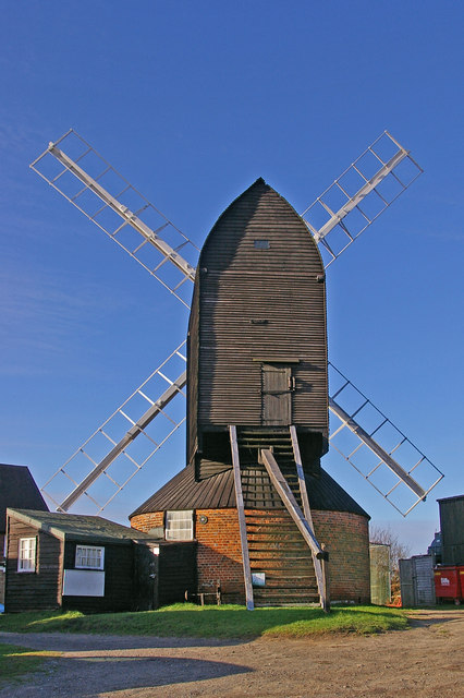
225:Photograph of Reigate Heath windmill
679:
335:Attribution-Share Alike 2.0 Generic
323:
318:
303:Attribution-ShareAlike 2.0 license.
424:
418:
309:
286:
113:
59:
423:
567:coordinates of the point of view
409:
365:Under the following conditions:
330:This file is licensed under the
322:
317:
311:
279:
202:
188:
180:
152:
138:
130:
80:
31:
21:
406:
14:
405:
287:This image was taken from the
26:
1:
956:వాడుకరి:Saketh 1305/ప్రయోగశాల
631:coordinates of depicted place
582:51°14'9.978"N, 0°13'58.555"W
431:Items portrayed in this file
179:
129:
872:Usage on lld.wikipedia.org
822:Usage on en.wikivoyage.org
802:Usage on ceb.wikipedia.org
763:List of windmills in Surrey
989:
962:Usage on www.wikidata.org
952:Usage on te.wikipedia.org
942:Usage on sh.wikipedia.org
932:Usage on ro.wikipedia.org
922:Usage on pl.wikipedia.org
912:Usage on no.wikipedia.org
902:Usage on nn.wikipedia.org
892:Usage on nl.wikipedia.org
882:Usage on lt.wikipedia.org
862:Usage on fr.wikipedia.org
852:Usage on eu.wikipedia.org
842:Usage on es.wikipedia.org
832:Usage on eo.wikipedia.org
812:Usage on cy.wikipedia.org
379:same or compatible license
896:Gebruiker:Mjroots/Sandbox
680:
646:51°14'10.7"N, 0°13'58.8"W
16:
408:
345:
87:This is a file from the
737:
257:
249:
239:
232:
229:
218:
91:. Information from its
773:Reigate Heath Windmill
293:this photograph's page
208:51.236300; -0.233000
158:51.236105; -0.232932
94:description page there
41:Size of this preview:
360:– to adapt the work
47:Other resolutions:
716:09:39, 17 May 2008
946:Crkva (građevina)
794:Global file usage
741:
622:
558:
489:copyright license
417:
308:
307:
291:collection. See
273:
272:
266:
263:Reusing this file
213:
212:
163:
162:
109:
108:
89:Wikimedia Commons
32:Global file usage
980:
728:
668:
667:
662:
604:
603:
598:
540:11 December 2007
453:copyright status
401:
398:
395:
392:
389:
381:as the original.
343:
332:Creative Commons
326:
325:
321:
320:
315:
314:
301:Creative Commons
289:Geograph project
283:
276:
260:
235:
234:11 December 2007
222:
216:
209:
206:
192:
191:
185:
184:
183:
177:
176:
165:
159:
156:
142:
141:
135:
134:
133:
127:
126:
115:
105:
84:
83:
77:
71:
69:
56:
53:426 × 640 pixels
49:160 × 240 pixels
43:399 × 599 pixels
988:
987:
983:
982:
981:
979:
978:
977:
792:
742:
734:
726:
682:
681:
678:
677:
676:
675:
674:
673:
672:
671:
670:
669:
665:
663:
660:
651:
650:
649:
647:
637:
636:
635:
633:
614:
613:
612:
611:
610:
609:
608:
607:
606:
605:
601:
599:
596:
587:
586:
585:
583:
573:
572:
571:
569:
550:
549:
548:
547:
546:
545:
544:
543:
541:
531:
530:
529:
527:
516:
515:
514:
513:
512:
511:
510:
509:
507:
495:
494:
493:
491:
480:
479:
478:
477:
476:
475:
474:
473:
471:
459:
458:
457:
455:
444:
443:
442:
441:
440:
438:
422:
421:
420:
403:
402:
399:
396:
393:
390:
387:
386:
344:
341:
338:
327:
304:
274:
221:Mill church.jpg
220:
207:
181:
172:
171:
168:Object location
157:
131:
122:
121:
118:Camera location
111:
110:
99:
98:
97:is shown below.
73:
67:
65:
58:
57:
46:
12:
11:
5:
986:
984:
976:
975:
974:
973:
968:
960:
959:
958:
950:
949:
948:
940:
939:
938:
930:
929:
928:
920:
919:
918:
910:
909:
908:
900:
899:
898:
890:
889:
888:
880:
879:
878:
870:
869:
868:
860:
859:
858:
850:
849:
848:
840:
839:
838:
830:
829:
828:
820:
819:
818:
810:
809:
808:
796:
795:
791:
790:
785:
780:
775:
770:
765:
760:
755:
746:
745:
740:
739:
736:
732:
729:
723:
718:
713:
709:
708:
705:
702:
699:
696:
693:
686:
685:
656:
655:
654:
653:
652:
648:
645:
643:
642:
641:
640:
639:
638:
634:
629:
627:
626:
625:
624:
618:
592:
591:
590:
589:
588:
584:
581:
579:
578:
577:
576:
575:
574:
570:
565:
563:
562:
561:
560:
554:
542:
539:
537:
536:
535:
534:
533:
532:
528:
523:
521:
520:
519:
518:
517:
508:
503:
501:
500:
499:
498:
497:
496:
492:
487:
485:
484:
483:
482:
481:
472:
467:
465:
464:
463:
462:
461:
460:
456:
451:
449:
448:
447:
446:
445:
439:
434:
432:
429:
428:
427:
426:
425:
414:
413:
410:
407:
385:
384:
383:
382:
372:
363:
362:
361:
355:
348:You are free:
339:
329:
328:
310:
306:
305:
284:
271:
270:
267:
255:
254:
251:
247:
246:
241:
237:
236:
231:
227:
226:
223:
214:
211:
210:
200:
194:
169:
161:
160:
150:
144:
119:
112:
107:
106:
85:
75:
74:
40:
36:
35:
34:
29:
24:
19:
13:
10:
9:
6:
4:
3:
2:
985:
972:
969:
967:
964:
963:
961:
957:
954:
953:
951:
947:
944:
943:
941:
937:
934:
933:
931:
927:
924:
923:
921:
917:
914:
913:
911:
907:
904:
903:
901:
897:
894:
893:
891:
887:
884:
883:
881:
877:
874:
873:
871:
867:
864:
863:
861:
857:
854:
853:
851:
847:
844:
843:
841:
837:
834:
833:
831:
827:
824:
823:
821:
817:
814:
813:
811:
807:
804:
803:
801:
800:
799:
793:
789:
786:
784:
781:
779:
776:
774:
771:
769:
766:
764:
761:
759:
756:
754:
751:
749:
743:
735:
730:
724:
722:
719:
717:
714:
711:
710:
706:
703:
700:
697:
694:
692:
691:
689:
683:
659:
632:
595:
568:
526:
506:
490:
470:
454:
437:
391:CC BY-SA 2.0
380:
376:
373:
370:
367:
366:
364:
359:
356:
353:
350:
349:
347:
346:
340:Attribution:
336:
333:
316:
302:
298:
294:
290:
285:
282:
278:
277:
268:
264:
259:
256:
252:
248:
245:
242:
238:
228:
224:
217:
205:
201:
199:
198:OpenStreetMap
195:
193:
175:
170:
166:
155:
151:
149:
148:OpenStreetMap
145:
143:
125:
120:
116:
103:
96:
95:
90:
86:
79:
78:
72:
63:
62:Original file
54:
50:
44:
39:
33:
30:
28:
25:
23:
20:
18:
15:
797:
747:
687:
684:File history
374:
368:
357:
351:
296:
178:
128:
102:You can help
92:
60:
22:File history
469:copyrighted
375:share alike
369:attribution
269:Attribution
219:Description
744:File usage
725:426 × 640
701:Dimensions
342:Ian Capper
297:Ian Capper
258:Permission
253:Ian Capper
68:image/jpeg
27:File usage
698:Thumbnail
695:Date/Time
525:inception
971:Q7310080
966:Q1018418
886:Raigetas
412:Captions
358:to remix
352:to share
337:license.
936:Reigate
926:Reigate
916:Reigate
906:Reigate
876:Reigate
866:Reigate
856:Reigate
846:Reigate
836:Reigate
816:Reigate
806:Reigate
768:Reigate
733:Mjroots
727:(76 KB)
712:current
707:Comment
658:heading
617:heading
594:heading
553:heading
436:depicts
416:English
64:
826:Surrey
666:degree
621:degree
602:degree
557:degree
250:Author
240:Source
186:
136:
704:User
664:315
600:315
400:true
397:true
230:Date
17:File
661::
597::
51:|
45:.
265:)
261:(
104:.
70:)
55:.
Text is available under the Creative Commons Attribution-ShareAlike License. Additional terms may apply.
_region:GB-ENG_heading:315.00&language=en)
