269:
236:
194:
250:
208:
275:
280:
67:
811:
749:
806:
719:
227:
327:– You must give appropriate credit, provide a link to the license, and indicate if changes were made. You may do so in any reasonable manner, but not in any way that suggests the licensor endorses you or your use.
959:
185:
954:
38:
141:
801:
163:
796:
562:
526:
243:
201:
407:
334:
489:
770:
650:
616:
510:
482:
469:
454:
791:
582:
546:
427:
391:
786:
78:
290:
46:
748:
743:
782:
The following pages on the
English Knowledge (XXG) use this file (pages on other projects are not listed):
333:– If you remix, transform, or build upon the material, you must distribute your contributions under the
729:
287:
854:
86:
767:
812:
Knowledge (XXG):WikiProject
Historic sites/Images of listed buildings in Scotland without ID
461:
759:
807:
Knowledge (XXG):Scottish
Wikipedians' notice board/New images/Archives/December 2005
249:
207:
944:
73:
718:
713:
37:
864:
829:
191:
130:
766:
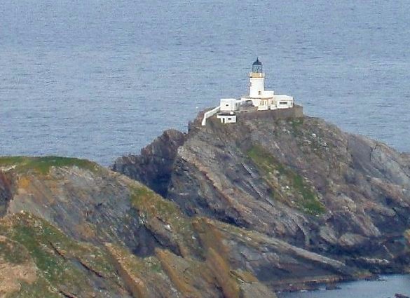
The lighthouse on Muckle Fluggs. Photograph by Rog Frost {{Cc-by-sa-2.0}}
934:
924:
874:
233:
152:
844:
899:
686:
Click on a date/time to view the file as it appeared at that time.
919:
609:
235:
193:
186:
60° 50′ 40.65″ N, 0° 52′ 39.53″ W
218:
176:
61:
909:
643:
894:
969:
839:
884:
228:
60° 51′ 18″ N, 0° 53′ 10″ W
375:
Add a one-line explanation of what this file represents
170:
Creative
Commons Attribution Share-alike license 2.0
105:
85:
Commons is a freely licensed media file repository.
563:
Creative
Commons Attribution-ShareAlike 2.0 Generic
51:(585 × 425 pixels, file size: 63 KB, MIME type:
344:https://creativecommons.org/licenses/by-sa/2.0
66:
350:Creative Commons Attribution-Share Alike 2.0
268:
8:
945:Sinru qillqa: Iskusya suyupi wat'akuna
310:– to copy, distribute and transmit the work
142:Muckle Flugga - geograph.org.uk - 84351.jpg
688:
371:
822:The following other wikis use this file:
462:https://www.geograph.org.uk/profile/3663
784:
664:
648:
630:
614:
596:
580:
560:
544:
524:
508:
441:
425:
405:
389:
386:
367:
360:
221:
179:
242:View this and other nearby images on:
200:View this and other nearby images on:
7:
802:User:Cactus.man/Contributions/Images
677:
291:Attribution-Share Alike 2.0 Generic
279:
274:
830:Llista de les illes d'Escòcia
380:
374:
265:
115:
98:
44:
871:Usage on incubator.wikimedia.org
379:
797:List of listed buildings in Unst
617:coordinates of the point of view
365:
321:Under the following conditions:
286:This file is licensed under the
278:
273:
267:
248:
234:
206:
192:
121:The lighthouse on Muckle Fluggs.
65:
31:
21:
362:
116:
41:No higher resolution available.
14:
361:
26:
1:
651:coordinates of depicted place
632:60°50'40.646"N, 0°52'39.529"W
140:This file was derived from:
845:Luettelo Skotlannin saarista
771:Category:Islands of Scotland
483:object of statement has role
387:Items portrayed in this file
960:Список Шетландских островов
935:Liste over øyer i Skottland
906:Usage on it.wikivoyage.org
792:List of islands of Scotland
988:
966:Usage on sv.wikipedia.org
951:Usage on ru.wikipedia.org
941:Usage on qu.wikipedia.org
931:Usage on no.wikipedia.org
916:Usage on nn.wikipedia.org
900:Lista delle isole Shetland
891:Usage on it.wikipedia.org
881:Usage on is.wikipedia.org
865:Skócia szigeteinek listája
861:Usage on hu.wikipedia.org
851:Usage on he.wikipedia.org
836:Usage on fi.wikipedia.org
826:Usage on ca.wikipedia.org
335:same or compatible license
955:Список островов Шотландии
678:
16:
787:List of Shetland islands
666:60°51'18.0"N, 0°53'9.6"W
408:Muckle Flugga Lighthouse
364:
301:
72:This is a file from the
765:
744:14:37, 28 December 2005
735:
158:
148:
136:
129:
126:
108:
76:. Information from its
714:11:09, 3 February 2012
254:60.855000; -0.886000
212:60.844624; -0.877647
79:description page there
925:Øyar i Shetlandsøyane
316:– to adapt the work
736:colours correction
470:author name string
818:Global file usage
775:
768:Category:Scotland
547:copyright license
373:
259:
258:
217:
216:
174:
173:
167:
164:Reusing this file
111:Muckle Flugga.jpg
94:
93:
74:Wikimedia Commons
47:Muckle_Flugga.jpg
32:Global file usage
979:
920:Øyar i Skottland
756:
726:
511:copyright status
492:
487:
477:
474:
464:
459:
357:
354:
351:
348:
345:
337:as the original.
299:
288:Creative Commons
282:
281:
277:
276:
271:
270:
255:
252:
238:
237:
231:
230:
219:
213:
210:
196:
195:
189:
188:
177:
161:
132:
120:
112:
106:
90:
69:
68:
62:
56:
54:
987:
986:
982:
981:
980:
978:
977:
976:
816:
783:
776:
762:
754:
732:
724:
680:
679:
676:
675:
674:
673:
672:
671:
670:
669:
667:
657:
656:
655:
653:
642:
641:
640:
639:
638:
637:
636:
635:
633:
623:
622:
621:
619:
608:
607:
606:
605:
604:
603:
602:
601:
599:
589:
588:
587:
585:
574:
573:
572:
571:
570:
569:
568:
567:
565:
553:
552:
551:
549:
538:
537:
536:
535:
534:
533:
532:
531:
529:
517:
516:
515:
513:
502:
501:
500:
499:
498:
497:
496:
495:
494:
493:
488:
485:
479:
478:
475:
472:
466:
465:
460:
457:
448:
447:
446:
444:
434:
433:
432:
430:
419:
418:
417:
416:
415:
414:
413:
412:
410:
398:
397:
396:
394:
378:
377:
376:
359:
358:
355:
352:
349:
346:
343:
342:
300:
297:
294:
283:
264:
253:
226:
225:
222:Object location
211:
184:
183:
180:Camera location
175:
122:
110:
103:
96:
95:
84:
83:
82:is shown below.
58:
52:
50:
43:
42:
12:
11:
5:
985:
983:
975:
974:
973:
972:
964:
963:
962:
957:
949:
948:
947:
939:
938:
937:
929:
928:
927:
922:
914:
913:
912:
910:Isole Shetland
904:
903:
902:
897:
895:Isole Shetland
889:
888:
887:
879:
878:
877:
875:Wy/diq/İsqoçya
869:
868:
867:
859:
858:
857:
849:
848:
847:
842:
834:
833:
832:
820:
819:
815:
814:
809:
804:
799:
794:
789:
781:
780:
779:
774:
773:
764:
760:
757:
751:
746:
741:
738:
737:
734:
730:
727:
721:
716:
711:
707:
706:
703:
700:
697:
694:
691:
684:
683:
668:
665:
663:
662:
661:
660:
659:
658:
654:
649:
647:
646:
645:
644:
634:
631:
629:
628:
627:
626:
625:
624:
620:
615:
613:
612:
611:
610:
600:
598:14 August 2005
597:
595:
594:
593:
592:
591:
590:
586:
581:
579:
578:
577:
576:
575:
566:
561:
559:
558:
557:
556:
555:
554:
550:
545:
543:
542:
541:
540:
539:
530:
525:
523:
522:
521:
520:
519:
518:
514:
509:
507:
506:
505:
504:
503:
481:
480:
468:
467:
453:
452:
451:
450:
449:
445:
442:
440:
439:
438:
437:
436:
435:
431:
426:
424:
423:
422:
421:
420:
411:
406:
404:
403:
402:
401:
400:
399:
395:
390:
388:
385:
384:
383:
382:
381:
370:
369:
366:
363:
341:
340:
339:
338:
328:
319:
318:
317:
311:
304:You are free:
295:
285:
284:
266:
263:
260:
257:
256:
246:
240:
223:
215:
214:
204:
198:
181:
172:
171:
168:
156:
155:
150:
146:
145:
138:
134:
133:
131:14 August 2005
128:
124:
123:
113:
104:
102:
99:
97:
92:
91:
70:
60:
59:
40:
36:
35:
34:
29:
24:
19:
13:
10:
9:
6:
4:
3:
2:
984:
971:
970:Muckle Flugga
968:
967:
965:
961:
958:
956:
953:
952:
950:
946:
943:
942:
940:
936:
933:
932:
930:
926:
923:
921:
918:
917:
915:
911:
908:
907:
905:
901:
898:
896:
893:
892:
890:
886:
883:
882:
880:
876:
873:
872:
870:
866:
863:
862:
860:
856:
853:
852:
850:
846:
843:
841:
840:Muckle Flugga
838:
837:
835:
831:
828:
827:
825:
824:
823:
817:
813:
810:
808:
805:
803:
800:
798:
795:
793:
790:
788:
785:
777:
772:
769:
763:
758:
752:
750:
747:
745:
742:
740:
739:
733:
728:
722:
720:
717:
715:
712:
709:
708:
704:
701:
698:
695:
692:
690:
689:
687:
681:
652:
618:
584:
564:
548:
528:
512:
491:
484:
471:
463:
456:
429:
409:
393:
347:CC BY-SA 2.0
336:
332:
329:
326:
323:
322:
320:
315:
312:
309:
306:
305:
303:
302:
296:Attribution:
292:
289:
272:
261:
251:
247:
245:
244:OpenStreetMap
241:
239:
229:
224:
220:
209:
205:
203:
202:OpenStreetMap
199:
197:
187:
182:
178:
169:
165:
160:
157:
154:
151:
147:
144:
143:
139:
135:
125:
119:
114:
107:
100:
88:
81:
80:
75:
71:
64:
63:
57:
48:
39:
33:
30:
28:
25:
23:
20:
18:
15:
885:Mikla-Flugey
821:
731:Desmodromico
685:
682:File history
490:photographer
330:
324:
313:
307:
117:
87:You can help
77:
45:
22:File history
527:copyrighted
331:share alike
325:attribution
109:Description
855:מאקל פלוגה
778:File usage
761:Cactus.man
753:585 × 425
723:585 × 425
699:Dimensions
443:some value
159:Permission
53:image/jpeg
27:File usage
696:Thumbnail
693:Date/Time
583:inception
476:Rog Frost
298:Rog Frost
262:Licensing
153:Rog Frost
118:English:
368:Captions
314:to remix
308:to share
293:license.
755:(53 KB)
725:(63 KB)
710:current
705:Comment
428:creator
392:depicts
372:English
101:Summary
49:
232:
190:
149:Author
137:Source
702:User
356:true
353:true
127:Date
17:File
455:URL
486::
473::
458::
166:)
162:(
89:.
55:)
Text is available under the Creative Commons Attribution-ShareAlike License. Additional terms may apply.
_region:GB-GBN_&language=en)