250:
211:
38:
341:
225:
256:
261:
94:
783:
302:– You must give appropriate credit, provide a link to the license, and indicate if changes were made. You may do so in any reasonable manner, but not in any way that suggests the licensor endorses you or your use.
202:
358:
356:; with no Invariant Sections, no Front-Cover Texts, and no Back-Cover Texts. A copy of the license is included in the section entitled
348:
694:
658:
588:
571:
535:
218:
60:
56:
52:
48:
42:
1020:
105:
843:
This file contains additional information, probably added from the digital camera or scanner used to create or digitize it.
309:
73:
813:
714:
678:
642:
519:
491:
478:
463:
353:
989:
608:
555:
470:
436:
419:
271:
846:
If the file has been modified from its original state, some details may not fully reflect the modified file.
1086:
800:{{Information |description ={{en|1=Entrance fees collection in a local community road checkpoint near
308:– If you remix, transform, or build upon the material, you must distribute your contributions under the
268:
1122:
816:
498:
113:
335:
346:
Permission is granted to copy, distribute and/or modify this document under the terms of the
809:
793:
782:
777:
64:
37:
224:
1182:
1104:
1060:
872:
243:
I, the copyright holder of this work, hereby publish it under the following licenses:
185:
100:
912:
1164:
208:
165:
892:
832:
882:
865:
808:).}} |date =2019-02-17 |source ={{own}} |author =
855:
805:
750:
Click on a date/time to view the file as it appeared at that time.
153:
148:
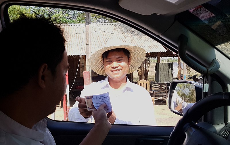
Entrance fees collection in a local community road checkpoint near
801:
707:
210:
203:
21° 23′ 53.59″ N, 95° 21′ 07.11″ E
149:
193:
88:
589:
Creative
Commons Attribution-ShareAlike 4.0 International
403:
Add a one-line explanation of what this file represents
78:(3,017 × 1,901 pixels, file size: 667 KB, MIME type:
572:
352:, Version 1.2 or any later version published by the
132:
112:
Commons is a freely licensed media file repository.
499:https://commons.wikimedia.org/user:Etan_J._Tal
319:https://creativecommons.org/licenses/by-sa/4.0
93:
325:Creative Commons Attribution-Share Alike 4.0
249:
8:
285:– to copy, distribute and transmit the work
848:
752:
399:
384:You may select the license of your choice.
272:Attribution-Share Alike 4.0 International
1214:
1206:
1198:
1190:
1180:
1172:
1162:
1154:
1146:
1138:
1130:
1120:
1112:
1102:
1094:
1084:
1076:
1068:
1058:
1037:
1029:
1018:
1010:
1002:
994:
984:
976:
968:
960:
952:
944:
936:
928:
920:
909:
901:
890:
880:
870:
860:
830:
728:
712:
692:
676:
656:
640:
622:
606:
586:
569:
553:
533:
517:
450:
434:
417:
414:
395:
388:
196:
217:View this and other nearby images on:
850:
7:
364:http://www.gnu.org/copyleft/fdl.html
828:The following page uses this file:
741:
260:
255:
841:
408:
402:
383:
246:
242:
142:
125:
71:
407:
990:A Better Camera, Expo-bracketing
903:Date and time of data generation
715:coordinates of the point of view
393:
340:
339:
296:Under the following conditions:
267:This file is licensed under the
259:
254:
248:
223:
209:
92:
21:
390:
143:
14:
877:1/491 sec (0.0020366598778004)
389:
370:GNU Free Documentation License
359:GNU Free Documentation License
349:GNU Free Documentation License
26:
1:
814:Category:Transport in Myanmar
730:21°23'53.592"N, 95°21'7.110"E
659:original creation by uploader
31:
1148:DateTimeDigitized subseconds
415:Items portrayed in this file
1140:DateTimeOriginal subseconds
1031:Date and time of digitizing
1236:
1192:Focal length in 35 mm film
1156:Supported Flashpix version
310:same or compatible license
1039:Meaning of each component
996:File change date and time
941:20 meters below sea level
742:
175:
16:
1211:F12LLJA00VM F12LLKL01GM
392:
354:Free Software Foundation
276:
138:MyanmarCheckpointFee.jpg
99:This is a file from the
1109:Center weighted average
1034:10:43, 17 February 2019
999:10:43, 17 February 2019
906:10:43, 17 February 2019
799:
181:
171:
164:
161:
135:
103:. Information from its
229:21.398220; 95.351975
106:description page there
41:Size of this preview:
1096:Maximum land aperture
970:Horizontal resolution
778:13:01, 14 March 2019
65:3,017 × 1,901 pixels
1132:DateTime subseconds
1004:Y and C positioning
978:Vertical resolution
852:Camera manufacturer
817:Category:Toll roads
291:– to adapt the work
47:Other resolutions:
1200:Scene capture type
1187:Auto white balance
1127:Flash did not fire
479:author name string
464:Wikimedia username
61:1,280 × 807 pixels
57:1,024 × 645 pixels
1223:
1222:
1099:1.53 APEX (f/1.7)
821:
695:Samsung Galaxy S8
556:copyright license
401:
381:
380:
234:
233:
191:
190:
121:
120:
101:Wikimedia Commons
1227:
1219:17 February 2019
1012:Exposure Program
925:21° 23′ 53.59″ N
849:
810:User:Etan J. Tal
790:
624:17 February 2019
520:copyright status
501:
496:
486:
483:
473:
468:
377:
374:
371:
368:
365:
343:
342:
336:
332:
329:
326:
323:
320:
312:as the original.
269:Creative Commons
263:
262:
258:
257:
252:
251:
230:
227:
213:
212:
206:
205:
194:
177:
167:
166:17 February 2019
147:
139:
133:
117:
96:
95:
89:
83:
81:
68:
53:640 × 403 pixels
49:320 × 202 pixels
43:800 × 504 pixels
1235:
1234:
1230:
1229:
1228:
1226:
1225:
1224:
1208:Unique image ID
1078:APEX brightness
933:95° 21′ 7.11″ E
837:
822:
796:
788:
744:
743:
740:
739:
738:
737:
736:
735:
734:
733:
731:
721:
720:
719:
717:
706:
705:
704:
703:
702:
701:
700:
699:
697:
685:
684:
683:
681:
670:
669:
668:
667:
666:
665:
664:
663:
661:
649:
648:
647:
645:
634:
633:
632:
631:
630:
629:
628:
627:
625:
615:
614:
613:
611:
600:
599:
598:
597:
596:
595:
594:
593:
591:
580:
579:
578:
577:
576:
574:
562:
561:
560:
558:
547:
546:
545:
544:
543:
542:
541:
540:
538:
526:
525:
524:
522:
511:
510:
509:
508:
507:
506:
505:
504:
503:
502:
497:
494:
488:
487:
484:
481:
475:
474:
469:
466:
457:
456:
455:
453:
443:
442:
441:
439:
428:
427:
426:
425:
424:
422:
406:
405:
404:
387:
386:
385:
375:
372:
369:
366:
363:
334:
333:
330:
327:
324:
321:
318:
317:
275:
264:
245:
244:
239:
228:
201:
200:
197:Camera location
192:
157:
137:
130:
123:
122:
111:
110:
109:is shown below.
85:
79:
77:
70:
69:
46:
12:
11:
5:
1233:
1231:
1221:
1220:
1217:
1213:
1212:
1209:
1205:
1204:
1201:
1197:
1196:
1193:
1189:
1188:
1185:
1179:
1178:
1175:
1171:
1170:
1167:
1161:
1160:
1157:
1153:
1152:
1149:
1145:
1144:
1141:
1137:
1136:
1133:
1129:
1128:
1125:
1119:
1118:
1115:
1111:
1110:
1107:
1101:
1100:
1097:
1093:
1092:
1089:
1083:
1082:
1079:
1075:
1074:
1071:
1067:
1066:
1063:
1057:
1056:
1055:
1054:
1053:does not exist
1051:
1048:
1045:
1040:
1036:
1035:
1032:
1028:
1027:
1024:
1017:
1016:
1015:Normal program
1013:
1009:
1008:
1005:
1001:
1000:
997:
993:
992:
987:
983:
982:
979:
975:
974:
971:
967:
966:
963:
959:
958:
955:
951:
950:
947:
943:
942:
939:
935:
934:
931:
927:
926:
923:
919:
918:
915:
908:
907:
904:
900:
899:
896:
889:
888:
885:
879:
878:
875:
869:
868:
863:
859:
858:
853:
840:
836:
835:
826:
825:
820:
819:
798:
794:
791:
787:3,017 × 1,901
785:
780:
775:
771:
770:
767:
764:
761:
758:
755:
748:
747:
732:
729:
727:
726:
725:
724:
723:
722:
718:
713:
711:
710:
709:
708:
698:
693:
691:
690:
689:
688:
687:
686:
682:
677:
675:
674:
673:
672:
671:
662:
657:
655:
654:
653:
652:
651:
650:
646:
643:source of file
641:
639:
638:
637:
636:
635:
626:
623:
621:
620:
619:
618:
617:
616:
612:
607:
605:
604:
603:
602:
601:
592:
587:
585:
584:
583:
582:
581:
575:
570:
568:
567:
566:
565:
564:
563:
559:
554:
552:
551:
550:
549:
548:
539:
534:
532:
531:
530:
529:
528:
527:
523:
518:
516:
515:
514:
513:
512:
490:
489:
477:
476:
462:
461:
460:
459:
458:
454:
451:
449:
448:
447:
446:
445:
444:
440:
435:
433:
432:
431:
430:
429:
423:
418:
416:
413:
412:
411:
410:
409:
398:
397:
394:
391:
382:
379:
378:
344:
316:
315:
314:
313:
303:
294:
293:
292:
286:
279:You are free:
266:
265:
247:
241:
240:
238:
235:
232:
231:
221:
215:
198:
189:
188:
183:
179:
178:
173:
169:
168:
163:
159:
158:
140:
131:
129:
126:
124:
119:
118:
97:
87:
86:
40:
36:
35:
34:
29:
24:
19:
13:
10:
9:
6:
4:
3:
2:
1232:
1218:
1215:
1210:
1207:
1202:
1199:
1194:
1191:
1186:
1184:
1183:White balance
1181:
1177:Auto exposure
1176:
1174:Exposure mode
1173:
1168:
1166:
1163:
1158:
1155:
1150:
1147:
1142:
1139:
1134:
1131:
1126:
1124:
1121:
1116:
1113:
1108:
1106:
1105:Metering mode
1103:
1098:
1095:
1090:
1088:
1087:Exposure bias
1085:
1080:
1077:
1072:
1070:APEX aperture
1069:
1064:
1062:
1061:Shutter speed
1059:
1052:
1049:
1046:
1043:
1042:
1041:
1038:
1033:
1030:
1025:
1022:
1019:
1014:
1011:
1006:
1003:
998:
995:
991:
988:
986:Software used
985:
980:
977:
972:
969:
964:
961:
956:
953:
948:
945:
940:
937:
932:
929:
924:
921:
916:
914:
910:
905:
902:
897:
894:
891:
886:
884:
881:
876:
874:
873:Exposure time
871:
867:
864:
861:
857:
854:
851:
847:
844:
838:
834:
831:
829:
823:
818:
815:
811:
807:
803:
797:
792:
786:
784:
781:
779:
776:
773:
772:
768:
765:
762:
759:
756:
754:
753:
751:
745:
716:
696:
680:
679:captured with
660:
644:
610:
590:
573:
557:
537:
521:
500:
493:
480:
472:
465:
438:
421:
361:
360:
355:
351:
350:
345:
338:
337:
322:CC BY-SA 4.0
311:
307:
304:
301:
298:
297:
295:
290:
287:
284:
281:
280:
278:
277:
273:
270:
253:
236:
226:
222:
220:
219:OpenStreetMap
216:
214:
204:
199:
195:
187:
184:
180:
174:
170:
160:
155:
151:
146:
141:
134:
127:
115:
108:
107:
102:
98:
91:
90:
84:
75:
74:Original file
66:
62:
58:
54:
50:
44:
39:
33:
30:
28:
25:
23:
20:
18:
15:
1114:Light source
913:focal length
862:Camera model
845:
842:
827:
749:
746:File history
357:
347:
305:
299:
288:
282:
144:
114:You can help
104:
72:
22:File history
1165:Color space
962:Orientation
795:Etan J. Tal
536:copyrighted
485:Etan J. Tal
471:Etan J. Tal
306:share alike
300:attribution
186:Etan J. Tal
136:Description
824:File usage
763:Dimensions
452:some value
80:image/jpeg
27:File usage
930:Longitude
893:ISO speed
833:Toll road
760:Thumbnail
757:Date/Time
609:inception
237:Licensing
145:English:
1216:GPS date
1203:Standard
1007:Centered
957:2,268 px
949:4,032 px
938:Altitude
922:Latitude
883:F-number
866:SM-G950F
839:Metadata
789:(667 KB)
396:Captions
289:to remix
283:to share
274:license.
176:Own work
32:Metadata
1117:Unknown
1023:version
856:samsung
806:Myanmar
774:current
769:Comment
437:creator
420:depicts
400:English
154:Myanmar
128:Summary
76:
981:72 dpi
973:72 dpi
965:Normal
954:Height
917:4.2 mm
895:rating
207:
182:Author
172:Source
1195:26 mm
1123:Flash
946:Width
911:Lens
887:f/1.7
802:Bagan
150:Bagan
1169:sRGB
1151:0981
1143:0981
1135:0981
1081:7.81
1065:8.94
1021:Exif
812:}}
766:User
376:true
373:true
367:GFDL
331:true
328:true
162:Date
17:File
1073:1.7
1026:2.2
492:URL
1050:Cr
1047:Cb
898:40
495::
482::
467::
156:).
63:|
59:|
55:|
51:|
45:.
1159:1
1091:1
1044:Y
804:(
362:.
152:(
116:.
82:)
67:.
Text is available under the Creative Commons Attribution-ShareAlike License. Additional terms may apply.
