43:
227:
233:
238:
99:
621:
69:
65:
73:
61:
57:
53:
47:
815:
279:– You must give appropriate credit, provide a link to the license, and indicate if changes were made. You may do so in any reasonable manner, but not in any way that suggests the licensor endorses you or your use.
82:
780:
110:
775:
737:
652:
732:
620:
615:
42:
697:
566:
496:
460:
825:
873:
This file contains additional information, probably added from the digital camera or scanner used to create or digitize it.
286:
820:
672:
550:
444:
416:
403:
388:
712:
662:
516:
480:
361:
344:
423:
860:
770:
722:
248:
876:
If the file has been modified from its original state, some details may not fully reflect the modified file.
765:
648:
The following pages on the
English Knowledge (XXG) use this file (pages on other projects are not listed):
285:– If you remix, transform, or build upon the material, you must distribute your contributions under the
727:
245:
395:
790:
118:
657:
631:
702:
692:
840:
805:
707:
105:
220:
I, the copyright holder of this work, hereby publish it under the following license:
204:
835:
800:
667:
687:
184:
682:
850:
717:
677:
588:
Click on a date/time to view the file as it appeared at that time.
93:
755:
855:
497:
Creative
Commons Attribution-ShareAlike 4.0 International
87:(SVG file, nominally 744 × 744 pixels, file size: 263 KB)
328:
Add a one-line explanation of what this file represents
137:
117:
Commons is a freely licensed media file repository.
143:
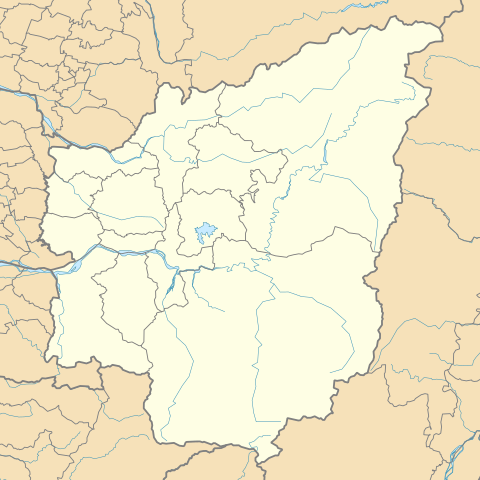
Nàmthèu - Lâmtâu - (Nantou County) location map.svg
396:https://commons.wikimedia.org/user:A-l%C3%BA-mih
296:https://creativecommons.org/licenses/by-sa/4.0
98:
302:Creative Commons Attribution-Share Alike 4.0
226:
8:
262:– to copy, distribute and transmit the work
46:Size of this PNG preview of this SVG file:
878:
841:Module:Location map/data/Nantou County/doc
806:Module:Location map/data/Nantou County/doc
738:Module:Location map/data/Nantou County/doc
590:
324:
826:มอดูล:Location map/data/Nantou County/doc
748:The following other wikis use this file:
249:Attribution-Share Alike 4.0 International
896:
888:
880:
653:Aowanda National Forest Recreation Area
650:
564:
548:
530:
514:
494:
478:
458:
442:
375:
359:
342:
339:
320:
313:
836:Module:Location map/data/Nantou County
801:Module:Location map/data/Nantou County
791:Modèle:Géolocalisation/Comté de Nantou
733:Module:Location map/data/Nantou County
821:มอดูล:Location map/data/Nantou County
7:
638:User created page with UploadWizard
579:
237:
232:
159:West: 120° 32' 56.4'' E (120.549 E)
871:
861:Pang-bô͘:Location map Lâm-tâu-koān
847:Usage on zh-min-nan.wikipedia.org
333:
327:
223:
219:
167:North: 23° 24' 25.2'' N (24.274 N)
163:East: 121° 25' 1.2'' E (121.417 E)
147:
130:
80:
332:
171:South: 23° 8' 52.8'' N (23.407 N)
698:Shanlinxi Forest Recreation Area
318:
273:Under the following conditions:
244:This file is licensed under the
236:
231:
225:
97:
31:
21:
315:
148:
14:
314:
156:Geographic limits of the map:
26:
1:
781:منطقه تفریحی جنگل ملی آوواندا
673:Huisun Forest Recreation Area
567:original creation by uploader
153:*Projection: TWD97 (≈ WGS84)
36:
340:Items portrayed in this file
713:Sun Moon Lake Wen Wu Temple
663:Chuping Archaeological Site
918:
832:Usage on uz.wikipedia.org
812:Usage on th.wikipedia.org
797:Usage on si.wikipedia.org
787:Usage on fr.wikipedia.org
762:Usage on fa.wikipedia.org
752:Usage on de.wikipedia.org
287:same or compatible license
580:
194:
16:
776:منطقه تفریحی جنگل هویسون
723:Xuanzang Temple (Taiwan)
317:
253:
104:This is a file from the
637:
200:
190:
183:
180:
140:
108:. Information from its
616:08:35, 9 November 2018
111:description page there
816:ทะเลสาบสุริยันจันทรา
728:Zhushan Zinan Temple
70:2,048 × 2,048 pixels
66:1,024 × 1,024 pixels
268:– to adapt the work
52:Other resolutions:
417:Wikimedia username
404:author name string
905:
904:
885:Generated with Qt
744:Global file usage
641:
481:copyright license
326:
210:
209:
126:
125:
106:Wikimedia Commons
32:Global file usage
909:
879:
756:Landkreis Nantou
658:Chenyoulan River
628:
445:copyright status
426:
421:
411:
408:
398:
393:
309:
306:
303:
300:
297:
289:as the original.
246:Creative Commons
240:
239:
235:
234:
229:
228:
196:
186:
152:
144:
138:
122:
101:
100:
94:
88:
77:
74:744 × 744 pixels
62:768 × 768 pixels
58:480 × 480 pixels
54:240 × 240 pixels
48:600 × 600 pixels
917:
916:
912:
911:
910:
908:
907:
906:
867:
742:
703:Shoutian Temple
693:Mount Dongjunda
649:
642:
634:
626:
582:
581:
578:
577:
576:
575:
574:
573:
572:
571:
569:
557:
556:
555:
553:
542:
541:
540:
539:
538:
537:
536:
535:
533:
532:9 November 2018
523:
522:
521:
519:
508:
507:
506:
505:
504:
503:
502:
501:
499:
487:
486:
485:
483:
472:
471:
470:
469:
468:
467:
466:
465:
463:
451:
450:
449:
447:
436:
435:
434:
433:
432:
431:
430:
429:
428:
427:
422:
419:
413:
412:
409:
406:
400:
399:
394:
391:
382:
381:
380:
378:
368:
367:
366:
364:
353:
352:
351:
350:
349:
347:
331:
330:
329:
312:
311:
310:
307:
304:
301:
298:
295:
294:
252:
241:
222:
221:
216:
211:
185:9 November 2018
176:
142:
135:
128:
127:
116:
115:
114:is shown below.
90:
86:
79:
78:
51:
12:
11:
5:
915:
913:
903:
902:
899:
895:
894:
891:
887:
886:
883:
870:
866:
865:
864:
863:
858:
853:
845:
844:
843:
838:
830:
829:
828:
823:
818:
810:
809:
808:
803:
795:
794:
793:
785:
784:
783:
778:
773:
768:
760:
759:
758:
746:
745:
741:
740:
735:
730:
725:
720:
715:
710:
705:
700:
695:
690:
685:
680:
675:
670:
665:
660:
655:
647:
646:
645:
640:
639:
636:
632:
629:
623:
618:
613:
609:
608:
605:
602:
599:
596:
593:
586:
585:
570:
565:
563:
562:
561:
560:
559:
558:
554:
551:source of file
549:
547:
546:
545:
544:
543:
534:
531:
529:
528:
527:
526:
525:
524:
520:
515:
513:
512:
511:
510:
509:
500:
495:
493:
492:
491:
490:
489:
488:
484:
479:
477:
476:
475:
474:
473:
464:
459:
457:
456:
455:
454:
453:
452:
448:
443:
441:
440:
439:
438:
437:
415:
414:
402:
401:
387:
386:
385:
384:
383:
379:
376:
374:
373:
372:
371:
370:
369:
365:
360:
358:
357:
356:
355:
354:
348:
343:
341:
338:
337:
336:
335:
334:
323:
322:
319:
316:
293:
292:
291:
290:
280:
271:
270:
269:
263:
256:You are free:
243:
242:
224:
218:
217:
215:
212:
208:
207:
202:
198:
197:
192:
188:
187:
182:
178:
177:
175:
174:
173:
172:
169:
165:
161:
145:
136:
134:
131:
129:
124:
123:
102:
92:
91:
45:
41:
40:
39:
34:
29:
24:
19:
13:
10:
9:
6:
4:
3:
2:
914:
900:
897:
892:
889:
884:
881:
877:
874:
868:
862:
859:
857:
854:
852:
849:
848:
846:
842:
839:
837:
834:
833:
831:
827:
824:
822:
819:
817:
814:
813:
811:
807:
804:
802:
799:
798:
796:
792:
789:
788:
786:
782:
779:
777:
774:
772:
769:
767:
764:
763:
761:
757:
754:
753:
751:
750:
749:
743:
739:
736:
734:
731:
729:
726:
724:
721:
719:
716:
714:
711:
709:
708:Sun Moon Lake
706:
704:
701:
699:
696:
694:
691:
689:
686:
684:
681:
679:
676:
674:
671:
669:
666:
664:
661:
659:
656:
654:
651:
643:
635:
630:
624:
622:
619:
617:
614:
611:
610:
606:
603:
600:
597:
594:
592:
591:
589:
583:
568:
552:
518:
498:
482:
462:
446:
425:
418:
405:
397:
390:
363:
346:
299:CC BY-SA 4.0
288:
284:
281:
278:
275:
274:
272:
267:
264:
261:
258:
257:
255:
254:
250:
247:
230:
213:
206:
203:
199:
193:
189:
179:
170:
168:
166:
164:
162:
160:
158:
157:
155:
154:
151:
146:
139:
132:
120:
113:
112:
107:
103:
96:
95:
89:
84:
83:Original file
75:
71:
67:
63:
59:
55:
49:
44:
38:
35:
33:
30:
28:
25:
23:
20:
18:
15:
875:
872:
771:کوه مابولاسی
766:کوه دونگ جون
747:
668:Ci En Pagoda
587:
584:File history
282:
276:
265:
259:
149:
119:You can help
109:
81:
22:File history
882:Image title
688:Mingtan Dam
461:copyrighted
283:share alike
277:attribution
141:Description
683:Minghu Dam
644:File usage
625:744 × 744
601:Dimensions
377:some value
27:File usage
901:209.973mm
893:209.973mm
851:O͘-gû-lân
718:Wushe Dam
678:Jiji Weir
598:Thumbnail
595:Date/Time
517:inception
214:Licensing
150:English:
869:Metadata
633:A-lú-mih
627:(263 KB)
424:A-lú-mih
410:A-lú-mih
321:Captions
266:to remix
260:to share
251:license.
205:A-lú-mih
195:Own work
37:Metadata
856:Bwarung
612:current
607:Comment
362:creator
345:depicts
325:English
133:Summary
85:
898:Height
201:Author
191:Source
890:Width
604:User
308:true
305:true
181:Date
17:File
389:URL
420::
407::
392::
72:|
68:|
64:|
60:|
56:|
50:.
121:.
76:.
Text is available under the Creative Commons Attribution-ShareAlike License. Additional terms may apply.

_location_map.svg)