268:
38:
454:
356:
460:
362:
559:
541:
443:
465:
367:
94:
1116:
1258:
506:– You must give appropriate credit, provide a link to the license, and indicate if changes were made. You may do so in any reasonable manner, but not in any way that suggests the licensor endorses you or your use.
408:– You must give appropriate credit, provide a link to the license, and indicate if changes were made. You may do so in any reasonable manner, but not in any way that suggests the licensor endorses you or your use.
1298:
1532:
1160:
1215:
1210:
64:
60:
68:
56:
52:
48:
42:
105:
77:
573:
255:
1205:
1061:
991:
955:
1141:}} Quadratische Plattkarte, N-S-Streckung 200 %. Geographische Begrenzung der Karte: * N: 61.1° N * S: 59.4° N * W: 4.4° O * O
513:
415:
1155:
1045:
939:
911:
896:
883:
1011:
975:
856:
839:
475:
377:
903:
1273:
798:
566:
298:
A weblink to the original file is provided: //commons.wikimedia.org/File:Norway_Hordaland_location_map.svg
512:– If you remix, transform, or build upon the material, you must distribute your contributions under the
414:– If you remix, transform, or build upon the material, you must distribute your contributions under the
1200:
472:
374:
1233:
1115:
1110:
37:
1195:
918:
113:
1165:
1126:
346:
PS: In case of refusal of the above terms the author reserves the right to take legal action.
319:
302:
1523:
1373:
277:
1498:
558:
1293:
1288:
244:
158:
Quadratische
Plattkarte, N-S-Streckung 200 %. Geographische Begrenzung der Karte:
1378:
1308:
1248:
190:
Equirectangular projection, N/S stretching 200 %. Geographic limits of the map:
100:
1333:
608:
1358:
1268:
328:
Please send me a specimen copy or the URL of the website where the file is used.
213:
181:
1190:
1180:
716:
680:
788:
779:
770:
761:
752:
743:
734:
725:
707:
698:
689:
671:
662:
653:
644:
635:
626:
617:
599:
590:
581:
1175:
1353:
1283:
1185:
1134:
149:
1318:
1138:
153:
1133:={{int:filedesc}}== {{Information |Description= {{de|Positionskarte von
185:
1408:
1338:
1170:
1083:
Click on a date/time to view the file as it appeared at that time.
1513:
1503:
1278:
1403:
1393:
88:
1423:
1363:
1428:
539:
441:
274:
I have published this file as author NordNordWest under the
266:
1413:
320:
https://creativecommons.org/licenses/by-sa/3.0/de/legalcode
303:
https://creativecommons.org/licenses/by-sa/3.0/de/legalcode
1518:
1418:
609:
523:
https://creativecommons.org/licenses/by-sa/3.0/de/deed.en
425:
https://creativecommons.org/licenses/by-sa/3.0/de/deed.en
82:(SVG file, nominally 939 × 912 pixels, file size: 267 KB)
1483:
1343:
1493:
1478:
1448:
1433:
823:
Add a one-line explanation of what this file represents
1443:
1388:
231:
United States
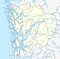
National Imagery and Mapping Agency data
1398:
342:
have further questions about the terms of the licence
1473:
1348:
1328:
553:
132:
112:
Commons is a freely licensed media file repository.
1488:
1463:
1243:
992:
Creative
Commons Attribution-ShareAlike 3.0 Germany
717:
681:
1458:
789:
780:
771:
762:
753:
744:
735:
726:
708:
699:
690:
672:
663:
654:
645:
636:
627:
618:
600:
591:
582:
565:This map has been made or improved in the German
339:need my postal address for sending a specimen copy
1468:
1453:
1438:
286:is permitted under the following licence terms:
1374:Knowledge:Kartenwerkstatt/Positionskarten/Europa
529:Creative Commons Attribution-Share Alike 3.0 de
431:Creative Commons Attribution-Share Alike 3.0 de
919:http://commons.wikimedia.org/User:NordNordWest
318:A copy of or the Uniform Resource Identifier (
301:A copy of or the Uniform Resource Identifier (
93:
1216:Module:Location map/data/Norway Hordaland/doc
453:
355:
8:
315:The author "NordNordWest/Wikipedia" is named
295:The author "NordNordWest/Wikipedia" is named
1524:Plantilla:Mapa de localización de Hordaland
1161:2018–19 Eliteserien (women's handball)
489:– to copy, distribute and transmit the work
391:– to copy, distribute and transmit the work
284:free, commercial usage outside of Knowledge
41:Size of this PNG preview of this SVG file:
1085:
819:
797:
1499:Ŝablono:Situo sur mapo Norvegio Hordaland
1379:Vorlage:Positionskarte Norwegen Hordaland
1226:The following other wikis use this file:
1211:Module:Location map/data/Norway Hordaland
262:
1334:Skabelon:Kortpositioner Norge Hordaland
1309:Plantilya:Location map Norway Hordaland
1249:Vorlog:Positionskarte Norwegn Hordaland
1153:
1059:
1043:
1025:
1009:
989:
973:
953:
937:
870:
854:
837:
834:
815:
808:
1151:The following 13 pages use this file:
7:
1359:Kollisionen ved Stureterminalen 2018
1074:
476:Attribution-Share Alike 3.0 Germany
464:
459:
378:Attribution-Share Alike 3.0 Germany
366:
361:
1234:قالب:Location map Norway Hordaland
1206:Module:Location map/data/Hordaland
828:
822:
564:
450:
352:
322:) for this licence with every copy
305:) for this licence with every copy
174:
142:
125:
75:
1259:Ҡалып:ПозКарта Норвегия Хордаланд
827:
138:Norway Hordaland location map.svg
813:
557:
500:Under the following conditions:
471:This file is licensed under the
463:
458:
452:
402:Under the following conditions:
373:This file is licensed under the
365:
360:
354:
92:
31:
21:
810:
175:
14:
1354:Skabelon:Infoboks vandfald/doc
809:
282:in Knowledge. This means that
143:
26:
1:
1156:2013 Norwegian Third Division
1062:original creation by uploader
835:Items portrayed in this file
1305:Usage on ceb.wikipedia.org
1299:Шаблон:ПК Норвегия Хордалан
1240:Usage on bar.wikipedia.org
1549:
1510:Usage on es.wikipedia.org
1385:Usage on eo.wikipedia.org
1370:Usage on de.wikipedia.org
1339:Skabelon:Infoboks vandfald
1325:Usage on da.wikipedia.org
1315:Usage on cs.wikipedia.org
1265:Usage on bg.wikipedia.org
1255:Usage on ba.wikipedia.org
1230:Usage on ar.wikipedia.org
514:same or compatible license
416:same or compatible license
1075:
331:Please write an email to
224:
16:
1319:Šablona:LocMap Hordaland
812:
480:
382:
99:This is a file from the
1132:
250:
240:
234:World Data Base II data
219:
212:
209:
135:
103:. Information from its
544:
446:
271:
106:description page there
543:
445:
270:
1201:User:Blazine/sandbox
576:to improve as well.
65:2,109 × 2,048 pixels
61:1,054 × 1,024 pixels
1514:Fiordo de Hardanger
495:– to adapt the work
397:– to adapt the work
148:Positionskarte von
47:Other resolutions:
1196:Trengereid Station
1111:13:53, 24 May 2010
897:Wikimedia username
884:author name string
610:Deutsch (Sie-Form)
545:
447:
272:
1533:more global usage
1404:Askjelldalsvatnet
1394:Bergen (Norvegio)
1222:Global file usage
1166:Bogegrend Station
1144:
976:copyright license
821:
807:
806:
801:
551:
550:
351:
350:
259:
256:Reusing this file
121:
120:
101:Wikimedia Commons
32:Global file usage
1540:
1409:Bjølsegrøvvatnet
1364:Samnangerfjorden
1123:
940:copyright status
921:
916:
906:
901:
891:
888:
802:
561:
554:
542:
536:
533:
530:
527:
524:
516:as the original.
473:Creative Commons
467:
466:
462:
461:
456:
455:
444:
438:
435:
432:
429:
426:
418:as the original.
375:Creative Commons
369:
368:
364:
363:
358:
357:
269:
263:
253:
226:
215:
180:Location map of
179:
147:
139:
133:
117:
96:
95:
89:
83:
72:
69:939 × 912 pixels
57:791 × 768 pixels
53:494 × 480 pixels
49:247 × 240 pixels
43:617 × 599 pixels
1548:
1547:
1543:
1542:
1541:
1539:
1538:
1537:
1220:
1145:
1129:
1121:
1077:
1076:
1073:
1072:
1071:
1070:
1069:
1068:
1067:
1066:
1064:
1052:
1051:
1050:
1048:
1037:
1036:
1035:
1034:
1033:
1032:
1031:
1030:
1028:
1018:
1017:
1016:
1014:
1003:
1002:
1001:
1000:
999:
998:
997:
996:
994:
982:
981:
980:
978:
967:
966:
965:
964:
963:
962:
961:
960:
958:
946:
945:
944:
942:
931:
930:
929:
928:
927:
926:
925:
924:
923:
922:
917:
914:
908:
907:
902:
899:
893:
892:
889:
886:
877:
876:
875:
873:
863:
862:
861:
859:
848:
847:
846:
845:
844:
842:
826:
825:
824:
803:
791:
782:
773:
764:
755:
746:
737:
728:
719:
710:
701:
692:
683:
674:
665:
656:
647:
638:
629:
620:
611:
602:
593:
584:
580:
577:
567:Kartenwerkstatt
552:
547:
546:
540:
537:
534:
531:
528:
526:CC BY-SA 3.0 de
525:
522:
521:
479:
468:
449:
448:
442:
439:
436:
433:
430:
428:CC BY-SA 3.0 de
427:
424:
423:
381:
370:
278:CC-BY-SA-3.0-DE
267:
188:
156:
137:
130:
123:
122:
111:
110:
109:is shown below.
85:
81:
74:
73:
46:
12:
11:
5:
1546:
1544:
1535:of this file.
1529:
1528:
1527:
1526:
1521:
1516:
1508:
1507:
1506:
1501:
1496:
1491:
1486:
1481:
1476:
1471:
1466:
1461:
1456:
1451:
1446:
1441:
1436:
1431:
1426:
1421:
1416:
1414:Eidfjordvatnet
1411:
1406:
1401:
1396:
1391:
1383:
1382:
1381:
1376:
1368:
1367:
1366:
1361:
1356:
1351:
1346:
1341:
1336:
1331:
1323:
1322:
1321:
1313:
1312:
1311:
1303:
1302:
1301:
1296:
1291:
1286:
1281:
1276:
1274:Ода (Норвегия)
1271:
1263:
1262:
1261:
1253:
1252:
1251:
1246:
1238:
1237:
1236:
1224:
1223:
1219:
1218:
1213:
1208:
1203:
1198:
1193:
1188:
1183:
1178:
1173:
1168:
1163:
1158:
1149:
1148:
1143:
1142:
1131:
1127:
1124:
1118:
1113:
1108:
1104:
1103:
1100:
1097:
1094:
1091:
1088:
1081:
1080:
1065:
1060:
1058:
1057:
1056:
1055:
1054:
1053:
1049:
1046:source of file
1044:
1042:
1041:
1040:
1039:
1038:
1029:
1026:
1024:
1023:
1022:
1021:
1020:
1019:
1015:
1010:
1008:
1007:
1006:
1005:
1004:
995:
990:
988:
987:
986:
985:
984:
983:
979:
974:
972:
971:
970:
969:
968:
959:
954:
952:
951:
950:
949:
948:
947:
943:
938:
936:
935:
934:
933:
932:
910:
909:
895:
894:
882:
881:
880:
879:
878:
874:
871:
869:
868:
867:
866:
865:
864:
860:
855:
853:
852:
851:
850:
849:
843:
838:
836:
833:
832:
831:
830:
829:
818:
817:
814:
811:
805:
804:
579:
562:
549:
548:
538:
520:
519:
518:
517:
507:
498:
497:
496:
490:
483:You are free:
470:
469:
451:
440:
422:
421:
420:
419:
409:
400:
399:
398:
392:
385:You are free:
372:
371:
353:
349:
348:
344:
343:
340:
326:
325:
324:
323:
316:
308:
307:
306:
299:
296:
260:
248:
247:
242:
238:
237:
236:
235:
232:
221:
217:
216:
211:
207:
206:
205:
204:
201:
198:
195:
173:
172:
169:
166:
163:
140:
131:
129:
126:
124:
119:
118:
97:
87:
86:
40:
36:
35:
34:
29:
24:
19:
13:
10:
9:
6:
4:
3:
2:
1545:
1536:
1534:
1525:
1522:
1520:
1519:Hjeltefjorden
1517:
1515:
1512:
1511:
1509:
1505:
1504:Bjørnafjorden
1502:
1500:
1497:
1495:
1492:
1490:
1487:
1485:
1482:
1480:
1477:
1475:
1472:
1470:
1467:
1465:
1462:
1460:
1457:
1455:
1452:
1450:
1447:
1445:
1442:
1440:
1437:
1435:
1432:
1430:
1427:
1425:
1422:
1420:
1419:Evangervatnet
1417:
1415:
1412:
1410:
1407:
1405:
1402:
1400:
1397:
1395:
1392:
1390:
1387:
1386:
1384:
1380:
1377:
1375:
1372:
1371:
1369:
1365:
1362:
1360:
1357:
1355:
1352:
1350:
1347:
1345:
1342:
1340:
1337:
1335:
1332:
1330:
1327:
1326:
1324:
1320:
1317:
1316:
1314:
1310:
1307:
1306:
1304:
1300:
1297:
1295:
1292:
1290:
1287:
1285:
1282:
1280:
1277:
1275:
1272:
1270:
1267:
1266:
1264:
1260:
1257:
1256:
1254:
1250:
1247:
1245:
1242:
1241:
1239:
1235:
1232:
1231:
1229:
1228:
1227:
1221:
1217:
1214:
1212:
1209:
1207:
1204:
1202:
1199:
1197:
1194:
1192:
1189:
1187:
1184:
1182:
1179:
1177:
1174:
1172:
1169:
1167:
1164:
1162:
1159:
1157:
1154:
1152:
1146:
1140:
1136:
1130:
1125:
1119:
1117:
1114:
1112:
1109:
1106:
1105:
1101:
1098:
1095:
1092:
1089:
1087:
1086:
1084:
1078:
1063:
1047:
1013:
993:
977:
957:
941:
920:
913:
905:
898:
885:
858:
841:
800:
796:
792:
787:
783:
778:
774:
769:
765:
760:
756:
751:
747:
742:
738:
733:
729:
724:
720:
715:
711:
706:
702:
697:
693:
688:
684:
679:
675:
670:
666:
661:
657:
652:
648:
643:
639:
634:
630:
625:
621:
616:
612:
607:
603:
598:
594:
589:
585:
578:
575:
571:
568:
563:
560:
556:
555:
515:
511:
508:
505:
502:
501:
499:
494:
491:
488:
485:
484:
482:
481:
477:
474:
457:
417:
413:
410:
407:
404:
403:
401:
396:
393:
390:
387:
386:
384:
383:
379:
376:
359:
347:
341:
338:
337:
336:
334:
329:
321:
317:
314:
313:
312:
309:
304:
300:
297:
294:
293:
292:
291:Online media:
289:
288:
287:
285:
281:
279:
265:
264:
261:
257:
252:
249:
246:
243:
239:
233:
230:
229:
228:
222:
218:
208:
202:
199:
196:
193:
192:
191:
187:
183:
178:
170:
167:
164:
161:
160:
159:
155:
151:
146:
141:
134:
127:
115:
108:
107:
102:
98:
91:
90:
84:
79:
78:Original file
70:
66:
62:
58:
54:
50:
44:
39:
33:
30:
28:
25:
23:
20:
18:
15:
1530:
1225:
1150:
1128:NordNordWest
1082:
1079:File history
904:NordNordWest
890:NordNordWest
794:
785:
776:
767:
758:
749:
740:
731:
722:
713:
704:
695:
686:
682:Plattdüütsch
677:
668:
659:
650:
641:
632:
623:
614:
605:
596:
587:
583:azərbaycanca
574:propose maps
569:
509:
503:
492:
486:
411:
405:
394:
388:
345:
333:nnwestweb.de
332:
330:
327:
311:Print media:
310:
290:
283:
275:
273:
245:NordNordWest
223:
189:
176:
157:
144:
114:You can help
104:
76:
22:File history
1424:Gjønavatnet
1344:Vardetangen
1027:24 May 2010
956:copyrighted
727:slovenščina
510:share alike
504:attribution
412:share alike
406:attribution
214:24 May 2010
136:Description
1479:Kvinnherad
1429:Kvennsjøen
1191:Trengereid
1147:File usage
1120:939 × 912
1096:Dimensions
872:some value
745:македонски
673:Nederlands
572:. You can
251:Permission
197:S: 59.4° N
194:N: 61.1° N
165:S: 59.4° N
162:N: 61.1° N
27:File usage
1444:Austrheim
1389:Hordaland
1176:Hordaland
1135:Hordaland
1093:Thumbnail
1090:Date/Time
1012:inception
718:sicilianu
700:português
570:(Map Lab)
227:, using
203:E: 7.9° E
200:W: 4.4° E
182:Hordaland
177:English:
171:O: 7.9° O
168:W: 4.4° O
150:Hordaland
145:Deutsch:
1399:Eidfjord
1139:Norwegen
1122:(267 KB)
816:Captions
655:latviešu
646:italiano
637:français
493:to remix
487:to share
478:license.
395:to remix
389:to share
380:license.
225:Own work
154:Norwegen
1474:Granvin
1349:Hagavik
1329:Ulriken
1294:Телеваг
1289:Лайрвик
1181:Kjeåsen
1171:Follese
1107:current
1102:Comment
857:creator
840:depicts
820:English
772:հայերեն
763:ქართული
754:русский
628:español
619:English
601:Deutsch
592:čeština
335:if you
128:Summary
80:
1489:Meland
1484:Lindås
1464:Fitjar
1269:Берген
1186:Ringøy
793:
784:
775:
766:
757:
748:
739:
730:
721:
712:
709:română
703:
694:
691:polski
685:
676:
667:
664:magyar
658:
649:
640:
631:
622:
613:
604:
595:
586:
241:Author
220:Source
186:Norway
1531:View
1494:Radøy
1459:Fedje
1449:Bømlo
1434:Askøy
1284:Юндал
1244:Sotra
781:বাংলা
736:suomi
1469:Fusa
1454:Etne
1439:Kvam
1099:User
535:true
532:true
437:true
434:true
210:Date
17:File
1279:Вос
912:URL
799:+/−
790:ไทย
1137:,
915::
900::
887::
184:,
152:,
67:|
63:|
59:|
55:|
51:|
45:.
795:∙
786:∙
777:∙
768:∙
759:∙
750:∙
741:∙
732:∙
723:∙
714:∙
705:∙
696:∙
687:∙
678:∙
669:∙
660:∙
651:∙
642:∙
633:∙
624:∙
615:∙
606:∙
597:∙
588:∙
280:"
276:"
258:)
254:(
116:.
71:.
Text is available under the Creative Commons Attribution-ShareAlike License. Additional terms may apply.
