137:
43:
256:
270:
311:
99:
717:
752:
247:
757:
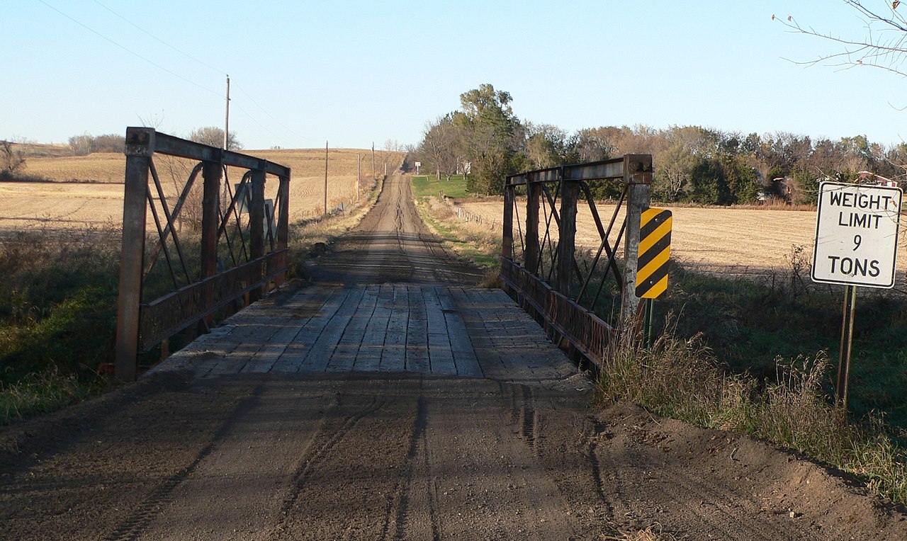
197:; seen from the south. The bridge carries county road 26 across the creek north of county road G. Upstream is west (left). The bridge was built about 1905, and is listed in the
65:
61:
57:
53:
47:
110:
78:
144:
198:
738:
in {{w|Thurston County, Nebraska}}; seen from the south. The bridge carries county road 26 across the creek north of county road G. The bri
558:
522:
486:
263:
628:
916:
803:
This file contains additional information, probably added from the digital camera or scanner used to create or digitize it.
648:
612:
542:
470:
442:
427:
414:
578:
506:
387:
370:
194:
449:
186:
762:
806:
If the file has been modified from its original state, some details may not fully reflect the modified file.
716:
711:
69:
42:
748:
The following pages on the
English Knowledge (XXG) use this file (pages on other projects are not listed):
943:
190:
979:
735:
118:
434:
1060:
318:
885:
727:
269:
153:
1023:
961:
832:
105:
1070:
1033:
872:
230:
253:
989:
210:
131:
852:
734:{{Information |Description={{en|1={{w|North Omaha Creek Bridge}} southwest of
815:
1080:
842:
825:
780:
753:
List of bridges on the
National Register of Historic Places in Nebraska
333:, without any conditions, unless such conditions are required by law.
684:
Click on a date/time to view the file as it appeared at that time.
641:
316:
I, the copyright holder of this work, release this work into the
148:
255:
487:
copyrighted, dedicated to the public domain by copyright holder
305:
238:
143:
This is an image of a place or building that is listed on the
93:
248:
42° 11′ 38″ N, 96° 31′ 51.5″ W
325:
In some countries this may not be legally possible; if so:
758:
National
Register of Historic Places listings in Nebraska
523:
released into the public domain by the copyright holder
354:
Add a one-line explanation of what this file represents
790:
83:(2,356 × 1,406 pixels, file size: 1.17 MB, MIME type:
170:
117:
Commons is a freely licensed media file repository.
984:Flash did not fire, compulsory flash suppression
98:
435:https://commons.wikimedia.org/user:Ammodramus
8:
808:
686:
350:
329:I grant anyone the right to use this work
285:
773:The following other wikis use this file:
176:North Omaha Creek Bridge 26 Rd from S.JPG
1078:
1068:
1058:
1050:
1042:
1031:
1021:
1013:
1005:
997:
987:
977:
969:
959:
951:
941:
933:
925:
914:
906:
898:
890:
880:
869:
861:
850:
840:
830:
820:
750:
662:
646:
626:
610:
592:
576:
556:
540:
520:
504:
484:
468:
401:
385:
368:
365:
346:
339:
241:
262:View this and other nearby images on:
810:
310:
7:
199:National Register of Historic Places
145:National Register of Historic Places
675:
801:
359:
353:
180:
130:
76:
358:
863:Date and time of data generation
344:
309:
268:
254:
135:
97:
31:
21:
341:
181:
14:
664:42°11'38.000"N, 96°31'51.499"W
340:
26:
1:
649:coordinates of depicted place
559:original creation by uploader
36:
366:Items portrayed in this file
927:Date and time of digitizing
1102:
1044:Focal length in 35 mm film
1002:One-chip color area sensor
787:Usage on www.wikidata.org
781:Thurston County (Nebraska)
777:Usage on de.wikipedia.org
151:. Its reference number is
892:File change date and time
676:
322:. This applies worldwide.
220:
195:Thurston County, Nebraska
16:
763:North Omaha Creek Bridge
629:Panasonic Lumix DMC-FZ20
343:
187:North Omaha Creek Bridge
149:United States of America
104:This is a file from the
1007:Custom image processing
733:
226:
216:
209:
206:
173:
108:. Information from its
935:Image compression mode
930:17:12, 28 October 2010
895:17:12, 28 October 2010
866:17:12, 28 October 2010
712:13:44, 2 November 2010
274:42.193889; -96.530972
111:description page there
46:Size of this preview:
953:Maximum land aperture
837:1/320 sec (0.003125)
70:2,356 × 1,406 pixels
900:Y and C positioning
812:Camera manufacturer
52:Other resolutions:
1052:Scene capture type
1028:Auto white balance
443:Wikimedia username
415:author name string
66:1,280 × 764 pixels
62:1,024 × 611 pixels
1089:
1088:
769:Global file usage
741:
507:copyright license
352:
338:
337:
326:
304:
303:
279:
278:
236:
235:
163:
162:
126:
125:
106:Wikimedia Commons
32:Global file usage
1093:
908:Exposure Program
809:
724:
471:copyright status
452:
447:
437:
432:
422:
419:
324:
313:
312:
306:
300:
297:
294:
291:
286:
275:
272:
258:
257:
251:
250:
239:
222:
212:
185:
177:
171:
156:
139:
138:
132:
122:
101:
100:
94:
88:
86:
73:
58:640 × 382 pixels
54:320 × 191 pixels
48:800 × 477 pixels
1101:
1100:
1096:
1095:
1094:
1092:
1091:
1090:
956:3 APEX (f/2.83)
797:
767:
749:
742:
730:
722:
678:
677:
674:
673:
672:
671:
670:
669:
668:
667:
665:
655:
654:
653:
651:
640:
639:
638:
637:
636:
635:
634:
633:
631:
619:
618:
617:
615:
604:
603:
602:
601:
600:
599:
598:
597:
595:
594:28 October 2010
585:
584:
583:
581:
570:
569:
568:
567:
566:
565:
564:
563:
561:
549:
548:
547:
545:
534:
533:
532:
531:
530:
529:
528:
527:
525:
513:
512:
511:
509:
498:
497:
496:
495:
494:
493:
492:
491:
489:
477:
476:
475:
473:
462:
461:
460:
459:
458:
457:
456:
455:
454:
453:
448:
445:
439:
438:
433:
430:
424:
423:
420:
417:
408:
407:
406:
404:
394:
393:
392:
390:
379:
378:
377:
376:
375:
373:
357:
356:
355:
331:for any purpose
298:
295:
292:
289:
284:
273:
246:
245:
242:Object location
237:
211:28 October 2010
202:
175:
168:
152:
136:
128:
127:
116:
115:
114:is shown below.
90:
84:
82:
75:
74:
51:
12:
11:
5:
1099:
1097:
1087:
1086:
1083:
1077:
1076:
1073:
1067:
1066:
1063:
1057:
1056:
1053:
1049:
1048:
1045:
1041:
1040:
1037:
1030:
1029:
1026:
1020:
1019:
1016:
1012:
1011:
1010:Normal process
1008:
1004:
1003:
1000:
999:Sensing method
996:
995:
992:
986:
985:
982:
976:
975:
972:
968:
967:
964:
958:
957:
954:
950:
949:
946:
940:
939:
936:
932:
931:
928:
924:
923:
920:
913:
912:
911:Normal program
909:
905:
904:
901:
897:
896:
893:
889:
888:
883:
879:
878:
875:
868:
867:
864:
860:
859:
856:
849:
848:
845:
839:
838:
835:
829:
828:
823:
819:
818:
813:
800:
796:
795:
794:
793:
785:
784:
783:
771:
770:
766:
765:
760:
755:
747:
746:
745:
740:
739:
732:
728:
725:
721:2,356 × 1,406
719:
714:
709:
705:
704:
701:
698:
695:
692:
689:
682:
681:
666:
663:
661:
660:
659:
658:
657:
656:
652:
647:
645:
644:
643:
642:
632:
627:
625:
624:
623:
622:
621:
620:
616:
611:
609:
608:
607:
606:
605:
596:
593:
591:
590:
589:
588:
587:
586:
582:
577:
575:
574:
573:
572:
571:
562:
557:
555:
554:
553:
552:
551:
550:
546:
543:source of file
541:
539:
538:
537:
536:
535:
526:
521:
519:
518:
517:
516:
515:
514:
510:
505:
503:
502:
501:
500:
499:
490:
485:
483:
482:
481:
480:
479:
478:
474:
469:
467:
466:
465:
464:
463:
441:
440:
426:
425:
413:
412:
411:
410:
409:
405:
402:
400:
399:
398:
397:
396:
395:
391:
386:
384:
383:
382:
381:
380:
374:
369:
367:
364:
363:
362:
361:
360:
349:
348:
345:
342:
336:
335:
314:
302:
301:
283:
280:
277:
276:
266:
260:
243:
234:
233:
228:
224:
223:
218:
214:
213:
208:
204:
203:
178:
169:
167:
164:
161:
160:
140:
129:
124:
123:
102:
92:
91:
45:
41:
40:
39:
34:
29:
24:
19:
13:
10:
9:
6:
4:
3:
2:
1098:
1084:
1082:
1079:
1074:
1072:
1069:
1064:
1062:
1059:
1054:
1051:
1046:
1043:
1038:
1035:
1032:
1027:
1025:
1024:White balance
1022:
1018:Auto exposure
1017:
1015:Exposure mode
1014:
1009:
1006:
1001:
998:
993:
991:
988:
983:
981:
978:
973:
970:
965:
963:
962:Metering mode
960:
955:
952:
947:
945:
944:Exposure bias
942:
937:
934:
929:
926:
921:
918:
915:
910:
907:
902:
899:
894:
891:
887:
884:
882:Software used
881:
876:
874:
870:
865:
862:
857:
854:
851:
846:
844:
841:
836:
834:
833:Exposure time
831:
827:
824:
821:
817:
814:
811:
807:
804:
798:
792:
789:
788:
786:
782:
779:
778:
776:
775:
774:
768:
764:
761:
759:
756:
754:
751:
743:
737:
731:
726:
720:
718:
715:
713:
710:
707:
706:
702:
699:
696:
693:
690:
688:
687:
685:
679:
650:
630:
614:
613:captured with
580:
560:
544:
524:
508:
488:
472:
451:
444:
436:
429:
416:
389:
372:
334:
332:
327:
323:
321:
320:
319:public domain
315:
308:
307:
293:Public domain
290:Public domain
288:
287:
281:
271:
267:
265:
264:OpenStreetMap
261:
259:
249:
244:
240:
232:
229:
225:
219:
215:
205:
200:
196:
192:
189:southwest of
188:
184:
179:
172:
165:
159:
158:
155:
150:
146:
141:
134:
133:
120:
113:
112:
107:
103:
96:
95:
89:
80:
79:Original file
71:
67:
63:
59:
55:
49:
44:
38:
35:
33:
30:
28:
25:
23:
20:
18:
15:
1034:Digital zoom
971:Light source
873:focal length
822:Camera model
805:
802:
772:
683:
680:File history
330:
328:
317:
182:
142:
119:You can help
109:
77:
22:File history
990:Color space
174:Description
1071:Saturation
744:File usage
729:Ammodramus
697:Dimensions
450:Ammodramus
421:Ammodramus
403:some value
231:Ammodramus
85:image/jpeg
27:File usage
1081:Sharpness
853:ISO speed
816:Panasonic
791:Q28147964
736:Winnebago
723:(1.17 MB)
694:Thumbnail
691:Date/Time
579:inception
282:Licensing
191:Winnebago
183:English:
1061:Contrast
1055:Standard
903:Co-sited
843:F-number
826:DMC-FZ20
799:Metadata
347:Captions
221:Own work
154:92000727
37:Metadata
974:Unknown
966:Pattern
919:version
886:Ver1.0
877:11.1 mm
708:current
703:Comment
388:creator
371:depicts
351:English
166:Summary
147:in the
81:
1085:Normal
1075:Normal
1065:Normal
855:rating
252:
227:Author
217:Source
1047:67 mm
1036:ratio
980:Flash
871:Lens
299:false
296:false
994:sRGB
917:Exif
700:User
207:Date
17:File
922:2.2
847:f/4
428:URL
193:in
858:80
446::
431::
418::
68:|
64:|
60:|
56:|
50:.
1039:0
948:0
938:4
201:.
157:.
121:.
87:)
72:.
Text is available under the Creative Commons Attribution-ShareAlike License. Additional terms may apply.
