264:
153:
295:
242:
309:
159:
62:
508:
33:
286:
206:– You must give appropriate credit, provide a link to the license, and indicate if changes were made. You may do so in any reasonable manner, but not in any way that suggests the licensor endorses you or your use.
41:
73:
525:
142:
255:
546:
419:
383:
302:
439:
367:
403:
350:
507:
502:
32:
263:
169:
166:
81:
131:
518:
308:
68:
529:
292:
121:
241:
475:
Click on a date/time to view the file as it appeared at that time.
432:
294:
287:
61° 41′ 03.02″ N, 149° 59′ 53″ W
277:
56:
334:
Add a one-line explanation of what this file represents
236:
95:
80:
Commons is a freely licensed media file repository.
46:(598 × 442 pixels, file size: 96 KB, MIME type:
528:cropped 7 % horizontally, 8 % vertically using
61:
152:
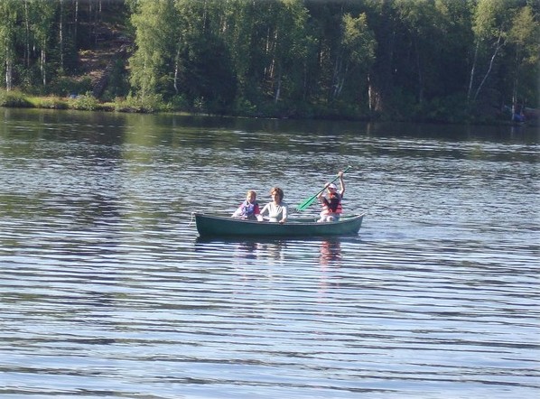
101:Nancy Lake Canoeing - panoramio (cropped).jpg
42:Nancy_Lake_Canoeing_-_panoramio_(cropped).jpg
8:
213:https://creativecommons.org/licenses/by/3.0
189:– to copy, distribute and transmit the work
477:
330:
420:Creative Commons Attribution 3.0 Unported
526:File:Nancy Lake Canoeing - panoramio.jpg
122:https://www.panoramio.com/photo/13071056
544:
453:
437:
417:
401:
381:
365:
348:
345:
326:
319:
280:
301:View this and other nearby images on:
113:12 August 2008 (original upload date)
7:
542:The following page uses this file:
466:
256:Nancy Lake Canoeing - panoramio.jpg
158:
339:
333:
247:
180:
149:
93:
39:
338:
219:Creative Commons Attribution 3.0
547:Nancy Lake State Recreation Area
440:coordinates of the point of view
324:
307:
293:
262:
240:
200:Under the following conditions:
165:This file is licensed under the
157:
151:
60:
21:
321:
36:No higher resolution available.
14:
455:61°41'3.023"N, 149°59'52.998"W
320:
26:
1:
346:Items portrayed in this file
563:
467:
16:
323:
170:Attribution 3.0 Unported
67:This is a file from the
524:
232:
137:
127:
117:
112:
109:
98:
71:. Information from its
503:19:35, 24 October 2018
313:61.684173; -149.998055
74:description page there
248:This file has been
195:– to adapt the work
105:Nancy Lake Canoeing
532:with precise mode.
535:
404:copyright license
332:
318:
317:
275:
274:
271:
270:
252:from another file
146:
143:Reusing this file
89:
88:
69:Wikimedia Commons
554:
515:
368:copyright status
314:
311:
297:
296:
290:
289:
278:
266:
244:
237:
226:
223:
220:
217:
214:
178:
167:Creative Commons
161:
160:
155:
154:
140:
102:
96:
85:
64:
63:
57:
51:
49:
562:
561:
557:
556:
555:
553:
552:
551:
536:
521:
513:
469:
468:
465:
464:
463:
462:
461:
460:
459:
458:
456:
446:
445:
444:
442:
431:
430:
429:
428:
427:
426:
425:
424:
422:
410:
409:
408:
406:
395:
394:
393:
392:
391:
390:
389:
388:
386:
374:
373:
372:
370:
359:
358:
357:
356:
355:
353:
337:
336:
335:
312:
285:
284:
281:Camera location
276:
267:
253:
228:
227:
224:
221:
218:
215:
212:
211:
179:
177:wolcott_theresa
176:
173:
162:
132:wolcott_theresa
100:
91:
90:
79:
78:
77:is shown below.
53:
47:
45:
38:
37:
12:
11:
5:
560:
558:
550:
549:
540:
539:
534:
533:
523:
519:
516:
510:
505:
500:
496:
495:
492:
489:
486:
483:
480:
473:
472:
457:
454:
452:
451:
450:
449:
448:
447:
443:
438:
436:
435:
434:
433:
423:
418:
416:
415:
414:
413:
412:
411:
407:
402:
400:
399:
398:
397:
396:
387:
382:
380:
379:
378:
377:
376:
375:
371:
366:
364:
363:
362:
361:
360:
354:
349:
347:
344:
343:
342:
341:
340:
329:
328:
325:
322:
316:
315:
305:
299:
282:
273:
272:
269:
268:
261:
259:
245:
234:
233:Other versions
230:
229:
210:
209:
208:
207:
198:
197:
196:
190:
183:You are free:
174:
164:
163:
150:
147:
135:
134:
129:
125:
124:
119:
115:
114:
111:
107:
106:
103:
94:
92:
87:
86:
65:
55:
54:
35:
31:
30:
29:
24:
19:
13:
10:
9:
6:
4:
3:
2:
559:
548:
545:
543:
537:
531:
527:
522:
517:
511:
509:
506:
504:
501:
498:
497:
493:
490:
487:
484:
481:
479:
478:
476:
470:
441:
421:
405:
385:
369:
352:
310:
306:
304:
303:OpenStreetMap
300:
298:
288:
283:
279:
265:
260:
258:
257:
251:
246:
243:
239:
238:
235:
231:
205:
202:
201:
199:
194:
191:
188:
185:
184:
182:
181:
175:Attribution:
171:
168:
156:
148:
144:
139:
136:
133:
130:
126:
123:
120:
116:
108:
104:
97:
83:
76:
75:
70:
66:
59:
58:
52:
43:
34:
28:
25:
23:
20:
18:
15:
541:
520:GreenMeansGo
474:
471:File history
249:
203:
192:
186:
82:You can help
72:
40:
22:File history
384:copyrighted
204:attribution
99:Description
538:File usage
512:598 × 442
488:Dimensions
216:CC BY 3.0
138:Permission
48:image/jpeg
27:File usage
485:Thumbnail
482:Date/Time
250:extracted
530:CropTool
327:Captions
193:to remix
187:to share
172:license.
514:(96 KB)
499:current
494:Comment
351:depicts
331:English
44:
291:
128:Author
118:Source
491:User
225:true
222:true
110:Date
17:File
254::
145:)
141:(
84:.
50:)
Text is available under the Creative Commons Attribution-ShareAlike License. Additional terms may apply.
.jpg)

.jpg¶ms=061.684173_N_-149.998055_E_globe:Earth_type:camera_source:Panoramio_&language=en)