38:
289:
229:
90:
191:
A telephone call with NevadaDOT cleared their design for any use whatsoever to the extent of Nevada law (i.e., do not use this to physically create professional-grade signs on use on public roads — though that is separate from copyright). Anyways, see
338:
252:(herein referred to as the MUTCD) adopted by the Federal Highway Administrator as a National Standard for application on all classes of highways, subject to such modifications as is set forth in this supplement." The 2003 federal
442:
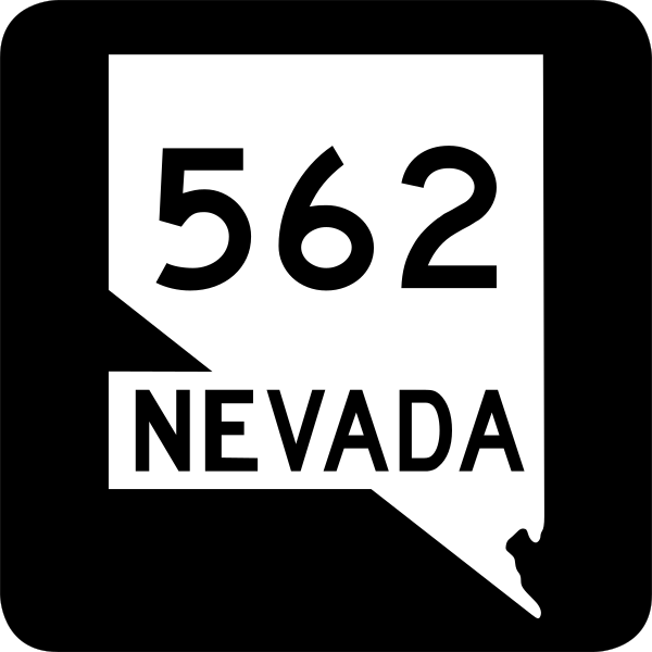
355:{{Information |Description=32 in by 32 in (900 mm by 900 mm) Nevada State Route shield. Uses the . (United States law does not permit the copyrighting of typeface designs, and the fonts are mea
424:
414:
142:. (United States law does not permit the copyrighting of typeface designs, and the fonts are meant to be copies of a U.S. Government-produced work anyway.)
249:
244:
184:
517:
394:
389:
379:
264:
Any traffic control device design or application provision contained in this Manual shall be considered to be in the
64:
60:
419:
56:
52:
48:
42:
409:
404:
399:
365:
The following pages on the
English Knowledge (XXG) use this file (pages on other projects are not listed):
101:
73:
369:
537:
374:
109:
384:
256:
237:
492:
348:
96:
462:
337:
332:
37:
172:
150:
452:
241:
because it is prescribed by the Manual of
Uniform Traffic Control Devices,
139:
482:
477:
472:
467:
138:
32 in by 32 in (900 mm by 900 mm) Nevada State Route shield. Uses the
272:, except for the Interstate Shield and any other items owned by FHWA.
507:
502:
305:
Click on a date/time to view the file as it appeared at that time.
288:
243:, sign number GNV1-3. The Nevada Department of Transportation
223:
84:
278:
No provisions of the supplement modify this provision of the
287:
270:
shall not be protected by a patent, trademark, or copyright
161:
78:(SVG file, nominally 600 × 600 pixels, file size: 14 KB)
425:
Knowledge (XXG):WikiProject U.S. Roads/Redirects/Nevada
527:
268:. Traffic control devices contained in this Manual
128:
108:
Commons is a freely licensed media file repository.
415:User:Alexlatham96/List of State Routes in Nevada
160:Derived from sign specifications e-mailed from
89:
8:
41:Size of this PNG preview of this SVG file:
307:
203:
435:The following other wikis use this file:
250:Manual on Uniform Traffic Control Devices
257:states specifically on its page I-1 that
367:
493:Liste des routes d'État au Nevada
228:
7:
463:Anexo:Carreteras estatales de Nevada
534:Usage on zh-min-nan.wikipedia.org
121:
71:
453:Harry Reid International Airport
227:
88:
31:
21:
14:
395:List of state routes in Nevada
26:
1:
390:List of highways numbered 562
380:Harry Reid Airport Connector
245:has adopted the 2003 version
556:
524:Usage on www.wikidata.org
514:Usage on ja.wikipedia.org
499:Usage on id.wikipedia.org
489:Usage on fr.wikipedia.org
483:Ruta Estatal de Nevada 535
478:Ruta Estatal de Nevada 171
473:Interestatal 515 en Nevada
468:Ruta Estatal de Nevada 562
459:Usage on es.wikipedia.org
449:Usage on de.wikipedia.org
439:Usage on bn.wikipedia.org
16:
538:Nevada Chiu Lō͘-sòaⁿ 562
420:User:DeFaultRyan/Travels
95:This is a file from the
354:
179:
168:
156:
149:
146:
131:
99:. Information from its
508:Nevada State Route 582
503:Nevada State Route 562
410:Nevada State Route 564
405:Nevada State Route 562
400:Nevada State Route 535
292:
102:description page there
291:
443:নেভাডা স্টেট রুট ৫৬৪
370:Clark County, Nevada
235:This file is in the
65:2,048 × 2,048 pixels
61:1,024 × 1,024 pixels
333:01:08, 19 July 2006
140:Roadgeek 2005 fonts
47:Other resolutions:
375:Enterprise, Nevada
293:
431:Global file usage
358:
297:
296:
222:
221:
196:
195:
188:
185:Reusing this file
117:
116:
97:Wikimedia Commons
32:Global file usage
547:
385:Las Vegas Valley
345:
231:
230:
224:
218:
215:
212:
209:
204:
182:
152:
135:
129:
113:
92:
91:
85:
79:
68:
57:768 × 768 pixels
53:480 × 480 pixels
49:240 × 240 pixels
43:600 × 600 pixels
555:
554:
550:
549:
548:
546:
545:
544:
429:
366:
359:
351:
343:
299:
298:
216:
213:
210:
207:
202:
197:
133:
126:
119:
118:
107:
106:
105:is shown below.
81:
77:
70:
69:
46:
12:
11:
5:
553:
551:
543:
542:
541:
540:
532:
531:
530:
522:
521:
520:
512:
511:
510:
505:
497:
496:
495:
487:
486:
485:
480:
475:
470:
465:
457:
456:
455:
447:
446:
445:
433:
432:
428:
427:
422:
417:
412:
407:
402:
397:
392:
387:
382:
377:
372:
364:
363:
362:
357:
356:
353:
349:
346:
340:
335:
330:
326:
325:
322:
319:
316:
313:
310:
303:
302:
295:
294:
285:
275:
274:
232:
220:
219:
201:
198:
194:
193:
189:
177:
176:
170:
166:
165:
158:
154:
153:
148:
144:
143:
136:
134:Nevada 562.svg
127:
125:
122:
120:
115:
114:
93:
83:
82:
40:
36:
35:
34:
29:
24:
19:
13:
10:
9:
6:
4:
3:
2:
552:
539:
536:
535:
533:
529:
526:
525:
523:
519:
516:
515:
513:
509:
506:
504:
501:
500:
498:
494:
491:
490:
488:
484:
481:
479:
476:
474:
471:
469:
466:
464:
461:
460:
458:
454:
451:
450:
448:
444:
441:
440:
438:
437:
436:
430:
426:
423:
421:
418:
416:
413:
411:
408:
406:
403:
401:
398:
396:
393:
391:
388:
386:
383:
381:
378:
376:
373:
371:
368:
360:
352:
347:
341:
339:
336:
334:
331:
328:
327:
323:
320:
317:
314:
311:
309:
308:
306:
300:
290:
286:
284:
283:
279:
273:
271:
267:
266:public domain
262:
261:
260:
258:
253:
251:
246:
242:
240:
239:
238:public domain
233:
226:
225:
211:Public domain
208:Public domain
206:
205:
199:
190:
186:
181:
178:
174:
171:
167:
163:
159:
155:
145:
141:
137:
130:
123:
111:
104:
103:
98:
94:
87:
86:
80:
75:
74:Original file
66:
62:
58:
54:
50:
44:
39:
33:
30:
28:
25:
23:
20:
18:
15:
434:
304:
301:File history
281:
277:
276:
269:
265:
263:
255:
248:
236:
234:
151:18 July 2006
110:You can help
100:
72:
22:File history
175:; NevadaDOT
132:Description
361:File usage
342:600 × 600
318:Dimensions
180:Permission
27:File usage
518:ラスベガス・バレー
315:Thumbnail
312:Date/Time
200:Licensing
162:NevadaDOT
350:Geopgeop
173:Geopgeop
528:Q887675
344:(14 KB)
329:current
324:Comment
247:of the
124:Summary
76:
192:below.
169:Author
157:Source
280:MUTCD
254:MUTCD
217:false
214:false
321:User
147:Date
17:File
63:|
59:|
55:|
51:|
45:.
282:.
259::
187:)
183:(
164:.
112:.
67:.
Text is available under the Creative Commons Attribution-ShareAlike License. Additional terms may apply.


