38:
370:
303:
253:
295:
245:
317:
267:
338:
376:
381:
94:
846:"}},"text\/plain":{"en":{"":"heading"}}},"{\"value\":{\"amount\":\"+45\",\"unit\":\"http:\\\/\\\/www.wikidata.org\\\/entity\\\/Q28390\"},\"type\":\"quantity\"}":{"text\/html":{"en":{"P7787":"45
748:"}},"text\/plain":{"en":{"":"heading"}}},"{\"value\":{\"amount\":\"+45\",\"unit\":\"http:\\\/\\\/www.wikidata.org\\\/entity\\\/Q28390\"},\"type\":\"quantity\"}":{"text\/html":{"en":{"P7787":"45
948:
842:
236:
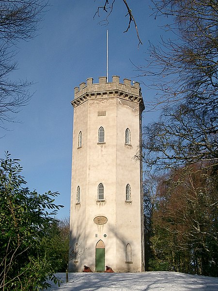
965:== {{int:filedesc}} == {{Information |description={{en|1=Nelson's Tower, Cluny Hill, Forres Built in 1806 to commemorate Nelson's victories at the Nile and Trafalgar. Now looked after by Historic Scotland.
Keywords: tower monument Nelson Forres Moray S
60:
56:
52:
48:
42:
73:
105:
428:– You must give appropriate credit, provide a link to the license, and indicate if changes were made. You may do so in any reasonable manner, but not in any way that suggests the licensor endorses you or your use.
148:
Nelson's Tower, Cluny Hill, Forres Built in 1806 to commemorate Nelson's victories at the Nile and
Trafalgar. Now looked after by Historic Scotland. Keywords: tower monument Nelson Forres Moray Scotland
843:
745:
984:
947:
942:
64:
37:
680:
644:
608:
310:
260:
730:
1121:
345:
995:
This file contains additional information, probably added from the digital camera or scanner used to create or digitize it.
435:
543:
884:
857:
786:
759:
693:
664:
592:
566:
551:
536:
815:
723:
708:
628:
509:
492:
332:
391:
1007:
998:
If the file has been modified from its original state, some details may not fully reflect the modified file.
1148:
434:– If you remix, transform, or build upon the material, you must distribute your contributions under the
352:
on the
Geograph website for the photographer's contact details. The copyright on this image is owned by
958:
388:
1184:
850:"}},"text\/plain":{"en":{"P7787":"45 degree"}}}}": -->
752:"}},"text\/plain":{"en":{"P7787":"45 degree"}}}}": -->
113:
205:
1257:
715:
700:
558:
1017:
189:
1090:
316:
266:
1220:
1166:
1024:
357:
100:
1267:
1230:
1053:
1194:
157:
979:
300:
250:
178:
168:
1277:
1034:
337:
349:
915:
Click on a date/time to view the file as it appeared at that time.
138:
Nelson's Tower, Cluny Hill, Forres - geograph.org.uk - 1720070.jpg
302:
252:
277:
227:
88:
287:
57° 36′ 41″ N, 3° 36′ 03″ W
237:
57° 36′ 41″ N, 3° 36′ 04″ W
476:
Add a one-line explanation of what this file represents
78:(1,536 × 2,048 pixels, file size: 1.04 MB, MIME type:
132:
112:
Commons is a freely licensed media file repository.
645:
Creative
Commons Attribution-ShareAlike 2.0 Generic
1189:Flash did not fire, compulsory flash suppression
445:https://creativecommons.org/licenses/by-sa/2.0
93:
451:Creative Commons Attribution-Share Alike 2.0
369:
8:
847:
749:
411:– to copy, distribute and transmit the work
1000:
917:
472:
985:List of listed buildings in Forres, Moray
716:https://www.geograph.org.uk/photo/1720070
559:https://www.geograph.org.uk/profile/43517
1275:
1265:
1255:
1247:
1239:
1228:
1218:
1210:
1202:
1192:
1182:
1174:
1164:
1156:
1146:
1138:
1130:
1119:
1111:
1103:
1095:
1085:
1077:
1069:
1061:
1050:
1042:
1032:
1022:
1012:
977:
871:
855:
829:
813:
773:
757:
678:
662:
642:
626:
606:
590:
523:
507:
490:
487:
468:
461:
280:
230:
309:View this and other nearby images on:
259:View this and other nearby images on:
1002:
975:The following 2 pages use this file:
7:
356:and is licensed for reuse under the
906:
392:Attribution-Share Alike 2.0 Generic
380:
375:
360:Attribution-ShareAlike 2.0 license.
993:
481:
475:
366:
343:
220:Nelson's Tower, Cluny Hill, Forres
201:Nelson's Tower, Cluny Hill, Forres
142:
125:
71:
480:
1044:Date and time of data generation
760:coordinates of the point of view
466:
422:Under the following conditions:
387:This file is licensed under the
379:
374:
368:
336:
315:
301:
293:
265:
251:
243:
92:
21:
463:
143:
14:
681:file available on the internet
462:
344:This image was taken from the
26:
1:
858:coordinates of depicted place
31:
731:Geograph Britain and Ireland
537:object of statement has role
488:Items portrayed in this file
1132:Date and time of digitizing
292:
242:
1299:
1241:Focal length in 35 mm film
873:57°36'41.11"N, 3°36'2.52"W
775:57°36'40.79"N, 3°36'3.60"W
436:same or compatible license
1097:File change date and time
907:
16:
694:geograph.org.uk image ID
465:
402:
99:This is a file from the
1204:Custom image processing
1135:13:57, 20 February 2010
1100:13:57, 20 February 2010
1047:13:57, 20 February 2010
1008:CASIO COMPUTER CO.,LTD.
964:
218:nairnbairn /
199:nairnbairn /
190:required by the license
174:
163:
156:
153:
135:
103:. Information from its
1140:Image compression mode
1029:1/1,600 sec (0.000625)
350:this photograph's page
321:57.611420; -3.600700
271:57.611330; -3.601000
106:description page there
41:Size of this preview:
1158:Maximum land aperture
1091:1.00
1071:Horizontal resolution
65:1,536 × 2,048 pixels
1105:Y and C positioning
1079:Vertical resolution
1004:Camera manufacturer
943:12:18, 5 March 2011
417:– to adapt the work
47:Other resolutions:
1249:Scene capture type
1225:Auto white balance
567:author name string
61:768 × 1,024 pixels
1286:
1285:
1161:2.6 APEX (f/2.46)
968:
849:
751:
629:copyright license
474:
365:
364:
348:collection. See
326:
325:
276:
275:
225:
224:
193:
121:
120:
101:Wikimedia Commons
1290:
1143:0.40006510416667
1113:Exposure Program
1001:
955:
895:
894:
889:
831:20 February 2010
797:
796:
791:
733:
728:
718:
713:
709:described at URL
703:
698:
593:copyright status
574:
571:
561:
556:
546:
541:
458:
455:
452:
449:
446:
438:as the original.
400:
389:Creative Commons
383:
382:
378:
377:
372:
371:
358:Creative Commons
346:Geograph project
340:
333:
322:
319:
305:
304:
298:
297:
296:
290:
289:
278:
272:
269:
255:
254:
248:
247:
246:
240:
239:
228:
187:
159:
158:20 February 2010
147:
139:
133:
117:
96:
95:
89:
83:
81:
68:
57:576 × 768 pixels
53:360 × 480 pixels
49:180 × 240 pixels
43:450 × 600 pixels
1298:
1297:
1293:
1292:
1291:
1289:
1288:
1287:
989:
969:
961:
953:
909:
908:
905:
904:
903:
902:
901:
900:
899:
898:
897:
896:
892:
890:
887:
878:
877:
876:
874:
864:
863:
862:
860:
841:
840:
839:
838:
837:
836:
835:
834:
832:
822:
821:
820:
818:
807:
806:
805:
804:
803:
802:
801:
800:
799:
798:
794:
792:
789:
780:
779:
778:
776:
766:
765:
764:
762:
743:
742:
741:
740:
739:
738:
737:
736:
735:
734:
729:
726:
720:
719:
714:
711:
705:
704:
699:
696:
687:
686:
685:
683:
671:
670:
669:
667:
656:
655:
654:
653:
652:
651:
650:
649:
647:
635:
634:
633:
631:
620:
619:
618:
617:
616:
615:
614:
613:
611:
599:
598:
597:
595:
584:
583:
582:
581:
580:
579:
578:
577:
576:
575:
572:
569:
563:
562:
557:
554:
548:
547:
542:
539:
530:
529:
528:
526:
516:
515:
514:
512:
501:
500:
499:
498:
497:
495:
479:
478:
477:
460:
459:
456:
453:
450:
447:
444:
443:
401:
398:
395:
384:
361:
331:
320:
294:
285:
284:
281:Object location
270:
244:
235:
234:
231:Camera location
226:
215:
208:
196:
169:geograph.org.uk
149:
137:
130:
123:
122:
111:
110:
109:is shown below.
85:
79:
77:
70:
69:
46:
12:
11:
5:
1296:
1294:
1284:
1283:
1280:
1274:
1273:
1270:
1264:
1263:
1260:
1254:
1253:
1250:
1246:
1245:
1242:
1238:
1237:
1234:
1227:
1226:
1223:
1217:
1216:
1213:
1209:
1208:
1207:Normal process
1205:
1201:
1200:
1197:
1191:
1190:
1187:
1181:
1180:
1177:
1173:
1172:
1169:
1163:
1162:
1159:
1155:
1154:
1151:
1145:
1144:
1141:
1137:
1136:
1133:
1129:
1128:
1125:
1118:
1117:
1116:Normal program
1114:
1110:
1109:
1106:
1102:
1101:
1098:
1094:
1093:
1088:
1084:
1083:
1080:
1076:
1075:
1072:
1068:
1067:
1064:
1060:
1059:
1056:
1049:
1048:
1045:
1041:
1040:
1037:
1031:
1030:
1027:
1021:
1020:
1015:
1011:
1010:
1005:
992:
988:
987:
982:
973:
972:
967:
966:
963:
959:
956:
952:1,536 × 2,048
950:
945:
940:
936:
935:
932:
929:
926:
923:
920:
913:
912:
883:
882:
881:
880:
879:
875:
872:
870:
869:
868:
867:
866:
865:
861:
856:
854:
853:
852:
851:
845:
833:
830:
828:
827:
826:
825:
824:
823:
819:
814:
812:
811:
810:
809:
808:
785:
784:
783:
782:
781:
777:
774:
772:
771:
770:
769:
768:
767:
763:
758:
756:
755:
754:
753:
747:
722:
721:
707:
706:
692:
691:
690:
689:
688:
684:
679:
677:
676:
675:
674:
673:
672:
668:
665:source of file
663:
661:
660:
659:
658:
657:
648:
643:
641:
640:
639:
638:
637:
636:
632:
627:
625:
624:
623:
622:
621:
612:
607:
605:
604:
603:
602:
601:
600:
596:
591:
589:
588:
587:
586:
585:
565:
564:
550:
549:
535:
534:
533:
532:
531:
527:
524:
522:
521:
520:
519:
518:
517:
513:
508:
506:
505:
504:
503:
502:
496:
491:
489:
486:
485:
484:
483:
482:
471:
470:
467:
464:
442:
441:
440:
439:
429:
420:
419:
418:
412:
405:You are free:
396:
386:
385:
367:
363:
362:
341:
330:
327:
324:
323:
313:
307:
282:
274:
273:
263:
257:
232:
223:
222:
216:
213:
210:
209:
204:
197:
194:
182:
181:
176:
172:
171:
165:
161:
160:
155:
151:
150:
140:
131:
129:
126:
124:
119:
118:
97:
87:
86:
40:
36:
35:
34:
29:
24:
19:
13:
10:
9:
6:
4:
3:
2:
1295:
1281:
1279:
1276:
1271:
1269:
1266:
1261:
1259:
1256:
1251:
1248:
1243:
1240:
1235:
1232:
1229:
1224:
1222:
1221:White balance
1219:
1215:Auto exposure
1214:
1212:Exposure mode
1211:
1206:
1203:
1198:
1196:
1193:
1188:
1186:
1183:
1178:
1175:
1170:
1168:
1167:Metering mode
1165:
1160:
1157:
1152:
1150:
1149:Exposure bias
1147:
1142:
1139:
1134:
1131:
1126:
1123:
1120:
1115:
1112:
1107:
1104:
1099:
1096:
1092:
1089:
1087:Software used
1086:
1081:
1078:
1073:
1070:
1065:
1062:
1057:
1055:
1051:
1046:
1043:
1038:
1036:
1033:
1028:
1026:
1025:Exposure time
1023:
1019:
1016:
1013:
1009:
1006:
1003:
999:
996:
990:
986:
983:
981:
978:
976:
970:
962:
957:
951:
949:
946:
944:
941:
938:
937:
933:
930:
927:
924:
921:
919:
918:
916:
910:
886:
859:
817:
788:
761:
732:
725:
717:
710:
702:
695:
682:
666:
646:
630:
610:
594:
568:
560:
553:
545:
538:
511:
494:
448:CC BY-SA 2.0
437:
433:
430:
427:
424:
423:
421:
416:
413:
410:
407:
406:
404:
403:
397:Attribution:
393:
390:
373:
359:
355:
351:
347:
342:
339:
335:
334:
328:
318:
314:
312:
311:OpenStreetMap
308:
306:
288:
283:
279:
268:
264:
262:
261:OpenStreetMap
258:
256:
238:
233:
229:
221:
217:
212:
211:
207:
203: /
202:
198:
191:
186:
184:
183:
180:
177:
173:
170:
166:
162:
152:
146:
141:
134:
127:
115:
108:
107:
102:
98:
91:
90:
84:
75:
74:Original file
66:
62:
58:
54:
50:
44:
39:
33:
30:
28:
25:
23:
20:
18:
15:
1231:Digital zoom
1176:Light source
1054:focal length
1014:Camera model
997:
994:
974:
914:
911:File history
544:photographer
431:
425:
414:
408:
353:
291:
241:
219:
206:CC BY-SA 2.0
200:
144:
114:You can help
104:
72:
22:File history
1195:Color space
1063:Orientation
960:GeographBot
609:copyrighted
432:share alike
426:attribution
185:Attribution
136:Description
1268:Saturation
980:Cluny Hill
971:File usage
928:Dimensions
573:nairnbairn
525:some value
399:nairnbairn
354:nairnbairn
179:nairnbairn
80:image/jpeg
27:File usage
1278:Sharpness
954:(1.04 MB)
925:Thumbnail
922:Date/Time
816:inception
329:Licensing
214:InfoField
195:InfoField
145:English:
1258:Contrast
1252:Standard
1108:Centered
1035:F-number
991:Metadata
724:operator
469:Captions
415:to remix
409:to share
394:license.
32:Metadata
1179:Unknown
1171:Pattern
1124:version
1058:10.2 mm
1018:QV-R3
939:current
934:Comment
885:heading
844:heading
787:heading
746:heading
701:1720070
510:creator
493:depicts
473:English
128:Summary
76:
1282:Normal
1272:Normal
1262:Normal
1082:72 dpi
1074:72 dpi
1066:Normal
893:degree
848:degree
795:degree
750:degree
299:
249:
175:Author
164:Source
1244:49 mm
1233:ratio
1185:Flash
1052:Lens
1039:f/5.8
167:From
1199:sRGB
1122:Exif
931:User
457:true
454:true
154:Date
17:File
1127:2.2
891:45
793:45
552:URL
888::
790::
727::
712::
697::
570::
555::
540::
63:|
59:|
55:|
51:|
45:.
1236:0
1153:0
192:)
188:(
116:.
82:)
67:.
Text is available under the Creative Commons Attribution-ShareAlike License. Additional terms may apply.

_heading:45.00&language=en)
_heading:45.00&language=en)
