43:
288:
249:
263:
294:
299:
103:
815:
Sir
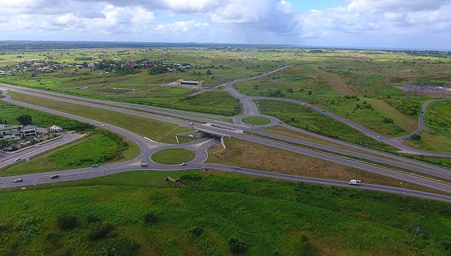
Solomon Hochoy Highway, Debe, Penal-Debe, Trinidad and Tobago.
Debe intersection, looking southwest. Debe is behind the left bottom.
Photo taken as part of the Southern Trinidad Aerial Photo Project, a small project sponsored by WMDE. Drone used: DJI Phantom 4. Snapshot taken from video footage
716:
340:– You must give appropriate credit, provide a link to the license, and indicate if changes were made. You may do so in any reasonable manner, but not in any way that suggests the licensor endorses you or your use.
240:
161:
Photo taken as part of the
Southern Trinidad Aerial Photo Project, a small project sponsored by WMDE. Drone used: DJI Phantom 4. Snapshot taken from video footage via VLC.
69:
65:
61:
57:
53:
47:
114:
82:
214:
Free, commercial usage of this picture outside of
Knowledge (XXG) is permitted under the condition of the correct attribution of its author and licence:
201:
593:
557:
521:
256:
803:
This file contains additional information, probably added from the digital camera or scanner used to create or digitize it.
347:
647:
577:
505:
479:
464:
449:
613:
541:
422:
405:
752:
471:
715:
710:
73:
42:
309:
806:
If the file has been modified from its original state, some details may not fully reflect the modified file.
743:
The following pages on the
English Knowledge (XXG) use this file (pages on other projects are not listed):
346:– If you remix, transform, or build upon the material, you must distribute your contributions under the
770:
306:
122:
456:
726:
262:
109:
790:
281:
I, the copyright holder of this work, hereby publish it under the following license:
190:
246:
170:
159:
Debe intersection, looking southwest. Debe is behind the left bottom.
683:
Click on a date/time to view the file as it appeared at that time.
157:
Sir
Solomon Hochoy Highway, Debe, Penal-Debe, Trinidad and Tobago.
640:
747:
248:
241:
10° 13′ 02.41″ N, 61° 27′ 18.09″ W
780:
231:
97:
771:
Benutzer:Grueslayer/Southern
Trinidad Aerial Photo Project
558:
Creative
Commons Attribution-ShareAlike 4.0 International
389:
Add a one-line explanation of what this file represents
87:(3,840 × 2,178 pixels, file size: 5.55 MB, MIME type:
141:
121:
Commons is a freely licensed media file repository.
357:https://creativecommons.org/licenses/by-sa/4.0
102:
457:https://commons.wikimedia.org/user:Grueslayer
363:Creative Commons Attribution-Share Alike 4.0
287:
147:STAPP 070 Debe Sir Solomon Hochoy Highway.jpg
8:
323:– to copy, distribute and transmit the work
808:
685:
385:
832:STAPP 070 Debe Sir Solomon Hochoy Highway
763:The following other wikis use this file:
310:Attribution-Share Alike 4.0 International
216:Grueslayer @Knowledge (XXG), CC BY-SA 4.0
835:
827:
819:
810:
745:
661:
645:
627:
611:
591:
575:
555:
539:
519:
503:
436:
420:
403:
400:
381:
374:
234:
255:View this and other nearby images on:
7:
733:User created page with UploadWizard
674:
298:
293:
801:
394:
388:
284:
280:
209:
151:
134:
80:
393:
648:coordinates of the point of view
379:
334:Under the following conditions:
305:This file is licensed under the
297:
292:
286:
261:
247:
101:
31:
21:
376:
152:
14:
375:
26:
1:
663:10°13'2.410"N, 61°27'18.090"W
594:original creation by uploader
36:
401:Items portrayed in this file
857:
787:Usage on fr.wikipedia.org
777:Usage on es.wikipedia.org
767:Usage on de.wikipedia.org
753:Sir Solomon Hochoy Highway
348:same or compatible license
675:
180:
16:
840:(c) 2016 Baldur Brückner
791:Débé (Trinité-et-Tobago)
378:
314:
108:This is a file from the
732:
711:19:33, 28 February 2017
196:
186:
176:
169:
166:
144:
112:. Information from its
267:10.217336; -61.455025
115:description page there
46:Size of this preview:
74:3,840 × 2,178 pixels
70:2,560 × 1,452 pixels
329:– to adapt the work
52:Other resolutions:
480:author name string
465:Wikimedia username
66:1,280 × 726 pixels
62:1,024 × 581 pixels
844:
843:
781:Trinidad y Tobago
759:Global file usage
736:
542:copyright license
387:
272:
271:
229:
228:
224:
223:
205:
202:Reusing this file
130:
129:
110:Wikimedia Commons
32:Global file usage
848:
837:Copyright holder
809:
723:
629:23 December 2016
506:copyright status
487:
484:
474:
469:
459:
454:
370:
367:
364:
361:
358:
350:as the original.
307:Creative Commons
301:
300:
296:
295:
290:
289:
268:
265:
251:
250:
244:
243:
232:
210:
199:
182:
172:
171:23 December 2016
156:
148:
142:
126:
105:
104:
98:
92:
90:
77:
58:640 × 363 pixels
54:320 × 182 pixels
48:800 × 454 pixels
856:
855:
851:
850:
849:
847:
846:
845:
824:Baldur Brückner
797:
757:
744:
737:
729:
721:
677:
676:
673:
672:
671:
670:
669:
668:
667:
666:
664:
654:
653:
652:
650:
639:
638:
637:
636:
635:
634:
633:
632:
630:
620:
619:
618:
616:
605:
604:
603:
602:
601:
600:
599:
598:
596:
584:
583:
582:
580:
569:
568:
567:
566:
565:
564:
563:
562:
560:
548:
547:
546:
544:
533:
532:
531:
530:
529:
528:
527:
526:
524:
512:
511:
510:
508:
497:
496:
495:
494:
493:
492:
491:
490:
489:
488:
485:
482:
476:
475:
470:
467:
461:
460:
455:
452:
443:
442:
441:
439:
429:
428:
427:
425:
414:
413:
412:
411:
410:
408:
392:
391:
390:
373:
372:
371:
368:
365:
362:
359:
356:
355:
313:
302:
283:
282:
277:
266:
239:
238:
235:Camera location
230:
225:
162:
146:
139:
132:
131:
120:
119:
118:is shown below.
94:
88:
86:
79:
78:
51:
12:
11:
5:
854:
852:
842:
841:
838:
834:
833:
830:
826:
825:
822:
818:
817:
813:
800:
796:
795:
794:
793:
785:
784:
783:
775:
774:
773:
761:
760:
756:
755:
750:
742:
741:
740:
735:
734:
731:
727:
724:
720:3,840 × 2,178
718:
713:
708:
704:
703:
700:
697:
694:
691:
688:
681:
680:
665:
662:
660:
659:
658:
657:
656:
655:
651:
646:
644:
643:
642:
641:
631:
628:
626:
625:
624:
623:
622:
621:
617:
612:
610:
609:
608:
607:
606:
597:
592:
590:
589:
588:
587:
586:
585:
581:
578:source of file
576:
574:
573:
572:
571:
570:
561:
556:
554:
553:
552:
551:
550:
549:
545:
540:
538:
537:
536:
535:
534:
525:
520:
518:
517:
516:
515:
514:
513:
509:
504:
502:
501:
500:
499:
498:
478:
477:
463:
462:
448:
447:
446:
445:
444:
440:
437:
435:
434:
433:
432:
431:
430:
426:
421:
419:
418:
417:
416:
415:
409:
404:
402:
399:
398:
397:
396:
395:
384:
383:
380:
377:
354:
353:
352:
351:
341:
332:
331:
330:
324:
317:You are free:
304:
303:
285:
279:
278:
276:
273:
270:
269:
259:
253:
236:
227:
226:
222:
221:
219:
208:
206:
194:
193:
188:
184:
183:
178:
174:
173:
168:
164:
163:
149:
140:
138:
135:
133:
128:
127:
106:
96:
95:
45:
41:
40:
39:
34:
29:
24:
19:
13:
10:
9:
6:
4:
3:
2:
853:
839:
836:
831:
828:
823:
820:
814:
811:
807:
804:
798:
792:
789:
788:
786:
782:
779:
778:
776:
772:
769:
768:
766:
765:
764:
758:
754:
751:
749:
746:
738:
730:
725:
719:
717:
714:
712:
709:
706:
705:
701:
698:
695:
692:
689:
687:
686:
684:
678:
649:
615:
595:
579:
559:
543:
523:
507:
481:
473:
466:
458:
451:
424:
407:
360:CC BY-SA 4.0
349:
345:
342:
339:
336:
335:
333:
328:
325:
322:
319:
318:
316:
315:
311:
308:
291:
274:
264:
260:
258:
257:OpenStreetMap
254:
252:
242:
237:
233:
220:
218:
217:
212:
211:
207:
203:
198:
195:
192:
189:
185:
179:
175:
165:
160:
155:
150:
143:
136:
124:
117:
116:
111:
107:
100:
99:
93:
84:
83:Original file
75:
71:
67:
63:
59:
55:
49:
44:
38:
35:
33:
30:
28:
25:
23:
20:
18:
15:
805:
802:
762:
682:
679:File history
343:
337:
326:
320:
215:
213:
158:
153:
123:You can help
113:
81:
22:File history
829:Short title
812:Image title
522:copyrighted
344:share alike
338:attribution
145:Description
739:File usage
728:Grueslayer
696:Dimensions
486:Grueslayer
472:Grueslayer
438:some value
197:Permission
191:Grueslayer
89:image/jpeg
27:File usage
722:(5.55 MB)
693:Thumbnail
690:Date/Time
614:inception
275:Licensing
154:English:
816:via VLC.
799:Metadata
382:Captions
327:to remix
321:to share
312:license.
181:Own work
37:Metadata
707:current
702:Comment
423:creator
406:depicts
386:English
137:Summary
85:
821:Author
245:
187:Author
177:Source
748:Debe
699:User
369:true
366:true
167:Date
17:File
450:URL
483::
468::
453::
72:|
68:|
64:|
60:|
56:|
50:.
204:)
200:(
125:.
91:)
76:.
Text is available under the Creative Commons Attribution-ShareAlike License. Additional terms may apply.
