43:
254:
260:
265:
99:
621:
1450:
306:– You must give appropriate credit, provide a link to the license, and indicate if changes were made. You may do so in any reasonable manner, but not in any way that suggests the licensor endorses you or your use.
1162:
653:
1474:
73:
69:
65:
61:
57:
53:
47:
760:
110:
82:
1040:
805:
642:
Equirectangular projection, N/S stretching 110 %. Geographic limits of the map: * N: 21.8° S * S: 35.2° S * W: 16.0° E * E: 33.2° ...
1055:
498:
462:
426:
1050:
1485:
This file contains additional information, probably added from the digital camera or scanner used to create or digitize it.
313:
1185:
990:
750:
690:
214:
194:
1095:
935:
552:
446:
1180:
665:
660:
518:
482:
394:
378:
840:
1325:
1100:
835:
1105:
1045:
1010:
1465:
1020:
980:
275:
1305:
237:
1488:
If the file has been modified from its original state, some details may not fully reflect the modified file.
1035:
910:
652:
More than 100 pages use this file. The following list shows the first 100 pages that use this file only. A
960:
770:
765:
715:
1300:
1030:
875:
775:
745:
312:– If you remix, transform, or build upon the material, you must distribute your contributions under the
620:
615:
42:
1145:
895:
740:
272:
1150:
865:
870:
720:
705:
675:
118:
800:
1130:
885:
825:
780:
1460:
1000:
930:
810:
1125:
950:
815:
685:
1315:
1115:
1090:
995:
940:
755:
218:
1375:
154:
1070:
975:
860:
855:
845:
790:
730:
158:
Equirectangular projection, N/S stretching 110 %. Geographic limits of the map:
105:
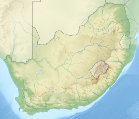
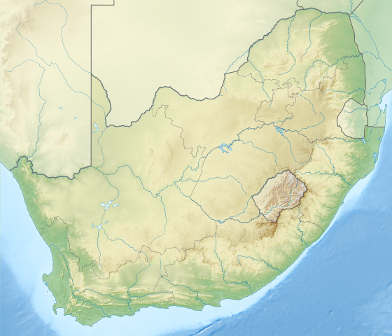
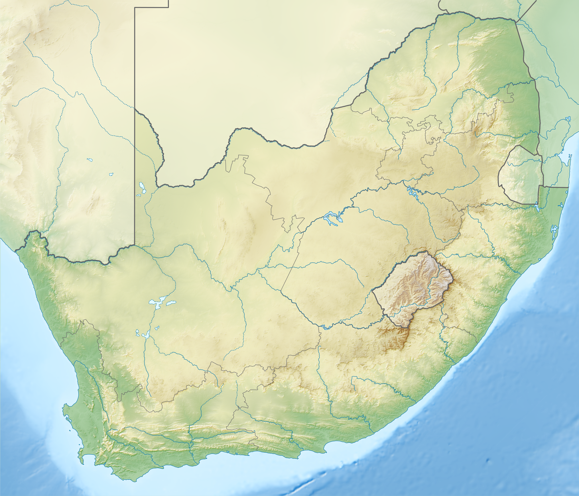
638:== {{int:filedesc}} == {{Information |Description ={{en|1=Relief location map of
1290:
1120:
1110:
1065:
1060:
1025:
1015:
985:
970:
955:
925:
920:
905:
725:
639:
1335:
1155:
1005:
890:
850:
830:
735:
710:
700:
680:
1385:
1365:
182:
1430:
1140:
1080:
915:
795:
695:
631:
1220:
1085:
1075:
880:
785:
670:
1355:
1330:
1440:
1400:
1135:
965:
224:
1360:
1410:
1380:
945:
820:
1345:
1415:
1395:
1390:
1340:
900:
1435:
1420:
1250:
1230:
1425:
588:
Click on a date/time to view the file as it appeared at that time.
1405:
1270:
1260:
1350:
1275:
1245:
1240:
1235:
1200:
93:
87:(SVG file, nominally 2,031 × 1,741 pixels, file size: 5.23 MB)
1280:
1255:
1215:
1205:
1225:
354:
Add a one-line explanation of what this file represents
1265:
1210:
1195:
499:
Creative
Commons Attribution-ShareAlike 3.0 Unported
137:
117:
Commons is a freely licensed media file repository.
1306:Módulu:Mapa de llocalización/datos/Sudáfrica/usu
1326:Şablon:Yer xəritəsi Cənubi Afrika Respublikası
323:https://creativecommons.org/licenses/by-sa/3.0
98:
329:Creative Commons Attribution-Share Alike 3.0
253:
8:
1301:Módulu:Mapa de llocalización/datos/Sudáfrica
289:– to copy, distribute and transmit the work
46:Size of this PNG preview of this SVG file:
1490:
1186:Амодуль:Location map/data/South Africa/doc
761:Chief Dawid Stuurman International Airport
590:
358:
350:
1451:Ҡалып:ПозКарта Көньяҡ Африка Республикаһы
1173:The following other wikis use this file:
1376:Taman Nasional Dataran Tegeh Golden Gate
1500:
1492:
658:
566:
550:
532:
516:
496:
480:
460:
444:
424:
409:
392:
376:
373:
346:
339:
1181:Амодуль:Location map/data/South Africa
1041:South African Astronomical Observatory
236:Derivative works of this file:
7:
276:Attribution-Share Alike 3.0 Unported
143:South Africa relief location map.svg
806:Golden Gate Highlands National Park
579:
362:Relief location map of South Africa
361:
264:
259:
1483:
367:
353:
250:
215:File:South Africa location map.svg
195:File:South Africa location map.svg
147:
130:
80:
1386:Taman Nasional Grobogan Augrabies
366:
1291:Vorlage:Positionskarte Südafrika
1056:Southern African Large Telescope
344:
300:Under the following conditions:
271:This file is licensed under the
263:
258:
252:
97:
31:
21:
1221:Suid-Afrikaanse Nasionale Parke
341:
148:
14:
1051:South African PGA Championship
340:
26:
1:
991:Palmiet Pumped Storage Scheme
751:Cathedral Peak (South Africa)
691:Augrabies Falls National Park
36:
1096:Table Mountain National Park
936:Mountain Zebra National Park
374:Items portrayed in this file
1441:Taman Nasional Tankwa Karoo
1431:Taman Nasional Gunung Zébra
1401:Taman Nasional Garden Route
1372:Usage on ban.wikipedia.org
1312:Usage on azb.wikipedia.org
1297:Usage on ast.wikipedia.org
1287:Usage on als.wikipedia.org
666:Alfred Dunhill Championship
661:Addo Elephant National Park
1522:
1457:Usage on bg.wikipedia.org
1447:Usage on ba.wikipedia.org
1322:Usage on az.wikipedia.org
1192:Usage on af.wikipedia.org
1177:Usage on ab.wikipedia.org
1101:Tankwa Karoo National Park
836:Hlathikhulu Forest Reserve
314:same or compatible license
1411:Taman Nasional Mapungubwe
1381:Taman Nasional Gajah Addo
1106:Tsitsikamma National Park
1046:South African Open (golf)
1011:Pilanesberg National Park
580:
427:Lengths, Widths, Surfaces
16:
1366:İSimanqaliso Milli Parkı
1356:Maloti-Drakensberq parkı
1021:Rondevlei Nature Reserve
981:Olifants River (Limpopo)
343:
280:
104:This is a file from the
1416:Taman Nasional Marakele
1396:Taman Nasional Camdeboo
1391:Taman Nasional Bontebok
1251:Dassiesklip (windplaas)
1231:Palmiet-pompopgaarskema
1036:South African Air Force
911:Maloti-Drakensberg Park
637:
232:
208:
188:
181:
178:
153:Relief location map of
140:
108:. Information from its
1436:Taman Nasional Namaqua
1421:Taman Nasional Meerkat
1336:Zebra Dağı Milli Parkı
961:Nedbank Golf Challenge
841:Hluhluwe–Imfolozi Park
771:Dikhololo Game Reserve
766:De Hoop Nature Reserve
716:Bontebok National Park
238:Shaka's Empire map.svg
111:description page there
1426:Taman Nasional Mocala
1031:Shamwari Game Reserve
876:Kingdom of Mapungubwe
776:Dimension Data Pro-Am
746:Cape Floristic Region
616:19:59, 4 January 2013
1406:Taman Nasional Karoo
1346:Prins-Eduard adaları
1146:Vodacom Championship
896:Madikwe Game Reserve
741:Cango Wildlife Ranch
74:2,031 × 1,741 pixels
70:2,389 × 2,048 pixels
66:1,195 × 1,024 pixels
1271:Hendrina-kragstasie
1151:Waterberg Biosphere
866:Karoo National Park
801:Giant's Castle
295:– to adapt the work
223:derivative work by
52:Other resolutions:
1261:Matimba-kragstasie
871:King Phalo Airport
721:Boyden Observatory
706:Blyde River Canyon
676:Amathole Mountains
1509:
1508:
1475:more global usage
1361:Maxonyvua dağları
1351:Vredefort krateri
1276:Camden-kragstasie
1246:Kendal-kragstasie
1241:Kusile-kragstasie
1236:Majuba-kragstasie
1201:Medupi-kragstasie
1169:Global file usage
1131:Union Observatory
886:Lebombo Mountains
826:Hartbeespoort Dam
781:Elsieskraal River
645:
483:copyright license
360:
352:
243:
242:
126:
125:
106:Wikimedia Commons
32:Global file usage
1513:
1491:
1281:Matla-kragstasie
1001:Pietermaritzburg
931:Mont-Aux-Sources
811:Great Fish River
628:
447:copyright status
336:
333:
330:
327:
324:
316:as the original.
273:Creative Commons
267:
266:
262:
261:
256:
255:
184:
152:
144:
138:
122:
101:
100:
94:
88:
77:
62:896 × 768 pixels
58:560 × 480 pixels
54:280 × 240 pixels
48:699 × 599 pixels
1521:
1520:
1516:
1515:
1514:
1512:
1511:
1510:
1479:
1167:
1126:Umzimkulu River
951:Mthatha Airport
816:Great Kei River
686:Augrabies Falls
646:
634:
626:
582:
581:
578:
577:
576:
575:
574:
573:
572:
571:
569:
559:
558:
557:
555:
544:
543:
542:
541:
540:
539:
538:
537:
535:
525:
524:
523:
521:
510:
509:
508:
507:
506:
505:
504:
503:
501:
489:
488:
487:
485:
474:
473:
472:
471:
470:
469:
468:
467:
465:
453:
452:
451:
449:
438:
437:
436:
435:
434:
433:
432:
431:
429:
418:
417:
416:
415:
414:
412:
403:
402:
401:
400:
399:
397:
385:
384:
383:
381:
365:
364:
363:
356:
355:
338:
337:
334:
331:
328:
325:
322:
321:
279:
268:
249:
244:
174:
142:
135:
128:
127:
116:
115:
114:is shown below.
90:
86:
79:
78:
51:
12:
11:
5:
1519:
1517:
1507:
1506:
1503:
1499:
1498:
1495:
1482:
1477:of this file.
1471:
1470:
1469:
1468:
1463:
1455:
1454:
1453:
1445:
1444:
1443:
1438:
1433:
1428:
1423:
1418:
1413:
1408:
1403:
1398:
1393:
1388:
1383:
1378:
1370:
1369:
1368:
1363:
1358:
1353:
1348:
1343:
1341:Kap yarımadası
1338:
1333:
1331:Əjdaha dağları
1328:
1320:
1319:
1318:
1310:
1309:
1308:
1303:
1295:
1294:
1293:
1285:
1284:
1283:
1278:
1273:
1268:
1263:
1258:
1256:KaXu Solar One
1253:
1248:
1243:
1238:
1233:
1228:
1223:
1218:
1213:
1208:
1203:
1198:
1190:
1189:
1188:
1183:
1171:
1170:
1165:to this file.
1159:
1158:
1153:
1148:
1143:
1138:
1133:
1128:
1123:
1118:
1116:Umfolozi River
1113:
1108:
1103:
1098:
1093:
1091:Table Mountain
1088:
1083:
1078:
1073:
1068:
1063:
1058:
1053:
1048:
1043:
1038:
1033:
1028:
1023:
1018:
1013:
1008:
1003:
998:
996:Phuthaditjhaba
993:
988:
983:
978:
973:
968:
963:
958:
953:
948:
943:
941:Mtamvuna River
938:
933:
928:
923:
918:
913:
908:
903:
898:
893:
888:
883:
878:
873:
868:
863:
858:
853:
848:
843:
838:
833:
828:
823:
818:
813:
808:
803:
798:
793:
788:
783:
778:
773:
768:
763:
758:
756:Chalumna River
753:
748:
743:
738:
733:
728:
723:
718:
713:
708:
703:
698:
693:
688:
683:
678:
673:
668:
663:
656:is available.
650:
649:
644:
643:
636:
632:
629:
625:2,031 × 1,741
623:
618:
613:
609:
608:
605:
602:
599:
596:
593:
586:
585:
570:
567:
565:
564:
563:
562:
561:
560:
556:
551:
549:
548:
547:
546:
545:
536:
534:2 January 2013
533:
531:
530:
529:
528:
527:
526:
522:
517:
515:
514:
513:
512:
511:
502:
497:
495:
494:
493:
492:
491:
490:
486:
481:
479:
478:
477:
476:
475:
466:
461:
459:
458:
457:
456:
455:
454:
450:
445:
443:
442:
441:
440:
439:
430:
425:
423:
422:
421:
420:
419:
413:
410:
408:
407:
406:
405:
404:
398:
393:
391:
390:
389:
388:
387:
386:
382:
377:
375:
372:
371:
370:
369:
368:
357:
349:
348:
345:
342:
320:
319:
318:
317:
307:
298:
297:
296:
290:
283:You are free:
270:
269:
251:
248:
245:
241:
240:
234:
233:Other versions
230:
229:
228:
227:
221:
210:
206:
205:
204:
203:
200:
197:
190:
186:
185:
183:2 January 2013
180:
176:
175:
173:
172:
169:
166:
163:
145:
136:
134:
131:
129:
124:
123:
102:
92:
91:
45:
41:
40:
39:
34:
29:
24:
19:
13:
10:
9:
6:
4:
3:
2:
1518:
1504:
1501:
1496:
1493:
1489:
1486:
1480:
1478:
1476:
1467:
1464:
1462:
1459:
1458:
1456:
1452:
1449:
1448:
1446:
1442:
1439:
1437:
1434:
1432:
1429:
1427:
1424:
1422:
1419:
1417:
1414:
1412:
1409:
1407:
1404:
1402:
1399:
1397:
1394:
1392:
1389:
1387:
1384:
1382:
1379:
1377:
1374:
1373:
1371:
1367:
1364:
1362:
1359:
1357:
1354:
1352:
1349:
1347:
1344:
1342:
1339:
1337:
1334:
1332:
1329:
1327:
1324:
1323:
1321:
1317:
1314:
1313:
1311:
1307:
1304:
1302:
1299:
1298:
1296:
1292:
1289:
1288:
1286:
1282:
1279:
1277:
1274:
1272:
1269:
1267:
1264:
1262:
1259:
1257:
1254:
1252:
1249:
1247:
1244:
1242:
1239:
1237:
1234:
1232:
1229:
1227:
1224:
1222:
1219:
1217:
1214:
1212:
1209:
1207:
1204:
1202:
1199:
1197:
1194:
1193:
1191:
1187:
1184:
1182:
1179:
1178:
1176:
1175:
1174:
1168:
1166:
1164:
1157:
1154:
1152:
1149:
1147:
1144:
1142:
1139:
1137:
1134:
1132:
1129:
1127:
1124:
1122:
1119:
1117:
1114:
1112:
1109:
1107:
1104:
1102:
1099:
1097:
1094:
1092:
1089:
1087:
1084:
1082:
1079:
1077:
1074:
1072:
1071:Sundays River
1069:
1067:
1064:
1062:
1059:
1057:
1054:
1052:
1049:
1047:
1044:
1042:
1039:
1037:
1034:
1032:
1029:
1027:
1024:
1022:
1019:
1017:
1014:
1012:
1009:
1007:
1004:
1002:
999:
997:
994:
992:
989:
987:
984:
982:
979:
977:
976:Ohlanga River
974:
972:
969:
967:
964:
962:
959:
957:
954:
952:
949:
947:
944:
942:
939:
937:
934:
932:
929:
927:
924:
922:
919:
917:
914:
912:
909:
907:
904:
902:
899:
897:
894:
892:
889:
887:
884:
882:
879:
877:
874:
872:
869:
867:
864:
862:
861:Karbonkelberg
859:
857:
856:Jukskei River
854:
852:
849:
847:
846:Hofmeyr Skull
844:
842:
839:
837:
834:
832:
829:
827:
824:
822:
819:
817:
814:
812:
809:
807:
804:
802:
799:
797:
794:
792:
791:Gamtoos River
789:
787:
784:
782:
779:
777:
774:
772:
769:
767:
764:
762:
759:
757:
754:
752:
749:
747:
744:
742:
739:
737:
734:
732:
731:Caledon River
729:
727:
724:
722:
719:
717:
714:
712:
709:
707:
704:
702:
699:
697:
694:
692:
689:
687:
684:
682:
679:
677:
674:
672:
669:
667:
664:
662:
659:
657:
655:
647:
641:
635:
630:
624:
622:
619:
617:
614:
611:
610:
606:
603:
600:
597:
594:
592:
591:
589:
583:
568:image/svg+xml
554:
520:
500:
484:
464:
448:
428:
396:
380:
326:CC BY-SA 3.0
315:
311:
308:
305:
302:
301:
299:
294:
291:
288:
285:
284:
282:
281:
277:
274:
257:
246:
239:
235:
231:
226:
222:
220:
216:
213:
212:
211:
207:
201:
198:
196:
193:
192:
191:
187:
177:
170:
167:
164:
161:
160:
159:
156:
151:
146:
139:
132:
120:
113:
112:
107:
103:
96:
95:
89:
84:
83:Original file
75:
71:
67:
63:
59:
55:
49:
44:
38:
35:
33:
30:
28:
25:
23:
20:
18:
15:
1487:
1484:
1472:
1216:Soweto Derby
1172:
1160:
1121:Umgeni River
1111:Tugela Falls
1066:Stellenbosch
1061:Soutpansberg
1026:Saldanha Bay
1016:Richtersveld
986:Palala River
971:Nossob River
956:Nahoon River
926:Molopo River
921:Mokolo River
906:Magaliesberg
726:Breede River
651:
640:South Africa
587:
584:File history
395:South Africa
309:
303:
292:
286:
219:NordNordWest
157:
155:South Africa
149:
119:You can help
109:
81:
22:File history
1466:Йоханесбург
1206:Sodwanabaai
1156:Windsor Dam
1006:Pilanesberg
891:Lebowakgomo
851:Joburg Open
831:Harts River
736:Cango Caves
711:Boesmansgat
701:Blood River
681:Apies River
463:copyrighted
310:share alike
304:attribution
141:Description
1226:Maputaland
1163:more links
1141:Vaal River
1081:Swartkrans
916:Midmar Dam
796:Gariep Dam
696:Berg River
648:File usage
601:Dimensions
553:media type
411:some value
171:E: 33.2° E
168:W: 16.0° E
165:S: 35.2° S
162:N: 21.8° S
27:File usage
1266:Grensgrot
1086:Table Bay
1076:Swartberg
881:Langeberg
786:False Bay
671:Algoa Bay
654:full list
627:(5.23 MB)
598:Thumbnail
595:Date/Time
519:inception
359:Alemannic
247:Licensing
150:English:
1505:1740.957
1497:2031.464
1481:Metadata
1461:Претория
1136:Vaal Dam
966:Njesuthi
347:Captions
293:to remix
287:to share
278:license.
37:Metadata
1316:پرتوریا
1211:Haarlem
1196:Koeberg
946:Mthatha
821:Hanglip
612:current
607:Comment
379:depicts
351:English
133:Summary
85:
1502:Height
901:Mafadi
209:Author
202:ETOPO1
189:Source
1494:Width
1473:View
1161:View
633:Htonl
225:Htonl
604:User
335:true
332:true
199:SRTM
179:Date
17:File
217:by
72:|
68:|
64:|
60:|
56:|
50:.
121:.
76:.
Text is available under the Creative Commons Attribution-ShareAlike License. Additional terms may apply.
