341:
271:
285:
309:
347:
352:
233:
72:
916:
262:
43:
399:– You must give appropriate credit, provide a link to the license, and indicate if changes were made. You may do so in any reasonable manner, but not in any way that suggests the licensor endorses you or your use.
83:
51:
933:== {{int:filedesc}} == {{Information |description={{en|1=Saint Mary's Church, Kilvington.}} |date=2005-11-20 |source=From |author= |permission= |
915:
910:
42:
704:
634:
598:
479:
278:
861:
724:
1111:
952:
316:
1003:
This file contains additional information, probably added from the digital camera or scanner used to create or digitize it.
825:
406:
561:
845:
809:
775:
732:
688:
582:
554:
541:
526:
747:
717:
654:
618:
499:
463:
303:
362:
1006:
If the file has been modified from its original state, some details may not fully reflect the modified file.
943:
The following pages on the
English Knowledge (XXG) use this file (pages on other projects are not listed):
1156:
1025:
405:– If you remix, transform, or build upon the material, you must distribute your contributions under the
323:
on the
Geograph website for the photographer's contact details. The copyright on this image is owned by
926:
359:
216:
1184:
238:
91:
183:
211:
533:
167:
1015:
754:
739:
284:
1252:
1174:
1138:
1032:
328:
78:
1262:
1061:
1194:
135:
947:
268:
156:
242:
146:
1042:
308:
126:
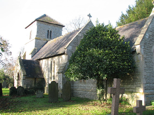
St Mary's parish church, Kilvington, Nottinghamshire, seen from the east
320:
883:
Click on a date/time to view the file as it appeared at that time.
232:
52:
Saint_Mary's_Church,_Kilvington._-_geograph.org.uk_-_81778.jpg
270:
253:
227:
116:
Saint Mary's Church, Kilvington. - geograph.org.uk - 81778.jpg
66:
768:
263:
52° 58′ 37″ N, 0° 48′ 29″ W
980:
970:
447:
Add a one-line explanation of what this file represents
990:
205:
110:
90:
Commons is a freely licensed media file repository.
635:
Creative
Commons Attribution-ShareAlike 2.0 Generic
56:(640 × 480 pixels, file size: 140 KB, MIME type:
1189:Flash did not fire, compulsory flash suppression
416:https://creativecommons.org/licenses/by-sa/2.0
71:
422:Creative Commons Attribution-Share Alike 2.0
340:
8:
382:– to copy, distribute and transmit the work
1008:
885:
443:
963:The following other wikis use this file:
534:https://www.geograph.org.uk/profile/3264
1271:
1260:
1250:
1242:
1234:
1226:
1218:
1210:
1202:
1192:
1182:
1172:
1164:
1154:
1146:
1136:
1128:
1120:
1109:
1101:
1093:
1085:
1077:
1069:
1058:
1050:
1040:
1030:
1020:
945:
859:
843:
823:
807:
789:
773:
755:https://www.geograph.org.uk/photo/81778
702:
686:
668:
652:
632:
616:
596:
580:
513:
497:
477:
461:
458:
439:
432:
256:
277:View this and other nearby images on:
1010:
7:
327:and is licensed for reuse under the
874:
363:Attribution-Share Alike 2.0 Generic
351:
346:
331:Attribution-ShareAlike 2.0 license.
1001:
452:
446:
337:
314:
209:
120:
103:
49:
451:
1052:Date and time of data generation
437:
393:Under the following conditions:
358:This file is licensed under the
350:
345:
339:
307:
283:
269:
231:
198:Saint Mary's Church, Kilvington.
179:Saint Mary's Church, Kilvington.
70:
31:
21:
434:
248:with data related to this item.
121:
46:No higher resolution available.
14:
953:Listed buildings in Kilvington
705:file available on the internet
433:
315:This image was taken from the
26:
1:
776:coordinates of depicted place
36:
1037:1/60 sec (0.016666666666667)
725:Geograph Britain and Ireland
555:object of statement has role
459:Items portrayed in this file
1220:Focal plane resolution unit
1122:Date and time of digitizing
1293:
1231:One-chip color area sensor
987:Usage on www.wikidata.org
977:Usage on pl.wikipedia.org
967:Usage on nl.wikipedia.org
407:same or compatible license
1095:File change date and time
875:
791:52°58'37.2"N, 0°48'28.8"W
16:
1212:Focal plane Y resolution
1204:Focal plane X resolution
733:geograph.org.uk image ID
436:
373:
243:entry Church of St Mary
196:Bob Danylec /
177:Bob Danylec /
77:This is a file from the
1236:Custom image processing
1125:13:07, 20 November 2005
1098:13:07, 20 November 2005
1055:13:07, 20 November 2005
932:
230:
168:required by the license
152:
141:
134:
131:
113:
81:. Information from its
1130:Image compression mode
911:23:30, 30 January 2010
321:this photograph's page
289:52.977000; -0.808000
84:description page there
1166:Maximum land aperture
1079:Horizontal resolution
1026:Canon PowerShot S2 IS
826:Canon PowerShot S2 IS
846:location of creation
1169:2.875 APEX (f/2.71)
1103:Y and C positioning
1087:Vertical resolution
1012:Camera manufacturer
388:– to adapt the work
210:This is a photo of
1273:Scene capture type
1257:Auto white balance
542:author name string
1280:
1279:
959:Global file usage
936:
619:copyright license
480:Church of St Mary
445:
336:
335:
319:collection. See
294:
293:
252:
251:
246:
226:
225:
203:
202:
171:
99:
98:
79:Wikimedia Commons
32:Global file usage
1284:
1215:11,571.428571429
1009:
923:
757:
752:
748:described at URL
742:
737:
727:
722:
670:20 November 2005
583:copyright status
564:
559:
549:
546:
536:
531:
429:
426:
423:
420:
417:
409:as the original.
371:
360:Creative Commons
354:
353:
349:
348:
343:
342:
329:Creative Commons
317:Geograph project
311:
304:
290:
287:
273:
272:
266:
265:
254:
244:
235:
228:
219:
206:
165:
137:
136:20 November 2005
125:
117:
111:
95:
74:
73:
67:
61:
59:
1292:
1291:
1287:
1286:
1285:
1283:
1282:
1281:
997:
957:
944:
937:
929:
921:
877:
876:
873:
872:
871:
870:
869:
868:
867:
866:
864:
852:
851:
850:
848:
837:
836:
835:
834:
833:
832:
831:
830:
828:
816:
815:
814:
812:
801:
800:
799:
798:
797:
796:
795:
794:
792:
782:
781:
780:
778:
767:
766:
765:
764:
763:
762:
761:
760:
759:
758:
753:
750:
744:
743:
738:
735:
729:
728:
723:
720:
711:
710:
709:
707:
695:
694:
693:
691:
680:
679:
678:
677:
676:
675:
674:
673:
671:
661:
660:
659:
657:
646:
645:
644:
643:
642:
641:
640:
639:
637:
625:
624:
623:
621:
610:
609:
608:
607:
606:
605:
604:
603:
601:
589:
588:
587:
585:
574:
573:
572:
571:
570:
569:
568:
567:
566:
565:
560:
557:
551:
550:
547:
544:
538:
537:
532:
529:
520:
519:
518:
516:
506:
505:
504:
502:
491:
490:
489:
488:
487:
486:
485:
484:
482:
470:
469:
468:
466:
450:
449:
448:
431:
430:
427:
424:
421:
418:
415:
414:
372:
369:
366:
355:
332:
302:
288:
261:
260:
257:Object location
221:
215:
212:listed building
204:
193:
186:
174:
147:geograph.org.uk
127:
115:
108:
101:
100:
89:
88:
87:is shown below.
63:
57:
55:
48:
47:
12:
11:
5:
1290:
1288:
1278:
1277:
1274:
1270:
1269:
1266:
1259:
1258:
1255:
1249:
1248:
1245:
1241:
1240:
1239:Normal process
1237:
1233:
1232:
1229:
1228:Sensing method
1225:
1224:
1221:
1217:
1216:
1213:
1209:
1208:
1205:
1201:
1200:
1197:
1191:
1190:
1187:
1181:
1180:
1177:
1171:
1170:
1167:
1163:
1162:
1159:
1153:
1152:
1149:
1145:
1144:
1141:
1135:
1134:
1131:
1127:
1126:
1123:
1119:
1118:
1115:
1108:
1107:
1104:
1100:
1099:
1096:
1092:
1091:
1088:
1084:
1083:
1080:
1076:
1075:
1072:
1068:
1067:
1064:
1057:
1056:
1053:
1049:
1048:
1045:
1039:
1038:
1035:
1029:
1028:
1023:
1019:
1018:
1013:
1000:
996:
995:
994:
993:
985:
984:
983:
975:
974:
973:
961:
960:
956:
955:
950:
942:
941:
940:
935:
934:
931:
927:
924:
918:
913:
908:
904:
903:
900:
897:
894:
891:
888:
881:
880:
865:
860:
858:
857:
856:
855:
854:
853:
849:
844:
842:
841:
840:
839:
838:
829:
824:
822:
821:
820:
819:
818:
817:
813:
808:
806:
805:
804:
803:
802:
793:
790:
788:
787:
786:
785:
784:
783:
779:
774:
772:
771:
770:
769:
746:
745:
731:
730:
716:
715:
714:
713:
712:
708:
703:
701:
700:
699:
698:
697:
696:
692:
689:source of file
687:
685:
684:
683:
682:
681:
672:
669:
667:
666:
665:
664:
663:
662:
658:
653:
651:
650:
649:
648:
647:
638:
633:
631:
630:
629:
628:
627:
626:
622:
617:
615:
614:
613:
612:
611:
602:
597:
595:
594:
593:
592:
591:
590:
586:
581:
579:
578:
577:
576:
575:
553:
552:
540:
539:
525:
524:
523:
522:
521:
517:
514:
512:
511:
510:
509:
508:
507:
503:
498:
496:
495:
494:
493:
492:
483:
478:
476:
475:
474:
473:
472:
471:
467:
462:
460:
457:
456:
455:
454:
453:
442:
441:
438:
435:
413:
412:
411:
410:
400:
391:
390:
389:
383:
376:You are free:
367:
357:
356:
338:
334:
333:
312:
301:
298:
292:
291:
281:
275:
258:
250:
249:
236:
224:
223:
201:
200:
194:
191:
188:
187:
182:
175:
172:
160:
159:
154:
150:
149:
143:
139:
138:
133:
129:
128:
118:
109:
107:
104:
102:
97:
96:
75:
65:
64:
45:
41:
40:
39:
34:
29:
24:
19:
13:
10:
9:
6:
4:
3:
2:
1289:
1275:
1272:
1267:
1264:
1261:
1256:
1254:
1253:White balance
1251:
1247:Auto exposure
1246:
1244:Exposure mode
1243:
1238:
1235:
1230:
1227:
1222:
1219:
1214:
1211:
1206:
1203:
1198:
1196:
1193:
1188:
1186:
1183:
1178:
1176:
1175:Metering mode
1173:
1168:
1165:
1160:
1158:
1157:Exposure bias
1155:
1150:
1148:APEX aperture
1147:
1142:
1140:
1139:Shutter speed
1137:
1132:
1129:
1124:
1121:
1116:
1113:
1110:
1105:
1102:
1097:
1094:
1089:
1086:
1081:
1078:
1073:
1070:
1065:
1063:
1059:
1054:
1051:
1046:
1044:
1041:
1036:
1034:
1033:Exposure time
1031:
1027:
1024:
1021:
1017:
1014:
1011:
1007:
1004:
998:
992:
989:
988:
986:
982:
979:
978:
976:
972:
969:
968:
966:
965:
964:
958:
954:
951:
949:
946:
938:
930:
925:
919:
917:
914:
912:
909:
906:
905:
901:
898:
895:
892:
889:
887:
886:
884:
878:
863:
847:
827:
811:
810:captured with
777:
756:
749:
741:
734:
726:
719:
706:
690:
656:
636:
620:
600:
584:
563:
556:
543:
535:
528:
501:
481:
465:
419:CC BY-SA 2.0
408:
404:
401:
398:
395:
394:
392:
387:
384:
381:
378:
377:
375:
374:
368:Attribution:
364:
361:
344:
330:
326:
322:
318:
313:
310:
306:
305:
299:
297:
296:
286:
282:
280:
279:OpenStreetMap
276:
274:
264:
259:
255:
247:
240:
237:
234:
229:
222:
218:
213:
208:
207:
199:
195:
190:
189:
185:
181: /
180:
176:
169:
164:
162:
161:
158:
155:
151:
148:
144:
140:
130:
124:
119:
112:
105:
93:
86:
85:
80:
76:
69:
68:
62:
53:
44:
38:
35:
33:
30:
28:
25:
23:
20:
18:
15:
1263:Digital zoom
1062:focal length
1022:Camera model
1005:
1002:
962:
882:
879:File history
562:photographer
402:
396:
385:
379:
324:
295:
197:
184:CC BY-SA 2.0
178:
122:
92:You can help
82:
50:
22:File history
1195:Color space
1071:Orientation
928:GeographBot
599:copyrighted
548:Bob Danylec
403:share alike
397:attribution
370:Bob Danylec
325:Bob Danylec
245:(Q26473296)
163:Attribution
157:Bob Danylec
114:Description
981:Kilvington
971:Kilvington
948:Kilvington
939:File usage
920:640 × 480
896:Dimensions
862:Kilvington
515:some value
58:image/jpeg
27:File usage
991:Q26473296
893:Thumbnail
890:Date/Time
655:inception
300:Licensing
192:InfoField
173:InfoField
123:English:
1276:Standard
1106:Centered
1043:F-number
999:Metadata
922:(140 KB)
718:operator
440:Captions
386:to remix
380:to share
365:license.
239:Wikidata
37:Metadata
1179:Pattern
1143:5.90625
1114:version
1090:180 dpi
1082:180 dpi
907:current
902:Comment
500:creator
464:depicts
444:English
217:1178578
214:number
106:Summary
54:
1223:inches
1207:11,520
1074:Normal
267:
153:Author
142:Source
1265:ratio
1185:Flash
1060:Lens
1016:Canon
740:81778
145:From
1199:sRGB
1112:Exif
1066:6 mm
899:User
428:true
425:true
241:has
132:Date
17:File
1117:2.2
1047:f/4
527:URL
751::
736::
721::
558::
545::
530::
1268:1
1161:0
1151:4
1133:5
220:.
170:)
166:(
94:.
60:)
Text is available under the Creative Commons Attribution-ShareAlike License. Additional terms may apply.
_&language=en)
