295:
228:
242:
263:
301:
898:
306:
868:
990:
72:
43:
219:
51:
83:
353:– You must give appropriate credit, provide a link to the license, and indicate if changes were made. You may do so in any reasonable manner, but not in any way that suggests the licensor endorses you or your use.
957:
947:
937:
897:
892:
952:
867:
862:
42:
197:
779:
624:
588:
552:
433:
235:
644:
270:
1078:
This file contains additional information, probably added from the digital camera or scanner used to create or digitize it.
360:
515:
1098:
799:
763:
729:
652:
608:
536:
508:
495:
480:
695:
667:
637:
572:
453:
417:
257:
153:
920:
316:
1081:
If the file has been modified from its original state, some details may not fully reflect the modified file.
923:|Source=Geograph project http://www.geograph.org.uk/photo/224365 |Date=Submitted to Geograph Wednesday, 23
359:– If you remix, transform, or build upon the material, you must distribute your contributions under the
277:
on the
Geograph website for the photographer's contact details. The copyright on this image is owned by
1010:
149:
962:
313:
115:
942:
916:
908:
91:
110:
674:
659:
487:
241:
138:
Saint
Michael and All Angels Church, Garton on the Wolds, Yorkshire, England - 2004.jpg
52:
Saint_Michael_and_All_Angels_Church,_Garton_on_the_Wolds,_Yorkshire,_England_-_2004.jpg
878:
282:
78:
980:
225:
186:
176:
262:
165:
274:
835:
Click on a date/time to view the file as it appeared at that time.
1000:
1050:
1040:
1030:
1020:
227:
991:كنيسه القديس مايكل (ايست رايدينج اوف يوركشير, المملكه المتحده)
210:
66:
915:{{Information |Description=St Michael and All Angels Church,
722:
958:
List of church restorations and alterations by G. E. Street
220:
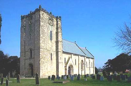
54° 01′ 15″ N, 0° 30′ 11″ W
1011:
Grade I listed buildings in the East Riding of
Yorkshire
948:
Grade I listed buildings in the East Riding of
Yorkshire
938:
Church of St
Michael and All Angels, Garton on the Wolds
953:
Grade I listed churches in the East Riding of
Yorkshire
401:
Add a one-line explanation of what this file represents
1065:
1060:
204:
Creative
Commons Attribution Share-alike license 2.0
132:
104:
90:
Commons is a freely licensed media file repository.
589:
Creative
Commons Attribution-ShareAlike 2.0 Generic
56:(432 × 285 pixels, file size: 49 KB, MIME type:
370:https://creativecommons.org/licenses/by-sa/2.0
71:
376:Creative Commons Attribution-Share Alike 2.0
294:
8:
336:– to copy, distribute and transmit the work
1083:
885:adjust perspective per {{Perspective}} tag
837:
397:
973:The following other wikis use this file:
675:https://www.geograph.org.uk/photo/224365
488:https://www.geograph.org.uk/profile/7164
1093:
1085:
935:
813:
797:
777:
761:
743:
727:
709:
693:
622:
606:
586:
570:
550:
534:
467:
451:
431:
415:
412:
393:
386:
213:
234:View this and other nearby images on:
933:The following 6 pages use this file:
7:
281:and is licensed for reuse under the
826:
317:Attribution-Share Alike 2.0 Generic
305:
300:
285:Attribution-ShareAlike 2.0 license.
1076:
406:
400:
291:
268:
148:St Michael and All Angels Church,
142:
108:
103:
49:
405:
1090:CAEC85D9287AC9607B97625797E39E09
391:
347:Under the following conditions:
312:This file is licensed under the
304:
299:
293:
261:
240:
226:
70:
31:
21:
388:
143:
46:No higher resolution available.
14:
1087:Unique ID of original document
625:file available on the internet
387:
269:This image was taken from the
26:
1:
730:coordinates of depicted place
36:
1099:Adobe Photoshop 2021 Windows
645:Geograph Britain and Ireland
509:object of statement has role
413:Items portrayed in this file
1007:Usage on dag.wikipedia.org
997:Usage on ceb.wikipedia.org
987:Usage on arz.wikipedia.org
977:Usage on ang.wikipedia.org
1117:
1057:Usage on www.wikidata.org
1047:Usage on tr.wikipedia.org
1037:Usage on pl.wikipedia.org
1027:Usage on nl.wikipedia.org
1017:Usage on fr.wikipedia.org
361:same or compatible license
827:
16:
921:East Riding of Yorkshire
780:East Riding of Yorkshire
745:54°1'14.9"N, 0°30'10.8"W
653:geograph.org.uk image ID
390:
327:
154:East Riding of Yorkshire
77:This is a file from the
914:
884:
192:
182:
171:
164:
161:
135:
81:. Information from its
981:Garatūn on þām Wealdum
917:en:Garton on the Wolds
893:16:03, 14 October 2007
275:this photograph's page
246:54.020800; -0.503000
84:description page there
863:20:21, 30 August 2021
963:Sykes Churches Trail
764:location of creation
434:Church of St Michael
1051:Garton on the Wolds
1041:Garton-on-the-Wolds
1031:Garton on the Wolds
1021:Garton on the Wolds
1001:Garton-on-the-Wolds
943:Garton on the Wolds
342:– to adapt the work
150:Garton on the Wolds
109:This is a photo of
496:author name string
1104:
1103:
969:Global file usage
926:
573:copyright license
399:
290:
289:
273:collection. See
251:
250:
208:
207:
201:
198:Reusing this file
125:
124:
99:
98:
79:Wikimedia Commons
32:Global file usage
1108:
1084:
905:
875:
677:
672:
668:described at URL
662:
657:
647:
642:
537:copyright status
518:
513:
503:
500:
490:
485:
383:
380:
377:
374:
371:
363:as the original.
325:
314:Creative Commons
308:
307:
303:
302:
297:
296:
283:Creative Commons
271:Geograph project
265:
258:
247:
244:
230:
229:
223:
222:
211:
195:
167:
147:
139:
133:
118:
105:
95:
74:
73:
67:
61:
59:
1116:
1115:
1111:
1110:
1109:
1107:
1106:
1105:
1072:
967:
927:
911:
903:
881:
873:
829:
828:
825:
824:
823:
822:
821:
820:
819:
818:
816:
806:
805:
804:
802:
791:
790:
789:
788:
787:
786:
785:
784:
782:
770:
769:
768:
766:
755:
754:
753:
752:
751:
750:
749:
748:
746:
736:
735:
734:
732:
721:
720:
719:
718:
717:
716:
715:
714:
712:
702:
701:
700:
698:
687:
686:
685:
684:
683:
682:
681:
680:
679:
678:
673:
670:
664:
663:
658:
655:
649:
648:
643:
640:
631:
630:
629:
627:
615:
614:
613:
611:
600:
599:
598:
597:
596:
595:
594:
593:
591:
579:
578:
577:
575:
564:
563:
562:
561:
560:
559:
558:
557:
555:
543:
542:
541:
539:
528:
527:
526:
525:
524:
523:
522:
521:
520:
519:
514:
511:
505:
504:
501:
498:
492:
491:
486:
483:
474:
473:
472:
470:
460:
459:
458:
456:
445:
444:
443:
442:
441:
440:
439:
438:
436:
424:
423:
422:
420:
404:
403:
402:
385:
384:
381:
378:
375:
372:
369:
368:
326:
323:
320:
309:
286:
256:
245:
218:
217:
214:Object location
209:
177:geograph.org.uk
157:
137:
130:
120:
114:
111:listed building
101:
100:
89:
88:
87:is shown below.
63:
57:
55:
48:
47:
12:
11:
5:
1114:
1112:
1102:
1101:
1096:
1092:
1091:
1088:
1075:
1071:
1070:
1069:
1068:
1063:
1055:
1054:
1053:
1045:
1044:
1043:
1035:
1034:
1033:
1025:
1024:
1023:
1015:
1014:
1013:
1005:
1004:
1003:
995:
994:
993:
985:
984:
983:
971:
970:
966:
965:
960:
955:
950:
945:
940:
931:
930:
925:
924:
913:
909:
906:
900:
895:
890:
887:
886:
883:
879:
876:
870:
865:
860:
856:
855:
852:
849:
846:
843:
840:
833:
832:
817:
814:
812:
811:
810:
809:
808:
807:
803:
798:
796:
795:
794:
793:
792:
783:
778:
776:
775:
774:
773:
772:
771:
767:
762:
760:
759:
758:
757:
756:
747:
744:
742:
741:
740:
739:
738:
737:
733:
728:
726:
725:
724:
723:
713:
710:
708:
707:
706:
705:
704:
703:
699:
694:
692:
691:
690:
689:
688:
666:
665:
651:
650:
636:
635:
634:
633:
632:
628:
623:
621:
620:
619:
618:
617:
616:
612:
609:source of file
607:
605:
604:
603:
602:
601:
592:
587:
585:
584:
583:
582:
581:
580:
576:
571:
569:
568:
567:
566:
565:
556:
551:
549:
548:
547:
546:
545:
544:
540:
535:
533:
532:
531:
530:
529:
507:
506:
502:Bill Henderson
494:
493:
479:
478:
477:
476:
475:
471:
468:
466:
465:
464:
463:
462:
461:
457:
452:
450:
449:
448:
447:
446:
437:
432:
430:
429:
428:
427:
426:
425:
421:
416:
414:
411:
410:
409:
408:
407:
396:
395:
392:
389:
367:
366:
365:
364:
354:
345:
344:
343:
337:
330:You are free:
324:Bill Henderson
321:
311:
310:
292:
288:
287:
279:Bill Henderson
266:
255:
252:
249:
248:
238:
232:
215:
206:
205:
202:
190:
189:
187:Bill Henderson
184:
180:
179:
173:
169:
168:
163:
159:
158:
140:
131:
129:
126:
123:
122:
102:
97:
96:
75:
65:
64:
45:
41:
40:
39:
34:
29:
24:
19:
13:
10:
9:
6:
4:
3:
2:
1113:
1100:
1097:
1095:Software used
1094:
1089:
1086:
1082:
1079:
1073:
1067:
1064:
1062:
1059:
1058:
1056:
1052:
1049:
1048:
1046:
1042:
1039:
1038:
1036:
1032:
1029:
1028:
1026:
1022:
1019:
1018:
1016:
1012:
1009:
1008:
1006:
1002:
999:
998:
996:
992:
989:
988:
986:
982:
979:
978:
976:
975:
974:
968:
964:
961:
959:
956:
954:
951:
949:
946:
944:
941:
939:
936:
934:
928:
922:
918:
912:
910:Angusmclellan
907:
901:
899:
896:
894:
891:
889:
888:
882:
877:
871:
869:
866:
864:
861:
858:
857:
853:
850:
847:
844:
841:
839:
838:
836:
830:
801:
781:
765:
731:
697:
676:
669:
661:
654:
646:
639:
626:
610:
590:
574:
554:
538:
517:
510:
497:
489:
482:
455:
435:
419:
373:CC BY-SA 2.0
362:
358:
355:
352:
349:
348:
346:
341:
338:
335:
332:
331:
329:
328:
322:Attribution:
318:
315:
298:
284:
280:
276:
272:
267:
264:
260:
259:
253:
243:
239:
237:
236:OpenStreetMap
233:
231:
221:
216:
212:
203:
199:
194:
191:
188:
185:
181:
178:
174:
170:
160:
155:
151:
146:
141:
134:
127:
121:
117:
112:
107:
106:
93:
86:
85:
80:
76:
69:
68:
62:
53:
44:
38:
35:
33:
30:
28:
25:
23:
20:
18:
15:
1080:
1077:
972:
932:
834:
831:File history
516:photographer
356:
350:
339:
333:
278:
144:
92:You can help
82:
50:
22:File history
553:copyrighted
357:share alike
351:attribution
136:Description
929:File usage
902:432 × 285
872:432 × 285
848:Dimensions
815:image/jpeg
800:media type
469:some value
193:Permission
156:, England.
58:image/jpeg
27:File usage
1066:Q17534133
845:Thumbnail
842:Date/Time
696:inception
254:Licensing
145:English:
1074:Metadata
1061:Q1956801
880:Hebrides
638:operator
394:Captions
340:to remix
334:to share
319:license.
37:Metadata
904:(17 KB)
874:(49 KB)
859:current
854:Comment
454:creator
418:depicts
398:English
128:Summary
116:1160977
113:number
54:
660:224365
224:
183:Author
172:Source
175:From
851:User
711:2004
382:true
379:true
166:2004
162:Date
17:File
481:URL
919:,
671::
656::
641::
512::
499::
484::
152:,
200:)
196:(
119:.
94:.
60:)
Text is available under the Creative Commons Attribution-ShareAlike License. Additional terms may apply.
_region:GB-ENG_&language=en)
