264:
231:
340:
245:
270:
105:
129:
67:
1071:
874:{{subst:Upload marker added by en.wp UW}} {{Information |Description = {{en|Foto del Salar de Huasco.}} |Source = http://www.flickr.com/photos/alita/188277373/ |Date = 12 de julio, 2006. |Author = Naturaleza |Permission = http://www.flickr.com/photos/a...
857:
918:
311:– You must give appropriate credit, provide a link to the license, and indicate if changes were made. You may do so in any reasonable manner, but not in any way that suggests the licensor endorses you or your use.
222:
938:
38:
888:
928:
923:
1176:
1193:
933:
121:
681:
611:
575:
238:
893:
716:
520:
752:
788:
724:
665:
559:
504:
476:
463:
448:
709:
694:
631:
595:
533:
421:
404:
1166:
908:
78:
46:
1136:
731:
1006:
903:
867:
913:
280:
116:
976:
277:
104:
128:
701:
360:
86:
768:
455:
898:
1171:
364:
483:
368:, who confirmed that it was available on Flickr under the stated license on that date.
244:
1187:
856:
851:
73:
37:
228:
991:
184:
1081:
205:
174:
111:
919:
Knowledge:Did you know/Statistics/Monthly DYK pageview leaders/2024/March
348:
1126:
1101:
1061:
961:
356:
1051:
1011:
1036:
1116:
996:
781:
1106:
1091:
956:
824:
Click on a date/time to view the file as it appeared at that time.
1016:
230:
223:
20° 17′ 57.45″ S, 68° 50′ 51.88″ W
1021:
981:
334:
213:
99:
61:
1041:
127:
732:
https://live.staticflickr.com/72/188277373_fe9aab31e3_o.jpg
1026:
977:
Cerro Laguna (bukid sa
Bolibiya, lat -20,33, long -68,68)
966:
388:
Add a one-line explanation of what this file represents
1156:
1151:
1146:
1007:
Anexo:Monumentos nacionales de la Región de
Tarapacá
149:
85:
Commons is a freely licensed media file repository.
939:Template:Did you know nominations/Salar del Huasco
51:(640 × 316 pixels, file size: 57 KB, MIME type:
702:https://www.flickr.com/photos/alita/188277373/
185:https://www.flickr.com/photos/alita/188277373/
66:
889:List of National Monuments of Chile by region
263:
8:
318:https://creativecommons.org/licenses/by/2.0
294:– to copy, distribute and transmit the work
929:Knowledge:Main Page history/2024 March 25b
826:
384:
949:The following other wikis use this file:
924:Knowledge:Main Page history/2024 March 25
612:Creative Commons Attribution 2.0 Generic
886:
802:
786:
766:
750:
679:
663:
645:
629:
609:
593:
573:
557:
518:
502:
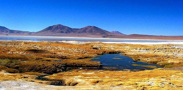
435:
419:
402:
399:
380:
373:
216:
884:The following 11 pages use this file:
237:View this and other nearby images on:
934:Knowledge:Recent additions/2024/March
355:, was reviewed on 3 July 2012 by the
7:
484:https://www.flickr.com/people/alita/
1082:Lijst van nationale parken in Chili
992:User:SHB2000/Chilean national parks
815:
349:
347:
269:
110:This image appeared on Knowledge's
393:
387:
285:
260:
159:
142:
98:
44:
1137:Danh sách vườn quốc gia tại Chile
392:
345:This image, originally posted to
324:Creative Commons Attribution 2.0
804:20°17'57.4490"S, 68°50'51.8820"W
378:
338:
305:Under the following conditions:
276:This file is licensed under the
268:
262:
243:
229:
103:
65:
31:
21:
894:List of national parks of Chile
375:
160:
41:No higher resolution available.
14:
682:file available on the internet
374:
26:
1:
1194:Knowledge Did you know images
789:coordinates of depicted place
120:column on 26 March 2024 (see
400:Items portrayed in this file
1072:ჩილეს ეროვნული პარკების სია
1058:Usage on it.wikivoyage.org
988:Usage on en.wikivoyage.org
973:Usage on ceb.wikipedia.org
1210:
1163:Usage on zh.wikipedia.org
1143:Usage on www.wikidata.org
1133:Usage on vi.wikipedia.org
1127:Wila Qullu (Bolivia-Chile)
1123:Usage on sv.wikipedia.org
1113:Usage on sl.wikipedia.org
1102:Wila Qullu (Buliwya-Chili)
1098:Usage on qu.wikipedia.org
1088:Usage on pl.wikipedia.org
1078:Usage on nl.wikipedia.org
1068:Usage on ka.wikipedia.org
1048:Usage on it.wikipedia.org
1033:Usage on fr.wikipedia.org
1003:Usage on es.wikipedia.org
962:Wila Qullu (Chili-Wuliwya)
953:Usage on ay.wikipedia.org
909:Wila Qullu (Bolivia-Chile)
1062:Parchi nazionali del Cile
1052:Parchi nazionali del Cile
1012:Usuario:Superzerocool/WLE
816:
165:Foto del Salar de Huasco.
16:
1037:Parcs nationaux du Chili
377:
72:This is a file from the
873:
281:Attribution 2.0 Generic
249:-20.299291; -68.847745
190:
180:
173:
170:
152:
76:. Information from its
1107:Waylla (Buliwya-Chili)
1092:Parki narodowe w Chile
997:Chilean national parks
957:Waylla (Chili-Wuliwya)
904:Waylla (Bolivia-Chile)
206:Link to Openstreetmap
133:
79:description page there
914:Talk:Salar del Huasco
131:
852:17:51, 26 April 2012
300:– to adapt the work
199:Openstreetmap entry
155:Salar de huasco.jpg
47:Salar_de_huasco.jpg
1117:Narodni parki Čila
464:author name string
134:
945:Global file usage
877:
869:Chiton magnificus
596:copyright license
386:
372:
371:
254:
253:
211:
210:
138:
137:
94:
93:
74:Wikimedia Commons
32:Global file usage
1201:
1042:Salar del Huasco
982:Salar del Guasco
899:Salar del Huasco
864:
753:Flickr photo ID
734:
729:
719:
714:
704:
699:
695:described at URL
560:copyright status
541:
538:
534:publication date
486:
481:
471:
468:
458:
453:
353:
351:
342:
341:
335:
331:
328:
325:
322:
319:
278:Creative Commons
272:
271:
266:
265:
250:
247:
233:
232:
226:
225:
214:
176:
164:
156:
150:
107:
100:
90:
69:
68:
62:
56:
54:
1209:
1208:
1204:
1203:
1202:
1200:
1199:
1198:
1184:
1183:
1177:維拉科柳山 (玻利維亞-智利)
943:
878:
870:
862:
818:
817:
814:
813:
812:
811:
810:
809:
808:
807:
805:
795:
794:
793:
791:
780:
779:
778:
777:
776:
775:
774:
773:
771:
759:
758:
757:
755:
744:
743:
742:
741:
740:
739:
738:
737:
736:
735:
730:
727:
721:
720:
715:
712:
706:
705:
700:
697:
688:
687:
686:
684:
672:
671:
670:
668:
657:
656:
655:
654:
653:
652:
651:
650:
648:
638:
637:
636:
634:
623:
622:
621:
620:
619:
618:
617:
616:
614:
602:
601:
600:
598:
587:
586:
585:
584:
583:
582:
581:
580:
578:
566:
565:
564:
562:
551:
550:
549:
548:
547:
546:
545:
544:
543:
542:
539:
536:
527:
526:
525:
523:
511:
510:
509:
507:
496:
495:
494:
493:
492:
491:
490:
489:
488:
487:
482:
479:
473:
472:
469:
466:
460:
459:
454:
451:
442:
441:
440:
438:
428:
427:
426:
424:
413:
412:
411:
410:
409:
407:
391:
390:
389:
339:
333:
332:
329:
326:
323:
320:
317:
316:
284:
273:
259:
248:
221:
220:
217:Object location
212:
202:
166:
154:
147:
140:
139:
96:
95:
84:
83:
82:is shown below.
58:
52:
50:
43:
42:
12:
11:
5:
1207:
1205:
1197:
1196:
1186:
1185:
1182:
1181:
1180:
1179:
1174:
1169:
1161:
1160:
1159:
1154:
1149:
1141:
1140:
1139:
1131:
1130:
1129:
1121:
1120:
1119:
1111:
1110:
1109:
1104:
1096:
1095:
1094:
1086:
1085:
1084:
1076:
1075:
1074:
1066:
1065:
1064:
1056:
1055:
1054:
1046:
1045:
1044:
1039:
1031:
1030:
1029:
1024:
1019:
1017:Río Collacagua
1014:
1009:
1001:
1000:
999:
994:
986:
985:
984:
979:
971:
970:
969:
964:
959:
947:
946:
942:
941:
936:
931:
926:
921:
916:
911:
906:
901:
896:
891:
882:
881:
876:
875:
872:
868:
865:
859:
854:
849:
845:
844:
841:
838:
835:
832:
829:
822:
821:
806:
803:
801:
800:
799:
798:
797:
796:
792:
787:
785:
784:
783:
782:
772:
767:
765:
764:
763:
762:
761:
760:
756:
751:
749:
748:
747:
746:
745:
723:
722:
708:
707:
693:
692:
691:
690:
689:
685:
680:
678:
677:
676:
675:
674:
673:
669:
666:source of file
664:
662:
661:
660:
659:
658:
649:
646:
644:
643:
642:
641:
640:
639:
635:
630:
628:
627:
626:
625:
624:
615:
610:
608:
607:
606:
605:
604:
603:
599:
594:
592:
591:
590:
589:
588:
579:
574:
572:
571:
570:
569:
568:
567:
563:
558:
556:
555:
554:
553:
552:
532:
531:
530:
529:
528:
524:
519:
517:
516:
515:
514:
513:
512:
508:
503:
501:
500:
499:
498:
497:
475:
474:
462:
461:
449:Flickr user ID
447:
446:
445:
444:
443:
439:
436:
434:
433:
432:
431:
430:
429:
425:
420:
418:
417:
416:
415:
414:
408:
403:
401:
398:
397:
396:
395:
394:
383:
382:
379:
376:
370:
369:
343:
315:
314:
313:
312:
303:
302:
301:
295:
288:You are free:
275:
274:
261:
258:
255:
252:
251:
241:
235:
218:
209:
208:
203:
200:
196:
195:
192:
188:
187:
182:
178:
177:
172:
168:
167:
157:
148:
146:
143:
141:
136:
135:
125:
108:
97:
92:
91:
70:
60:
59:
40:
36:
35:
34:
29:
24:
19:
13:
10:
9:
6:
4:
3:
2:
1206:
1195:
1192:
1191:
1189:
1178:
1175:
1173:
1170:
1168:
1165:
1164:
1162:
1158:
1155:
1153:
1150:
1148:
1145:
1144:
1142:
1138:
1135:
1134:
1132:
1128:
1125:
1124:
1122:
1118:
1115:
1114:
1112:
1108:
1105:
1103:
1100:
1099:
1097:
1093:
1090:
1089:
1087:
1083:
1080:
1079:
1077:
1073:
1070:
1069:
1067:
1063:
1060:
1059:
1057:
1053:
1050:
1049:
1047:
1043:
1040:
1038:
1035:
1034:
1032:
1028:
1025:
1023:
1020:
1018:
1015:
1013:
1010:
1008:
1005:
1004:
1002:
998:
995:
993:
990:
989:
987:
983:
980:
978:
975:
974:
972:
968:
965:
963:
960:
958:
955:
954:
952:
951:
950:
944:
940:
937:
935:
932:
930:
927:
925:
922:
920:
917:
915:
912:
910:
907:
905:
902:
900:
897:
895:
892:
890:
887:
885:
879:
871:
866:
860:
858:
855:
853:
850:
847:
846:
842:
839:
836:
833:
830:
828:
827:
825:
819:
790:
770:
754:
733:
726:
718:
711:
703:
696:
683:
667:
633:
613:
597:
577:
561:
535:
522:
506:
485:
478:
465:
457:
450:
423:
406:
367:
366:
365:Sven Manguard
362:
358:
357:administrator
354:
352:
344:
337:
336:
310:
307:
306:
304:
299:
296:
293:
290:
289:
287:
286:
282:
279:
267:
256:
246:
242:
240:
239:OpenStreetMap
236:
234:
224:
219:
215:
207:
204:
198:
197:
193:
189:
186:
183:
179:
169:
163:
158:
151:
144:
130:
126:
123:
119:
118:
117:Did you know?
113:
109:
106:
102:
101:
88:
81:
80:
75:
71:
64:
63:
57:
48:
39:
33:
30:
28:
25:
23:
20:
18:
15:
1022:Río Chaquina
948:
883:
823:
820:File history
647:12 July 2006
540:12 July 2006
505:published in
456:42198580@N00
363:
346:
308:
297:
291:
175:12 July 2006
161:
115:
87:You can help
77:
45:
22:File history
967:Phuju Qullu
576:copyrighted
309:attribution
153:Description
880:File usage
861:640 × 316
837:Dimensions
470:Naturaleza
437:some value
321:CC BY 2.0
194:Naturaleza
53:image/jpeg
27:File usage
1157:Q20022191
834:Thumbnail
831:Date/Time
769:188277373
632:inception
257:Licensing
201:InfoField
162:English:
132:Knowledge
112:Main Page
1188:Category
1167:智利國家公園列表
1152:Q1651078
1147:Q1651061
1027:Río Piga
710:operator
381:Captions
361:reviewer
298:to remix
292:to share
283:license.
122:archives
863:(57 KB)
848:current
843:Comment
422:creator
405:depicts
385:English
145:Summary
114:in the
49:
717:Flickr
521:Flickr
350:Flickr
227:
191:Author
181:Source
1172:瓦伊利亞山
840:User
330:true
327:true
171:Date
17:File
725:URL
477:URL
359:or
1190::
728::
713::
698::
537::
480::
467::
452::
124:).
89:.
55:)
Text is available under the Creative Commons Attribution-ShareAlike License. Additional terms may apply.