363:
296:
246:
288:
238:
310:
260:
331:
369:
374:
43:
87:
839:"}},"text\/plain":{"en":{"":"heading"}}},"{\"value\":{\"amount\":\"+337\",\"unit\":\"http:\\\/\\\/www.wikidata.org\\\/entity\\\/Q28390\"},\"type\":\"quantity\"}":{"text\/html":{"en":{"P7787":"337
688:"}},"text\/plain":{"en":{"":"heading"}}},"{\"value\":{\"amount\":\"+337\",\"unit\":\"http:\\\/\\\/www.wikidata.org\\\/entity\\\/Q28390\"},\"type\":\"quantity\"}":{"text\/html":{"en":{"P7787":"337
835:
279:
992:== {{int:filedesc}} == {{Information |description={{en|1=Salem Chapel Guarded by neat railings this is a well-kept and modest building entirely in keeping with the houses of the street.}} |date=2007-07-27 |source=From [http://www.geograph.org.uk/photo/551
229:
421:– You must give appropriate credit, provide a link to the license, and indicate if changes were made. You may do so in any reasonable manner, but not in any way that suggests the licensor endorses you or your use.
836:
685:
53:
47:
98:
66:
1006:
771:
637:
601:
303:
253:
141:
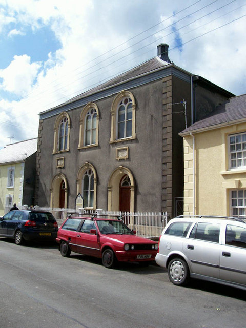
Salem Chapel
Guarded by neat railings this is a well-kept and modest building entirely in keeping with the houses of the street.
791:
338:
1037:
This file contains additional information, probably added from the digital camera or scanner used to create or digitize it.
428:
551:
906:
877:
850:
814:
755:
726:
699:
585:
559:
544:
529:
799:
784:
657:
621:
502:
485:
325:
384:
974:
969:
57:
42:
1040:
If the file has been modified from its original state, some details may not fully reflect the modified file.
1002:
The following pages on the
English Knowledge (XXG) use this file (pages on other projects are not listed):
427:– If you remix, transform, or build upon the material, you must distribute your contributions under the
345:
on the
Geograph website for the photographer's contact details. The copyright on this image is owned by
985:
381:
843:"}},"text\/plain":{"en":{"P7787":"337 degree"}}}}": -->
692:"}},"text\/plain":{"en":{"P7787":"337 degree"}}}}": -->
106:
198:
821:
806:
536:
182:
309:
259:
350:
93:
150:
293:
243:
171:
161:
330:
342:
942:
Click on a date/time to view the file as it appeared at that time.
295:
245:
270:
220:
81:
280:
51° 59′ 42″ N, 3° 47′ 39″ W
230:
51° 59′ 42″ N, 3° 47′ 39″ W
469:
Add a one-line explanation of what this file represents
1024:
125:
105:
Commons is a freely licensed media file repository.
638:
Creative
Commons Attribution-ShareAlike 2.0 Generic
71:(480 × 640 pixels, file size: 87 KB, MIME type:
438:https://creativecommons.org/licenses/by-sa/2.0
86:
444:Creative Commons Attribution-Share Alike 2.0
362:
8:
840:
689:
404:– to copy, distribute and transmit the work
131:Salem Chapel - geograph.org.uk - 551541.jpg
1042:
944:
465:
1017:The following other wikis use this file:
807:https://www.geograph.org.uk/photo/551541
537:https://www.geograph.org.uk/profile/7090
1044:
1004:
920:
904:
864:
848:
769:
753:
713:
697:
671:
655:
635:
619:
599:
583:
516:
500:
483:
480:
461:
454:
273:
223:
302:View this and other nearby images on:
252:View this and other nearby images on:
7:
1007:Salem Independent Chapel, Llandovery
349:and is licensed for reuse under the
933:
385:Attribution-Share Alike 2.0 Generic
373:
368:
353:Attribution-ShareAlike 2.0 license.
1035:
474:
468:
359:
336:
135:
118:
64:
473:
700:coordinates of the point of view
459:
415:Under the following conditions:
380:This file is licensed under the
372:
367:
361:
329:
308:
294:
286:
258:
244:
236:
85:
31:
21:
456:
136:
14:
772:file available on the internet
455:
337:This image was taken from the
26:
1:
851:coordinates of depicted place
211:Jonathan Wilkins /
192:Jonathan Wilkins /
36:
792:Geograph Britain and Ireland
545:object of statement has role
481:Items portrayed in this file
285:
235:
866:51°59'41.82"N, 3°47'39.48"W
715:51°59'41.82"N, 3°47'39.48"W
1066:
1021:Usage on www.wikidata.org
429:same or compatible license
934:
16:
815:geograph.org.uk image ID
458:
395:
92:This is a file from the
991:
183:required by the license
167:
156:
149:
146:
128:
96:. Information from its
970:04:01, 6 February 2011
343:this photograph's page
314:51.994950; -3.794300
264:51.994950; -3.794300
99:description page there
46:Size of this preview:
410:– to adapt the work
52:Other resolutions:
560:author name string
1053:
1052:
1013:Global file usage
995:
842:
691:
622:copyright license
467:
358:
357:
341:collection. See
319:
318:
269:
268:
218:
217:
186:
114:
113:
94:Wikimedia Commons
32:Global file usage
1057:
1043:
982:
888:
887:
882:
824:
819:
809:
804:
800:described at URL
794:
789:
737:
736:
731:
586:copyright status
567:
566:Jonathan Wilkins
564:
554:
549:
539:
534:
451:
448:
445:
442:
439:
431:as the original.
393:
392:Jonathan Wilkins
382:Creative Commons
376:
375:
371:
370:
365:
364:
351:Creative Commons
347:Jonathan Wilkins
339:Geograph project
333:
326:
315:
312:
298:
297:
291:
290:
289:
283:
282:
271:
265:
262:
248:
247:
241:
240:
239:
233:
232:
221:
180:
172:Jonathan Wilkins
152:
140:
132:
126:
110:
89:
88:
82:
76:
74:
61:
58:480 × 640 pixels
54:180 × 240 pixels
48:450 × 600 pixels
1065:
1064:
1060:
1059:
1058:
1056:
1055:
1054:
1031:
1011:
1003:
996:
988:
980:
936:
935:
932:
931:
930:
929:
928:
927:
926:
925:
923:
913:
912:
911:
909:
898:
897:
896:
895:
894:
893:
892:
891:
890:
889:
885:
883:
880:
871:
870:
869:
867:
857:
856:
855:
853:
834:
833:
832:
831:
830:
829:
828:
827:
826:
825:
820:
817:
811:
810:
805:
802:
796:
795:
790:
787:
778:
777:
776:
774:
762:
761:
760:
758:
747:
746:
745:
744:
743:
742:
741:
740:
739:
738:
734:
732:
729:
720:
719:
718:
716:
706:
705:
704:
702:
683:
682:
681:
680:
679:
678:
677:
676:
674:
664:
663:
662:
660:
649:
648:
647:
646:
645:
644:
643:
642:
640:
628:
627:
626:
624:
613:
612:
611:
610:
609:
608:
607:
606:
604:
592:
591:
590:
588:
577:
576:
575:
574:
573:
572:
571:
570:
569:
568:
565:
562:
556:
555:
550:
547:
541:
540:
535:
532:
523:
522:
521:
519:
509:
508:
507:
505:
494:
493:
492:
491:
490:
488:
472:
471:
470:
453:
452:
449:
446:
443:
440:
437:
436:
394:
391:
388:
377:
354:
324:
313:
287:
278:
277:
274:Object location
263:
237:
228:
227:
224:Camera location
219:
208:
201:
189:
162:geograph.org.uk
142:
130:
123:
116:
115:
104:
103:
102:is shown below.
78:
72:
70:
63:
62:
51:
12:
11:
5:
1063:
1061:
1051:
1050:
1047:
1034:
1030:
1029:
1028:
1027:
1015:
1014:
1010:
1009:
1001:
1000:
999:
994:
993:
990:
986:
983:
977:
972:
967:
963:
962:
959:
956:
953:
950:
947:
940:
939:
924:
921:
919:
918:
917:
916:
915:
914:
910:
905:
903:
902:
901:
900:
899:
876:
875:
874:
873:
872:
868:
865:
863:
862:
861:
860:
859:
858:
854:
849:
847:
846:
845:
844:
838:
813:
812:
798:
797:
783:
782:
781:
780:
779:
775:
770:
768:
767:
766:
765:
764:
763:
759:
756:source of file
754:
752:
751:
750:
749:
748:
725:
724:
723:
722:
721:
717:
714:
712:
711:
710:
709:
708:
707:
703:
698:
696:
695:
694:
693:
687:
675:
672:
670:
669:
668:
667:
666:
665:
661:
656:
654:
653:
652:
651:
650:
641:
636:
634:
633:
632:
631:
630:
629:
625:
620:
618:
617:
616:
615:
614:
605:
600:
598:
597:
596:
595:
594:
593:
589:
584:
582:
581:
580:
579:
578:
558:
557:
543:
542:
528:
527:
526:
525:
524:
520:
517:
515:
514:
513:
512:
511:
510:
506:
501:
499:
498:
497:
496:
495:
489:
484:
482:
479:
478:
477:
476:
475:
464:
463:
460:
457:
435:
434:
433:
432:
422:
413:
412:
411:
405:
398:You are free:
389:
379:
378:
360:
356:
355:
334:
323:
320:
317:
316:
306:
300:
275:
267:
266:
256:
250:
225:
216:
215:
209:
206:
203:
202:
197:
190:
187:
175:
174:
169:
165:
164:
158:
154:
153:
148:
144:
143:
133:
124:
122:
119:
117:
112:
111:
90:
80:
79:
45:
41:
40:
39:
34:
29:
24:
19:
13:
10:
9:
6:
4:
3:
2:
1062:
1048:
1045:
1041:
1038:
1032:
1026:
1023:
1022:
1020:
1019:
1018:
1012:
1008:
1005:
997:
989:
984:
978:
976:
973:
971:
968:
965:
964:
960:
957:
954:
951:
948:
946:
945:
943:
937:
908:
879:
852:
823:
816:
808:
801:
793:
786:
773:
757:
728:
701:
659:
639:
623:
603:
587:
561:
553:
546:
538:
531:
504:
487:
441:CC BY-SA 2.0
430:
426:
423:
420:
417:
416:
414:
409:
406:
403:
400:
399:
397:
396:
390:Attribution:
386:
383:
366:
352:
348:
344:
340:
335:
332:
328:
327:
321:
311:
307:
305:
304:OpenStreetMap
301:
299:
281:
276:
272:
261:
257:
255:
254:OpenStreetMap
251:
249:
231:
226:
222:
214:
210:
205:
204:
200:
196: /
195:
191:
184:
179:
177:
176:
173:
170:
166:
163:
159:
155:
145:
139:
134:
127:
120:
108:
101:
100:
95:
91:
84:
83:
77:
68:
67:Original file
59:
55:
49:
44:
38:
35:
33:
30:
28:
25:
23:
20:
18:
15:
1039:
1036:
1016:
941:
938:File history
673:27 July 2007
552:photographer
424:
418:
407:
401:
346:
284:
234:
213:Salem Chapel
212:
199:CC BY-SA 2.0
194:Salem Chapel
193:
151:27 July 2007
137:
107:You can help
97:
65:
22:File history
987:GeographBot
602:copyrighted
425:share alike
419:attribution
178:Attribution
129:Description
1046:_error
998:File usage
979:480 × 640
955:Dimensions
922:image/jpeg
907:media type
518:some value
73:image/jpeg
27:File usage
1025:Q24183241
952:Thumbnail
949:Date/Time
658:inception
322:Licensing
207:InfoField
188:InfoField
138:English:
1033:Metadata
785:operator
462:Captions
408:to remix
402:to share
387:license.
37:Metadata
981:(87 KB)
966:current
961:Comment
878:heading
837:heading
727:heading
686:heading
503:creator
486:depicts
466:English
121:Summary
69:
886:degree
841:degree
822:551541
735:degree
690:degree
292:
242:
168:Author
157:Source
160:From
958:User
884:337
733:337
450:true
447:true
147:Date
17:File
530:URL
881::
818::
803::
788::
730::
563::
548::
533::
56:|
50:.
1049:0
185:)
181:(
109:.
75:)
60:.
Text is available under the Creative Commons Attribution-ShareAlike License. Additional terms may apply.
_heading:337.00&language=en)
_heading:337.00&language=en)
