38:
357:
249:
202:
363:
255:
368:
714:
94:
260:
68:
64:
60:
56:
52:
48:
42:
105:
77:
418:– You must give appropriate credit, provide a link to the license, and indicate if changes were made. You may do so in any reasonable manner, but not in any way that suggests the licensor endorses you or your use.
308:– You must give appropriate credit, provide a link to the license, and indicate if changes were made. You may do so in any reasonable manner, but not in any way that suggests the licensor endorses you or your use.
219:
713:
708:
37:
829:
859:
849:
779:
799:
879:
217:; with no Invariant Sections, no Front-Cover Texts, and no Back-Cover Texts. A copy of the license is included in the section entitled
209:
625:
608:
591:
574:
557:
521:
425:
315:
505:
214:
645:
541:
488:
142:
724:
387:
383:
379:
269:
736:
172:
424:– If you remix, transform, or build upon the material, you must distribute your contributions under the
314:– If you remix, transform, or build upon the material, you must distribute your contributions under the
150:
789:
761:
744:
375:
266:
153:
in red. It was created with a custom script with US Census Bureau data and modified with
Inkscape.
113:
196:
329:
207:
Permission is granted to copy, distribute and/or modify this document under the terms of the
133:
Sanders County
Montana Incorporated and Unincorporated areas Trout Creek Highlighted.svg
138:
193:
I, the copyright holder of this work, hereby publish it under the following licenses:
100:
732:
182:
171:
My own work, based on public domain information. Based on similar map concepts by
161:
146:
740:
681:
Click on a date/time to view the file as it appeared at that time.
819:
839:
328:
This licensing tag was added to this file as part of the GFDL
243:
88:
82:(SVG file, nominally 1,150 × 1,050 pixels, file size: 145 KB)
809:
472:
Add a one-line explanation of what this file represents
869:
592:
575:
Creative
Commons Attribution-ShareAlike 3.0 Unported
213:, Version 1.2 or any later version published by the
127:
112:
Commons is a freely licensed media file repository.
626:
Creative
Commons Attribution-ShareAlike 2.5 Generic
609:
Creative
Commons Attribution-ShareAlike 1.0 Generic
558:
Creative
Commons Attribution-ShareAlike 2.0 Generic
731:{{Information |Description=This map shows the
435:https://creativecommons.org/licenses/by-sa/2.5
335:http://creativecommons.org/licenses/by-sa/3.0/
93:
441:Creative Commons Attribution-Share Alike 2.5
356:
248:
8:
341:Creative Commons Attribution-Share Alike 3.0
401:– to copy, distribute and transmit the work
291:– to copy, distribute and transmit the work
41:Size of this PNG preview of this SVG file:
683:
468:
453:You may select the license of your choice.
772:The following other wikis use this file:
759:
659:
643:
623:
606:
589:
572:
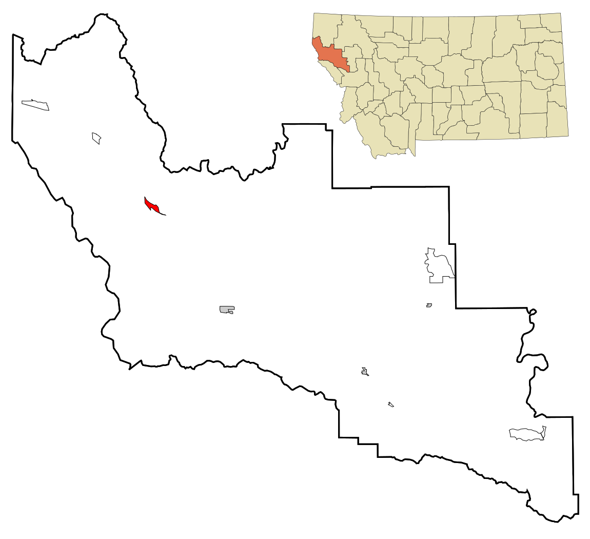
555:
539:
519:
503:
486:
483:
464:
457:
7:
270:Attribution-Share Alike 3.0 Unported
225:http://www.gnu.org/copyleft/fdl.html
757:The following page uses this file:
672:
367:
362:
259:
254:
477:
471:
452:
353:
192:
125:
75:
476:
462:
412:Under the following conditions:
374:This file is licensed under the
366:
361:
355:
302:Under the following conditions:
265:This file is licensed under the
258:
253:
247:
201:
200:
92:
31:
21:
459:
14:
458:
231:GNU Free Documentation License
220:GNU Free Documentation License
210:GNU Free Documentation License
26:
1:
735:and unincorporated areas in
484:Items portrayed in this file
141:and unincorporated areas in
796:Usage on azb.wikipedia.org
786:Usage on arz.wikipedia.org
898:
876:Usage on zh.wikipedia.org
866:Usage on www.wikidata.org
856:Usage on tt.wikipedia.org
846:Usage on sr.wikipedia.org
836:Usage on sh.wikipedia.org
826:Usage on fa.wikipedia.org
816:Usage on eu.wikipedia.org
806:Usage on ca.wikipedia.org
776:Usage on ar.wikipedia.org
426:same or compatible license
316:same or compatible license
673:
274:
246:
16:
461:
392:
378:Attribution-Share Alike
215:Free Software Foundation
99:This is a file from the
730:
178:
167:
160:
157:
130:
103:. Information from its
709:22:50, 24 October 2007
106:description page there
820:Trout Creek (Montana)
860:Траут-Крик (Монтана)
850:Траут Крик (Монтана)
840:Trout Creek, Montana
780:تراوت كريك (مونتانا)
762:Trout Creek, Montana
69:1,150 × 1,050 pixels
65:2,243 × 2,048 pixels
61:1,122 × 1,024 pixels
830:تراوت کریک، مونتانا
726:ArkyBot~commonswiki
407:– to adapt the work
297:– to adapt the work
137:This map shows the
47:Other resolutions:
800:تروت کریک، مونتانا
768:Global file usage
750:
747:in red. It was c
542:copyright license
470:
352:
351:
242:
241:
188:
187:
121:
120:
101:Wikimedia Commons
32:Global file usage
889:
721:
506:copyright status
448:
445:
442:
439:
436:
428:as the original.
376:Creative Commons
370:
369:
365:
364:
359:
358:
348:
345:
342:
339:
336:
333:
330:licensing update
318:as the original.
267:Creative Commons
262:
261:
257:
256:
251:
250:
244:
238:
235:
232:
229:
226:
204:
203:
197:
173:Ixnayonthetimmay
163:
134:
128:
117:
96:
95:
89:
83:
72:
57:841 × 768 pixels
53:526 × 480 pixels
49:263 × 240 pixels
43:657 × 600 pixels
897:
896:
892:
891:
890:
888:
887:
886:
766:
751:
743:, highlighting
727:
719:
675:
674:
671:
670:
669:
668:
667:
666:
665:
664:
662:
661:24 October 2007
652:
651:
650:
648:
637:
636:
635:
634:
633:
632:
631:
630:
628:
617:
616:
615:
614:
613:
611:
600:
599:
598:
597:
596:
594:
583:
582:
581:
580:
579:
577:
566:
565:
564:
563:
562:
560:
548:
547:
546:
544:
533:
532:
531:
530:
529:
528:
527:
526:
524:
512:
511:
510:
508:
497:
496:
495:
494:
493:
491:
475:
474:
473:
456:
455:
454:
450:
449:
446:
443:
440:
437:
434:
433:
391:
371:
346:
343:
340:
337:
334:
327:
236:
233:
230:
227:
224:
195:
194:
189:
162:24 October 2007
149:, highlighting
132:
123:
122:
111:
110:
109:is shown below.
85:
81:
74:
73:
46:
12:
11:
5:
895:
893:
885:
884:
883:
882:
874:
873:
872:
864:
863:
862:
854:
853:
852:
844:
843:
842:
834:
833:
832:
824:
823:
822:
814:
813:
812:
804:
803:
802:
794:
793:
792:
784:
783:
782:
770:
769:
765:
764:
755:
754:
749:
748:
737:Sanders County
729:
725:
722:
718:1,150 × 1,050
716:
711:
706:
702:
701:
698:
695:
692:
689:
686:
679:
678:
663:
660:
658:
657:
656:
655:
654:
653:
649:
644:
642:
641:
640:
639:
638:
629:
624:
622:
621:
620:
619:
618:
612:
607:
605:
604:
603:
602:
601:
595:
590:
588:
587:
586:
585:
584:
578:
573:
571:
570:
569:
568:
567:
561:
556:
554:
553:
552:
551:
550:
549:
545:
540:
538:
537:
536:
535:
534:
525:
520:
518:
517:
516:
515:
514:
513:
509:
504:
502:
501:
500:
499:
498:
492:
487:
485:
482:
481:
480:
479:
478:
467:
466:
463:
460:
451:
432:
431:
430:
429:
419:
410:
409:
408:
402:
395:You are free:
373:
372:
354:
350:
349:
324:
323:
322:
321:
320:
319:
309:
300:
299:
298:
292:
285:You are free:
280:
279:
276:
275:
273:
263:
240:
239:
205:
191:
190:
186:
185:
180:
176:
175:
169:
165:
164:
159:
155:
154:
143:Sanders County
135:
126:
124:
119:
118:
97:
87:
86:
40:
36:
35:
34:
29:
24:
19:
13:
10:
9:
6:
4:
3:
2:
894:
881:
880:特勞特克里克 (蒙大拿州)
878:
877:
875:
871:
868:
867:
865:
861:
858:
857:
855:
851:
848:
847:
845:
841:
838:
837:
835:
831:
828:
827:
825:
821:
818:
817:
815:
811:
808:
807:
805:
801:
798:
797:
795:
791:
788:
787:
785:
781:
778:
777:
775:
774:
773:
767:
763:
760:
758:
752:
746:
742:
738:
734:
728:
723:
717:
715:
712:
710:
707:
704:
703:
699:
696:
693:
690:
687:
685:
684:
682:
676:
647:
627:
610:
593:
576:
559:
543:
523:
507:
490:
438:CC BY-SA 2.5
427:
423:
420:
417:
414:
413:
411:
406:
403:
400:
397:
396:
394:
393:
389:
385:
381:
377:
360:
331:
326:
325:
317:
313:
310:
307:
304:
303:
301:
296:
293:
290:
287:
286:
284:
283:
282:
281:
278:
277:
271:
268:
264:
252:
245:
222:
221:
216:
212:
211:
206:
199:
198:
184:
181:
177:
174:
170:
166:
156:
152:
148:
144:
140:
136:
129:
115:
108:
107:
102:
98:
91:
90:
84:
79:
78:Original file
70:
66:
62:
58:
54:
50:
44:
39:
33:
30:
28:
25:
23:
20:
18:
15:
771:
756:
733:incorporated
680:
677:File history
421:
415:
404:
398:
338:CC BY-SA 3.0
311:
305:
294:
288:
218:
208:
139:incorporated
114:You can help
104:
76:
22:File history
810:Trout Creek
745:Trout Creek
522:copyrighted
422:share alike
416:attribution
388:1.0 Generic
384:2.0 Generic
380:2.5 Generic
312:share alike
306:attribution
151:Trout Creek
131:Description
790:تراوت كريك
753:File usage
694:Dimensions
27:File usage
691:Thumbnail
688:Date/Time
646:inception
272:license.
720:(145 KB)
465:Captions
405:to remix
399:to share
390:license.
295:to remix
289:to share
870:Q962493
741:Montana
705:current
700:Comment
489:depicts
469:English
147:Montana
80:
183:Arkyan
179:Author
168:Source
697:User
447:true
444:true
386:and
347:true
344:true
237:true
234:true
228:GFDL
158:Date
17:File
739:,
382:,
145:,
67:|
63:|
59:|
55:|
51:|
45:.
332:.
223:.
116:.
71:.
Text is available under the Creative Commons Attribution-ShareAlike License. Additional terms may apply.
