339:
199:
275:
205:
87:
43:
602:
338:
619:{{Information |Description=The raw satellite imagery shown in these images was obtain from NASA and/or the US Geological Survey. Post-processing and production by http://www.terraprints.com |Source=http://www.terraprints.com |Date=20061025 |Author=http://
572:
246:– You must give appropriate credit, provide a link to the license, and indicate if changes were made. You may do so in any reasonable manner, but not in any way that suggests the licensor endorses you or your use.
279:
297:
The
Wikimedia Foundation has received an e-mail confirming that the copyright holder has approved publication under the terms mentioned on this page. This correspondence has been
748:
668:
1018:
753:
683:
313:
823:
483:
673:
1008:
963:
833:
738:
828:
713:
663:
322:
903:
723:
291:
798:
788:
633:
447:
411:
993:
743:
53:
47:
728:
98:
1134:
This file contains additional information, probably added from the digital camera or scanner used to create or digitize it.
66:
1058:
1053:
928:
678:
768:
467:
395:
329:
913:
503:
431:
378:
1033:
1003:
693:
601:
596:
308:
304:
898:
295:, you do not need to request permission as long as you follow any licensing requirements mentioned on this page.
998:
983:
813:
763:
138:
1137:
If the file has been modified from its original state, some details may not fully reflect the modified file.
1023:
758:
958:
933:
843:
773:
215:
883:
149:
The raw satellite imagery shown in these images was obtained from NASA and/or the US Geological Survey.
612:
978:
968:
803:
658:
212:
973:
330:
https://ticket.wikimedia.org/otrs/index.pl?Action=AgentTicketZoom&TicketNumber=2006110810005047
988:
948:
938:
106:
943:
708:
698:
648:
1043:
908:
888:
848:
783:
733:
286:
1170:
953:
923:
893:
853:
718:
571:
566:
57:
42:
1038:
838:
793:
638:
1048:
1013:
918:
873:
863:
93:
878:
868:
808:
703:
688:
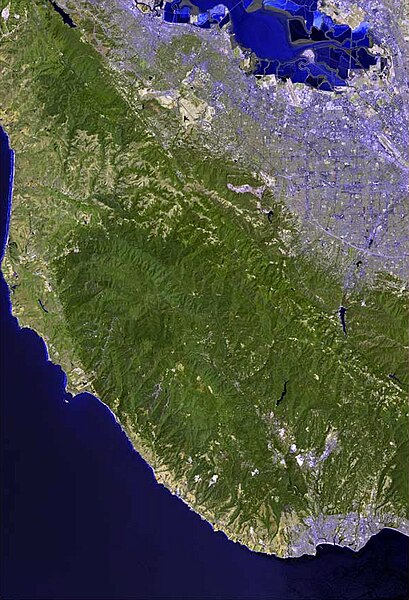
653:
643:
1185:
858:
818:
167:
1028:
778:
582:
1111:
143:
1076:
321:
If you have questions about the archived correspondence, please use the
1106:
1121:
539:
Click on a date/time to view the file as it appeared at that time.
1101:
1086:
1096:
269:
81:
187:
177:
153:
311:. The correspondence is available to trusted volunteers as
289:
and may be used by anyone for any purpose. If you wish to
362:
Add a one-line explanation of what this file represents
120:
105:
Commons is a freely licensed media file repository.
71:(586 × 859 pixels, file size: 321 KB, MIME type:
86:
749:Crystal Peak (Santa Clara County, California)
669:Bear Creek (San Francisquito Creek tributary)
198:
8:
1019:Twin Peaks (Santa Clara County, California)
754:Deer Creek (Santa Clara County, California)
684:Black Mountain (near Los Altos, California)
253:https://creativecommons.org/licenses/by/2.5
229:– to copy, distribute and transmit the work
1139:
541:
358:
1069:The following other wikis use this file:
824:Long Ridge (San Mateo County, California)
448:Creative Commons Attribution 2.5 Generic
1183:
1175:
1165:
1157:
1149:
1141:
674:Bear Creek Redwoods Open Space Preserve
631:
517:
501:
481:
465:
445:
429:
409:
393:
376:
373:
354:
347:
629:The following 86 pages use this file:
335:Find other files from the same ticket:
1009:The Forest of Nisene Marks State Park
964:San Vicente Creek (Santa Cruz County)
834:Martin Creek (Sausal Creek tributary)
739:Corte Madera Creek (San Mateo County)
274:
7:
829:Los Gatos Creek (Santa Clara County)
714:Calabazas Creek (Santa Clara County)
664:Bean Creek (Zayante Creek tributary)
305:Volunteer Response Team (VRT) member
904:Pheasant Creek (Santa Clara County)
724:Castle Rock State Park (California)
530:
299:
204:
1132:
367:
361:
220:
195:
152:Post-processing and production by
130:
118:
64:
366:
259:Creative Commons Attribution 2.5
799:Laguna Creek (Santa Cruz County)
789:Hicks Creek (Santa Clara County)
634:Adobe Creek (Santa Clara County)
352:
337:
273:
240:Under the following conditions:
211:This file is licensed under the
203:
197:
85:
31:
21:
994:Sausal Creek (San Mateo County)
744:Coyote Creek (San Mateo County)
349:
131:
14:
729:Clear Creek (San Mateo County)
348:
26:
1:
1059:Category:Santa Cruz Mountains
1054:Template:Santa Cruz Mountains
929:San Bruno Mountain State Park
679:Big Basin Redwoods State Park
139:Category:Santa Cruz Mountains
36:
769:Guadalupe River (California)
468:Wikimedia VRTS ticket number
374:Items portrayed in this file
914:Portola Redwoods State Park
1207:
1118:Usage on pl.wikipedia.org
1093:Usage on oc.wikipedia.org
1083:Usage on nl.wikipedia.org
1073:Usage on cs.wikipedia.org
1034:Waddell Creek (California)
1004:Stevens Creek (California)
694:Boulder Creek (California)
188:http://www.terraprints.com
178:http://www.terraprints.com
154:http://www.terraprints.com
1177:File change date and time
1112:Modèl:Monts de Santa Cruz
899:Peters Creek (California)
531:
16:
999:Skyline-to-the-Sea Trail
984:Santa Cruz Mountains AVA
814:Loch Lomond (California)
764:El Corte de Madera Creek
759:Devil's Slide Trail
351:
314:ticket #2006110810005047
272:
126:Santa Cruz Mountains.jpg
92:This is a file from the
1024:Uvas Canyon County Park
618:
588:
216:Attribution 2.5 Generic
183:
173:
166:
163:
123:
96:. Information from its
1180:03:07, 5 February 2011
959:San Tomas Aquino Creek
934:San Francisquito Creek
844:McNee Ranch State Park
774:Guadalupe Valley Creek
597:18:47, 25 October 2006
567:02:10, 5 February 2011
99:description page there
46:Size of this preview:
1151:Horizontal resolution
1087:Santa Cruz Mountains
979:Santa Cruz Mountains
969:San Vicente Redwoods
804:Little Boulder Creek
659:Bay Area Ridge Trail
1159:Vertical resolution
1107:Rèc de San Gregorio
1097:Monts de Santa Cruz
974:Sanborn County Park
235:– to adapt the work
136:Aerial view of the
52:Other resolutions:
989:Santa Teresa Hills
949:San Lorenzo Valley
939:San Gregorio Creek
884:Old Almadén Winery
309:permission archive
307:and stored in our
1194:
1193:
1122:Santa Cruz (góry)
1077:Pohoří Santa Cruz
1065:Global file usage
944:San Lorenzo River
709:Butano State Park
699:Branciforte Creek
649:Arastradero Creek
622:
432:copyright license
360:
346:
345:
336:
332:
326:
193:
192:
114:
113:
94:Wikimedia Commons
32:Global file usage
1198:
1140:
1044:West Union Creek
909:Pilarcitos Creek
889:Permanente Creek
849:Montara Mountain
784:Harrington Creek
734:Corralitos Creek
609:
579:
484:2006110810005047
396:copyright status
341:
334:
327:
320:
301:
292:use this content
281:
277:
276:
270:
266:
263:
260:
257:
254:
213:Creative Commons
207:
206:
201:
200:
169:
135:
127:
121:
110:
89:
88:
82:
76:
74:
61:
58:586 × 859 pixels
54:164 × 240 pixels
48:409 × 600 pixels
1206:
1205:
1201:
1200:
1199:
1197:
1196:
1195:
1171:Adobe Photoshop
1128:
1102:Rèc de La Honda
1063:
954:San Pedro Creek
924:San Bruno Creek
894:Pescadero Creek
854:Mount Bielawski
719:Carbonera Creek
623:
615:
607:
585:
577:
533:
532:
529:
528:
527:
526:
525:
524:
523:
522:
520:
519:25 October 2006
510:
509:
508:
506:
495:
494:
493:
492:
491:
490:
489:
488:
486:
474:
473:
472:
470:
459:
458:
457:
456:
455:
454:
453:
452:
450:
438:
437:
436:
434:
423:
422:
421:
420:
419:
418:
417:
416:
414:
402:
401:
400:
398:
387:
386:
385:
384:
383:
381:
365:
364:
363:
323:VRT noticeboard
268:
267:
264:
261:
258:
255:
252:
251:
219:
208:
194:
168:25 October 2006
159:
125:
116:
115:
104:
103:
102:is shown below.
78:
72:
70:
63:
62:
51:
12:
11:
5:
1204:
1202:
1192:
1191:
1188:
1182:
1181:
1178:
1174:
1173:
1168:
1164:
1163:
1160:
1156:
1155:
1152:
1148:
1147:
1144:
1131:
1127:
1126:
1125:
1124:
1116:
1115:
1114:
1109:
1104:
1099:
1091:
1090:
1089:
1081:
1080:
1079:
1067:
1066:
1062:
1061:
1056:
1051:
1046:
1041:
1039:Waterman Creek
1036:
1031:
1026:
1021:
1016:
1011:
1006:
1001:
996:
991:
986:
981:
976:
971:
966:
961:
956:
951:
946:
941:
936:
931:
926:
921:
916:
911:
906:
901:
896:
891:
886:
881:
876:
871:
866:
861:
856:
851:
846:
841:
839:Matadero Creek
836:
831:
826:
821:
816:
811:
806:
801:
796:
794:La Honda Creek
791:
786:
781:
776:
771:
766:
761:
756:
751:
746:
741:
736:
731:
726:
721:
716:
711:
706:
701:
696:
691:
686:
681:
676:
671:
666:
661:
656:
651:
646:
641:
639:Alamitos Creek
636:
627:
626:
621:
620:
617:
613:
610:
604:
599:
594:
591:
590:
587:
583:
580:
574:
569:
564:
560:
559:
556:
553:
550:
547:
544:
537:
536:
521:
518:
516:
515:
514:
513:
512:
511:
507:
502:
500:
499:
498:
497:
496:
487:
482:
480:
479:
478:
477:
476:
475:
471:
466:
464:
463:
462:
461:
460:
451:
446:
444:
443:
442:
441:
440:
439:
435:
430:
428:
427:
426:
425:
424:
415:
410:
408:
407:
406:
405:
404:
403:
399:
394:
392:
391:
390:
389:
388:
382:
377:
375:
372:
371:
370:
369:
368:
357:
356:
353:
350:
344:
343:
283:
250:
249:
248:
247:
238:
237:
236:
230:
223:You are free:
210:
209:
196:
191:
190:
185:
181:
180:
175:
171:
170:
165:
161:
160:
158:
157:
150:
142:- in northern
128:
119:
117:
112:
111:
90:
80:
79:
45:
41:
40:
39:
34:
29:
24:
19:
13:
10:
9:
6:
4:
3:
2:
1203:
1189:
1187:
1184:
1179:
1176:
1172:
1169:
1167:Software used
1166:
1161:
1158:
1153:
1150:
1145:
1142:
1138:
1135:
1129:
1123:
1120:
1119:
1117:
1113:
1110:
1108:
1105:
1103:
1100:
1098:
1095:
1094:
1092:
1088:
1085:
1084:
1082:
1078:
1075:
1074:
1072:
1071:
1070:
1064:
1060:
1057:
1055:
1052:
1050:
1049:Zayante Creek
1047:
1045:
1042:
1040:
1037:
1035:
1032:
1030:
1027:
1025:
1022:
1020:
1017:
1015:
1014:Tip Toe Falls
1012:
1010:
1007:
1005:
1002:
1000:
997:
995:
992:
990:
987:
985:
982:
980:
977:
975:
972:
970:
967:
965:
962:
960:
957:
955:
952:
950:
947:
945:
942:
940:
937:
935:
932:
930:
927:
925:
922:
920:
919:Redwood Grove
917:
915:
912:
910:
907:
905:
902:
900:
897:
895:
892:
890:
887:
885:
882:
880:
877:
875:
874:Mount Umunhum
872:
870:
867:
865:
864:Mount Madonna
862:
860:
857:
855:
852:
850:
847:
845:
842:
840:
837:
835:
832:
830:
827:
825:
822:
820:
817:
815:
812:
810:
807:
805:
802:
800:
797:
795:
792:
790:
787:
785:
782:
780:
777:
775:
772:
770:
767:
765:
762:
760:
757:
755:
752:
750:
747:
745:
742:
740:
737:
735:
732:
730:
727:
725:
722:
720:
717:
715:
712:
710:
707:
705:
702:
700:
697:
695:
692:
690:
687:
685:
682:
680:
677:
675:
672:
670:
667:
665:
662:
660:
657:
655:
652:
650:
647:
645:
642:
640:
637:
635:
632:
630:
624:
616:
611:
605:
603:
600:
598:
595:
593:
592:
586:
581:
575:
573:
570:
568:
565:
562:
561:
557:
554:
551:
548:
545:
543:
542:
540:
534:
505:
485:
469:
449:
433:
413:
397:
380:
342:
340:
333:
331:
328:Ticket link:
324:
318:
316:
315:
310:
306:
302:
294:
293:
288:
285:This work is
284:
282:
271:
245:
242:
241:
239:
234:
231:
228:
225:
224:
222:
221:
217:
214:
202:
189:
186:
182:
179:
176:
172:
162:
155:
151:
148:
147:
145:
141:
140:
134:
129:
122:
108:
101:
100:
95:
91:
84:
83:
77:
68:
67:Original file
59:
55:
49:
44:
38:
35:
33:
30:
28:
25:
23:
20:
18:
15:
1136:
1133:
1068:
879:Naples Creek
869:Mount Thayer
809:Llagas Creek
704:Butano Creek
689:Bogess Creek
654:Barron Creek
644:Alpine Creek
628:
606:671 × 1,000
538:
535:File history
319:
312:
298:
296:
290:
278:
243:
232:
226:
137:
132:
107:You can help
97:
65:
22:File history
1186:Color space
1143:Orientation
859:Mount Chual
819:Loma Prieta
614:Terraprints
412:copyrighted
244:attribution
124:Description
1029:Uvas Creek
779:Hale Creek
625:File usage
576:586 × 859
552:Dimensions
256:CC BY 2.5
144:California
73:image/jpeg
27:File usage
549:Thumbnail
546:Date/Time
504:inception
133:English:
1130:Metadata
578:(321 KB)
355:Captions
300:reviewed
233:to remix
227:to share
218:license.
37:Metadata
608:(91 KB)
589:cropped
563:current
558:Comment
379:depicts
359:English
69:
1162:72 dpi
1154:72 dpi
1146:Normal
280:
184:Author
174:Source
584:Ras67
303:by a
1190:sRGB
555:User
287:free
265:true
262:true
164:Date
17:File
146:].
317:.
56:|
50:.
325:.
156:.
109:.
75:)
60:.
Text is available under the Creative Commons Attribution-ShareAlike License. Additional terms may apply.
