363:
296:
246:
462:
288:
238:
310:
260:
331:
369:
374:
43:
87:
955:"}},"text\/plain":{"en":{"":"heading"}}},"{\"value\":{\"amount\":\"+270\",\"unit\":\"http:\\\/\\\/www.wikidata.org\\\/entity\\\/Q28390\"},\"type\":\"quantity\"}":{"text\/html":{"en":{"P7787":"270
891:"}},"text\/plain":{"en":{"":"heading"}}},"{\"value\":{\"amount\":\"+270\",\"unit\":\"http:\\\/\\\/www.wikidata.org\\\/entity\\\/Q28390\"},\"type\":\"quantity\"}":{"text\/html":{"en":{"P7787":"270
951:
279:
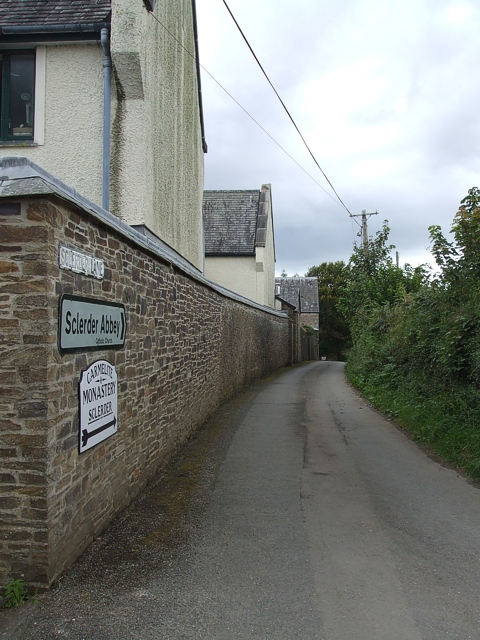
1074:== {{int:filedesc}} == {{Information |description={{en|1=Sclerder Lane Taken from the crossroads looking west along Sclerder Lane. As the signs on the wall indicate, this lane leads to the Carmelite Monastery of Sclerder Abbey.}} |date=2007-08-17 |source=
229:
421:– You must give appropriate credit, provide a link to the license, and indicate if changes were made. You may do so in any reasonable manner, but not in any way that suggests the licensor endorses you or your use.
141:
Sclerder Lane Taken from the crossroads looking west along
Sclerder Lane. As the signs on the wall indicate, this lane leads to the Carmelite Monastery of Sclerder Abbey.
952:
888:
53:
47:
98:
487:
66:
470:
1088:
1093:
823:
753:
717:
303:
253:
873:
1266:
338:
1129:
This file contains additional information, probably added from the digital camera or scanner used to create or digitize it.
428:
652:
1235:
993:
966:
929:
902:
851:
807:
701:
675:
660:
645:
563:
866:
836:
773:
737:
618:
601:
510:
325:
502:
1056:
1051:
384:
57:
42:
1132:
If the file has been modified from its original state, some details may not fully reflect the modified file.
483:
1084:
The following pages on the
English Knowledge (XXG) use this file (pages on other projects are not listed):
1319:
427:– If you remix, transform, or build upon the material, you must distribute your contributions under the
345:
on the
Geograph website for the photographer's contact details. The copyright on this image is owned by
1067:
381:
959:"}},"text\/plain":{"en":{"P7787":"270 degree"}}}}": -->
895:"}},"text\/plain":{"en":{"P7787":"270 degree"}}}}": -->
1355:
1151:
491:
106:
198:
476:
Remove redundant categories and try to put this image in the most specific category/categories
858:
843:
667:
182:
554:
1098:
558:
550:
546:
542:
538:
534:
530:
526:
522:
518:
309:
259:
1423:
1337:
1293:
1158:
350:
93:
1198:
1365:
150:
1178:
293:
243:
171:
161:
1441:
1168:
1141:
330:
342:
1024:
Click on a date/time to view the file as it appeared at that time.
295:
245:
1116:
270:
220:
81:
280:
50° 21′ 02.4″ N, 4° 30′ 04″ W
230:
50° 21′ 02.4″ N, 4° 30′ 02″ W
585:
Add a one-line explanation of what this file represents
490:
combined with a database. You can also have a look at
482:
The location categories are based on information from
125:
105:
Commons is a freely licensed media file repository.
754:
Creative
Commons Attribution-ShareAlike 2.0 Generic
71:(480 × 640 pixels, file size: 178 KB, MIME type:
1360:Flash did not fire, compulsory flash suppression
467:The categories of this image should be checked.
438:https://creativecommons.org/licenses/by-sa/2.0
86:
444:Creative Commons Attribution-Share Alike 2.0
362:
8:
131:Sclerder Lane - geograph.org.uk - 530758.jpg
956:
892:
404:– to copy, distribute and transmit the work
1134:
1026:
581:
562:
1109:The following other wikis use this file:
844:https://www.geograph.org.uk/photo/530758
668:https://www.geograph.org.uk/profile/3546
1449:
1439:
1431:
1421:
1413:
1405:
1397:
1389:
1381:
1373:
1363:
1353:
1345:
1335:
1327:
1317:
1309:
1301:
1291:
1283:
1275:
1264:
1256:
1248:
1240:
1230:
1222:
1214:
1206:
1195:
1187:
1176:
1166:
1156:
1146:
1086:
980:
964:
916:
900:
821:
805:
787:
771:
751:
735:
715:
699:
632:
616:
599:
596:
577:
570:
509:This image was uploaded as part of the
273:
223:
1236:Digital Camera FinePix V10 Ver1.00
302:View this and other nearby images on:
252:View this and other nearby images on:
1136:
497:The topic category from Geograph was
7:
349:and is licensed for reuse under the
1089:List of monastic houses in Cornwall
1015:
385:Attribution-Share Alike 2.0 Generic
373:
368:
353:Attribution-ShareAlike 2.0 license.
1127:
1094:List of monastic houses in England
590:
584:
359:
336:
135:
118:
64:
589:
1189:Date and time of data generation
903:coordinates of the point of view
575:
460:
415:Under the following conditions:
380:This file is licensed under the
372:
367:
361:
329:
308:
294:
286:
258:
244:
236:
85:
31:
21:
572:
136:
14:
1163:1/480 sec (0.0020833333333333)
824:file available on the internet
571:
337:This image was taken from the
26:
1:
967:coordinates of depicted place
36:
874:Geograph Britain and Ireland
646:object of statement has role
597:Items portrayed in this file
285:
235:
1391:Focal plane resolution unit
1277:Date and time of digitizing
1471:
1402:One-chip color area sensor
1113:Usage on fr.wikipedia.org
429:same or compatible license
1242:File change date and time
1016:
982:50°21'2.38"N, 4°30'4.32"W
918:50°21'2.45"N, 4°30'1.80"W
16:
1383:Focal plane Y resolution
1375:Focal plane X resolution
852:geograph.org.uk image ID
574:
492:this tool from mysociety
458:
457:
395:
92:This is a file from the
1407:Custom image processing
1073:
488:this OpenStreetMap tool
211:Rob Farrow /
192:Rob Farrow /
183:required by the license
167:
156:
149:
146:
128:
96:. Information from its
1451:Subject distance range
1285:Image compression mode
1052:20:57, 5 February 2011
343:this photograph's page
314:50.350660; -4.501200
264:50.350680; -4.500500
99:description page there
46:Size of this preview:
1329:Maximum land aperture
1280:14:10, 17 August 2007
1245:14:10, 17 August 2007
1216:Horizontal resolution
1192:14:10, 17 August 2007
511:Geograph batch upload
501:(find similar images
479:Remove this template
1250:Y and C positioning
1224:Vertical resolution
1138:Camera manufacturer
555:português do Brasil
410:– to adapt the work
52:Other resolutions:
1433:Scene capture type
1428:Auto white balance
1117:Abbaye de Sclerder
676:author name string
484:this geonames tool
1458:
1457:
1105:Global file usage
1077:
958:
894:
738:copyright license
583:
566:
513:
358:
357:
341:collection. See
319:
318:
269:
268:
218:
217:
186:
114:
113:
94:Wikimedia Commons
32:Global file usage
1462:
1258:Exposure Program
1135:
1064:
1004:
1003:
998:
940:
939:
934:
876:
871:
861:
856:
846:
841:
837:described at URL
702:copyright status
683:
680:
670:
665:
655:
650:
567:
508:
465:
464:
463:
451:
448:
445:
442:
439:
431:as the original.
393:
382:Creative Commons
376:
375:
371:
370:
365:
364:
351:Creative Commons
339:Geograph project
333:
326:
315:
312:
298:
297:
291:
290:
289:
283:
282:
271:
265:
262:
248:
247:
241:
240:
239:
233:
232:
221:
180:
152:
140:
132:
126:
110:
89:
88:
82:
76:
74:
61:
58:480 × 640 pixels
54:180 × 240 pixels
48:450 × 600 pixels
1470:
1469:
1465:
1464:
1463:
1461:
1460:
1459:
1332:3 APEX (f/2.83)
1311:APEX brightness
1152:FinePix V10
1123:
1103:
1085:
1078:
1070:
1062:
1018:
1017:
1014:
1013:
1012:
1011:
1010:
1009:
1008:
1007:
1006:
1005:
1001:
999:
996:
987:
986:
985:
983:
973:
972:
971:
969:
950:
949:
948:
947:
946:
945:
944:
943:
942:
941:
937:
935:
932:
923:
922:
921:
919:
909:
908:
907:
905:
886:
885:
884:
883:
882:
881:
880:
879:
878:
877:
872:
869:
863:
862:
857:
854:
848:
847:
842:
839:
830:
829:
828:
826:
814:
813:
812:
810:
799:
798:
797:
796:
795:
794:
793:
792:
790:
780:
779:
778:
776:
765:
764:
763:
762:
761:
760:
759:
758:
756:
744:
743:
742:
740:
729:
728:
727:
726:
725:
724:
723:
722:
720:
708:
707:
706:
704:
693:
692:
691:
690:
689:
688:
687:
686:
685:
684:
681:
678:
672:
671:
666:
663:
657:
656:
651:
648:
639:
638:
637:
635:
625:
624:
623:
621:
610:
609:
608:
607:
606:
604:
588:
587:
586:
569:
517:
514:
471:Check them now!
461:
459:
453:
452:
449:
446:
443:
440:
437:
436:
394:
391:
388:
377:
354:
324:
313:
287:
278:
277:
274:Object location
263:
237:
228:
227:
224:Camera location
219:
208:
201:
189:
162:geograph.org.uk
142:
130:
123:
116:
115:
104:
103:
102:is shown below.
78:
72:
70:
63:
62:
51:
12:
11:
5:
1468:
1466:
1456:
1455:
1452:
1448:
1447:
1444:
1438:
1437:
1434:
1430:
1429:
1426:
1420:
1419:
1416:
1412:
1411:
1410:Normal process
1408:
1404:
1403:
1400:
1399:Sensing method
1396:
1395:
1392:
1388:
1387:
1384:
1380:
1379:
1376:
1372:
1371:
1368:
1362:
1361:
1358:
1352:
1351:
1348:
1344:
1343:
1340:
1334:
1333:
1330:
1326:
1325:
1322:
1316:
1315:
1312:
1308:
1307:
1304:
1300:
1299:
1296:
1290:
1289:
1286:
1282:
1281:
1278:
1274:
1273:
1270:
1263:
1262:
1261:Normal program
1259:
1255:
1254:
1251:
1247:
1246:
1243:
1239:
1238:
1233:
1229:
1228:
1225:
1221:
1220:
1217:
1213:
1212:
1209:
1205:
1204:
1201:
1194:
1193:
1190:
1186:
1185:
1182:
1175:
1174:
1171:
1165:
1164:
1161:
1155:
1154:
1149:
1145:
1144:
1139:
1126:
1122:
1121:
1120:
1119:
1107:
1106:
1102:
1101:
1099:Sclerder Abbey
1096:
1091:
1083:
1082:
1081:
1076:
1075:
1072:
1068:
1065:
1059:
1054:
1049:
1045:
1044:
1041:
1038:
1035:
1032:
1029:
1022:
1021:
992:
991:
990:
989:
988:
984:
981:
979:
978:
977:
976:
975:
974:
970:
965:
963:
962:
961:
960:
954:
928:
927:
926:
925:
924:
920:
917:
915:
914:
913:
912:
911:
910:
906:
901:
899:
898:
897:
896:
890:
865:
864:
850:
849:
835:
834:
833:
832:
831:
827:
822:
820:
819:
818:
817:
816:
815:
811:
808:source of file
806:
804:
803:
802:
801:
800:
791:
789:17 August 2007
788:
786:
785:
784:
783:
782:
781:
777:
772:
770:
769:
768:
767:
766:
757:
752:
750:
749:
748:
747:
746:
745:
741:
736:
734:
733:
732:
731:
730:
721:
716:
714:
713:
712:
711:
710:
709:
705:
700:
698:
697:
696:
695:
694:
674:
673:
659:
658:
644:
643:
642:
641:
640:
636:
633:
631:
630:
629:
628:
627:
626:
622:
617:
615:
614:
613:
612:
611:
605:
600:
598:
595:
594:
593:
592:
591:
580:
579:
576:
573:
507:
506:
495:
480:
477:
435:
434:
433:
432:
422:
413:
412:
411:
405:
398:You are free:
389:
379:
378:
360:
356:
355:
334:
323:
320:
317:
316:
306:
300:
275:
267:
266:
256:
250:
225:
216:
215:
209:
206:
203:
202:
197:
190:
187:
175:
174:
169:
165:
164:
158:
154:
153:
151:17 August 2007
148:
144:
143:
133:
124:
122:
119:
117:
112:
111:
90:
80:
79:
45:
41:
40:
39:
34:
29:
24:
19:
13:
10:
9:
6:
4:
3:
2:
1467:
1453:
1450:
1445:
1443:
1440:
1435:
1432:
1427:
1425:
1424:White balance
1422:
1418:Auto exposure
1417:
1415:Exposure mode
1414:
1409:
1406:
1401:
1398:
1393:
1390:
1385:
1382:
1377:
1374:
1369:
1367:
1364:
1359:
1357:
1354:
1349:
1346:
1341:
1339:
1338:Metering mode
1336:
1331:
1328:
1323:
1321:
1320:Exposure bias
1318:
1313:
1310:
1305:
1303:APEX aperture
1302:
1297:
1295:
1294:Shutter speed
1292:
1287:
1284:
1279:
1276:
1271:
1268:
1265:
1260:
1257:
1252:
1249:
1244:
1241:
1237:
1234:
1232:Software used
1231:
1226:
1223:
1218:
1215:
1210:
1207:
1202:
1200:
1196:
1191:
1188:
1183:
1180:
1177:
1172:
1170:
1167:
1162:
1160:
1159:Exposure time
1157:
1153:
1150:
1147:
1143:
1140:
1137:
1133:
1130:
1124:
1118:
1115:
1114:
1112:
1111:
1110:
1104:
1100:
1097:
1095:
1092:
1090:
1087:
1079:
1071:
1066:
1060:
1058:
1055:
1053:
1050:
1047:
1046:
1042:
1039:
1036:
1033:
1030:
1028:
1027:
1025:
1019:
995:
968:
931:
904:
875:
868:
860:
853:
845:
838:
825:
809:
775:
755:
739:
719:
703:
677:
669:
662:
654:
647:
620:
603:
568:
565:
560:
556:
552:
548:
544:
540:
536:
532:
528:
524:
520:
515:
512:
504:
500:
496:
493:
489:
485:
481:
478:
475:
474:
473:
472:
468:
456:
455:
441:CC BY-SA 2.0
430:
426:
423:
420:
417:
416:
414:
409:
406:
403:
400:
399:
397:
396:
390:Attribution:
386:
383:
366:
352:
348:
344:
340:
335:
332:
328:
327:
321:
311:
307:
305:
304:OpenStreetMap
301:
299:
281:
276:
272:
261:
257:
255:
254:OpenStreetMap
251:
249:
231:
226:
222:
214:
213:Sclerder Lane
210:
205:
204:
200:
196: /
195:
194:Sclerder Lane
191:
184:
179:
177:
176:
173:
170:
166:
163:
159:
155:
145:
139:
134:
127:
120:
108:
101:
100:
95:
91:
84:
83:
77:
68:
67:Original file
59:
55:
49:
44:
38:
35:
33:
30:
28:
25:
23:
20:
18:
15:
1347:Light source
1199:focal length
1148:Camera model
1131:
1128:
1108:
1023:
1020:File history
653:photographer
516:
498:
469:
466:
454:
424:
418:
407:
401:
346:
284:
234:
212:
199:CC BY-SA 2.0
193:
137:
107:You can help
97:
65:
22:File history
1366:Color space
1208:Orientation
1069:GeographBot
718:copyrighted
503:at Geograph
425:share alike
419:attribution
178:Attribution
129:Description
1080:File usage
1061:480 × 640
1037:Dimensions
682:Rob Farrow
634:some value
543:македонски
392:Rob Farrow
347:Rob Farrow
172:Rob Farrow
73:image/jpeg
27:File usage
1442:Sharpness
1179:ISO speed
1034:Thumbnail
1031:Date/Time
774:inception
551:português
322:Licensing
207:InfoField
188:InfoField
138:English:
1436:Standard
1253:Co-sited
1169:F-number
1142:FUJIFILM
1125:Metadata
1063:(178 KB)
867:operator
578:Captions
561: |
557: |
553: |
549: |
545: |
541: |
537: |
533: |
529: |
527:français
525: |
521: |
408:to remix
402:to share
387:license.
37:Metadata
1454:Unknown
1350:Unknown
1342:Pattern
1269:version
1048:current
1043:Comment
994:heading
953:heading
930:heading
889:heading
619:creator
602:depicts
582:English
519:English
121:Summary
69:
1227:72 dpi
1219:72 dpi
1211:Normal
1203:6.3 mm
1181:rating
1002:degree
957:degree
938:degree
893:degree
859:530758
559:Türkçe
547:മലയാളം
539:magyar
531:galego
292:
242:
168:Author
157:Source
1386:4,442
1378:4,442
1356:Flash
1197:Lens
1173:f/2.8
535:עברית
523:suomi
160:From
1370:sRGB
1314:7.24
1267:Exif
1040:User
1000:270
936:270
499:Lane
486:and
450:true
447:true
147:Date
17:File
1298:8.9
1272:2.2
1184:100
661:URL
564:+/−
997::
933::
870::
855::
840::
679::
664::
649::
56:|
50:.
1446:3
1394:3
1324:0
1306:3
1288:4
505:)
494:.
185:)
181:(
109:.
75:)
60:.
Text is available under the Creative Commons Attribution-ShareAlike License. Additional terms may apply.
_heading:270.00&language=en)
_heading:270.00&language=en)
