450:
348:
281:
231:
273:
223:
295:
245:
316:
354:
359:
72:
870:"}},"text\/plain":{"en":{"":"heading"}}},"{\"value\":{\"amount\":\"+45\",\"unit\":\"http:\\\/\\\/www.wikidata.org\\\/entity\\\/Q28390\"},\"type\":\"quantity\"}":{"text\/html":{"en":{"P7787":"45
685:"}},"text\/plain":{"en":{"":"heading"}}},"{\"value\":{\"amount\":\"+45\",\"unit\":\"http:\\\/\\\/www.wikidata.org\\\/entity\\\/Q28390\"},\"type\":\"quantity\"}":{"text\/html":{"en":{"P7787":"45
866:
264:
214:
43:
406:– You must give appropriate credit, provide a link to the license, and indicate if changes were made. You may do so in any reasonable manner, but not in any way that suggests the licensor endorses you or your use.
989:== {{int:filedesc}} == {{Information |description={{en|1=Scotter Green Photo taken from the Green looking northeast.}} |date=2006-03-26 |source=From |author=[http://www.geograph.org.uk/profile/178
867:
682:
83:
51:
470:
459:
802:
668:
632:
288:
238:
852:
323:
1104:
This file contains additional information, probably added from the digital camera or scanner used to create or digitize it.
413:
567:
908:
881:
815:
786:
723:
696:
616:
588:
575:
560:
845:
830:
752:
652:
533:
516:
310:
971:
966:
42:
369:
1107:
If the file has been modified from its original state, some details may not fully reflect the modified file.
412:– If you remix, transform, or build upon the material, you must distribute your contributions under the
330:
on the
Geograph website for the photographer's contact details. The copyright on this image is owned by
982:
466:
Please remove redundant categories and try to put this image in the most specific category/categories.
366:
874:"}},"text\/plain":{"en":{"P7787":"45 degree"}}}}": -->
689:"}},"text\/plain":{"en":{"P7787":"45 degree"}}}}": -->
91:
837:
822:
595:
167:
294:
244:
335:
78:
183:
135:
278:
228:
146:
156:
315:
1003:
327:
939:
Click on a date/time to view the file as it appeared at that time.
280:
230:
1021:
255:
205:
66:
126:
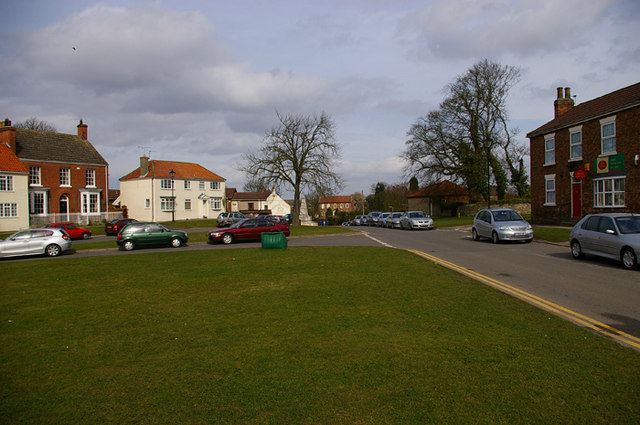
Scotter Green Photo taken from the Green looking northeast.
456:
The categories of this image need checking. You can do so
265:
53° 29′ 51″ N, 0° 39′ 54″ W
215:
53° 29′ 50″ N, 0° 39′ 55″ W
500:
Add a one-line explanation of what this file represents
1091:
1061:
1081:
1071:
1051:
1041:
1031:
110:
90:
Commons is a freely licensed media file repository.
669:
Creative
Commons Attribution-ShareAlike 2.0 Generic
56:(640 × 425 pixels, file size: 78 KB, MIME type:
423:https://creativecommons.org/licenses/by-sa/2.0
71:
429:Creative Commons Attribution-Share Alike 2.0
347:
116:Scotter Green - geograph.org.uk - 1410395.jpg
52:Scotter_Green_-_geograph.org.uk_-_1410395.jpg
8:
871:
686:
389:– to copy, distribute and transmit the work
1109:
941:
496:
1014:The following other wikis use this file:
838:https://www.geograph.org.uk/photo/1410395
469:You can remove this template by clicking
596:https://www.geograph.org.uk/profile/1782
1111:
1001:
895:
879:
800:
784:
766:
750:
710:
694:
666:
650:
630:
614:
547:
531:
514:
511:
492:
485:
258:
208:
287:View this and other nearby images on:
237:View this and other nearby images on:
7:
334:and is licensed for reuse under the
999:The following page uses this file:
930:
370:Attribution-Share Alike 2.0 Generic
358:
353:
338:Attribution-ShareAlike 2.0 license.
1102:
505:
499:
443:
344:
321:
120:
103:
49:
504:
697:coordinates of the point of view
490:
448:
400:Under the following conditions:
365:This file is licensed under the
357:
352:
346:
314:
293:
279:
271:
243:
229:
221:
70:
31:
21:
487:
121:
46:No higher resolution available.
14:
803:file available on the internet
486:
322:This image was taken from the
26:
1:
882:coordinates of depicted place
36:
853:Geograph Britain and Ireland
561:object of statement has role
512:Items portrayed in this file
1058:Usage on lld.wikipedia.org
1018:Usage on ceb.wikipedia.org
897:53°29'51.22"N, 0°39'53.64"W
270:
220:
1133:
1088:Usage on www.wikidata.org
1078:Usage on tr.wikipedia.org
1068:Usage on pl.wikipedia.org
1048:Usage on fr.wikipedia.org
1038:Usage on es.wikipedia.org
1028:Usage on cy.wikipedia.org
447:
414:same or compatible license
931:
712:53°29'50.3"N, 0°39'55.1"W
196:David Wright /
177:David Wright /
16:
816:geograph.org.uk image ID
489:
380:
77:This is a file from the
988:
473:(or on the first line).
168:required by the license
152:
141:
134:
131:
113:
81:. Information from its
328:this photograph's page
299:53.497560; -0.664900
249:53.497300; -0.665300
84:description page there
967:16:54, 1 March 2011
395:– to adapt the work
576:author name string
1120:
1119:
1022:Scotter (lungsod)
1010:Global file usage
992:
873:
688:
653:copyright license
498:
479:
478:
343:
342:
326:collection. See
304:
303:
254:
253:
203:
202:
171:
99:
98:
79:Wikimedia Commons
32:Global file usage
1124:
1110:
979:
919:
918:
913:
855:
850:
840:
835:
831:described at URL
825:
820:
734:
733:
728:
617:copyright status
598:
593:
583:
580:
570:
565:
452:
451:
445:
444:
436:
433:
430:
427:
424:
416:as the original.
378:
367:Creative Commons
361:
360:
356:
355:
350:
349:
336:Creative Commons
324:Geograph project
318:
311:
300:
297:
283:
282:
276:
275:
274:
268:
267:
256:
250:
247:
233:
232:
226:
225:
224:
218:
217:
206:
165:
137:
125:
117:
111:
95:
74:
73:
67:
61:
59:
1132:
1131:
1127:
1126:
1125:
1123:
1122:
1121:
1098:
1008:
993:
985:
977:
933:
932:
929:
928:
927:
926:
925:
924:
923:
922:
921:
920:
916:
914:
911:
902:
901:
900:
898:
888:
887:
886:
884:
865:
864:
863:
862:
861:
860:
859:
858:
857:
856:
851:
848:
842:
841:
836:
833:
827:
826:
821:
818:
809:
808:
807:
805:
793:
792:
791:
789:
778:
777:
776:
775:
774:
773:
772:
771:
769:
759:
758:
757:
755:
744:
743:
742:
741:
740:
739:
738:
737:
736:
735:
731:
729:
726:
717:
716:
715:
713:
703:
702:
701:
699:
680:
679:
678:
677:
676:
675:
674:
673:
671:
659:
658:
657:
655:
644:
643:
642:
641:
640:
639:
638:
637:
635:
623:
622:
621:
619:
608:
607:
606:
605:
604:
603:
602:
601:
600:
599:
594:
591:
585:
584:
581:
578:
572:
571:
566:
563:
554:
553:
552:
550:
540:
539:
538:
536:
525:
524:
523:
522:
521:
519:
503:
502:
501:
484:
480:
449:
438:
437:
434:
431:
428:
425:
422:
421:
379:
376:
373:
362:
339:
309:
298:
272:
263:
262:
259:Object location
248:
222:
213:
212:
209:Camera location
204:
193:
186:
174:
147:geograph.org.uk
127:
115:
108:
101:
100:
89:
88:
87:is shown below.
63:
57:
55:
48:
47:
12:
11:
5:
1130:
1128:
1118:
1117:
1114:
1101:
1097:
1096:
1095:
1094:
1086:
1085:
1084:
1076:
1075:
1074:
1066:
1065:
1064:
1056:
1055:
1054:
1046:
1045:
1044:
1036:
1035:
1034:
1026:
1025:
1024:
1012:
1011:
1007:
1006:
997:
996:
991:
990:
987:
983:
980:
974:
969:
964:
960:
959:
956:
953:
950:
947:
944:
937:
936:
907:
906:
905:
904:
903:
899:
896:
894:
893:
892:
891:
890:
889:
885:
880:
878:
877:
876:
875:
869:
844:
843:
829:
828:
814:
813:
812:
811:
810:
806:
801:
799:
798:
797:
796:
795:
794:
790:
787:source of file
785:
783:
782:
781:
780:
779:
770:
767:
765:
764:
763:
762:
761:
760:
756:
751:
749:
748:
747:
746:
745:
722:
721:
720:
719:
718:
714:
711:
709:
708:
707:
706:
705:
704:
700:
695:
693:
692:
691:
690:
684:
672:
667:
665:
664:
663:
662:
661:
660:
656:
651:
649:
648:
647:
646:
645:
636:
631:
629:
628:
627:
626:
625:
624:
620:
615:
613:
612:
611:
610:
609:
587:
586:
574:
573:
559:
558:
557:
556:
555:
551:
548:
546:
545:
544:
543:
542:
541:
537:
532:
530:
529:
528:
527:
526:
520:
515:
513:
510:
509:
508:
507:
506:
495:
494:
491:
488:
477:
476:
475:
474:
467:
453:
442:
420:
419:
418:
417:
407:
398:
397:
396:
390:
383:You are free:
374:
364:
363:
345:
341:
340:
319:
308:
305:
302:
301:
291:
285:
260:
252:
251:
241:
235:
210:
201:
200:
194:
191:
188:
187:
182:
175:
172:
160:
159:
154:
150:
149:
143:
139:
138:
133:
129:
128:
118:
109:
107:
104:
102:
97:
96:
75:
65:
64:
45:
41:
40:
39:
34:
29:
24:
19:
13:
10:
9:
6:
4:
3:
2:
1129:
1115:
1112:
1108:
1105:
1099:
1093:
1090:
1089:
1087:
1083:
1080:
1079:
1077:
1073:
1070:
1069:
1067:
1063:
1060:
1059:
1057:
1053:
1050:
1049:
1047:
1043:
1040:
1039:
1037:
1033:
1030:
1029:
1027:
1023:
1020:
1019:
1017:
1016:
1015:
1009:
1005:
1002:
1000:
994:
986:
981:
975:
973:
970:
968:
965:
962:
961:
957:
954:
951:
948:
945:
943:
942:
940:
934:
910:
883:
854:
847:
839:
832:
824:
817:
804:
788:
768:26 March 2006
754:
725:
698:
670:
654:
634:
618:
597:
590:
577:
569:
562:
535:
518:
483:
482:
472:
468:
465:
464:
463:
461:
457:
454:
446:
441:
440:
426:CC BY-SA 2.0
415:
411:
408:
405:
402:
401:
399:
394:
391:
388:
385:
384:
382:
381:
375:Attribution:
371:
368:
351:
337:
333:
329:
325:
320:
317:
313:
312:
306:
296:
292:
290:
289:OpenStreetMap
286:
284:
266:
261:
257:
246:
242:
240:
239:OpenStreetMap
236:
234:
216:
211:
207:
199:
198:Scotter Green
195:
190:
189:
185:
181: /
180:
179:Scotter Green
176:
169:
164:
162:
161:
158:
155:
151:
148:
144:
140:
136:26 March 2006
130:
124:
119:
112:
105:
93:
86:
85:
80:
76:
69:
68:
62:
53:
44:
38:
35:
33:
30:
28:
25:
23:
20:
18:
15:
1106:
1103:
1013:
998:
938:
935:File history
582:David Wright
568:photographer
481:
458:
455:
439:
409:
403:
392:
386:
377:David Wright
332:David Wright
331:
269:
219:
197:
184:CC BY-SA 2.0
178:
157:David Wright
122:
92:You can help
82:
50:
22:File history
984:GeographBot
633:copyrighted
410:share alike
404:attribution
163:Attribution
114:Description
1113:_error
995:File usage
976:640 × 425
952:Dimensions
549:some value
58:image/jpeg
27:File usage
949:Thumbnail
946:Date/Time
753:inception
307:Licensing
192:InfoField
173:InfoField
123:English:
1100:Metadata
1092:Q7437584
846:operator
493:Captions
393:to remix
387:to share
372:license.
37:Metadata
1082:Scotter
1072:Scotter
1062:Scotter
1052:Scotter
1042:Scotter
1032:Scotter
1004:Scotter
978:(78 KB)
963:current
958:Comment
909:heading
868:heading
823:1410395
724:heading
683:heading
534:creator
517:depicts
497:English
106:Summary
54:
917:degree
872:degree
732:degree
687:degree
277:
227:
153:Author
142:Source
145:From
955:User
471:here
460:here
435:true
432:true
132:Date
17:File
915:45
730:45
589:URL
912::
849::
834::
819::
727::
592::
579::
564::
1116:0
462:.
170:)
166:(
94:.
60:)
Text is available under the Creative Commons Attribution-ShareAlike License. Additional terms may apply.
_heading:45.00&language=en)
_heading:45.00&language=en)
