38:
242:
248:
253:
94:
691:
538:
701:
300:– You must give appropriate credit, provide a link to the license, and indicate if changes were made. You may do so in any reasonable manner, but not in any way that suggests the licensor endorses you or your use.
955:
663:
658:
559:, UK. Equirectangular map projection on WGS 84 datum, with N/S stretched 170% Geographic limits: *West: 3.60W *East: 1.95W *North: 56.00N *South: 55.10N |Source=[[w:Ordn
60:
56:
52:
48:
42:
105:
73:
231:
340:
449:
413:
307:
397:
469:
433:
380:
202:
263:
537:
532:
64:
37:
681:
569:
The following pages on the
English Knowledge (XXG) use this file (pages on other projects are not listed):
588:
306:– If you remix, transform, or build upon the material, you must distribute your contributions under the
653:
260:
185:
613:
598:
113:
816:
643:
711:
139:
638:
603:
578:
556:
182:
648:
593:
618:
548:
206:
573:
100:
633:
623:
731:
219:
583:
171:
628:
608:
906:
931:
756:
145:
Equirectangular map projection on WGS 84 datum, with N/S stretched 170%
195:
Administrative borders and coastline data from
Boundary-Line product.
861:
851:
726:
505:
Click on a date/time to view the file as it appeared at that time.
896:
271:
Contains
Ordnance Survey data © Crown copyright and database right
886:
811:
941:
88:
916:
881:
836:
831:
721:
891:
876:
856:
766:
761:
746:
741:
921:
871:
841:
821:
781:
736:
866:
846:
801:
771:
806:
692:Ҡалып:ПозКарта Бөйөк Британия Шотландия Шотландия сиктәре
826:
751:
926:
776:
364:
Add a one-line explanation of what this file represents
946:
936:
796:
791:
786:
664:
Module:Location map/data/Scotland
Scottish Borders/doc
911:
78:(2,003 × 1,857 pixels, file size: 618 KB, MIME type:
901:
450:
Creative
Commons Attribution-ShareAlike 3.0 Unported
127:
112:
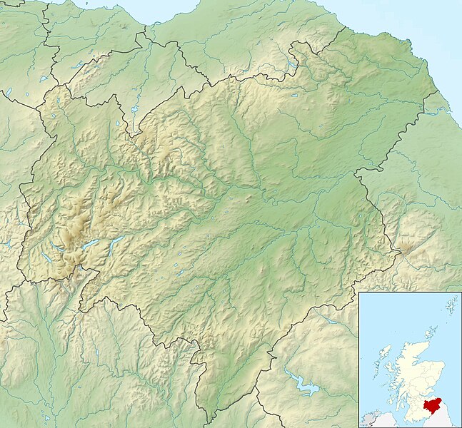
Commons is a freely licensed media file repository.
817:Vorlage:Positionskarte Schottland Scottish Borders
659:Module:Location map/data/Scotland Scottish Borders
198:All other geographic data from Meridian 2 product.
712:Plantilya:Location map Scotland Scottish Borders
317:https://creativecommons.org/licenses/by-sa/3.0
93:
555:{{Information |Description=Relief map of the
323:Creative Commons Attribution-Share Alike 3.0
241:
8:
192:Relief data from Land-Form Panorama product.
702:Шаблон:ПК Великобритания Шотландски граници
682:قالب:Location map Scotland Scottish Borders
283:– to copy, distribute and transmit the work
133:Scottish Borders UK relief location map.jpg
507:
360:
674:The following other wikis use this file:
571:
483:
467:
447:
431:
411:
395:
378:
375:
356:
349:
341:File:Scottish Borders UK blank map.svg
7:
732:Loch of the Lowes (Scottish Borders)
264:Attribution-Share Alike 3.0 Unported
222:, created using Ordnance Survey data
496:
252:
247:
369:
363:
238:
125:
71:
368:
354:
294:Under the following conditions:
259:This file is licensed under the
251:
246:
240:
201:Inset derived from derived from
92:
31:
21:
351:
14:
350:
203:File:Scotland location map.svg
26:
1:
907:Castle Hill (Moorfoot Hills)
376:Items portrayed in this file
932:Hog Hill (Scottish Borders)
757:Wether Law (Pentland Hills)
708:Usage on ceb.wikipedia.org
972:
718:Usage on de.wikipedia.org
698:Usage on bg.wikipedia.org
688:Usage on ba.wikipedia.org
678:Usage on ar.wikipedia.org
308:same or compatible license
497:
16:
353:
274:
99:This is a file from the
862:Newark Castle (Selkirk)
852:Nether Horsburgh Castle
589:First Bishops' War
554:
533:12:28, 30 November 2011
336:
226:
215:
177:
170:
167:
130:
103:. Information from its
106:description page there
41:Size of this preview:
897:Baddinsgill Reservoir
887:Upsettlington Castle
812:West Water Reservoir
654:West Water Reservoir
65:2,003 × 1,857 pixels
61:1,105 × 1,024 pixels
644:St Mary's Loch
289:– to adapt the work
148:Geographic limits:
47:Other resolutions:
942:Portmore Reservoir
639:St Abb's Head
614:Monteath Mausoleum
599:Lake of the Hirsel
138:Relief map of the
956:more global usage
670:Global file usage
562:
434:copyright license
362:
347:
346:
235:
232:Reusing this file
121:
120:
101:Wikimedia Commons
32:Global file usage
963:
917:Dunslair Heights
882:Timpendean Tower
837:Horsburgh Castle
832:Greenknowe Tower
722:Hermitage Castle
604:Megget Reservoir
579:Blackadder Water
557:Scottish Borders
545:
485:30 November 2010
398:copyright status
330:
327:
324:
321:
318:
310:as the original.
272:
261:Creative Commons
255:
254:
250:
249:
244:
243:
229:
173:
172:30 November 2010
140:Scottish Borders
134:
128:
117:
96:
95:
89:
83:
81:
68:
57:828 × 768 pixels
53:518 × 480 pixels
49:259 × 240 pixels
43:647 × 600 pixels
971:
970:
966:
965:
964:
962:
961:
960:
892:Whitslaid Tower
877:Roxburgh Castle
857:Neidpath Castle
767:West Cairn Hill
762:East Cairn Hill
747:Whitrope Tunnel
742:Bowshank Tunnel
668:
649:Talla Reservoir
594:Fruid Reservoir
570:
563:
551:
543:
499:
498:
495:
494:
493:
492:
491:
490:
489:
488:
486:
476:
475:
474:
472:
461:
460:
459:
458:
457:
456:
455:
454:
452:
440:
439:
438:
436:
425:
424:
423:
422:
421:
420:
419:
418:
416:
404:
403:
402:
400:
389:
388:
387:
386:
385:
383:
367:
366:
365:
348:
332:
331:
328:
325:
322:
319:
316:
315:
273:
270:
267:
256:
183:Ordnance Survey
132:
123:
122:
111:
110:
109:is shown below.
85:
79:
77:
70:
69:
46:
12:
11:
5:
969:
967:
958:of this file.
952:
951:
950:
949:
944:
939:
934:
929:
924:
922:Makeness Kipps
919:
914:
909:
904:
899:
894:
889:
884:
879:
874:
872:Peebles Castle
869:
864:
859:
854:
849:
844:
842:Langton Castle
839:
834:
829:
824:
822:Fatlips Castle
819:
814:
809:
804:
799:
794:
789:
784:
782:Byrehope Mount
779:
774:
769:
764:
759:
754:
749:
744:
739:
737:Jedburgh Abbey
734:
729:
727:St Mary’s Loch
724:
716:
715:
714:
706:
705:
704:
696:
695:
694:
686:
685:
684:
672:
671:
667:
666:
661:
656:
651:
646:
641:
636:
631:
626:
621:
619:Pentland Hills
616:
611:
606:
601:
596:
591:
586:
581:
576:
568:
567:
566:
561:
560:
553:
549:
546:
542:2,003 × 1,857
540:
535:
530:
526:
525:
522:
519:
516:
513:
510:
503:
502:
487:
484:
482:
481:
480:
479:
478:
477:
473:
468:
466:
465:
464:
463:
462:
453:
448:
446:
445:
444:
443:
442:
441:
437:
432:
430:
429:
428:
427:
426:
417:
412:
410:
409:
408:
407:
406:
405:
401:
396:
394:
393:
392:
391:
390:
384:
379:
377:
374:
373:
372:
371:
370:
359:
358:
355:
352:
345:
344:
338:
337:Other versions
334:
333:
314:
313:
312:
311:
301:
292:
291:
290:
284:
277:You are free:
268:
258:
257:
239:
236:
224:
223:
217:
213:
212:
211:
210:
199:
196:
193:
179:
175:
174:
169:
165:
164:
163:
162:
159:
156:
153:
135:
126:
124:
119:
118:
97:
87:
86:
40:
36:
35:
34:
29:
24:
19:
13:
10:
9:
6:
4:
3:
2:
968:
959:
957:
948:
945:
943:
940:
938:
935:
933:
930:
928:
925:
923:
920:
918:
915:
913:
910:
908:
905:
903:
900:
898:
895:
893:
890:
888:
885:
883:
880:
878:
875:
873:
870:
868:
867:Oliver Castle
865:
863:
860:
858:
855:
853:
850:
848:
847:Liddel Castle
845:
843:
840:
838:
835:
833:
830:
828:
825:
823:
820:
818:
815:
813:
810:
808:
805:
803:
802:Catstone Hill
800:
798:
795:
793:
790:
788:
785:
783:
780:
778:
775:
773:
772:Millstone Rig
770:
768:
765:
763:
760:
758:
755:
753:
750:
748:
745:
743:
740:
738:
735:
733:
730:
728:
725:
723:
720:
719:
717:
713:
710:
709:
707:
703:
700:
699:
697:
693:
690:
689:
687:
683:
680:
679:
677:
676:
675:
669:
665:
662:
660:
657:
655:
652:
650:
647:
645:
642:
640:
637:
635:
632:
630:
627:
625:
622:
620:
617:
615:
612:
610:
607:
605:
602:
600:
597:
595:
592:
590:
587:
585:
582:
580:
577:
575:
574:Akermoor Loch
572:
564:
558:
552:
547:
541:
539:
536:
534:
531:
528:
527:
523:
520:
517:
514:
511:
509:
508:
506:
500:
471:
451:
435:
415:
399:
382:
342:
339:
335:
320:CC BY-SA 3.0
309:
305:
302:
299:
296:
295:
293:
288:
285:
282:
279:
278:
276:
275:
269:Attribution:
265:
262:
245:
237:
233:
228:
225:
221:
218:
214:
208:
204:
200:
197:
194:
191:
190:
189:
187:
184:
180:
176:
166:
161:South: 55.10N
160:
158:North: 56.00N
157:
154:
151:
150:
149:
146:
143:
141:
136:
129:
115:
108:
107:
102:
98:
91:
90:
84:
75:
74:Original file
66:
62:
58:
54:
50:
44:
39:
33:
30:
28:
25:
23:
20:
18:
15:
953:
807:Mendick Hill
673:
634:Siccar Point
624:River Teviot
504:
501:File history
303:
297:
286:
280:
207:NordNordWest
181:
147:
144:
137:
114:You can help
104:
72:
22:File history
827:Fast Castle
752:Grain Heads
584:Eildon Hill
414:copyrighted
343:- Blank map
304:share alike
298:attribution
155:East: 1.95W
152:West: 3.60W
131:Description
927:Cardon Law
777:Craigengar
629:Rubers Law
565:File usage
518:Dimensions
227:Permission
80:image/jpeg
27:File usage
947:Emly Bank
937:Dundreich
797:King Seat
792:Faw Mount
787:Mount Maw
609:Mire Loch
550:Nilfanion
515:Thumbnail
512:Date/Time
470:inception
220:Nilfanion
912:Kirn Law
544:(618 KB)
357:Captions
287:to remix
281:to share
266:license.
186:OpenData
902:Ven Law
529:current
524:Comment
381:depicts
361:English
76:
216:Author
178:Source
142:, UK.
954:View
521:User
329:true
326:true
168:Date
17:File
205:by
188:.
63:|
59:|
55:|
51:|
45:.
234:)
230:(
209:.
116:.
82:)
67:.
Text is available under the Creative Commons Attribution-ShareAlike License. Additional terms may apply.
