348:
281:
231:
273:
223:
295:
245:
316:
354:
359:
72:
824:"}},"text\/plain":{"en":{"":"heading"}}},"{\"value\":{\"amount\":\"+90\",\"unit\":\"http:\\\/\\\/www.wikidata.org\\\/entity\\\/Q28390\"},\"type\":\"quantity\"}":{"text\/html":{"en":{"P7787":"90
760:"}},"text\/plain":{"en":{"":"heading"}}},"{\"value\":{\"amount\":\"+90\",\"unit\":\"http:\\\/\\\/www.wikidata.org\\\/entity\\\/Q28390\"},\"type\":\"quantity\"}":{"text\/html":{"en":{"P7787":"90
820:
264:
214:
43:
406:– You must give appropriate credit, provide a link to the license, and indicate if changes were made. You may do so in any reasonable manner, but not in any way that suggests the licensor endorses you or your use.
943:== {{int:filedesc}} == {{Information |description={{en|1=Scraggane Pier Scraggane Pier with Scaggane Bay beyond.}} |date=2006-09-10 |source=From |author=[http://www.geograph.org.uk/profile/4335 Col
821:
757:
83:
51:
658:
622:
586:
288:
238:
708:
1145:
323:
1018:
This file contains additional information, probably added from the digital camera or scanner used to create or digitize it.
413:
521:
862:
835:
798:
771:
686:
642:
570:
542:
529:
514:
729:
701:
671:
606:
487:
470:
310:
925:
920:
42:
369:
1021:
If the file has been modified from its original state, some details may not fully reflect the modified file.
953:
The following pages on the
English Knowledge (XXG) use this file (pages on other projects are not listed):
1172:
412:– If you remix, transform, or build upon the material, you must distribute your contributions under the
330:
on the
Geograph website for the photographer's contact details. The copyright on this image is owned by
936:
366:
1208:
828:"}},"text\/plain":{"en":{"P7787":"90 degree"}}}}": -->
764:"}},"text\/plain":{"en":{"P7787":"90 degree"}}}}": -->
91:
183:
693:
678:
549:
167:
294:
244:
1190:
1047:
335:
78:
1087:
1218:
135:
1067:
278:
228:
1040:
957:
156:
146:
1057:
315:
327:
893:
Click on a date/time to view the file as it appeared at that time.
1030:
280:
230:
255:
205:
66:
995:
975:
265:
52° 18′ 38″ N, 10° 02′ 02″ W
215:
52° 18′ 38″ N, 10° 02′ 02″ W
454:
Add a one-line explanation of what this file represents
126:
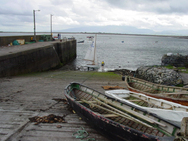
Scraggane Pier
Scraggane Pier with Scaggane Bay beyond.
985:
1005:
110:
90:
Commons is a freely licensed media file repository.
623:
Creative
Commons Attribution-ShareAlike 2.0 Generic
56:(640 × 480 pixels, file size: 86 KB, MIME type:
423:https://creativecommons.org/licenses/by-sa/2.0
71:
429:Creative Commons Attribution-Share Alike 2.0
347:
116:Scraggane Pier - geograph.org.uk - 332886.jpg
52:Scraggane_Pier_-_geograph.org.uk_-_332886.jpg
8:
825:
761:
389:– to copy, distribute and transmit the work
1023:
895:
450:
968:The following other wikis use this file:
679:https://www.geograph.org.uk/photo/332886
550:https://www.geograph.org.uk/profile/4335
1216:
1206:
1198:
1188:
1180:
1170:
1162:
1154:
1143:
1135:
1127:
1119:
1111:
1103:
1095:
1084:
1076:
1065:
1055:
1045:
1035:
955:
849:
833:
785:
769:
743:
727:
656:
640:
620:
604:
584:
568:
501:
485:
468:
465:
446:
439:
258:
208:
287:View this and other nearby images on:
237:View this and other nearby images on:
1025:
7:
334:and is licensed for reuse under the
884:
370:Attribution-Share Alike 2.0 Generic
358:
353:
338:Attribution-ShareAlike 2.0 license.
1016:
459:
453:
344:
321:
120:
103:
49:
458:
1078:Date and time of data generation
772:coordinates of the point of view
444:
400:Under the following conditions:
365:This file is licensed under the
357:
352:
346:
314:
293:
279:
271:
243:
229:
221:
70:
31:
21:
441:
121:
46:No higher resolution available.
14:
659:file available on the internet
440:
322:This image was taken from the
26:
1:
836:coordinates of depicted place
36:
709:Geograph Britain and Ireland
515:object of statement has role
466:Items portrayed in this file
1156:Date and time of digitizing
972:Usage on ceb.wikipedia.org
270:
220:
1240:
1002:Usage on www.wikidata.org
992:Usage on ga.wikipedia.org
982:Usage on eu.wikipedia.org
414:same or compatible license
1121:File change date and time
885:
16:
1159:13:44, 10 September 2006
1124:13:44, 10 September 2006
1081:13:44, 10 September 2006
851:52°18'37.8"N, 10°2'2.4"W
787:52°18'37.8"N, 10°2'2.4"W
687:geograph.org.uk image ID
443:
380:
77:This is a file from the
1195:Center weighted average
942:
921:22:26, 30 December 2010
196:Colin Park /
177:Colin Park /
168:required by the license
152:
141:
134:
131:
113:
81:. Information from its
1164:Image compression mode
328:this photograph's page
299:52.310500; -10.034000
249:52.310500; -10.034000
84:description page there
1182:Maximum land aperture
1105:Horizontal resolution
1052:1/640 sec (0.0015625)
1129:Y and C positioning
1113:Vertical resolution
1027:Camera manufacturer
395:– to adapt the work
1213:Flash did not fire
530:author name string
1227:
1226:
964:Global file usage
946:
827:
763:
745:10 September 2006
607:copyright license
452:
343:
342:
326:collection. See
304:
303:
254:
253:
203:
202:
171:
136:10 September 2006
99:
98:
79:Wikimedia Commons
32:Global file usage
1231:
1137:Exposure Program
1024:
933:
873:
872:
867:
809:
808:
803:
711:
706:
696:
691:
681:
676:
672:described at URL
571:copyright status
552:
547:
537:
534:
524:
519:
436:
433:
430:
427:
424:
416:as the original.
378:
367:Creative Commons
361:
360:
356:
355:
350:
349:
336:Creative Commons
324:Geograph project
318:
311:
300:
297:
283:
282:
276:
275:
274:
268:
267:
256:
250:
247:
233:
232:
226:
225:
224:
218:
217:
206:
165:
137:
125:
117:
111:
95:
74:
73:
67:
61:
59:
1239:
1238:
1234:
1233:
1232:
1230:
1229:
1228:
1012:
962:
954:
947:
939:
931:
887:
886:
883:
882:
881:
880:
879:
878:
877:
876:
875:
874:
870:
868:
865:
856:
855:
854:
852:
842:
841:
840:
838:
819:
818:
817:
816:
815:
814:
813:
812:
811:
810:
806:
804:
801:
792:
791:
790:
788:
778:
777:
776:
774:
755:
754:
753:
752:
751:
750:
749:
748:
746:
736:
735:
734:
732:
721:
720:
719:
718:
717:
716:
715:
714:
713:
712:
707:
704:
698:
697:
692:
689:
683:
682:
677:
674:
665:
664:
663:
661:
649:
648:
647:
645:
634:
633:
632:
631:
630:
629:
628:
627:
625:
613:
612:
611:
609:
598:
597:
596:
595:
594:
593:
592:
591:
589:
577:
576:
575:
573:
562:
561:
560:
559:
558:
557:
556:
555:
554:
553:
548:
545:
539:
538:
535:
532:
526:
525:
520:
517:
508:
507:
506:
504:
494:
493:
492:
490:
479:
478:
477:
476:
475:
473:
457:
456:
455:
438:
437:
434:
431:
428:
425:
422:
421:
379:
376:
373:
362:
339:
309:
298:
272:
263:
262:
259:Object location
248:
222:
213:
212:
209:Camera location
204:
193:
186:
174:
147:geograph.org.uk
127:
115:
108:
101:
100:
89:
88:
87:is shown below.
63:
57:
55:
48:
47:
12:
11:
5:
1237:
1235:
1225:
1224:
1221:
1215:
1214:
1211:
1205:
1204:
1201:
1197:
1196:
1193:
1187:
1186:
1183:
1179:
1178:
1175:
1169:
1168:
1165:
1161:
1160:
1157:
1153:
1152:
1149:
1142:
1141:
1138:
1134:
1133:
1130:
1126:
1125:
1122:
1118:
1117:
1114:
1110:
1109:
1106:
1102:
1101:
1098:
1094:
1093:
1090:
1083:
1082:
1079:
1075:
1074:
1071:
1064:
1063:
1060:
1054:
1053:
1050:
1044:
1043:
1038:
1034:
1033:
1028:
1015:
1011:
1010:
1009:
1008:
1000:
999:
998:
990:
989:
988:
980:
979:
978:
966:
965:
961:
960:
952:
951:
950:
945:
944:
941:
937:
934:
928:
923:
918:
914:
913:
910:
907:
904:
901:
898:
891:
890:
861:
860:
859:
858:
857:
853:
850:
848:
847:
846:
845:
844:
843:
839:
834:
832:
831:
830:
829:
823:
797:
796:
795:
794:
793:
789:
786:
784:
783:
782:
781:
780:
779:
775:
770:
768:
767:
766:
765:
759:
747:
744:
742:
741:
740:
739:
738:
737:
733:
728:
726:
725:
724:
723:
722:
700:
699:
685:
684:
670:
669:
668:
667:
666:
662:
657:
655:
654:
653:
652:
651:
650:
646:
643:source of file
641:
639:
638:
637:
636:
635:
626:
621:
619:
618:
617:
616:
615:
614:
610:
605:
603:
602:
601:
600:
599:
590:
585:
583:
582:
581:
580:
579:
578:
574:
569:
567:
566:
565:
564:
563:
541:
540:
528:
527:
513:
512:
511:
510:
509:
505:
502:
500:
499:
498:
497:
496:
495:
491:
486:
484:
483:
482:
481:
480:
474:
469:
467:
464:
463:
462:
461:
460:
449:
448:
445:
442:
420:
419:
418:
417:
407:
398:
397:
396:
390:
383:You are free:
374:
364:
363:
345:
341:
340:
319:
308:
305:
302:
301:
291:
285:
260:
252:
251:
241:
235:
210:
201:
200:
198:Scraggane Pier
194:
191:
188:
187:
182:
179:Scraggane Pier
175:
172:
160:
159:
154:
150:
149:
143:
139:
138:
133:
129:
128:
118:
109:
107:
104:
102:
97:
96:
75:
65:
64:
45:
41:
40:
39:
34:
29:
24:
19:
13:
10:
9:
6:
4:
3:
2:
1236:
1222:
1220:
1217:
1212:
1210:
1207:
1202:
1199:
1194:
1192:
1191:Metering mode
1189:
1184:
1181:
1176:
1174:
1173:Exposure bias
1171:
1166:
1163:
1158:
1155:
1150:
1147:
1144:
1139:
1136:
1131:
1128:
1123:
1120:
1115:
1112:
1107:
1104:
1099:
1096:
1091:
1089:
1085:
1080:
1077:
1072:
1069:
1066:
1061:
1059:
1056:
1051:
1049:
1048:Exposure time
1046:
1042:
1039:
1036:
1032:
1029:
1026:
1022:
1019:
1013:
1007:
1004:
1003:
1001:
997:
994:
993:
991:
987:
984:
983:
981:
977:
976:Scraggane Bay
974:
973:
971:
970:
969:
963:
959:
956:
948:
940:
935:
929:
927:
924:
922:
919:
916:
915:
911:
908:
905:
902:
899:
897:
896:
894:
888:
864:
837:
800:
773:
731:
710:
703:
695:
688:
680:
673:
660:
644:
624:
608:
588:
572:
551:
544:
531:
523:
516:
489:
472:
426:CC BY-SA 2.0
415:
411:
408:
405:
402:
401:
399:
394:
391:
388:
385:
384:
382:
381:
375:Attribution:
371:
368:
351:
337:
333:
329:
325:
320:
317:
313:
312:
306:
296:
292:
290:
289:OpenStreetMap
286:
284:
266:
261:
257:
246:
242:
240:
239:OpenStreetMap
236:
234:
216:
211:
207:
199:
195:
190:
189:
185:
181: /
180:
176:
169:
164:
162:
161:
158:
155:
151:
148:
144:
140:
130:
124:
119:
112:
105:
93:
86:
85:
80:
76:
69:
68:
62:
53:
44:
38:
35:
33:
30:
28:
25:
23:
20:
18:
15:
1200:Light source
1185:2 APEX (f/2)
1088:focal length
1037:Camera model
1020:
1017:
967:
892:
889:File history
522:photographer
409:
403:
392:
386:
331:
269:
219:
197:
184:CC BY-SA 2.0
178:
122:
92:You can help
82:
50:
22:File history
1219:Color space
1097:Orientation
938:GeographBot
587:copyrighted
410:share alike
404:attribution
163:Attribution
114:Description
996:An Scragán
949:File usage
930:640 × 480
906:Dimensions
536:Colin Park
503:some value
377:Colin Park
332:Colin Park
157:Colin Park
58:image/jpeg
27:File usage
1068:ISO speed
1041:CYBERSHOT
986:Scraggane
958:Scraggane
903:Thumbnail
900:Date/Time
730:inception
307:Licensing
192:InfoField
173:InfoField
123:English:
1132:Co-sited
1058:F-number
1014:Metadata
1006:Q4422480
702:operator
447:Captions
393:to remix
387:to share
372:license.
37:Metadata
1203:Unknown
1148:version
932:(86 KB)
917:current
912:Comment
863:heading
822:heading
799:heading
758:heading
488:creator
471:depicts
451:English
106:Summary
54:
1140:Manual
1116:72 dpi
1108:72 dpi
1100:Normal
1070:rating
871:degree
826:degree
807:degree
762:degree
694:332886
277:
227:
153:Author
142:Source
1209:Flash
1086:Lens
145:From
1223:sRGB
1146:Exif
1092:7 mm
1031:SONY
909:User
435:true
432:true
132:Date
17:File
1151:2.1
1073:100
1062:f/5
869:90
805:90
543:URL
866::
802::
705::
690::
675::
546::
533::
518::
1177:0
1167:2
170:)
166:(
94:.
60:)
Text is available under the Creative Commons Attribution-ShareAlike License. Additional terms may apply.
_heading:90.00&language=en)
_heading:90.00&language=en)
