828:
JKJK'�«\Ø
�ŽöF?��¶k�y �â�…�p£��xƒ�Å¡��dƒ�I�Å€ÿÿòîÿÿ\Âÿÿ’8���S�kBÿÿB·�2w�2w�2w�2w�2w�2w�2w�2w�2w�2w�2w�2w�2w�2w�2w�2w�2w�2w�2w�2w�2w�2w�2w�2w�2w�2w�2w�2w�2w�2w�2w�2w�2w�2w�2w�2w�2w�2w�2w�2w�2w�2w�2w�2w�2w�2w�2w�2w�2w�2w�2w�2w�2w�2w�2w�2w�2w�2w�2w�2w�2w�2w�2w�2w�2w�2w�2w�2w�2w�2w�2w�2w�2w�2w�2w�2w�2w�2w�2w�2w�2w�2w�2w�2w�2w�2w�2w�2w�2w�2w�2w�2w�2w�2w�2w�2w�2w�2w�2w�2w�2w�2w�2w�2w�2w�2w�2w�2w�2w�2w�2w�2w�2w�2w�2w�2w�2w�2w�2w�2w�2w�2w�2w�2w�2w�2w�2w�2w�RRR`````2w�2w�2w�2w�2w�2w�2w�2w�Bw�2w�2w�2w�1"�1"�P3�0�� ��!"��"�!"�1"�2w�2w�1"�2w�1"��"� ��!"� ��1"�!"�!"�‘���!"��"�1"�1"��"�‘��‘��‘��1"�@"�1"�1"� �� ���"��"�1"� �� ��!"��"�‘��‘��‘��0���ˆ��ˆ�!"�1"��"��ˆ��"��"��"��ˆ��ˆ��ˆ�2w�1"�1"��"��ˆ��ˆ��ˆ�2w�!"��ˆ��"��ˆ��"��ˆ��ˆ��ˆ�2w�2w�2w��ˆ��ˆ��ˆ��ˆ�1"�!"�!"��"��"��ˆ��ˆ��ˆ��ˆ�2w�1"��ˆ��ˆ��ˆ��ˆ��ˆ��ˆ�1"�‘��!"��"��"��ˆ��ˆ��ˆ�¾���wr�'¸���D`�öƒ���Io�ÉŒ���õ¸�”��lY�¿£���¶ƒ�™£���žƒ�™£���žƒ�™£���žƒ�™£���žƒ�îW @���L-�B���*FAFA�ˆ¼�0�l,�FAFAeÿ/�Ç�}J"(ùã/S9�ÉViBç….zq�!\Ózðÿ/àÐ��b=÷� é.”��ChE��ó.Óì�ØnjZ��þ/`��Ÿt ©��ÿ/èµ��l‹c�#ÿ/èµ��l‹c�#ÿ/èµ��l‹c�#ÿ/èµ��l‹c�#ÿ/èµ��l‹c�#ÿ/èµ��l‹c�#ÿ/èµ��l‹c�#ÿ/èµ��l‹c�#ÿ/èµ��l‹c�#ÿ/èµ��l‹c�#ÿ/èµ��FAFA¿�Z h×�f�â�Ó�tT�‚��F�l�l(��y ��3�ZPZ�fç�lÿ�FAFA®®®®F�y �¿�Ò� �»��Š d &�<$ 6��Ò��P�dh
�I�Ùÿÿÿ(Æ�B�y ����”ms��|���+wâ�©�H�w¹��†�P02011165F16QLGB00VB51FFEFDDFA4
43:
251:
212:
226:
257:
262:
103:
679:
303:– You must give appropriate credit, provide a link to the license, and indicate if changes were made. You may do so in any reasonable manner, but not in any way that suggests the licensor endorses you or your use.
203:
73:
69:
65:
61:
57:
53:
47:
114:
82:
715:
710:
590:
520:
484:
219:
931:
746:
This file contains additional information, probably added from the digital camera or scanner used to create or digitize it.
310:
574:
540:
468:
440:
427:
419:
412:
610:
504:
385:
368:
678:
673:
42:
272:
749:
If the file has been modified from its original state, some details may not fully reflect the modified file.
689:
997:
309:– If you remix, transform, or build upon the material, you must distribute your contributions under the
447:
269:
1033:
900:
186:
122:
166:
225:
1109:
1015:
971:
775:
109:
244:
I, the copyright holder of this work, hereby publish it under the following license:
815:
209:
1075:
795:
785:
768:
758:
646:
Click on a date/time to view the file as it appeared at that time.
533:
204:
32° 51′ 48.23″ N, 117° 15′ 11.97″ W
211:
194:
97:
733:
521:
Creative
Commons Attribution-ShareAlike 4.0 International
352:
Add a one-line explanation of what this file represents
87:(5,312 × 2,988 pixels, file size: 8.72 MB, MIME type:
448:
https://commons.wikimedia.org/user:RightCowLeftCoast
141:
121:
Commons is a freely licensed media file repository.
157:
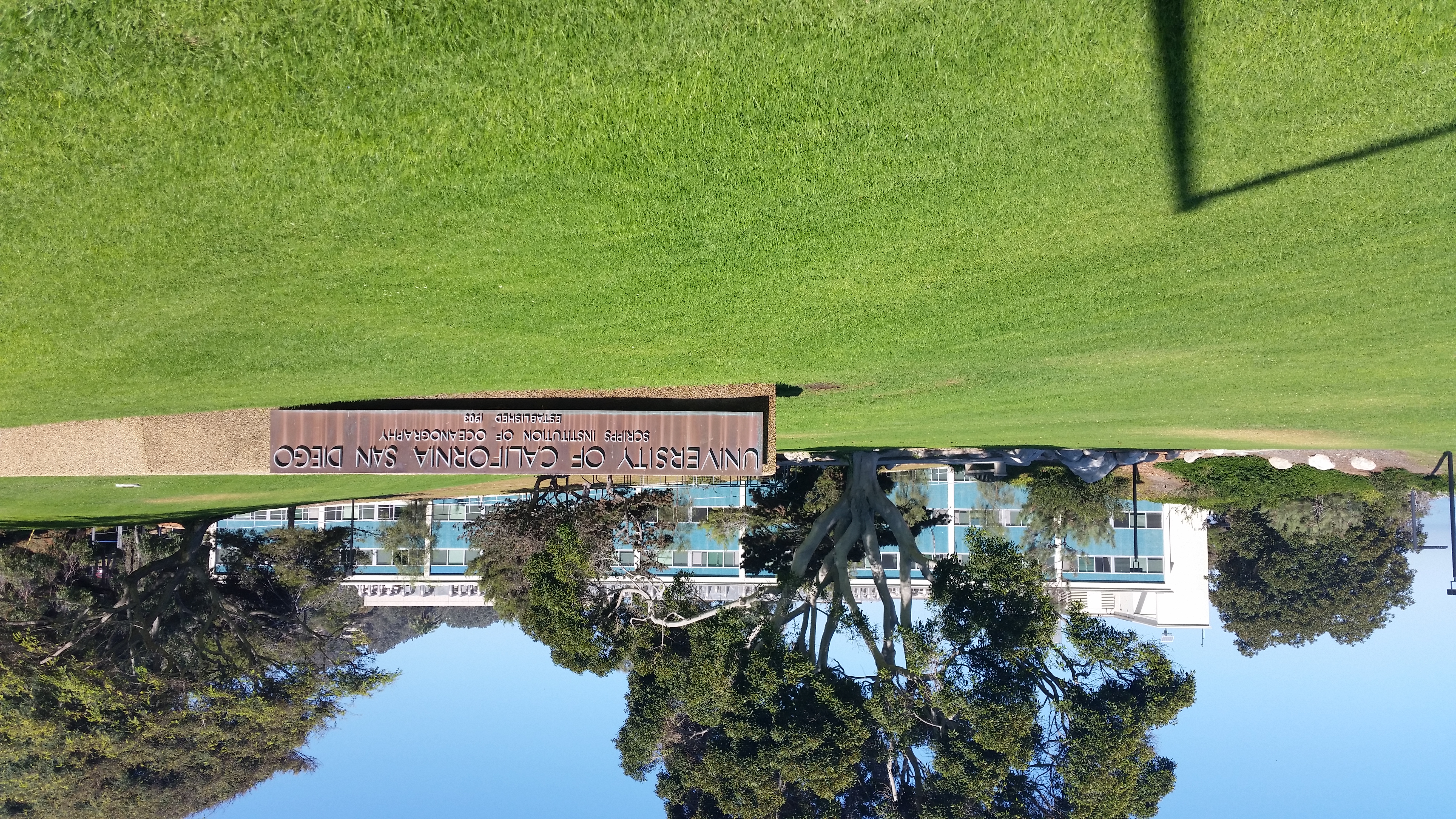
Corner of El Paseo Grande and La Jolla Shores Drive
147:
Scripps
Institute of Oceanography Monument Sign.jpg
320:https://creativecommons.org/licenses/by-sa/4.0
102:
326:Creative Commons Attribution-Share Alike 4.0
250:
8:
286:– to copy, distribute and transmit the work
751:
648:
348:
726:The following other wikis use this file:
273:Attribution-Share Alike 4.0 International
1157:
1149:
1141:
1133:
1125:
1117:
1107:
1099:
1091:
1083:
1073:
1065:
1057:
1049:
1041:
1031:
1023:
1013:
1005:
995:
987:
979:
969:
948:
940:
929:
921:
913:
905:
895:
887:
879:
871:
863:
855:
847:
839:
831:
823:
812:
804:
793:
783:
773:
763:
708:
624:
608:
588:
572:
554:
538:
518:
502:
482:
466:
399:
383:
366:
363:
344:
337:
197:
218:View this and other nearby images on:
753:
706:The following 2 pages use this file:
7:
716:University of California, San Diego
711:Scripps Institution of Oceanography
696:User created page with UploadWizard
637:
261:
256:
744:
357:
351:
247:
243:
151:
134:
80:
356:
806:Date and time of data generation
541:coordinates of the point of view
342:
297:Under the following conditions:
268:This file is licensed under the
260:
255:
249:
224:
210:
101:
31:
21:
556:32°51'48.226"N, 117°15'11.974"W
339:
152:
14:
780:1/710 sec (0.0014084507042254)
338:
26:
1:
1096:A directly photographed image
591:original creation by uploader
36:
1059:DateTimeDigitized subseconds
364:Items portrayed in this file
1051:DateTimeOriginal subseconds
942:Date and time of digitizing
1179:
1119:Focal length in 35 mm film
1088:One-chip color area sensor
1067:Supported Flashpix version
730:Usage on es.wikipedia.org
311:same or compatible license
950:Meaning of each component
907:File change date and time
852:21 meters below sea level
638:
176:
167:15 October 2017, 11:34:01
16:
341:
277:
108:This is a file from the
1143:GPS time (atomic clock)
695:
182:
172:
165:
162:
144:
112:. Information from its
945:11:34, 15 October 2017
910:11:34, 15 October 2017
809:11:34, 15 October 2017
674:01:17, 18 October 2017
230:32.863396; -117.253326
115:description page there
46:Size of this preview:
1007:Maximum land aperture
881:Horizontal resolution
74:5,312 × 2,988 pixels
70:2,560 × 1,440 pixels
1043:DateTime subseconds
915:Y and C positioning
889:Vertical resolution
755:Camera manufacturer
292:– to adapt the work
52:Other resolutions:
1127:Scene capture type
1114:Auto white balance
1038:Flash did not fire
428:author name string
413:Wikimedia username
66:1,280 × 720 pixels
62:1,024 × 576 pixels
1166:
1165:
1010:2.28 APEX (f/2.2)
844:117° 15′ 11.98″ W
722:Global file usage
699:
691:RightCowLeftCoast
505:copyright license
434:RightCowLeftCoast
420:RightCowLeftCoast
350:
235:
234:
192:
191:
187:RightCowLeftCoast
130:
129:
110:Wikimedia Commons
32:Global file usage
1170:
923:Exposure Program
836:32° 51′ 48.22″ N
752:
686:
469:copyright status
450:
445:
435:
432:
422:
417:
333:
330:
327:
324:
321:
313:as the original.
270:Creative Commons
264:
263:
259:
258:
253:
252:
231:
228:
214:
213:
207:
206:
195:
178:
168:
156:
148:
142:
126:
105:
104:
98:
92:
90:
77:
58:640 × 360 pixels
54:320 × 180 pixels
48:800 × 450 pixels
1178:
1177:
1173:
1172:
1171:
1169:
1168:
1167:
1159:GPS tag version
1154:15 October 2017
1135:Unique image ID
989:APEX brightness
740:
720:
700:
692:
684:
640:
639:
636:
635:
634:
633:
632:
631:
630:
629:
627:
626:15 October 2017
617:
616:
615:
613:
602:
601:
600:
599:
598:
597:
596:
595:
593:
581:
580:
579:
577:
566:
565:
564:
563:
562:
561:
560:
559:
557:
547:
546:
545:
543:
532:
531:
530:
529:
528:
527:
526:
525:
523:
511:
510:
509:
507:
496:
495:
494:
493:
492:
491:
490:
489:
487:
475:
474:
473:
471:
460:
459:
458:
457:
456:
455:
454:
453:
452:
451:
446:
443:
437:
436:
433:
430:
424:
423:
418:
415:
406:
405:
404:
402:
392:
391:
390:
388:
377:
376:
375:
374:
373:
371:
355:
354:
353:
336:
335:
334:
331:
328:
325:
322:
319:
318:
276:
265:
246:
245:
240:
229:
202:
201:
198:Camera location
193:
158:
146:
139:
132:
131:
120:
119:
118:is shown below.
94:
88:
86:
79:
78:
51:
12:
11:
5:
1176:
1174:
1164:
1163:
1160:
1156:
1155:
1152:
1148:
1147:
1144:
1140:
1139:
1136:
1132:
1131:
1128:
1124:
1123:
1120:
1116:
1115:
1112:
1106:
1105:
1102:
1098:
1097:
1094:
1090:
1089:
1086:
1085:Sensing method
1082:
1081:
1078:
1072:
1071:
1068:
1064:
1063:
1060:
1056:
1055:
1052:
1048:
1047:
1044:
1040:
1039:
1036:
1030:
1029:
1026:
1022:
1021:
1018:
1012:
1011:
1008:
1004:
1003:
1000:
994:
993:
990:
986:
985:
982:
978:
977:
974:
968:
967:
966:
965:
964:does not exist
962:
959:
956:
951:
947:
946:
943:
939:
938:
935:
928:
927:
926:Normal program
924:
920:
919:
916:
912:
911:
908:
904:
903:
898:
894:
893:
890:
886:
885:
882:
878:
877:
874:
870:
869:
866:
862:
861:
858:
854:
853:
850:
846:
845:
842:
838:
837:
834:
830:
829:
826:
822:
821:
818:
811:
810:
807:
803:
802:
799:
792:
791:
788:
782:
781:
778:
772:
771:
766:
762:
761:
756:
743:
739:
738:
737:
736:
724:
723:
719:
718:
713:
704:
703:
698:
697:
694:
690:
687:
683:5,312 × 2,988
681:
676:
671:
667:
666:
663:
660:
657:
654:
651:
644:
643:
628:
625:
623:
622:
621:
620:
619:
618:
614:
609:
607:
606:
605:
604:
603:
594:
589:
587:
586:
585:
584:
583:
582:
578:
575:source of file
573:
571:
570:
569:
568:
567:
558:
555:
553:
552:
551:
550:
549:
548:
544:
539:
537:
536:
535:
534:
524:
519:
517:
516:
515:
514:
513:
512:
508:
503:
501:
500:
499:
498:
497:
488:
483:
481:
480:
479:
478:
477:
476:
472:
467:
465:
464:
463:
462:
461:
439:
438:
426:
425:
411:
410:
409:
408:
407:
403:
400:
398:
397:
396:
395:
394:
393:
389:
384:
382:
381:
380:
379:
378:
372:
367:
365:
362:
361:
360:
359:
358:
347:
346:
343:
340:
317:
316:
315:
314:
304:
295:
294:
293:
287:
280:You are free:
267:
266:
248:
242:
241:
239:
236:
233:
232:
222:
216:
199:
190:
189:
184:
180:
179:
174:
170:
169:
164:
160:
159:
149:
140:
138:
135:
133:
128:
127:
106:
96:
95:
45:
41:
40:
39:
34:
29:
24:
19:
13:
10:
9:
6:
4:
3:
2:
1175:
1161:
1158:
1153:
1150:
1145:
1142:
1137:
1134:
1129:
1126:
1121:
1118:
1113:
1111:
1110:White balance
1108:
1104:Auto exposure
1103:
1101:Exposure mode
1100:
1095:
1092:
1087:
1084:
1079:
1077:
1074:
1069:
1066:
1061:
1058:
1053:
1050:
1045:
1042:
1037:
1035:
1032:
1027:
1024:
1019:
1017:
1016:Metering mode
1014:
1009:
1006:
1001:
999:
998:Exposure bias
996:
991:
988:
983:
981:APEX aperture
980:
975:
973:
972:Shutter speed
970:
963:
960:
957:
954:
953:
952:
949:
944:
941:
936:
933:
930:
925:
922:
917:
914:
909:
906:
902:
901:G900PVPS3CQD1
899:
897:Software used
896:
891:
888:
883:
880:
875:
872:
867:
864:
859:
856:
851:
848:
843:
840:
835:
832:
827:
825:User comments
824:
819:
817:
813:
808:
805:
800:
797:
794:
789:
787:
784:
779:
777:
776:Exposure time
774:
770:
767:
764:
760:
757:
754:
750:
747:
741:
735:
732:
731:
729:
728:
727:
721:
717:
714:
712:
709:
707:
701:
693:
688:
682:
680:
677:
675:
672:
669:
668:
664:
661:
658:
655:
652:
650:
649:
647:
641:
612:
592:
576:
542:
522:
506:
486:
470:
449:
442:
429:
421:
414:
387:
370:
323:CC BY-SA 4.0
312:
308:
305:
302:
299:
298:
296:
291:
288:
285:
282:
281:
279:
278:
274:
271:
254:
237:
227:
223:
221:
220:OpenStreetMap
217:
215:
205:
200:
196:
188:
185:
181:
175:
171:
161:
155:
150:
143:
136:
124:
117:
116:
111:
107:
100:
99:
93:
84:
83:Original file
75:
71:
67:
63:
59:
55:
49:
44:
38:
35:
33:
30:
28:
25:
23:
20:
18:
15:
1025:Light source
876:Rotated 180°
816:focal length
765:Camera model
748:
745:
734:Barton Myers
725:
705:
645:
642:File history
306:
300:
289:
283:
153:
123:You can help
113:
81:
22:File history
1138:F16QLHF01VB
1076:Color space
873:Orientation
485:copyrighted
307:share alike
301:attribution
145:Description
1093:Scene type
702:File usage
659:Dimensions
401:some value
89:image/jpeg
27:File usage
841:Longitude
796:ISO speed
685:(8.72 MB)
656:Thumbnail
653:Date/Time
611:inception
238:Licensing
154:English:
1151:GPS date
1130:Standard
918:Centered
868:2,988 px
860:5,312 px
849:Altitude
833:Latitude
786:F-number
769:SM-G900P
742:Metadata
345:Captions
290:to remix
284:to share
275:license.
177:Own work
37:Metadata
1162:0.0.2.2
1028:Unknown
1020:Pattern
934:version
759:samsung
670:current
665:Comment
386:creator
369:depicts
349:English
137:Summary
85:
892:72 dpi
884:72 dpi
865:Height
820:4.8 mm
798:rating
208:
183:Author
173:Source
1146:18:33
1122:31 mm
1034:Flash
857:Width
814:Lens
790:f/2.2
1080:sRGB
992:8.25
984:2.27
976:9.47
932:Exif
662:User
332:true
329:true
163:Date
17:File
1062:172
1054:172
1046:172
937:2.2
441:URL
961:Cr
958:Cb
801:40
444::
431::
416::
72:|
68:|
64:|
60:|
56:|
50:.
1070:1
1002:0
955:Y
125:.
91:)
76:.
Text is available under the Creative Commons Attribution-ShareAlike License. Additional terms may apply.