38:
253:
259:
264:
94:
1143:
549:
311:– You must give appropriate credit, provide a link to the license, and indicate if changes were made. You may do so in any reasonable manner, but not in any way that suggests the licensor endorses you or your use.
1090:
581:
570:, UK with the following information shown: *Administrative borders *Coastline, lakes and rivers *Roads and railways *Urban areas Equirectangular map projection on WGS 84 d
1407:
1133:
64:
68:
60:
56:
52:
48:
42:
242:
105:
77:
460:
424:
318:
1258:
678:
408:
1328:
480:
444:
391:
688:
351:
213:
708:
274:
623:
580:
More than 100 pages use this file. The following list shows the first 100 pages that use this file only. A
973:
1303:
1293:
1238:
1078:
938:
798:
317:– If you remix, transform, or build upon the material, you must distribute your contributions under the
1313:
271:
1288:
1113:
663:
199:
1023:
893:
843:
693:
113:
1318:
958:
863:
773:
698:
618:
548:
543:
139:
37:
1308:
1268:
1028:
1013:
643:
567:
196:
1043:
998:
993:
953:
778:
763:
613:
1323:
1163:
1123:
1038:
1033:
1003:
878:
703:
559:
217:
1353:
1153:
1073:
933:
758:
100:
928:
908:
793:
733:
713:
683:
673:
658:
1108:
230:
873:
828:
788:
185:
1083:
1058:
983:
963:
918:
813:
723:
608:
593:
1053:
1018:
943:
913:
903:
883:
868:
833:
823:
738:
638:
1298:
1068:
1008:
968:
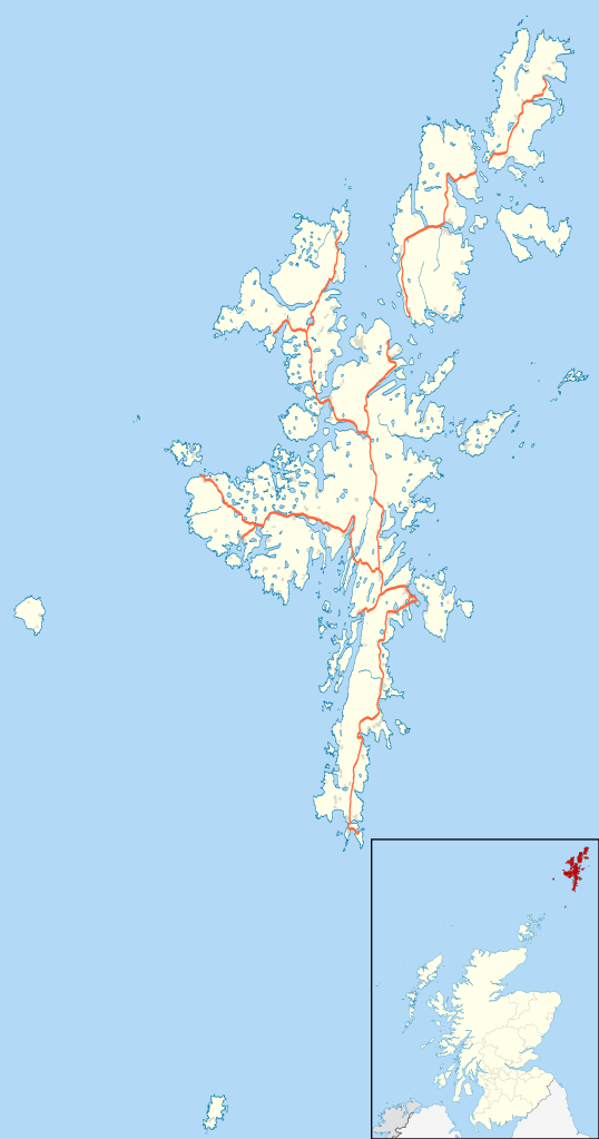
948:
888:
848:
808:
783:
753:
748:
728:
718:
668:
628:
159:
Equirectangular map projection on WGS 84 datum, with N/S stretched 200%
1363:
1348:
978:
858:
818:
768:
743:
598:
1368:
1343:
1193:
1188:
1063:
923:
838:
648:
633:
603:
206:
Administrative borders and coastline data from
Boundary-Line product.
1378:
1383:
1373:
1273:
1259:
Wikiproyecto:Ilustración/Taller de
Cartografía/Realizaciones/Europa
1213:
516:
Click on a date/time to view the file as it appeared at that time.
1398:
1048:
988:
803:
282:
Contains
Ordnance Survey data © Crown copyright and database right
1208:
1173:
898:
853:
653:
588:
1198:
1168:
1218:
88:
1388:
1228:
1178:
1203:
1183:
82:(SVG file, nominally 832 × 1,582 pixels, file size: 1.63 MB)
1393:
1223:
375:
Add a one-line explanation of what this file represents
1358:
1278:
1248:
1338:
1263:
461:
Creative
Commons Attribution-ShareAlike 3.0 Unported
127:
112:
Commons is a freely licensed media file repository.
1239:Ŝablono:Situo sur mapo Skotlando Ŝetlandaj Insuloj
209:All other geographic data from Meridian 2 product.
1253:
328:https://creativecommons.org/licenses/by-sa/3.0
93:
334:Creative Commons Attribution-Share Alike 3.0
252:
8:
566:{{Information |Description=Blank map of the
1144:Шаблон:ПК Великобритания Шетландски острови
294:– to copy, distribute and transmit the work
142:, UK with the following information shown:
41:Size of this PNG preview of this SVG file:
1269:Plantilla:Mapa de localización de Shetland
1164:Vorlage:Positionskarte Schottland Shetland
518:
371:
1124:Vorlog:Positionskarte Schottland Shetland
1101:The following other wikis use this file:
1154:Plantilya:Location map Scotland Shetland
586:
494:
478:
458:
442:
422:
406:
389:
386:
367:
360:
212:Inset derived from Inset derived from
7:
275:Attribution-Share Alike 3.0 Unported
233:, created using Ordnance Survey data
1289:الگو:Location map Scotland Shetland
1114:قالب:Location map Scotland Shetland
507:
263:
258:
380:
374:
249:
125:
75:
1130:Usage on be-tarask.wikipedia.org
379:
365:
305:Under the following conditions:
270:This file is licensed under the
262:
257:
251:
92:
31:
21:
1354:Modèle:Géolocalisation/Shetland
362:
14:
361:
352:File:Shetland UK blank map.svg
214:File:Scotland location map.svg
26:
1:
679:Bressay transmitting station
387:Items portrayed in this file
133:Shetland UK location map.svg
1150:Usage on ceb.wikipedia.org
1120:Usage on bar.wikipedia.org
149:Coastline, lakes and rivers
1424:
1349:Oceanic (paquebot de 1899)
1335:Usage on fr.wikipedia.org
1285:Usage on fa.wikipedia.org
1245:Usage on es.wikipedia.org
1235:Usage on eo.wikipedia.org
1160:Usage on de.wikipedia.org
1140:Usage on bg.wikipedia.org
1105:Usage on ar.wikipedia.org
319:same or compatible license
689:Brindister, West Mainland
508:
16:
1194:Sumburgh Head Lighthouse
1189:Muckle Flugga Lighthouse
709:Broch of West Burrafirth
544:20:25, 26 September 2010
364:
285:
99:This is a file from the
1379:Phare nord de Fair Isle
624:Belmont House, Shetland
565:
347:
237:
226:
191:
184:
181:
130:
103:. Information from its
1384:Phare sud de Fair Isle
1374:Phare de Sumburgh Head
1274:Aeropuerto de Sumburgh
1214:Flugplatz Out Skerries
974:Shetland Amenity Trust
146:Administrative borders
106:description page there
1399:Phare de Bound Skerry
1364:Aérodrome de Tingwall
1079:Westerfield, Shetland
939:Sandwick, Dunrossness
799:Gilbert Bain Hospital
1369:Aérodrome de Scatsta
1344:Aéroport de Sumburgh
1209:Flugplatz Papa Stour
65:1,077 × 2,048 pixels
1174:Flugplatz Fair Isle
1134:Шэтландзкія астравы
664:Braewick, Sandsting
300:– to adapt the work
162:Geographic limits:
47:Other resolutions:
1199:Bressay Lighthouse
1169:Flughafen Sumburgh
1024:Tingwall, Shetland
894:Mossbank, Shetland
844:Isbister, Shetland
694:Broch of Clickimin
152:Roads and railways
69:832 × 1,582 pixels
61:538 × 1,024 pixels
1408:more global usage
1219:Flugplatz Whalsay
1097:Global file usage
959:Scord of Brouster
864:Lerwick Town Hall
774:Fair Isle Airport
699:Broch of Culswick
619:Belmont, Shetland
573:
496:26 September 2010
445:copyright license
373:
358:
357:
246:
243:Reusing this file
186:26 September 2010
138:Blank map of the
121:
120:
101:Wikimedia Commons
32:Global file usage
1415:
1389:Phare de Bressay
1229:Flugplatz Fetlar
1179:Tingwall Airport
1029:Tingwall Airport
1014:Sumburgh Airport
644:Boddam, Shetland
568:Shetland Islands
556:
409:copyright status
341:
338:
335:
332:
329:
321:as the original.
283:
272:Creative Commons
266:
265:
261:
260:
255:
254:
240:
187:
140:Shetland Islands
134:
128:
117:
96:
95:
89:
83:
72:
57:404 × 768 pixels
53:252 × 480 pixels
49:126 × 240 pixels
43:315 × 599 pixels
1423:
1422:
1418:
1417:
1416:
1414:
1413:
1412:
1204:Flugplatz Foula
1184:Scatsta Airport
1095:
1044:Twatt, Shetland
999:Sodom, Shetland
994:Snabrough broch
954:Scatsta Airport
779:Firth, Shetland
764:Cutts, Shetland
614:Basta, Shetland
574:
562:
554:
510:
509:
506:
505:
504:
503:
502:
501:
500:
499:
497:
487:
486:
485:
483:
472:
471:
470:
469:
468:
467:
466:
465:
463:
451:
450:
449:
447:
436:
435:
434:
433:
432:
431:
430:
429:
427:
415:
414:
413:
411:
400:
399:
398:
397:
396:
394:
378:
377:
376:
359:
343:
342:
339:
336:
333:
330:
327:
326:
284:
281:
278:
267:
197:Ordnance Survey
132:
123:
122:
111:
110:
109:is shown below.
85:
81:
74:
73:
46:
12:
11:
5:
1421:
1419:
1410:of this file.
1404:
1403:
1402:
1401:
1396:
1394:Phare de Foula
1391:
1386:
1381:
1376:
1371:
1366:
1361:
1356:
1351:
1346:
1341:
1333:
1332:
1331:
1326:
1321:
1316:
1311:
1306:
1301:
1296:
1291:
1283:
1282:
1281:
1276:
1271:
1266:
1261:
1256:
1251:
1243:
1242:
1241:
1233:
1232:
1231:
1226:
1224:Flugplatz Unst
1221:
1216:
1211:
1206:
1201:
1196:
1191:
1186:
1181:
1176:
1171:
1166:
1158:
1157:
1156:
1148:
1147:
1146:
1138:
1137:
1136:
1128:
1127:
1126:
1118:
1117:
1116:
1111:
1099:
1098:
1093:to this file.
1087:
1086:
1081:
1076:
1071:
1066:
1061:
1056:
1051:
1046:
1041:
1039:Toft, Shetland
1036:
1034:Toab, Shetland
1031:
1026:
1021:
1016:
1011:
1006:
1004:Sound, Lerwick
1001:
996:
991:
986:
981:
976:
971:
966:
961:
956:
951:
946:
941:
936:
931:
926:
921:
916:
911:
906:
901:
896:
891:
886:
881:
879:Mail, Shetland
876:
871:
866:
861:
856:
851:
846:
841:
836:
831:
826:
821:
816:
811:
806:
801:
796:
791:
786:
781:
776:
771:
766:
761:
756:
751:
746:
741:
736:
731:
726:
721:
716:
711:
706:
704:Broch of Mousa
701:
696:
691:
686:
681:
676:
671:
666:
661:
656:
651:
646:
641:
636:
631:
626:
621:
616:
611:
606:
601:
596:
591:
584:is available.
578:
577:
572:
571:
564:
560:
557:
551:
546:
541:
537:
536:
533:
530:
527:
524:
521:
514:
513:
498:
495:
493:
492:
491:
490:
489:
488:
484:
479:
477:
476:
475:
474:
473:
464:
459:
457:
456:
455:
454:
453:
452:
448:
443:
441:
440:
439:
438:
437:
428:
423:
421:
420:
419:
418:
417:
416:
412:
407:
405:
404:
403:
402:
401:
395:
390:
388:
385:
384:
383:
382:
381:
370:
369:
366:
363:
356:
355:
349:
348:Other versions
345:
344:
325:
324:
323:
322:
312:
303:
302:
301:
295:
288:You are free:
279:
269:
268:
250:
247:
235:
234:
228:
224:
223:
222:
221:
210:
207:
193:
189:
188:
183:
179:
178:
177:
176:
173:
170:
167:
157:
156:
153:
150:
147:
135:
126:
124:
119:
118:
97:
87:
86:
40:
36:
35:
34:
29:
24:
19:
13:
10:
9:
6:
4:
3:
2:
1420:
1411:
1409:
1400:
1397:
1395:
1392:
1390:
1387:
1385:
1382:
1380:
1377:
1375:
1372:
1370:
1367:
1365:
1362:
1360:
1357:
1355:
1352:
1350:
1347:
1345:
1342:
1340:
1337:
1336:
1334:
1330:
1329:سامبرا، شتلند
1327:
1325:
1322:
1320:
1317:
1315:
1312:
1310:
1307:
1305:
1302:
1300:
1297:
1295:
1292:
1290:
1287:
1286:
1284:
1280:
1277:
1275:
1272:
1270:
1267:
1265:
1262:
1260:
1257:
1255:
1252:
1250:
1247:
1246:
1244:
1240:
1237:
1236:
1234:
1230:
1227:
1225:
1222:
1220:
1217:
1215:
1212:
1210:
1207:
1205:
1202:
1200:
1197:
1195:
1192:
1190:
1187:
1185:
1182:
1180:
1177:
1175:
1172:
1170:
1167:
1165:
1162:
1161:
1159:
1155:
1152:
1151:
1149:
1145:
1142:
1141:
1139:
1135:
1132:
1131:
1129:
1125:
1122:
1121:
1119:
1115:
1112:
1110:
1107:
1106:
1104:
1103:
1102:
1096:
1094:
1092:
1085:
1082:
1080:
1077:
1075:
1074:West Sandwick
1072:
1070:
1067:
1065:
1062:
1060:
1057:
1055:
1052:
1050:
1047:
1045:
1042:
1040:
1037:
1035:
1032:
1030:
1027:
1025:
1022:
1020:
1017:
1015:
1012:
1010:
1007:
1005:
1002:
1000:
997:
995:
992:
990:
987:
985:
982:
980:
977:
975:
972:
970:
967:
965:
962:
960:
957:
955:
952:
950:
947:
945:
942:
940:
937:
935:
934:RRH Saxa Vord
932:
930:
927:
925:
922:
920:
917:
915:
912:
910:
907:
905:
902:
900:
897:
895:
892:
890:
887:
885:
882:
880:
877:
875:
872:
870:
867:
865:
862:
860:
857:
855:
852:
850:
847:
845:
842:
840:
837:
835:
832:
830:
827:
825:
822:
820:
817:
815:
812:
810:
807:
805:
802:
800:
797:
795:
792:
790:
787:
785:
782:
780:
777:
775:
772:
770:
767:
765:
762:
760:
759:Cunningsburgh
757:
755:
752:
750:
747:
745:
742:
740:
737:
735:
732:
730:
727:
725:
722:
720:
717:
715:
712:
710:
707:
705:
702:
700:
697:
695:
692:
690:
687:
685:
682:
680:
677:
675:
672:
670:
667:
665:
662:
660:
657:
655:
652:
650:
647:
645:
642:
640:
637:
635:
632:
630:
627:
625:
622:
620:
617:
615:
612:
610:
607:
605:
602:
600:
597:
595:
592:
590:
587:
585:
583:
575:
569:
563:
558:
552:
550:
547:
545:
542:
539:
538:
534:
531:
528:
525:
522:
520:
519:
517:
511:
482:
462:
446:
426:
410:
393:
353:
350:
346:
331:CC BY-SA 3.0
320:
316:
313:
310:
307:
306:
304:
299:
296:
293:
290:
289:
287:
286:
280:Attribution:
276:
273:
256:
248:
244:
239:
236:
232:
229:
225:
219:
215:
211:
208:
205:
204:
203:
201:
198:
194:
190:
180:
175:South: 59.50N
174:
172:North: 60.88N
171:
168:
165:
164:
163:
160:
154:
151:
148:
145:
144:
143:
141:
136:
129:
115:
108:
107:
102:
98:
91:
90:
84:
79:
78:Original file
70:
66:
62:
58:
54:
50:
44:
39:
33:
30:
28:
25:
23:
20:
18:
15:
1405:
1100:
1088:
929:RAF Sumburgh
909:Old Scatness
794:Gardie House
734:Burwick Holm
714:Brough Lodge
684:Brettabister
674:Bremirehoull
659:Braehoulland
579:
553:832 × 1,582
515:
512:File history
314:
308:
297:
291:
218:NordNordWest
195:
161:
158:
137:
114:You can help
104:
76:
22:File history
874:Lunna House
829:Haroldswick
789:Funzie Girt
425:copyrighted
354:- Blank map
315:share alike
309:attribution
169:East: 0.70W
166:West: 2.15W
155:Urban areas
131:Description
1304:هارولدزویک
1294:بالتاساوند
1091:more links
1084:Westerwick
1059:Veensgarth
984:Skaw, Unst
964:Scousburgh
919:Otterswick
814:Gulberwick
724:Burrafirth
609:Baltasound
594:Aithsetter
576:File usage
529:Dimensions
238:Permission
27:File usage
1359:Scalloway
1314:سیمبیستر
1279:Scalloway
1249:Out Stack
1054:Uyeasound
1019:Symbister
944:Scalloway
914:Ollaberry
904:North Roe
884:Marrister
869:Levenwick
834:Hillswick
824:Haltadans
739:Clivocast
639:Billister
582:full list
561:Nilfanion
555:(1.63 MB)
526:Thumbnail
523:Date/Time
481:inception
231:Nilfanion
1319:اویساند
1309:اسکالووی
1069:Weisdale
1009:Sumburgh
969:Shetland
949:Scatness
889:Mid Yell
849:Jarlshof
809:Grutness
784:Freester
754:Cullivoe
749:Copister
729:Burravoe
719:Browland
669:Breiwick
629:Biggings
368:Captions
298:to remix
292:to share
277:license.
200:OpenData
1339:Lerwick
1324:یارلزهف
1264:Lerwick
979:Silwick
859:Lerwick
819:Gutcher
769:Exnaboe
744:Clousta
599:Assater
540:current
535:Comment
392:depicts
372:English
80:
1109:شتلاند
1064:Vidlin
924:Quarff
839:Huxter
649:Bousta
634:Bigton
604:Aywick
227:Author
192:Source
1406:View
1299:برائه
1089:View
1049:Ulsta
989:Skeld
804:Gloup
1254:Brae
899:Neap
854:Laxo
654:Brae
589:Aith
532:User
340:true
337:true
182:Date
17:File
216:by
202:.
67:|
63:|
59:|
55:|
51:|
45:.
245:)
241:(
220:.
116:.
71:.
Text is available under the Creative Commons Attribution-ShareAlike License. Additional terms may apply.
