38:
200:
245:
94:
478:
255:
207:
389:
353:
60:
264:
56:
52:
48:
42:
215:
the copyright holder is properly attributed. Redistribution, derivative work, commercial use, and all other use is permitted.
105:
73:
337:
267:(in Japanese and English). When you display this image on an article, include the following phrase in the description: "
409:
373:
320:
488:
113:
477:
472:
64:
37:
100:
165:
194:
270:
224:
239:
527:
260:
509:
256:
the
Ministry of Land, Infrastructure, Transport and Tourism of Japan
208:
the
Ministry of Land, Infrastructure, Transport and Tourism of Japan
445:
Click on a date/time to view the file as it appeared at that time.
244:
495:
Uploaded a work by 国土地理院 from 国土情報ウェブマッピングシステム with UploadWizard
88:
243:
271:
National Land Image
Information (Color Aerial Photographs)
225:
National Land Image
Information (Color Aerial Photographs)
273:, Ministry of Land, Infrastructure, Transport and Tourism
227:, Ministry of Land, Infrastructure, Transport and Tourism
78:(2,000 × 2,000 pixels, file size: 3.09 MB, MIME type:
132:
112:
Commons is a freely licensed media file repository.
261:
the stipulation to use of
National Land Information
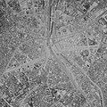
296:Aerial view around Shibuya Station (June 1963)
156:Aerial view around Shibuya Station (June 1963)
93:
8:
447:
300:
292:
520:The following other wikis use this file:
507:
423:
407:
387:
371:
351:
335:
318:
315:
288:
281:
7:
505:The following page uses this file:
436:
254:
206:
205:The copyright holder of this file,
309:
303:
295:
252:
150:
142:
125:
71:
308:
286:
198:
143:
92:
31:
21:
283:
151:
14:
282:
213:for any purpose, provided that
26:
1:
253:This image is copyrighted by
316:Items portrayed in this file
546:
524:Usage on ja.wikipedia.org
211:, allows anyone to use it
437:
199:
197:
16:
390:attribution only license
285:
259:. For terms of use, see
138:Shibuya Station.1963.jpg
99:This is a file from the
494:
304:渋谷駅周辺の白黒空中写真(1963年6月撮影)
179:
171:
164:
161:
148:渋谷駅周辺の白黒空中写真(1963年6月撮影)
135:
103:. Information from its
473:07:00, 27 October 2020
248:
106:description page there
41:Size of this preview:
247:
65:2,000 × 2,000 pixels
61:1,024 × 1,024 pixels
47:Other resolutions:
263:(in Japanese) and
249:
516:Global file usage
498:
374:copyright license
302:
294:
280:
279:
265:message from MLIT
238:
237:
187:
186:
121:
120:
101:Wikimedia Commons
32:Global file usage
537:
485:
338:copyright status
258:
240:
233:
210:
202:
201:
195:
175:国土情報ウェブマッピングシステム
167:
155:
147:
139:
133:
117:
96:
95:
89:
83:
81:
68:
57:768 × 768 pixels
53:480 × 480 pixels
49:240 × 240 pixels
43:600 × 600 pixels
545:
544:
540:
539:
538:
536:
535:
534:
514:
499:
491:
483:
439:
438:
435:
434:
433:
432:
431:
430:
429:
428:
426:
425:27 October 2020
416:
415:
414:
412:
401:
400:
399:
398:
397:
396:
395:
394:
392:
380:
379:
378:
376:
365:
364:
363:
362:
361:
360:
359:
358:
356:
344:
343:
342:
340:
329:
328:
327:
326:
325:
323:
307:
306:
305:
298:
297:
276:
231:
229:
228:
193:
188:
166:27 October 2020
157:
149:
137:
130:
123:
122:
111:
110:
109:is shown below.
85:
79:
77:
70:
69:
46:
12:
11:
5:
543:
541:
533:
532:
531:
530:
518:
517:
513:
512:
503:
502:
497:
496:
493:
489:
486:
482:2,000 × 2,000
480:
475:
470:
466:
465:
462:
459:
456:
453:
450:
443:
442:
427:
424:
422:
421:
420:
419:
418:
417:
413:
408:
406:
405:
404:
403:
402:
393:
388:
386:
385:
384:
383:
382:
381:
377:
372:
370:
369:
368:
367:
366:
357:
352:
350:
349:
348:
347:
346:
345:
341:
336:
334:
333:
332:
331:
330:
324:
319:
317:
314:
313:
312:
311:
310:
299:
291:
290:
287:
284:
278:
277:
269:Made based on
250:
236:
235:
222:
220:
217:
216:
203:
192:
189:
185:
184:
181:
177:
176:
173:
169:
168:
163:
159:
158:
140:
131:
129:
126:
124:
119:
118:
97:
87:
86:
40:
36:
35:
34:
29:
24:
19:
13:
10:
9:
6:
4:
3:
2:
542:
529:
526:
525:
523:
522:
521:
515:
511:
508:
506:
500:
492:
487:
481:
479:
476:
474:
471:
468:
467:
463:
460:
457:
454:
451:
449:
448:
446:
440:
411:
391:
375:
355:
339:
322:
274:
272:
266:
262:
257:
251:
246:
242:
241:
234:
226:
221:Attribution:
219:
218:
214:
209:
204:
196:
190:
182:
178:
174:
170:
160:
154:
146:
141:
134:
127:
115:
108:
107:
102:
98:
91:
90:
84:
75:
74:Original file
66:
62:
58:
54:
50:
44:
39:
33:
30:
28:
25:
23:
20:
18:
15:
519:
504:
444:
441:File history
268:
230:
223:Copyright ©
212:
152:
144:
114:You can help
104:
72:
22:File history
490:Keita.Honda
354:copyrighted
232:Attribution
136:Description
501:File usage
458:Dimensions
80:image/jpeg
27:File usage
484:(3.09 MB)
455:Thumbnail
452:Date/Time
410:inception
191:Licensing
153:English:
301:Japanese
289:Captions
510:Shibuya
469:current
464:Comment
321:depicts
293:English
128:Summary
76:
180:Author
172:Source
183:国土地理院
461:User
162:Date
145:日本語:
17:File
528:渋谷駅
275:".
63:|
59:|
55:|
51:|
45:.
116:.
82:)
67:.
Text is available under the Creative Commons Attribution-ShareAlike License. Additional terms may apply.


