43:
379:
312:
262:
304:
254:
326:
276:
347:
385:
390:
103:
891:"}},"text\/plain":{"en":{"":"heading"}}},"{\"value\":{\"amount\":\"+90\",\"unit\":\"http:\\\/\\\/www.wikidata.org\\\/entity\\\/Q28390\"},\"type\":\"quantity\"}":{"text\/html":{"en":{"P7787":"90
704:"}},"text\/plain":{"en":{"":"heading"}}},"{\"value\":{\"amount\":\"+90\",\"unit\":\"http:\\\/\\\/www.wikidata.org\\\/entity\\\/Q28390\"},\"type\":\"quantity\"}":{"text\/html":{"en":{"P7787":"90
1205:
700:
245:
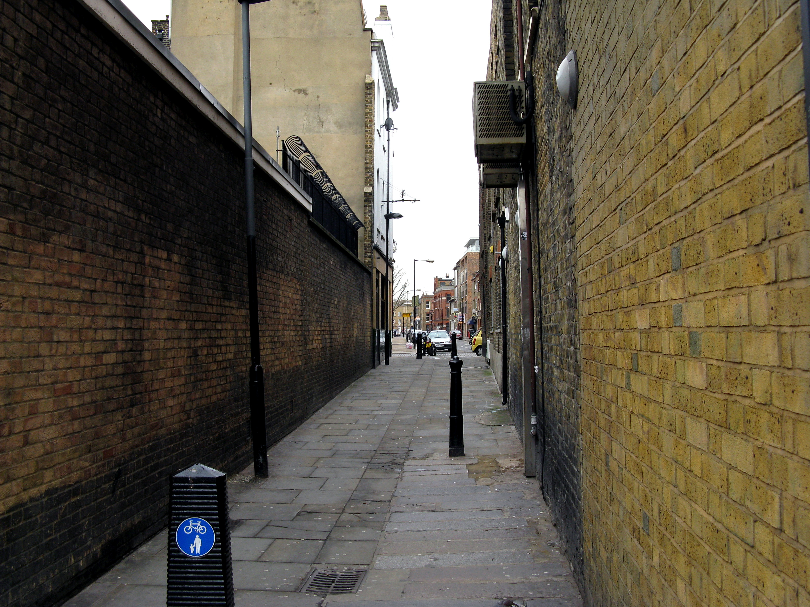
1222:== {{int:filedesc}} == {{Information |description={{en|1=Shoreditch: Boundary Passage Looking east from Shoreditch High Street. Across the far end of this passage is Boundary Street, and straight ahead is Old Nichol Street.}} |date=2010-02-03 |source=Fr
437:– You must give appropriate credit, provide a link to the license, and indicate if changes were made. You may do so in any reasonable manner, but not in any way that suggests the licensor endorses you or your use.
69:
65:
61:
57:
53:
47:
114:
82:
157:
Shoreditch: Boundary
Passage Looking east from Shoreditch High Street. Across the far end of this passage is Boundary Street, and straight ahead is Old Nichol Street.
888:
701:
1204:
1199:
787:
653:
617:
319:
269:
73:
42:
874:
807:
1406:
354:
1277:
This file contains additional information, probably added from the digital camera or scanner used to create or digitize it.
1150:
444:
552:
1383:
1100:
1066:
1029:
995:
958:
929:
902:
858:
815:
771:
742:
715:
601:
573:
560:
545:
830:
800:
673:
637:
518:
501:
1134:
341:
400:
1299:
1280:
If the file has been modified from its original state, some details may not fully reflect the modified file.
1232:
The following pages on the
English Knowledge (XXG) use this file (pages on other projects are not listed):
1451:
443:– If you remix, transform, or build upon the material, you must distribute your contributions under the
361:
on the
Geograph website for the photographer's contact details. The copyright on this image is owned by
1215:
397:
1479:
895:"}},"text\/plain":{"en":{"P7787":"90 degree"}}}}": -->
708:"}},"text\/plain":{"en":{"P7787":"90 degree"}}}}": -->
122:
214:
837:
822:
198:
1289:
580:
325:
275:
1547:
1469:
1433:
1306:
366:
109:
1557:
1346:
1489:
166:
1326:
259:
309:
177:
187:
1316:
346:
358:
1172:
Click on a date/time to view the file as it appeared at that time.
1236:
311:
261:
1254:
286:
236:
97:
147:
Shoreditch, Boundary
Passage - geograph.org.uk - 1692305.jpg
296:
51° 31′ 31″ N, 0° 04′ 34″ W
246:
51° 31′ 31″ N, 0° 04′ 37″ W
485:
Add a one-line explanation of what this file represents
1264:
87:(3,264 × 2,448 pixels, file size: 2.31 MB, MIME type:
141:
121:
Commons is a freely licensed media file repository.
654:
Creative
Commons Attribution-ShareAlike 2.0 Generic
454:https://creativecommons.org/licenses/by-sa/2.0
102:
460:Creative Commons Attribution-Share Alike 2.0
378:
8:
892:
705:
420:– to copy, distribute and transmit the work
1282:
1174:
481:
1247:The following other wikis use this file:
838:https://www.geograph.org.uk/photo/1692305
1566:
1555:
1545:
1537:
1529:
1521:
1513:
1505:
1497:
1487:
1477:
1467:
1459:
1449:
1441:
1431:
1423:
1415:
1404:
1396:
1388:
1378:
1370:
1362:
1354:
1343:
1335:
1324:
1314:
1304:
1294:
1234:
1148:
1132:
1114:
1098:
1080:
1064:
1043:
1027:
1009:
993:
972:
956:
916:
900:
872:
856:
785:
769:
729:
713:
687:
671:
651:
635:
615:
599:
581:https://www.geograph.org.uk/profile/796
532:
516:
499:
496:
477:
470:
289:
239:
318:View this and other nearby images on:
268:View this and other nearby images on:
1284:
7:
365:and is licensed for reuse under the
1163:
401:Attribution-Share Alike 2.0 Generic
389:
384:
369:Attribution-ShareAlike 2.0 license.
1275:
490:
484:
375:
352:
151:
134:
80:
489:
1337:Date and time of data generation
716:coordinates of the point of view
475:
431:Under the following conditions:
396:This file is licensed under the
388:
383:
377:
345:
324:
310:
302:
274:
260:
252:
101:
31:
21:
472:
152:
14:
788:file available on the internet
471:
353:This image was taken from the
26:
1:
1484:Flash did not fire, auto mode
903:coordinates of depicted place
229:Shoreditch: Boundary Passage
210:Shoreditch: Boundary Passage
36:
1384:Adobe Photoshop Elements 2.0
808:Geograph Britain and Ireland
546:object of statement has role
497:Items portrayed in this file
227:Dr Neil Clifton /
208:Dr Neil Clifton /
1515:Focal plane resolution unit
1417:Date and time of digitizing
301:
251:
1588:
1526:One-chip color area sensor
1261:Usage on www.wikidata.org
1251:Usage on lv.wikipedia.org
731:51°31'30.54"N, 0°4'37.20"W
445:same or compatible license
1390:File change date and time
1164:
16:
1507:Focal plane Y resolution
1499:Focal plane X resolution
918:51°31'30.7"N, 0°4'33.6"W
816:geograph.org.uk image ID
474:
411:
108:This is a file from the
1531:Custom image processing
1300:Canon PowerShot A720 IS
1221:
875:Canon PowerShot A720 IS
199:required by the license
183:
172:
165:
162:
144:
112:. Information from its
1425:Image compression mode
1420:11:55, 3 February 2010
1393:08:03, 4 February 2010
1340:11:55, 3 February 2010
359:this photograph's page
330:51.525200; -0.076000
280:51.525150; -0.077000
115:description page there
46:Size of this preview:
1461:Maximum land aperture
1364:Horizontal resolution
1464:2.96875 APEX (f/2.8)
74:3,264 × 2,448 pixels
70:2,560 × 1,920 pixels
1398:Y and C positioning
1372:Vertical resolution
1286:Camera manufacturer
1200:03:14, 5 March 2011
426:– to adapt the work
52:Other resolutions:
1568:Scene capture type
1552:Auto white balance
561:author name string
66:1,280 × 960 pixels
62:1,024 × 768 pixels
1575:
1574:
1243:Global file usage
1225:
894:
707:
638:copyright license
483:
374:
373:
357:collection. See
335:
334:
285:
284:
234:
233:
202:
130:
129:
110:Wikimedia Commons
32:Global file usage
1579:
1510:14,485.207100592
1502:14,506.666666667
1311:1/100 sec (0.01)
1283:
1212:
1048:
977:
940:
939:
934:
840:
835:
831:described at URL
825:
820:
810:
805:
753:
752:
747:
602:copyright status
583:
578:
568:
565:
555:
550:
467:
464:
461:
458:
455:
447:as the original.
409:
398:Creative Commons
392:
391:
387:
386:
381:
380:
367:Creative Commons
355:Geograph project
349:
342:
331:
328:
314:
313:
307:
306:
305:
299:
298:
287:
281:
278:
264:
263:
257:
256:
255:
249:
248:
237:
196:
168:
156:
148:
142:
126:
105:
104:
98:
92:
90:
77:
58:640 × 480 pixels
54:320 × 240 pixels
48:800 × 600 pixels
1587:
1586:
1582:
1581:
1580:
1578:
1577:
1576:
1271:
1241:
1233:
1226:
1218:
1210:
1166:
1165:
1162:
1161:
1160:
1159:
1158:
1157:
1156:
1155:
1153:
1141:
1140:
1139:
1137:
1126:
1125:
1124:
1123:
1122:
1121:
1120:
1119:
1117:
1107:
1106:
1105:
1103:
1092:
1091:
1090:
1089:
1088:
1087:
1086:
1085:
1083:
1073:
1072:
1071:
1069:
1058:
1057:
1056:
1055:
1054:
1053:
1052:
1051:
1049:
1046:
1036:
1035:
1034:
1032:
1021:
1020:
1019:
1018:
1017:
1016:
1015:
1014:
1012:
1002:
1001:
1000:
998:
987:
986:
985:
984:
983:
982:
981:
980:
978:
975:
965:
964:
963:
961:
950:
949:
948:
947:
946:
945:
944:
943:
942:
941:
937:
935:
932:
923:
922:
921:
919:
909:
908:
907:
905:
886:
885:
884:
883:
882:
881:
880:
879:
877:
865:
864:
863:
861:
850:
849:
848:
847:
846:
845:
844:
843:
842:
841:
836:
833:
827:
826:
821:
818:
812:
811:
806:
803:
794:
793:
792:
790:
778:
777:
776:
774:
763:
762:
761:
760:
759:
758:
757:
756:
755:
754:
750:
748:
745:
736:
735:
734:
732:
722:
721:
720:
718:
699:
698:
697:
696:
695:
694:
693:
692:
690:
689:3 February 2010
680:
679:
678:
676:
665:
664:
663:
662:
661:
660:
659:
658:
656:
644:
643:
642:
640:
629:
628:
627:
626:
625:
624:
623:
622:
620:
608:
607:
606:
604:
593:
592:
591:
590:
589:
588:
587:
586:
585:
584:
579:
576:
570:
569:
567:Dr Neil Clifton
566:
563:
557:
556:
551:
548:
539:
538:
537:
535:
525:
524:
523:
521:
510:
509:
508:
507:
506:
504:
488:
487:
486:
469:
468:
465:
462:
459:
456:
453:
452:
410:
408:Dr Neil Clifton
407:
404:
393:
370:
363:Dr Neil Clifton
340:
329:
303:
294:
293:
290:Object location
279:
253:
244:
243:
240:Camera location
235:
224:
217:
205:
188:Dr Neil Clifton
178:geograph.org.uk
167:3 February 2010
158:
146:
139:
132:
131:
120:
119:
118:is shown below.
94:
88:
86:
79:
78:
51:
12:
11:
5:
1585:
1583:
1573:
1572:
1569:
1565:
1564:
1561:
1554:
1553:
1550:
1544:
1543:
1540:
1536:
1535:
1534:Normal process
1532:
1528:
1527:
1524:
1523:Sensing method
1520:
1519:
1516:
1512:
1511:
1508:
1504:
1503:
1500:
1496:
1495:
1492:
1486:
1485:
1482:
1476:
1475:
1472:
1466:
1465:
1462:
1458:
1457:
1454:
1448:
1447:
1444:
1440:
1439:
1436:
1430:
1429:
1426:
1422:
1421:
1418:
1414:
1413:
1410:
1403:
1402:
1399:
1395:
1394:
1391:
1387:
1386:
1381:
1377:
1376:
1373:
1369:
1368:
1365:
1361:
1360:
1357:
1353:
1352:
1349:
1342:
1341:
1338:
1334:
1333:
1330:
1323:
1322:
1319:
1313:
1312:
1309:
1303:
1302:
1297:
1293:
1292:
1287:
1274:
1270:
1269:
1268:
1267:
1259:
1258:
1257:
1245:
1244:
1240:
1239:
1231:
1230:
1229:
1224:
1223:
1220:
1216:
1213:
1209:3,264 × 2,448
1207:
1202:
1197:
1193:
1192:
1189:
1186:
1183:
1180:
1177:
1170:
1169:
1154:
1149:
1147:
1146:
1145:
1144:
1143:
1142:
1138:
1133:
1131:
1130:
1129:
1128:
1127:
1118:
1115:
1113:
1112:
1111:
1110:
1109:
1108:
1104:
1099:
1097:
1096:
1095:
1094:
1093:
1084:
1081:
1079:
1078:
1077:
1076:
1075:
1074:
1070:
1065:
1063:
1062:
1061:
1060:
1059:
1050:
1044:
1042:
1041:
1040:
1039:
1038:
1037:
1033:
1028:
1026:
1025:
1024:
1023:
1022:
1013:
1010:
1008:
1007:
1006:
1005:
1004:
1003:
999:
994:
992:
991:
990:
989:
988:
979:
973:
971:
970:
969:
968:
967:
966:
962:
957:
955:
954:
953:
952:
951:
928:
927:
926:
925:
924:
920:
917:
915:
914:
913:
912:
911:
910:
906:
901:
899:
898:
897:
896:
890:
878:
873:
871:
870:
869:
868:
867:
866:
862:
857:
855:
854:
853:
852:
851:
829:
828:
814:
813:
799:
798:
797:
796:
795:
791:
786:
784:
783:
782:
781:
780:
779:
775:
772:source of file
770:
768:
767:
766:
765:
764:
741:
740:
739:
738:
737:
733:
730:
728:
727:
726:
725:
724:
723:
719:
714:
712:
711:
710:
709:
703:
691:
688:
686:
685:
684:
683:
682:
681:
677:
672:
670:
669:
668:
667:
666:
657:
652:
650:
649:
648:
647:
646:
645:
641:
636:
634:
633:
632:
631:
630:
621:
616:
614:
613:
612:
611:
610:
609:
605:
600:
598:
597:
596:
595:
594:
572:
571:
559:
558:
544:
543:
542:
541:
540:
536:
533:
531:
530:
529:
528:
527:
526:
522:
517:
515:
514:
513:
512:
511:
505:
500:
498:
495:
494:
493:
492:
491:
480:
479:
476:
473:
451:
450:
449:
448:
438:
429:
428:
427:
421:
414:You are free:
405:
395:
394:
376:
372:
371:
350:
339:
336:
333:
332:
322:
316:
291:
283:
282:
272:
266:
241:
232:
231:
225:
222:
219:
218:
213:
206:
203:
191:
190:
185:
181:
180:
174:
170:
169:
164:
160:
159:
149:
140:
138:
135:
133:
128:
127:
106:
96:
95:
45:
41:
40:
39:
34:
29:
24:
19:
13:
10:
9:
6:
4:
3:
2:
1584:
1570:
1567:
1562:
1559:
1556:
1551:
1549:
1548:White balance
1546:
1542:Auto exposure
1541:
1539:Exposure mode
1538:
1533:
1530:
1525:
1522:
1517:
1514:
1509:
1506:
1501:
1498:
1493:
1491:
1488:
1483:
1481:
1478:
1473:
1471:
1470:Metering mode
1468:
1463:
1460:
1455:
1453:
1452:Exposure bias
1450:
1445:
1443:APEX aperture
1442:
1437:
1435:
1434:Shutter speed
1432:
1427:
1424:
1419:
1416:
1411:
1408:
1405:
1400:
1397:
1392:
1389:
1385:
1382:
1380:Software used
1379:
1374:
1371:
1366:
1363:
1358:
1355:
1350:
1348:
1344:
1339:
1336:
1331:
1328:
1325:
1320:
1318:
1315:
1310:
1308:
1307:Exposure time
1305:
1301:
1298:
1295:
1291:
1288:
1285:
1281:
1278:
1272:
1266:
1263:
1262:
1260:
1256:
1253:
1252:
1250:
1249:
1248:
1242:
1238:
1235:
1227:
1219:
1214:
1208:
1206:
1203:
1201:
1198:
1195:
1194:
1190:
1187:
1184:
1181:
1178:
1176:
1175:
1173:
1167:
1152:
1136:
1102:
1068:
1031:
997:
960:
959:exposure time
931:
904:
876:
860:
859:captured with
839:
832:
824:
817:
809:
802:
789:
773:
744:
717:
675:
655:
639:
619:
603:
582:
575:
562:
554:
547:
520:
503:
457:CC BY-SA 2.0
446:
442:
439:
436:
433:
432:
430:
425:
422:
419:
416:
415:
413:
412:
406:Attribution:
402:
399:
382:
368:
364:
360:
356:
351:
348:
344:
343:
337:
327:
323:
321:
320:OpenStreetMap
317:
315:
297:
292:
288:
277:
273:
271:
270:OpenStreetMap
267:
265:
247:
242:
238:
230:
226:
221:
220:
216:
212: /
211:
207:
200:
195:
193:
192:
189:
186:
182:
179:
175:
171:
161:
155:
150:
143:
136:
124:
117:
116:
111:
107:
100:
99:
93:
84:
83:Original file
75:
71:
67:
63:
59:
55:
49:
44:
38:
35:
33:
30:
28:
25:
23:
20:
18:
15:
1558:Digital zoom
1347:focal length
1296:Camera model
1279:
1276:
1246:
1171:
1168:File history
1030:focal length
553:photographer
440:
434:
423:
417:
362:
300:
250:
228:
215:CC BY-SA 2.0
209:
153:
123:You can help
113:
81:
22:File history
1490:Color space
1356:Orientation
1217:GeographBot
1135:instance of
618:copyrighted
441:share alike
435:attribution
194:Attribution
145:Description
1228:File usage
1185:Dimensions
1151:photograph
1116:image/jpeg
1101:media type
1047:millimetre
534:some value
89:image/jpeg
27:File usage
1327:ISO speed
1265:Q66607000
1211:(2.31 MB)
1182:Thumbnail
1179:Date/Time
1067:ISO speed
674:inception
338:Licensing
223:InfoField
204:InfoField
154:English:
1571:Portrait
1401:Centered
1317:F-number
1273:Metadata
996:f-number
801:operator
478:Captions
424:to remix
418:to share
403:license.
37:Metadata
1474:Pattern
1438:6.65625
1409:version
1375:180 dpi
1367:180 dpi
1255:Šordiča
1196:current
1191:Comment
930:heading
889:heading
823:1692305
743:heading
702:heading
519:creator
502:depicts
482:English
137:Summary
85:
1518:inches
1359:Normal
1351:5.8 mm
1329:rating
976:second
938:degree
893:degree
751:degree
706:degree
308:
258:
184:Author
173:Source
1560:ratio
1480:Flash
1345:Lens
1290:Canon
1237:Alley
974:0.01
176:From
1494:sRGB
1407:Exif
1188:User
1045:5.8
466:true
463:true
163:Date
17:File
1412:2.2
1321:f/4
936:90
749:90
574:URL
1332:80
1082:80
933::
834::
819::
804::
746::
577::
564::
549::
72:|
68:|
64:|
60:|
56:|
50:.
1563:1
1456:0
1446:4
1428:3
1011:4
201:)
197:(
125:.
91:)
76:.
Text is available under the Creative Commons Attribution-ShareAlike License. Additional terms may apply.
_heading:90.00&language=en)
_heading:90.00&language=en)
