309:
242:
234:
256:
277:
315:
320:
67:
600:"}},"text\/plain":{"en":{"":"heading"}}},"{\"value\":{\"amount\":\"+0\",\"unit\":\"http:\\\/\\\/www.wikidata.org\\\/entity\\\/Q28390\"},\"type\":\"quantity\"}":{"text\/html":{"en":{"P7787":"0
596:
367:– You must give appropriate credit, provide a link to the license, and indicate if changes were made. You may do so in any reasonable manner, but not in any way that suggests the licensor endorses you or your use.
225:
38:
597:
840:== {{int:filedesc}} == {{Information |Description={{en|1=Site of Bullington Priory}} |Source=From |Date=2012-01-07 |Author= |Permission=Cr...
162:
78:
46:
859:
683:
583:
547:
249:
703:
284:
374:
510:
726:
667:
638:
611:
531:
503:
490:
475:
754:
711:
696:
567:
448:
431:
271:
330:
850:
The following pages on the
English Knowledge (XXG) use this file (pages on other projects are not listed):
833:
373:– If you remix, transform, or build upon the material, you must distribute your contributions under the
291:
on the
Geograph website for the photographer's contact details. The copyright on this image is owned by
327:
604:"}},"text\/plain":{"en":{"P7787":"0 degree"}}}}": -->
86:
194:
822:
817:
37:
854:
733:
718:
482:
178:
255:
296:
73:
239:
892:
130:
141:
151:
276:
877:
288:
790:
Click on a date/time to view the file as it appeared at that time.
241:
226:
53° 16′ 29.54″ N, 0° 21′ 00.75″ W
216:
61:
415:
Add a one-line explanation of what this file represents
887:
169:
Creative
Commons Attribution Share-alike license 2.0
105:
85:
Commons is a freely licensed media file repository.
584:
Creative
Commons Attribution-ShareAlike 2.0 Generic
51:(640 × 427 pixels, file size: 118 KB, MIME type:
384:https://creativecommons.org/licenses/by-sa/2.0
66:
390:Creative Commons Attribution-Share Alike 2.0
308:
8:
601:
350:– to copy, distribute and transmit the work
792:
411:
870:The following other wikis use this file:
719:https://www.geograph.org.uk/photo/2755174
483:https://www.geograph.org.uk/profile/1904
852:
768:
752:
681:
665:
625:
609:
581:
565:
545:
529:
462:
446:
429:
426:
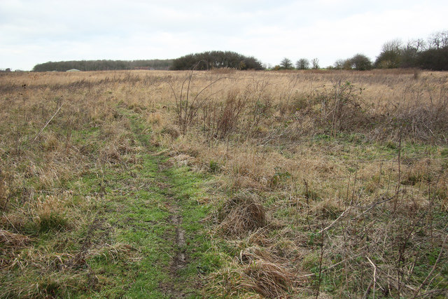
407:
400:
219:
248:View this and other nearby images on:
7:
295:and is licensed for reuse under the
781:
331:Attribution-Share Alike 2.0 Generic
319:
314:
299:Attribution-ShareAlike 2.0 license.
893:Wikidata:WP EMEW/Monasteries/Items
420:
414:
305:
282:
115:
98:
44:
419:
860:List of churches in Lincolnshire
612:coordinates of the point of view
405:
361:Under the following conditions:
326:This file is licensed under the
318:
313:
307:
275:
254:
240:
232:
65:
31:
21:
402:
116:
41:No higher resolution available.
14:
684:file available on the internet
401:
283:This image was taken from the
26:
1:
111:Site of Bullington Priory.jpg
47:Site_of_Bullington_Priory.jpg
704:Geograph Britain and Ireland
627:53°16'29.536"N, 0°21'0.749"W
504:object of statement has role
427:Items portrayed in this file
911:
884:Usage on www.wikidata.org
874:Usage on de.wikipedia.org
375:same or compatible license
231:
207:Richard Croft /
188:Richard Croft /
878:Simon (Adliger, vor 1116)
782:
209:Site of Bullington Priory
190:Site of Bullington Priory
121:Site of Bullington Priory
16:
727:geograph.org.uk image ID
404:
341:
72:This is a file from the
839:
179:required by the license
157:
147:
136:
129:
126:
108:
76:. Information from its
289:this photograph's page
260:53.274871; -0.350208
79:description page there
818:04:41, 22 April 2013
356:– to adapt the work
491:author name string
866:Global file usage
855:Bullington Priory
843:
603:
568:copyright license
413:
304:
303:
287:collection. See
265:
264:
214:
213:
182:
166:
163:Reusing this file
94:
93:
74:Wikimedia Commons
32:Global file usage
902:
835:Robert EA Harvey
830:
736:
731:
721:
716:
712:described at URL
706:
701:
649:
648:
643:
532:copyright status
513:
508:
498:
495:
485:
480:
397:
394:
391:
388:
385:
377:as the original.
339:
328:Creative Commons
322:
321:
317:
316:
311:
310:
297:Creative Commons
285:Geograph project
279:
272:
261:
258:
244:
243:
237:
236:
235:
229:
228:
217:
176:
160:
132:
120:
112:
106:
90:
69:
68:
62:
56:
54:
910:
909:
905:
904:
903:
901:
900:
899:
864:
851:
844:
836:
828:
784:
783:
780:
779:
778:
777:
776:
775:
774:
773:
771:
761:
760:
759:
757:
746:
745:
744:
743:
742:
741:
740:
739:
738:
737:
732:
729:
723:
722:
717:
714:
708:
707:
702:
699:
690:
689:
688:
686:
674:
673:
672:
670:
659:
658:
657:
656:
655:
654:
653:
652:
651:
650:
646:
644:
641:
632:
631:
630:
628:
618:
617:
616:
614:
595:
594:
593:
592:
591:
590:
589:
588:
586:
574:
573:
572:
570:
559:
558:
557:
556:
555:
554:
553:
552:
550:
538:
537:
536:
534:
523:
522:
521:
520:
519:
518:
517:
516:
515:
514:
509:
506:
500:
499:
496:
493:
487:
486:
481:
478:
469:
468:
467:
465:
455:
454:
453:
451:
440:
439:
438:
437:
436:
434:
418:
417:
416:
399:
398:
395:
392:
389:
386:
383:
382:
340:
337:
334:
323:
300:
270:
259:
233:
224:
223:
220:Camera location
215:
204:
197:
185:
142:geograph.org.uk
122:
110:
103:
96:
95:
84:
83:
82:is shown below.
58:
52:
50:
43:
42:
12:
11:
5:
908:
906:
898:
897:
896:
895:
890:
882:
881:
880:
868:
867:
863:
862:
857:
849:
848:
847:
842:
841:
838:
834:
831:
825:
820:
815:
811:
810:
807:
804:
801:
798:
795:
788:
787:
772:
770:7 January 2012
769:
767:
766:
765:
764:
763:
762:
758:
753:
751:
750:
749:
748:
747:
725:
724:
710:
709:
695:
694:
693:
692:
691:
687:
682:
680:
679:
678:
677:
676:
675:
671:
668:source of file
666:
664:
663:
662:
661:
660:
637:
636:
635:
634:
633:
629:
626:
624:
623:
622:
621:
620:
619:
615:
610:
608:
607:
606:
605:
599:
587:
582:
580:
579:
578:
577:
576:
575:
571:
566:
564:
563:
562:
561:
560:
551:
546:
544:
543:
542:
541:
540:
539:
535:
530:
528:
527:
526:
525:
524:
502:
501:
489:
488:
474:
473:
472:
471:
470:
466:
463:
461:
460:
459:
458:
457:
456:
452:
447:
445:
444:
443:
442:
441:
435:
430:
428:
425:
424:
423:
422:
421:
410:
409:
406:
403:
381:
380:
379:
378:
368:
359:
358:
357:
351:
344:You are free:
335:
325:
324:
306:
302:
301:
280:
269:
266:
263:
262:
252:
246:
221:
212:
211:
205:
202:
199:
198:
193:
186:
183:
171:
170:
167:
155:
154:
149:
145:
144:
138:
134:
133:
131:7 January 2012
128:
124:
123:
113:
104:
102:
99:
97:
92:
91:
70:
60:
59:
40:
36:
35:
34:
29:
24:
19:
13:
10:
9:
6:
4:
3:
2:
907:
894:
891:
889:
886:
885:
883:
879:
876:
875:
873:
872:
871:
865:
861:
858:
856:
853:
845:
837:
832:
826:
824:
821:
819:
816:
813:
812:
808:
805:
802:
799:
796:
794:
793:
791:
785:
756:
735:
728:
720:
713:
705:
698:
685:
669:
640:
613:
585:
569:
549:
533:
512:
505:
497:Richard Croft
492:
484:
477:
450:
433:
387:CC BY-SA 2.0
376:
372:
369:
366:
363:
362:
360:
355:
352:
349:
346:
345:
343:
342:
338:Richard Croft
336:Attribution:
332:
329:
312:
298:
294:
293:Richard Croft
290:
286:
281:
278:
274:
273:
267:
257:
253:
251:
250:OpenStreetMap
247:
245:
227:
222:
218:
210:
206:
201:
200:
196:
192: /
191:
187:
180:
175:
173:
172:
168:
164:
159:
156:
153:
152:Richard Croft
150:
146:
143:
139:
135:
125:
119:
114:
107:
100:
88:
81:
80:
75:
71:
64:
63:
57:
48:
39:
33:
30:
28:
25:
23:
20:
18:
15:
869:
789:
786:File history
511:photographer
370:
364:
353:
347:
292:
230:
208:
195:CC BY-SA 2.0
189:
117:
87:You can help
77:
45:
22:File history
548:copyrighted
371:share alike
365:attribution
174:Attribution
109:Description
846:File usage
827:640 × 427
803:Dimensions
464:some value
158:Permission
53:image/jpeg
27:File usage
800:Thumbnail
797:Date/Time
755:inception
268:Licensing
203:InfoField
184:InfoField
118:English:
888:Q4996939
829:(118 KB)
697:operator
408:Captions
354:to remix
348:to share
333:license.
814:current
809:Comment
734:2755174
639:heading
598:heading
449:creator
432:depicts
412:English
101:Summary
49:
647:degree
602:degree
238:
148:Author
137:Source
140:From
806:User
396:true
393:true
127:Date
17:File
476:URL
730::
715::
700::
645:0
642::
507::
494::
479::
181:)
177:(
165:)
161:(
89:.
55:)
Text is available under the Creative Commons Attribution-ShareAlike License. Additional terms may apply.
