285:
218:
384:
232:
253:
291:
296:
67:
885:
209:
343:– You must give appropriate credit, provide a link to the license, and indicate if changes were made. You may do so in any reasonable manner, but not in any way that suggests the licensor endorses you or your use.
38:
409:
392:
921:
78:
46:
902:== {{int:filedesc}} == {{Information |description={{en|1=Silvermere. looking east}} |date=2005-10-11 |source=From |author= |permission= |other
745:
675:
639:
225:
765:
1069:
260:
932:
This file contains additional information, probably added from the digital camera or scanner used to create or digitize it.
350:
602:
816:
773:
729:
623:
595:
582:
567:
485:
788:
758:
695:
659:
540:
523:
432:
247:
424:
306:
935:
If the file has been modified from its original state, some details may not fully reflect the modified file.
405:
884:
879:
37:
1096:
1038:
349:– If you remix, transform, or build upon the material, you must distribute your contributions under the
267:
on the
Geograph website for the photographer's contact details. The copyright on this image is owned by
954:
895:
303:
912:
The following pages on the
English Knowledge use this file (pages on other projects are not listed):
1124:
944:
413:
86:
178:
1186:
398:
Remove redundant categories and try to put this image in the most specific category/categories
574:
162:
795:
780:
476:
480:
472:
468:
464:
460:
456:
452:
448:
444:
440:
231:
1160:
1114:
961:
272:
73:
1196:
1001:
1134:
130:
981:
916:
215:
151:
141:
1206:
971:
252:
264:
852:
Click on a date/time to view the file as it appeared at that time.
217:
200:
61:
809:
210:
51° 20′ 11″ N, 0° 27′ 00″ W
507:
Add a one-line explanation of what this file represents
412:
combined with a database. You can also have a look at
404:
The location categories are based on information from
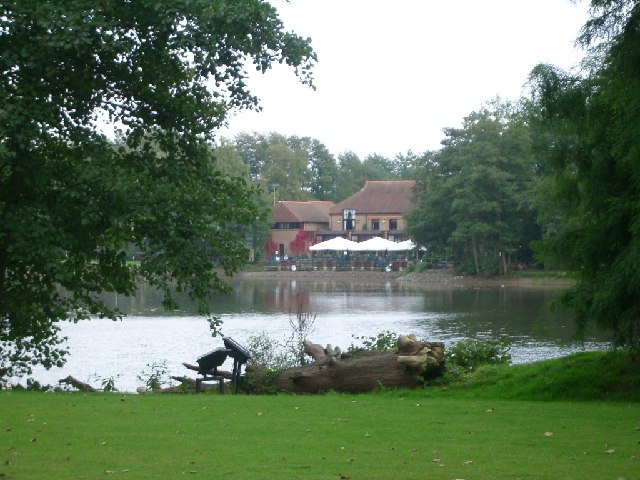
105:
85:
Commons is a freely licensed media file repository.
676:
Creative
Commons Attribution-ShareAlike 2.0 Generic
51:(640 × 480 pixels, file size: 123 KB, MIME type:
1129:Flash did not fire, compulsory flash suppression
389:The categories of this image should be checked.
360:https://creativecommons.org/licenses/by-sa/2.0
66:
366:Creative Commons Attribution-Share Alike 2.0
284:
8:
922:Template:Did you know nominations/Silvermere
326:– to copy, distribute and transmit the work
937:
854:
503:
484:
575:https://www.geograph.org.uk/profile/1142
111:Silvermere - geograph.org.uk - 64280.jpg
47:Silvermere_-_geograph.org.uk_-_64280.jpg
1214:
1204:
1194:
1184:
1176:
1168:
1158:
1150:
1142:
1132:
1122:
1112:
1104:
1094:
1086:
1078:
1067:
1059:
1051:
1043:
1033:
1025:
1017:
1009:
998:
990:
979:
969:
959:
949:
914:
830:
814:
796:https://www.geograph.org.uk/photo/64280
743:
727:
709:
693:
673:
657:
637:
621:
554:
538:
521:
518:
499:
492:
431:This image was uploaded as part of the
203:
224:View this and other nearby images on:
939:
419:The topic category from Geograph was
7:
271:and is licensed for reuse under the
843:
307:Attribution-Share Alike 2.0 Generic
295:
290:
275:Attribution-ShareAlike 2.0 license.
930:
512:
506:
281:
258:
115:
98:
44:
511:
992:Date and time of data generation
497:
382:
337:Under the following conditions:
302:This file is licensed under the
294:
289:
283:
251:
230:
216:
65:
21:
494:
116:
41:No higher resolution available.
14:
746:file available on the internet
493:
259:This image was taken from the
26:
1:
817:coordinates of depicted place
31:
766:Geograph Britain and Ireland
596:object of statement has role
519:Items portrayed in this file
1080:Date and time of digitizing
191:Andrew Longton /
172:Andrew Longton /
1236:
1170:Focal length in 35 mm film
351:same or compatible license
1045:File change date and time
844:
16:
832:51°20'11.4"N, 0°27'0.0"W
774:geograph.org.uk image ID
496:
414:this tool from mysociety
380:
379:
317:
121:Silvermere. looking east
72:This is a file from the
1144:Custom image processing
901:
410:this OpenStreetMap tool
163:required by the license
147:
136:
129:
126:
108:
76:. Information from its
1216:Subject distance range
1088:Image compression mode
1083:15:11, 11 October 2005
1048:15:11, 11 October 2005
995:15:11, 11 October 2005
880:18:50, 30 January 2010
265:this photograph's page
236:51.336500; -0.450000
79:description page there
1106:Maximum land aperture
1019:Horizontal resolution
433:Geograph batch upload
423:(find similar images
401:Remove this template
1053:Y and C positioning
1039:Optio S5n Ver 1.00
1027:Vertical resolution
945:PENTAX Corporation
941:Camera manufacturer
477:português do Brasil
332:– to adapt the work
1178:Scene capture type
1165:Auto white balance
583:author name string
406:this geonames tool
1223:
1222:
1109:2.8 APEX (f/2.64)
966:1/80 sec (0.0125)
955:PENTAX Optio S5n
905:
660:copyright license
505:
488:
435:
280:
279:
263:collection. See
241:
240:
198:
197:
166:
94:
93:
74:Wikimedia Commons
1227:
1061:Exposure Program
938:
892:
798:
793:
789:described at URL
783:
778:
768:
763:
624:copyright status
605:
600:
590:
587:
577:
572:
489:
430:
387:
386:
385:
373:
370:
367:
364:
361:
353:as the original.
315:
304:Creative Commons
298:
297:
293:
292:
287:
286:
273:Creative Commons
261:Geograph project
255:
248:
237:
234:
220:
219:
213:
212:
201:
160:
132:
120:
112:
106:
90:
69:
68:
62:
56:
54:
1235:
1234:
1230:
1229:
1228:
1226:
1225:
1224:
926:
913:
906:
898:
890:
846:
845:
842:
841:
840:
839:
838:
837:
836:
835:
833:
823:
822:
821:
819:
808:
807:
806:
805:
804:
803:
802:
801:
800:
799:
794:
791:
785:
784:
779:
776:
770:
769:
764:
761:
752:
751:
750:
748:
736:
735:
734:
732:
721:
720:
719:
718:
717:
716:
715:
714:
712:
711:11 October 2005
702:
701:
700:
698:
687:
686:
685:
684:
683:
682:
681:
680:
678:
666:
665:
664:
662:
651:
650:
649:
648:
647:
646:
645:
644:
642:
630:
629:
628:
626:
615:
614:
613:
612:
611:
610:
609:
608:
607:
606:
601:
598:
592:
591:
588:
585:
579:
578:
573:
570:
561:
560:
559:
557:
547:
546:
545:
543:
532:
531:
530:
529:
528:
526:
510:
509:
508:
491:
439:
436:
393:Check them now!
383:
381:
375:
374:
371:
368:
365:
362:
359:
358:
316:
313:
310:
299:
276:
246:
235:
208:
207:
204:Object location
199:
188:
181:
169:
142:geograph.org.uk
131:11 October 2005
122:
110:
103:
96:
95:
84:
83:
82:is shown below.
58:
52:
50:
43:
42:
12:
11:
5:
1233:
1231:
1221:
1220:
1217:
1213:
1212:
1209:
1203:
1202:
1199:
1193:
1192:
1189:
1183:
1182:
1179:
1175:
1174:
1171:
1167:
1166:
1163:
1157:
1156:
1153:
1149:
1148:
1147:Normal process
1145:
1141:
1140:
1137:
1131:
1130:
1127:
1121:
1120:
1117:
1111:
1110:
1107:
1103:
1102:
1099:
1093:
1092:
1089:
1085:
1084:
1081:
1077:
1076:
1073:
1066:
1065:
1064:Normal program
1062:
1058:
1057:
1054:
1050:
1049:
1046:
1042:
1041:
1036:
1032:
1031:
1028:
1024:
1023:
1020:
1016:
1015:
1012:
1008:
1007:
1004:
997:
996:
993:
989:
988:
985:
978:
977:
974:
968:
967:
964:
958:
957:
952:
948:
947:
942:
929:
925:
924:
919:
911:
910:
909:
904:
903:
900:
896:
893:
887:
882:
877:
873:
872:
869:
866:
863:
860:
857:
850:
849:
834:
831:
829:
828:
827:
826:
825:
824:
820:
815:
813:
812:
811:
810:
787:
786:
772:
771:
757:
756:
755:
754:
753:
749:
744:
742:
741:
740:
739:
738:
737:
733:
730:source of file
728:
726:
725:
724:
723:
722:
713:
710:
708:
707:
706:
705:
704:
703:
699:
694:
692:
691:
690:
689:
688:
679:
674:
672:
671:
670:
669:
668:
667:
663:
658:
656:
655:
654:
653:
652:
643:
638:
636:
635:
634:
633:
632:
631:
627:
622:
620:
619:
618:
617:
616:
594:
593:
589:Andrew Longton
581:
580:
566:
565:
564:
563:
562:
558:
555:
553:
552:
551:
550:
549:
548:
544:
539:
537:
536:
535:
534:
533:
527:
522:
520:
517:
516:
515:
514:
513:
502:
501:
498:
495:
429:
428:
417:
402:
399:
357:
356:
355:
354:
344:
335:
334:
333:
327:
320:You are free:
314:Andrew Longton
311:
301:
300:
282:
278:
277:
269:Andrew Longton
256:
245:
242:
239:
238:
228:
222:
205:
196:
195:
189:
186:
183:
182:
177:
170:
167:
155:
154:
152:Andrew Longton
149:
145:
144:
138:
134:
133:
128:
124:
123:
113:
104:
102:
99:
97:
92:
91:
70:
60:
59:
40:
36:
35:
34:
29:
24:
19:
13:
10:
9:
6:
4:
3:
2:
1232:
1218:
1215:
1210:
1208:
1205:
1200:
1198:
1195:
1190:
1188:
1185:
1180:
1177:
1172:
1169:
1164:
1162:
1161:White balance
1159:
1155:Auto exposure
1154:
1152:Exposure mode
1151:
1146:
1143:
1138:
1136:
1133:
1128:
1126:
1123:
1118:
1116:
1115:Metering mode
1113:
1108:
1105:
1100:
1098:
1097:Exposure bias
1095:
1090:
1087:
1082:
1079:
1074:
1071:
1068:
1063:
1060:
1055:
1052:
1047:
1044:
1040:
1037:
1035:Software used
1034:
1029:
1026:
1021:
1018:
1013:
1010:
1005:
1003:
999:
994:
991:
986:
983:
980:
975:
973:
970:
965:
963:
962:Exposure time
960:
956:
953:
950:
946:
943:
940:
936:
933:
927:
923:
920:
918:
915:
907:
899:
894:
888:
886:
883:
881:
878:
875:
874:
870:
867:
864:
861:
858:
856:
855:
853:
847:
818:
797:
790:
782:
775:
767:
760:
747:
731:
697:
677:
661:
641:
625:
604:
597:
584:
576:
569:
542:
525:
490:
487:
482:
478:
474:
470:
466:
462:
458:
454:
450:
446:
442:
437:
434:
426:
422:
418:
415:
411:
407:
403:
400:
397:
396:
395:
394:
390:
378:
377:
363:CC BY-SA 2.0
352:
348:
345:
342:
339:
338:
336:
331:
328:
325:
322:
321:
319:
318:
312:Attribution:
308:
305:
288:
274:
270:
266:
262:
257:
254:
250:
249:
243:
233:
229:
227:
226:OpenStreetMap
223:
221:
211:
206:
202:
194:
190:
185:
184:
180:
176: /
175:
171:
164:
159:
157:
156:
153:
150:
146:
143:
139:
135:
125:
119:
114:
107:
100:
88:
81:
80:
75:
71:
64:
63:
57:
48:
39:
33:
30:
28:
25:
23:
20:
18:
15:
1219:Distant view
1002:focal length
951:Camera model
934:
931:
851:
848:File history
603:photographer
438:
420:
391:
388:
376:
346:
340:
329:
323:
268:
192:
179:CC BY-SA 2.0
173:
117:
87:You can help
77:
45:
22:File history
1135:Color space
1011:Orientation
897:GeographBot
640:copyrighted
425:at Geograph
347:share alike
341:attribution
158:Attribution
109:Description
1197:Saturation
917:Silvermere
908:File usage
889:640 × 480
865:Dimensions
556:some value
465:македонски
193:Silvermere
174:Silvermere
53:image/jpeg
27:File usage
1207:Sharpness
982:ISO speed
862:Thumbnail
859:Date/Time
696:inception
473:português
244:Licensing
187:InfoField
168:InfoField
118:English:
1187:Contrast
1181:Standard
1056:Centered
972:F-number
928:Metadata
891:(123 KB)
759:operator
500:Captions
483: |
479: |
475: |
471: |
467: |
463: |
459: |
455: |
451: |
449:français
447: |
443: |
330:to remix
324:to share
309:license.
32:Metadata
1119:Pattern
1072:version
1006:14.6 mm
876:current
871:Comment
541:creator
524:depicts
504:English
441:English
101:Summary
49:
1211:Normal
1201:Normal
1191:Normal
1030:72 dpi
1022:72 dpi
1014:Normal
984:rating
481:Türkçe
469:മലയാളം
461:magyar
453:galego
214:
148:Author
137:Source
1173:88 mm
1125:Flash
1091:3.125
1000:Lens
976:f/4.4
781:64280
457:עברית
445:suomi
140:From
1139:sRGB
1070:Exif
868:User
421:Lake
408:and
372:true
369:true
127:Date
17:File
1075:2.2
987:100
568:URL
486:+/−
792::
777::
762::
599::
586::
571::
1101:0
427:)
416:.
165:)
161:(
89:.
55:)
Text is available under the Creative Commons Attribution-ShareAlike License. Additional terms may apply.
_&language=en)
