329:
262:
254:
276:
297:
335:
340:
87:
741:"}},"text\/plain":{"en":{"":"heading"}}},"{\"value\":{\"amount\":\"+270\",\"unit\":\"http:\\\/\\\/www.wikidata.org\\\/entity\\\/Q28390\"},\"type\":\"quantity\"}":{"text\/html":{"en":{"P7787":"270
737:
877:
387:– You must give appropriate credit, provide a link to the license, and indicate if changes were made. You may do so in any reasonable manner, but not in any way that suggests the licensor endorses you or your use.
245:
738:
894:== {{int:filedesc}} == {{Information |Description={{en|1=Single yellow line in Wilkinson Street}} |Source=From |Date=2012-04-04 |Author= |P...
182:
639:
603:
567:
269:
659:
304:
944:
This file contains additional information, probably added from the digital camera or scanner used to create or digitize it.
394:
53:
47:
502:
98:
808:
779:
752:
667:
623:
551:
523:
510:
495:
66:
710:
682:
652:
587:
468:
451:
913:
291:
350:
947:
If the file has been modified from its original state, some details may not fully reflect the modified file.
931:
393:– If you remix, transform, or build upon the material, you must distribute your contributions under the
311:
on the
Geograph website for the photographer's contact details. The copyright on this image is owned by
347:
904:
The following pages on the
English Knowledge use this file (pages on other projects are not listed):
745:"}},"text\/plain":{"en":{"P7787":"270 degree"}}}}": -->
887:
106:
214:
908:
689:
674:
530:
198:
876:
871:
57:
42:
275:
316:
93:
961:
259:
150:
171:
161:
296:
308:
844:
Click on a date/time to view the file as it appeared at that time.
261:
246:
53° 22′ 45.44″ N, 1° 29′ 13.93″ W
236:
81:
435:
Add a one-line explanation of what this file represents
189:
Creative
Commons Attribution Share-alike license 2.0
125:
105:
Commons is a freely licensed media file repository.
604:
Creative
Commons Attribution-ShareAlike 2.0 Generic
71:(480 × 640 pixels, file size: 85 KB, MIME type:
404:https://creativecommons.org/licenses/by-sa/2.0
86:
410:Creative Commons Attribution-Share Alike 2.0
328:
8:
742:
370:– to copy, distribute and transmit the work
949:
846:
431:
924:The following other wikis use this file:
690:https://www.geograph.org.uk/photo/3052269
531:https://www.geograph.org.uk/profile/17822
959:
951:
906:
822:
806:
766:
750:
724:
708:
637:
621:
601:
585:
565:
549:
482:
466:
449:
446:
427:
420:
239:
268:View this and other nearby images on:
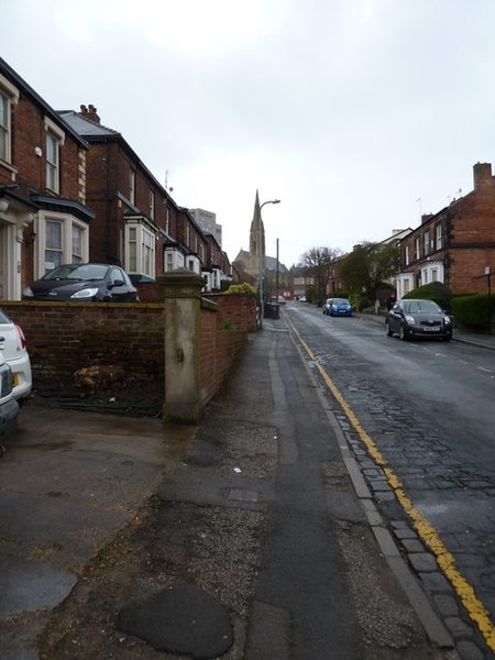
229:Single yellow line in Wilkinson Street
210:Single yellow line in Wilkinson Street
141:Single yellow line in Wilkinson Street
7:
315:and is licensed for reuse under the
835:
351:Attribution-Share Alike 2.0 Generic
339:
334:
319:Attribution-ShareAlike 2.0 license.
942:
440:
434:
325:
302:
135:
118:
64:
439:
753:coordinates of the point of view
425:
381:Under the following conditions:
346:This file is licensed under the
338:
333:
327:
295:
274:
260:
252:
85:
31:
21:
422:
136:
14:
928:Usage on zh-yue.wikipedia.org
640:file available on the internet
421:
303:This image was taken from the
26:
1:
768:53°22'45.444"N, 1°29'13.927"W
36:
660:Geograph Britain and Ireland
496:object of statement has role
447:Items portrayed in this file
251:
983:
914:Yellow line (road marking)
395:same or compatible license
836:
16:
668:geograph.org.uk image ID
424:
361:
227:Basher Eyre /
208:Basher Eyre /
92:This is a file from the
893:
199:required by the license
177:
167:
156:
149:
146:
128:
96:. Information from its
309:this photograph's page
280:53.379290; -1.487202
131:Single yellow line.jpg
99:description page there
46:Size of this preview:
872:08:30, 7 August 2013
376:– to adapt the work
52:Other resolutions:
511:author name string
970:
969:
920:Global file usage
909:Slough experiment
897:
744:
588:copyright license
433:
324:
323:
307:collection. See
285:
284:
234:
233:
202:
186:
183:Reusing this file
114:
113:
94:Wikimedia Commons
32:Global file usage
974:
950:
884:
790:
789:
784:
692:
687:
683:described at URL
677:
672:
662:
657:
552:copyright status
533:
528:
518:
515:
505:
500:
417:
414:
411:
408:
405:
397:as the original.
359:
348:Creative Commons
342:
341:
337:
336:
331:
330:
317:Creative Commons
305:Geograph project
299:
292:
281:
278:
264:
263:
257:
256:
255:
249:
248:
237:
196:
180:
152:
140:
132:
126:
110:
89:
88:
82:
76:
74:
61:
58:480 × 640 pixels
54:180 × 240 pixels
48:450 × 600 pixels
982:
981:
977:
976:
975:
973:
972:
971:
938:
918:
905:
898:
890:
882:
838:
837:
834:
833:
832:
831:
830:
829:
828:
827:
825:
815:
814:
813:
811:
800:
799:
798:
797:
796:
795:
794:
793:
792:
791:
787:
785:
782:
773:
772:
771:
769:
759:
758:
757:
755:
736:
735:
734:
733:
732:
731:
730:
729:
727:
717:
716:
715:
713:
702:
701:
700:
699:
698:
697:
696:
695:
694:
693:
688:
685:
679:
678:
673:
670:
664:
663:
658:
655:
646:
645:
644:
642:
630:
629:
628:
626:
615:
614:
613:
612:
611:
610:
609:
608:
606:
594:
593:
592:
590:
579:
578:
577:
576:
575:
574:
573:
572:
570:
558:
557:
556:
554:
543:
542:
541:
540:
539:
538:
537:
536:
535:
534:
529:
526:
520:
519:
516:
513:
507:
506:
501:
498:
489:
488:
487:
485:
475:
474:
473:
471:
460:
459:
458:
457:
456:
454:
438:
437:
436:
419:
418:
415:
412:
409:
406:
403:
402:
360:
357:
354:
343:
320:
290:
279:
253:
244:
243:
240:Camera location
235:
224:
217:
205:
162:geograph.org.uk
142:
130:
123:
116:
115:
104:
103:
102:is shown below.
78:
72:
70:
63:
62:
51:
12:
11:
5:
980:
978:
968:
967:
964:
958:
957:
954:
941:
937:
936:
935:
934:
922:
921:
917:
916:
911:
903:
902:
901:
896:
895:
892:
888:
885:
879:
874:
869:
865:
864:
861:
858:
855:
852:
849:
842:
841:
826:
823:
821:
820:
819:
818:
817:
816:
812:
807:
805:
804:
803:
802:
801:
778:
777:
776:
775:
774:
770:
767:
765:
764:
763:
762:
761:
760:
756:
751:
749:
748:
747:
746:
740:
728:
725:
723:
722:
721:
720:
719:
718:
714:
709:
707:
706:
705:
704:
703:
681:
680:
666:
665:
651:
650:
649:
648:
647:
643:
638:
636:
635:
634:
633:
632:
631:
627:
624:source of file
622:
620:
619:
618:
617:
616:
607:
602:
600:
599:
598:
597:
596:
595:
591:
586:
584:
583:
582:
581:
580:
571:
566:
564:
563:
562:
561:
560:
559:
555:
550:
548:
547:
546:
545:
544:
522:
521:
509:
508:
494:
493:
492:
491:
490:
486:
483:
481:
480:
479:
478:
477:
476:
472:
467:
465:
464:
463:
462:
461:
455:
450:
448:
445:
444:
443:
442:
441:
430:
429:
426:
423:
401:
400:
399:
398:
388:
379:
378:
377:
371:
364:You are free:
355:
345:
344:
326:
322:
321:
300:
289:
286:
283:
282:
272:
266:
241:
232:
231:
225:
222:
219:
218:
213:
206:
203:
191:
190:
187:
175:
174:
169:
165:
164:
158:
154:
153:
148:
144:
143:
133:
124:
122:
119:
117:
112:
111:
90:
80:
79:
45:
41:
40:
39:
34:
29:
24:
19:
13:
10:
9:
6:
4:
3:
2:
979:
965:
963:
960:
955:
952:
948:
945:
939:
933:
930:
929:
927:
926:
925:
919:
915:
912:
910:
907:
899:
891:
889:Rcsprinter123
886:
880:
878:
875:
873:
870:
867:
866:
862:
859:
856:
853:
850:
848:
847:
845:
839:
810:
781:
754:
712:
691:
684:
676:
669:
661:
654:
641:
625:
605:
589:
569:
553:
532:
525:
512:
504:
497:
470:
453:
407:CC BY-SA 2.0
396:
392:
389:
386:
383:
382:
380:
375:
372:
369:
366:
365:
363:
362:
356:Attribution:
352:
349:
332:
318:
314:
310:
306:
301:
298:
294:
293:
287:
277:
273:
271:
270:OpenStreetMap
267:
265:
247:
242:
238:
230:
226:
221:
220:
216:
212: /
211:
207:
200:
195:
193:
192:
188:
184:
179:
176:
173:
170:
166:
163:
159:
155:
145:
139:
134:
127:
120:
108:
101:
100:
95:
91:
84:
83:
77:
68:
67:Original file
59:
55:
49:
44:
38:
35:
33:
30:
28:
25:
23:
20:
18:
15:
946:
943:
923:
843:
840:File history
726:4 April 2012
503:photographer
390:
384:
373:
367:
312:
250:
228:
215:CC BY-SA 2.0
209:
151:4 April 2012
137:
107:You can help
97:
65:
22:File history
962:Color space
953:Orientation
568:copyrighted
517:Basher Eyre
391:share alike
385:attribution
358:Basher Eyre
313:Basher Eyre
194:Attribution
172:Basher Eyre
129:Description
900:File usage
881:480 × 640
857:Dimensions
824:image/jpeg
809:media type
484:some value
178:Permission
73:image/jpeg
27:File usage
932:黃綫 (道路標記)
854:Thumbnail
851:Date/Time
711:inception
288:Licensing
223:InfoField
204:InfoField
138:English:
940:Metadata
653:operator
428:Captions
374:to remix
368:to share
353:license.
37:Metadata
883:(85 KB)
868:current
863:Comment
780:heading
739:heading
675:3052269
469:creator
452:depicts
432:English
121:Summary
69:
956:Normal
788:degree
743:degree
258:
168:Author
157:Source
160:From
966:sRGB
860:User
786:270
416:true
413:true
147:Date
17:File
524:URL
783::
686::
671::
656::
527::
514::
499::
56:|
50:.
201:)
197:(
185:)
181:(
109:.
75:)
60:.
Text is available under the Creative Commons Attribution-ShareAlike License. Additional terms may apply.

