278:
398:
390:
412:
33:
246:
284:
289:
81:
743:"}},"text\/plain":{"en":{"":"heading"}}},"{\"value\":{\"amount\":\"+180\",\"unit\":\"http:\\\/\\\/www.wikidata.org\\\/entity\\\/Q28390\"},\"type\":\"quantity\"}":{"text\/html":{"en":{"P7787":"180
909:
739:
139:
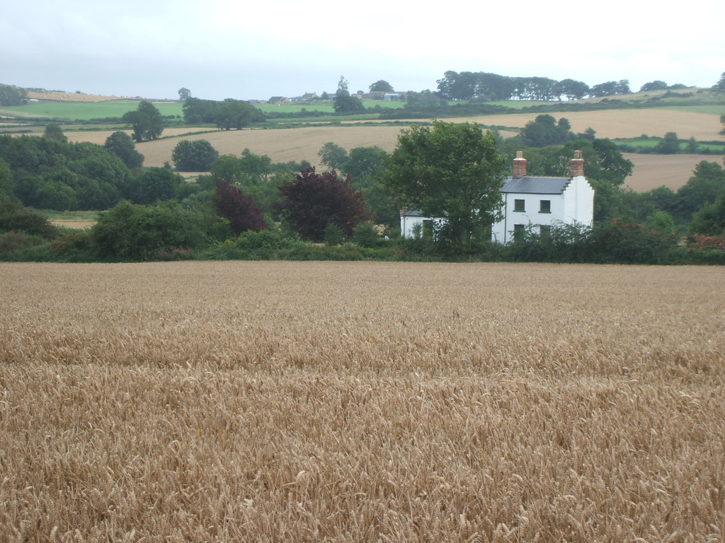
Opened in 1855 by the Bedale & Leyburn
Railway as an extension of the line from Northallerton. Closed in 1954, and although the Wensleydale Railway now runs through the site, the station remained closed at the time this image was taken. View south from the main
381:
336:– You must give appropriate credit, provide a link to the license, and indicate if changes were made. You may do so in any reasonable manner, but not in any way that suggests the licensor endorses you or your use.
47:
43:
37:
60:
92:
740:
908:
903:
181:
641:
605:
569:
405:
661:
253:
343:
878:
873:
504:
51:
32:
810:
781:
754:
669:
625:
553:
525:
512:
497:
712:
684:
654:
589:
470:
453:
240:
299:
936:
The following pages on the
English Knowledge (XXG) use this file (pages on other projects are not listed):
342:– If you remix, transform, or build upon the material, you must distribute your contributions under the
260:
on the
Geograph website for the photographer's contact details. The copyright on this image is owned by
296:
747:"}},"text\/plain":{"en":{"P7787":"180 degree"}}}}": -->
919:
100:
213:
691:
676:
532:
197:
411:
265:
87:
940:
395:
149:
889:
170:
160:
245:
257:
846:
Click on a date/time to view the file as it appeared at that time.
397:
382:
54° 18′ 27.22″ N, 1° 46′ 47.59″ W
372:
75:
437:
Add a one-line explanation of what this file represents
188:
Creative
Commons Attribution Share-alike license 2.0
119:
99:
Commons is a freely licensed media file repository.
606:
Creative
Commons Attribution-ShareAlike 2.0 Generic
65:(1,024 × 768 pixels, file size: 209 KB, MIME type:
125:Spennithorne railway station (site), Yorkshire.jpg
353:https://creativecommons.org/licenses/by-sa/2.0
228:Spennithorne railway station (site), Yorkshire
209:Spennithorne railway station (site), Yorkshire
136:Spennithorne railway station (site), Yorkshire
80:
359:Creative Commons Attribution-Share Alike 2.0
277:
8:
744:
319:– to copy, distribute and transmit the work
848:
433:
692:https://www.geograph.org.uk/photo/3268020
533:https://www.geograph.org.uk/profile/84225
896:Higher-resolution version from Geograph.
938:
824:
808:
768:
752:
726:
710:
639:
623:
603:
587:
567:
551:
484:
468:
451:
448:
429:
422:
375:
404:View this and other nearby images on:
7:
264:and is licensed for reuse under the
926:User created page with UploadWizard
837:
300:Attribution-Share Alike 2.0 Generic
288:
283:
268:Attribution-ShareAlike 2.0 license.
442:
436:
274:
251:
129:
112:
58:
441:
755:coordinates of the point of view
427:
410:
396:
388:
330:Under the following conditions:
295:This file is licensed under the
287:
282:
276:
244:
79:
21:
424:
130:
14:
642:file available on the internet
423:
252:This image was taken from the
26:
1:
770:54°18'27.216"N, 1°46'47.590"W
662:Geograph Britain and Ireland
498:object of statement has role
449:Items portrayed in this file
387:
226:Nigel Thompson /
207:Nigel Thompson /
957:
344:same or compatible license
838:
16:
670:geograph.org.uk image ID
426:
310:
86:This is a file from the
925:
895:
198:required by the license
176:
166:
155:
148:
145:
122:
90:. Information from its
416:54.307560; -1.779886
258:this photograph's page
93:description page there
36:Size of this preview:
904:16:25, 16 April 2013
874:22:35, 13 July 2017
325:– to adapt the work
42:Other resolutions:
513:author name string
52:1,024 × 768 pixels
929:
746:
590:copyright license
435:
421:
420:
273:
272:
256:collection. See
233:
232:
201:
185:
182:Reusing this file
108:
107:
88:Wikimedia Commons
948:
916:
886:
792:
791:
786:
694:
689:
685:described at URL
679:
674:
664:
659:
554:copyright status
535:
530:
520:
517:
507:
502:
417:
414:
400:
399:
393:
392:
391:
385:
384:
373:
366:
363:
360:
357:
354:
346:as the original.
308:
297:Creative Commons
291:
290:
286:
285:
280:
279:
266:Creative Commons
254:Geograph project
248:
241:
195:
179:
151:
134:
126:
120:
104:
83:
82:
76:
70:
68:
55:
48:640 × 480 pixels
44:320 × 240 pixels
38:800 × 600 pixels
956:
955:
951:
950:
949:
947:
946:
945:
937:
930:
922:
914:
892:
884:
840:
839:
836:
835:
834:
833:
832:
831:
830:
829:
827:
817:
816:
815:
813:
802:
801:
800:
799:
798:
797:
796:
795:
794:
793:
789:
787:
784:
775:
774:
773:
771:
761:
760:
759:
757:
738:
737:
736:
735:
734:
733:
732:
731:
729:
719:
718:
717:
715:
704:
703:
702:
701:
700:
699:
698:
697:
696:
695:
690:
687:
681:
680:
675:
672:
666:
665:
660:
657:
648:
647:
646:
644:
632:
631:
630:
628:
617:
616:
615:
614:
613:
612:
611:
610:
608:
596:
595:
594:
592:
581:
580:
579:
578:
577:
576:
575:
574:
572:
560:
559:
558:
556:
545:
544:
543:
542:
541:
540:
539:
538:
537:
536:
531:
528:
522:
521:
518:
515:
509:
508:
503:
500:
491:
490:
489:
487:
477:
476:
475:
473:
462:
461:
460:
459:
458:
456:
440:
439:
438:
415:
389:
380:
379:
376:Camera location
368:
367:
364:
361:
358:
355:
352:
351:
309:
306:
303:
292:
269:
239:
234:
223:
216:
204:
161:geograph.org.uk
141:
124:
117:
110:
109:
98:
97:
96:is shown below.
72:
66:
64:
57:
56:
41:
12:
11:
5:
954:
952:
944:
943:
935:
934:
933:
928:
927:
924:
920:
917:
911:
906:
901:
898:
897:
894:
890:
887:
881:
876:
871:
867:
866:
863:
860:
857:
854:
851:
844:
843:
828:
825:
823:
822:
821:
820:
819:
818:
814:
809:
807:
806:
805:
804:
803:
780:
779:
778:
777:
776:
772:
769:
767:
766:
765:
764:
763:
762:
758:
753:
751:
750:
749:
748:
742:
730:
728:25 August 2008
727:
725:
724:
723:
722:
721:
720:
716:
711:
709:
708:
707:
706:
705:
683:
682:
668:
667:
653:
652:
651:
650:
649:
645:
640:
638:
637:
636:
635:
634:
633:
629:
626:source of file
624:
622:
621:
620:
619:
618:
609:
604:
602:
601:
600:
599:
598:
597:
593:
588:
586:
585:
584:
583:
582:
573:
568:
566:
565:
564:
563:
562:
561:
557:
552:
550:
549:
548:
547:
546:
524:
523:
519:Nigel Thompson
511:
510:
496:
495:
494:
493:
492:
488:
485:
483:
482:
481:
480:
479:
478:
474:
469:
467:
466:
465:
464:
463:
457:
452:
450:
447:
446:
445:
444:
443:
432:
431:
428:
425:
419:
418:
408:
402:
377:
350:
349:
348:
347:
337:
328:
327:
326:
320:
313:You are free:
307:Nigel Thompson
304:
294:
293:
275:
271:
270:
262:Nigel Thompson
249:
238:
235:
231:
230:
224:
221:
218:
217:
212:
205:
202:
190:
189:
186:
174:
173:
171:Nigel Thompson
168:
164:
163:
157:
153:
152:
150:25 August 2008
147:
143:
142:
127:
118:
116:
113:
111:
106:
105:
84:
74:
73:
35:
31:
30:
29:
24:
19:
13:
10:
9:
6:
4:
3:
2:
953:
942:
939:
931:
923:
918:
912:
910:
907:
905:
902:
900:
899:
893:
888:
882:
880:
877:
875:
872:
869:
868:
864:
861:
858:
855:
852:
850:
849:
847:
841:
812:
783:
756:
714:
693:
686:
678:
671:
663:
656:
643:
627:
607:
591:
571:
555:
534:
527:
514:
506:
499:
472:
455:
413:
409:
407:
406:OpenStreetMap
403:
401:
383:
378:
374:
371:
370:
356:CC BY-SA 2.0
345:
341:
338:
335:
332:
331:
329:
324:
321:
318:
315:
314:
312:
311:
305:Attribution:
301:
298:
281:
267:
263:
259:
255:
250:
247:
243:
242:
236:
229:
225:
220:
219:
215:
211: /
210:
206:
199:
194:
192:
191:
187:
183:
178:
175:
172:
169:
165:
162:
158:
154:
144:
138:
137:
133:
128:
121:
114:
102:
95:
94:
89:
85:
78:
77:
71:
62:
61:Original file
53:
49:
45:
39:
34:
28:
25:
23:
20:
18:
15:
941:Spennithorne
883:1,024 × 768
845:
842:File history
505:photographer
386:
369:
339:
333:
322:
316:
261:
227:
214:CC BY-SA 2.0
208:
135:
131:
101:You can help
91:
59:
22:File history
570:copyrighted
340:share alike
334:attribution
193:Attribution
123:Description
932:File usage
913:640 × 480
859:Dimensions
826:image/jpeg
811:media type
486:some value
177:Permission
67:image/jpeg
27:File usage
856:Thumbnail
853:Date/Time
713:inception
237:Licensing
222:InfoField
203:InfoField
132:English:
921:Cgirdler
885:(209 KB)
655:operator
430:Captions
323:to remix
317:to share
302:license.
915:(85 KB)
870:current
865:Comment
782:heading
741:heading
677:3268020
471:creator
454:depicts
434:English
115:Summary
63:
790:degree
745:degree
394:
167:Author
156:Source
891:Bjh21
159:From
140:road.
862:User
788:180
365:true
362:true
146:Date
17:File
526:URL
785::
688::
673::
658::
529::
516::
501::
50:|
46:|
40:.
200:)
196:(
184:)
180:(
103:.
69:)
54:.
Text is available under the Creative Commons Attribution-ShareAlike License. Additional terms may apply.
,_Yorkshire.jpg)

,_Yorkshire.jpg¶ms=054.307560_N_-001.779886_E_globe:Earth_type:camera_heading:180.00&language=en)