370:
303:
253:
295:
245:
317:
267:
338:
376:
381:
72:
1037:
901:"}},"text\/plain":{"en":{"":"heading"}}},"{\"value\":{\"amount\":\"+315\",\"unit\":\"http:\\\/\\\/www.wikidata.org\\\/entity\\\/Q28390\"},\"type\":\"quantity\"}":{"text\/html":{"en":{"P7787":"315
767:"}},"text\/plain":{"en":{"":"heading"}}},"{\"value\":{\"amount\":\"+315\",\"unit\":\"http:\\\/\\\/www.wikidata.org\\\/entity\\\/Q28390\"},\"type\":\"quantity\"}":{"text\/html":{"en":{"P7787":"315
897:
43:
236:
51:
83:
428:– You must give appropriate credit, provide a link to the license, and indicate if changes were made. You may do so in any reasonable manner, but not in any way that suggests the licensor endorses you or your use.
1054:== {{int:filedesc}} == {{Information |description={{en|1=St.Andrew's church, Potterhanworth, Lincs gleaming in the afternoon sun}} |date=2010-03-07 |source=From |author=[http://www.geograph.org.uk
898:
764:
1036:
1031:
42:
699:
663:
627:
508:
310:
260:
884:
749:
345:
1179:
This file contains additional information, probably added from the digital camera or scanner used to create or digitize it.
435:
562:
968:
939:
912:
868:
805:
778:
712:
683:
611:
585:
570:
555:
834:
742:
727:
647:
528:
492:
332:
391:
1182:
If the file has been modified from its original state, some details may not fully reflect the modified file.
1064:
The following pages on the
English Knowledge (XXG) use this file (pages on other projects are not listed):
1116:
434:– If you remix, transform, or build upon the material, you must distribute your contributions under the
352:
on the
Geograph website for the photographer's contact details. The copyright on this image is owned by
1047:
388:
115:
905:"}},"text\/plain":{"en":{"P7787":"315 degree"}}}}": -->
771:"}},"text\/plain":{"en":{"P7787":"315 degree"}}}}": -->
91:
205:
110:
734:
719:
577:
189:
1068:
316:
266:
357:
78:
148:
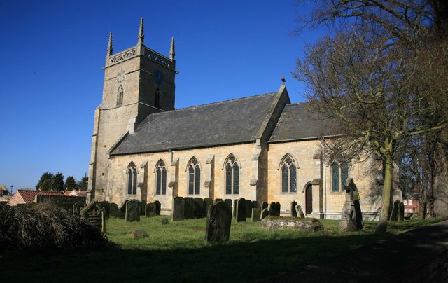
St Andrew's parish church, Potterhanworth, Lincolnshire, seen from the southeast
157:
250:
300:
52:
St.Andrew's_church,_Potterhanworth,_Lincs_-_geograph.org.uk_-_1741448.jpg
178:
168:
337:
138:
St.Andrew's church, Potterhanworth, Lincs - geograph.org.uk - 1741448.jpg
349:
1004:
Click on a date/time to view the file as it appeared at that time.
302:
252:
277:
227:
66:
1086:
1146:
1156:
1136:
1126:
1106:
1096:
287:
53° 10′ 54″ N, 0° 25′ 24″ W
237:
53° 10′ 52″ N, 0° 25′ 21″ W
476:
Add a one-line explanation of what this file represents
1166:
132:
104:
90:
Commons is a freely licensed media file repository.
664:
Creative
Commons Attribution-ShareAlike 2.0 Generic
56:(640 × 404 pixels, file size: 66 KB, MIME type:
445:https://creativecommons.org/licenses/by-sa/2.0
71:
451:Creative Commons Attribution-Share Alike 2.0
369:
8:
902:
768:
411:– to copy, distribute and transmit the work
1184:
1006:
472:
1079:The following other wikis use this file:
735:https://www.geograph.org.uk/photo/1741448
578:https://www.geograph.org.uk/profile/23895
220:St.Andrew's church, Potterhanworth, Lincs
201:St.Andrew's church, Potterhanworth, Lincs
1186:
1066:
982:
966:
926:
910:
882:
866:
848:
832:
792:
776:
697:
681:
661:
645:
625:
609:
542:
526:
506:
490:
487:
468:
461:
280:
230:
309:View this and other nearby images on:
259:View this and other nearby images on:
7:
356:and is licensed for reuse under the
995:
392:Attribution-Share Alike 2.0 Generic
380:
375:
360:Attribution-ShareAlike 2.0 license.
1177:
481:
475:
366:
343:
142:
108:
103:
49:
480:
779:coordinates of the point of view
466:
422:Under the following conditions:
387:This file is licensed under the
379:
374:
368:
336:
315:
301:
293:
265:
251:
243:
70:
31:
21:
463:
143:
46:No higher resolution available.
14:
700:file available on the internet
462:
344:This image was taken from the
26:
1:
913:coordinates of depicted place
36:
750:Geograph Britain and Ireland
556:object of statement has role
488:Items portrayed in this file
292:
242:
1143:Usage on lld.wikipedia.org
1083:Usage on ceb.wikipedia.org
928:53°10'53.76"N, 0°25'23.52"W
794:53°10'52.43"N, 0°25'21.36"W
1208:
1163:Usage on www.wikidata.org
1153:Usage on tr.wikipedia.org
1133:Usage on it.wikipedia.org
1123:Usage on fr.wikipedia.org
1113:Usage on fa.wikipedia.org
1103:Usage on es.wikipedia.org
1093:Usage on cy.wikipedia.org
436:same or compatible license
996:
16:
713:geograph.org.uk image ID
465:
402:
218:roger geach /
199:roger geach /
77:This is a file from the
1053:
190:required by the license
174:
163:
156:
153:
135:
81:. Information from its
350:this photograph's page
321:53.181600; -0.423200
271:53.181230; -0.422600
84:description page there
869:location of creation
1032:20:11, 5 March 2011
509:Church of St Andrew
417:– to adapt the work
109:This is a photo of
586:author name string
1195:
1194:
1075:Global file usage
1057:
904:
770:
648:copyright license
474:
365:
364:
348:collection. See
326:
325:
276:
275:
225:
224:
193:
125:
124:
99:
98:
79:Wikimedia Commons
32:Global file usage
1199:
1185:
1044:
950:
949:
944:
816:
815:
810:
752:
747:
737:
732:
728:described at URL
722:
717:
612:copyright status
593:
590:
580:
575:
565:
560:
458:
455:
452:
449:
446:
438:as the original.
400:
389:Creative Commons
383:
382:
378:
377:
372:
371:
358:Creative Commons
346:Geograph project
340:
333:
322:
319:
305:
304:
298:
297:
296:
290:
289:
278:
272:
269:
255:
254:
248:
247:
246:
240:
239:
228:
187:
159:
147:
139:
133:
118:
105:
95:
74:
73:
67:
61:
59:
1207:
1206:
1202:
1201:
1200:
1198:
1197:
1196:
1173:
1087:Potter Hanworth
1073:
1065:
1058:
1050:
1042:
998:
997:
994:
993:
992:
991:
990:
989:
988:
987:
985:
975:
974:
973:
971:
960:
959:
958:
957:
956:
955:
954:
953:
952:
951:
947:
945:
942:
933:
932:
931:
929:
919:
918:
917:
915:
896:
895:
894:
893:
892:
891:
890:
889:
887:
875:
874:
873:
871:
860:
859:
858:
857:
856:
855:
854:
853:
851:
841:
840:
839:
837:
826:
825:
824:
823:
822:
821:
820:
819:
818:
817:
813:
811:
808:
799:
798:
797:
795:
785:
784:
783:
781:
762:
761:
760:
759:
758:
757:
756:
755:
754:
753:
748:
745:
739:
738:
733:
730:
724:
723:
718:
715:
706:
705:
704:
702:
690:
689:
688:
686:
675:
674:
673:
672:
671:
670:
669:
668:
666:
654:
653:
652:
650:
639:
638:
637:
636:
635:
634:
633:
632:
630:
618:
617:
616:
614:
603:
602:
601:
600:
599:
598:
597:
596:
595:
594:
591:
588:
582:
581:
576:
573:
567:
566:
561:
558:
549:
548:
547:
545:
535:
534:
533:
531:
520:
519:
518:
517:
516:
515:
514:
513:
511:
499:
498:
497:
495:
479:
478:
477:
460:
459:
456:
453:
450:
447:
444:
443:
401:
398:
395:
384:
361:
331:
320:
294:
285:
284:
281:Object location
270:
244:
235:
234:
231:Camera location
226:
215:
208:
196:
169:geograph.org.uk
149:
137:
130:
120:
114:
111:listed building
101:
100:
89:
88:
87:is shown below.
63:
57:
55:
48:
47:
12:
11:
5:
1205:
1203:
1193:
1192:
1189:
1176:
1172:
1171:
1170:
1169:
1161:
1160:
1159:
1157:Potterhanworth
1151:
1150:
1149:
1147:Potterhanworth
1141:
1140:
1139:
1137:Potterhanworth
1131:
1130:
1129:
1127:Potterhanworth
1121:
1120:
1119:
1111:
1110:
1109:
1107:Potterhanworth
1101:
1100:
1099:
1097:Potterhanworth
1091:
1090:
1089:
1077:
1076:
1072:
1071:
1069:Potterhanworth
1063:
1062:
1061:
1056:
1055:
1052:
1048:
1045:
1039:
1034:
1029:
1025:
1024:
1021:
1018:
1015:
1012:
1009:
1002:
1001:
986:
983:
981:
980:
979:
978:
977:
976:
972:
967:
965:
964:
963:
962:
961:
938:
937:
936:
935:
934:
930:
927:
925:
924:
923:
922:
921:
920:
916:
911:
909:
908:
907:
906:
900:
888:
885:Potterhanworth
883:
881:
880:
879:
878:
877:
876:
872:
867:
865:
864:
863:
862:
861:
852:
849:
847:
846:
845:
844:
843:
842:
838:
833:
831:
830:
829:
828:
827:
804:
803:
802:
801:
800:
796:
793:
791:
790:
789:
788:
787:
786:
782:
777:
775:
774:
773:
772:
766:
741:
740:
726:
725:
711:
710:
709:
708:
707:
703:
698:
696:
695:
694:
693:
692:
691:
687:
684:source of file
682:
680:
679:
678:
677:
676:
667:
662:
660:
659:
658:
657:
656:
655:
651:
646:
644:
643:
642:
641:
640:
631:
626:
624:
623:
622:
621:
620:
619:
615:
610:
608:
607:
606:
605:
604:
584:
583:
569:
568:
554:
553:
552:
551:
550:
546:
543:
541:
540:
539:
538:
537:
536:
532:
527:
525:
524:
523:
522:
521:
512:
507:
505:
504:
503:
502:
501:
500:
496:
491:
489:
486:
485:
484:
483:
482:
471:
470:
467:
464:
442:
441:
440:
439:
429:
420:
419:
418:
412:
405:You are free:
396:
386:
385:
367:
363:
362:
341:
330:
327:
324:
323:
313:
307:
282:
274:
273:
263:
257:
232:
223:
222:
216:
213:
210:
209:
204:
197:
194:
182:
181:
176:
172:
171:
165:
161:
160:
155:
151:
150:
140:
131:
129:
126:
123:
122:
102:
97:
96:
75:
65:
64:
45:
41:
40:
39:
34:
29:
24:
19:
13:
10:
9:
6:
4:
3:
2:
1204:
1190:
1187:
1183:
1180:
1174:
1168:
1165:
1164:
1162:
1158:
1155:
1154:
1152:
1148:
1145:
1144:
1142:
1138:
1135:
1134:
1132:
1128:
1125:
1124:
1122:
1118:
1115:
1114:
1112:
1108:
1105:
1104:
1102:
1098:
1095:
1094:
1092:
1088:
1085:
1084:
1082:
1081:
1080:
1074:
1070:
1067:
1059:
1051:
1046:
1040:
1038:
1035:
1033:
1030:
1027:
1026:
1022:
1019:
1016:
1013:
1010:
1008:
1007:
1005:
999:
970:
941:
914:
886:
870:
836:
807:
780:
751:
744:
736:
729:
721:
714:
701:
685:
665:
649:
629:
613:
587:
579:
572:
564:
557:
530:
510:
494:
448:CC BY-SA 2.0
437:
433:
430:
427:
424:
423:
421:
416:
413:
410:
407:
406:
404:
403:
397:Attribution:
393:
390:
373:
359:
355:
351:
347:
342:
339:
335:
334:
328:
318:
314:
312:
311:OpenStreetMap
308:
306:
288:
283:
279:
268:
264:
262:
261:OpenStreetMap
258:
256:
238:
233:
229:
221:
217:
212:
211:
207:
203: /
202:
198:
191:
186:
184:
183:
180:
177:
173:
170:
166:
162:
152:
146:
141:
134:
127:
121:
117:
112:
107:
106:
93:
86:
85:
80:
76:
69:
68:
62:
53:
44:
38:
35:
33:
30:
28:
25:
23:
20:
18:
15:
1181:
1178:
1078:
1003:
1000:File history
850:7 March 2010
563:photographer
431:
425:
414:
408:
353:
291:
241:
219:
206:CC BY-SA 2.0
200:
158:7 March 2010
144:
92:You can help
82:
50:
22:File history
1049:GeographBot
628:copyrighted
592:roger geach
432:share alike
426:attribution
399:roger geach
354:roger geach
185:Attribution
179:roger geach
136:Description
1188:_error
1117:پاترهنوورت
1060:File usage
1041:640 × 404
1017:Dimensions
984:image/jpeg
969:media type
544:some value
58:image/jpeg
27:File usage
1014:Thumbnail
1011:Date/Time
835:inception
329:Licensing
214:InfoField
195:InfoField
145:English:
1175:Metadata
1167:Q2716948
743:operator
469:Captions
415:to remix
409:to share
394:license.
37:Metadata
1043:(66 KB)
1028:current
1023:Comment
940:heading
899:heading
806:heading
765:heading
720:1741448
529:creator
493:depicts
473:English
128:Summary
116:1309173
113:number
54:
948:degree
903:degree
814:degree
769:degree
299:
249:
175:Author
164:Source
167:From
1020:User
946:315
812:315
457:true
454:true
154:Date
17:File
571:URL
943::
809::
746::
731::
716::
589::
574::
559::
1191:0
192:)
188:(
119:.
94:.
60:)
Text is available under the Creative Commons Attribution-ShareAlike License. Additional terms may apply.
_heading:315.00&language=en)
_heading:315.00&language=en)
