348:
281:
231:
273:
223:
295:
245:
316:
354:
359:
72:
824:"}},"text\/plain":{"en":{"":"heading"}}},"{\"value\":{\"amount\":\"+45\",\"unit\":\"http:\\\/\\\/www.wikidata.org\\\/entity\\\/Q28390\"},\"type\":\"quantity\"}":{"text\/html":{"en":{"P7787":"45
760:"}},"text\/plain":{"en":{"":"heading"}}},"{\"value\":{\"amount\":\"+45\",\"unit\":\"http:\\\/\\\/www.wikidata.org\\\/entity\\\/Q28390\"},\"type\":\"quantity\"}":{"text\/html":{"en":{"P7787":"45
1126:
820:
214:
43:
1167:
406:– You must give appropriate credit, provide a link to the license, and indicate if changes were made. You may do so in any reasonable manner, but not in any way that suggests the licensor endorses you or your use.
83:
51:
1143:== {{int:filedesc}} == {{Information |description={{en|1=St. Maelog's church, Llandefaelog Viewed from the south-west.}} |date=2008-08-15 |source=From |author=[http://www.geograph.org.uk/profile/85
821:
757:
1157:
1125:
1120:
42:
1070:
692:
622:
586:
288:
238:
742:
323:
1198:
This file contains additional information, probably added from the digital camera or scanner used to create or digitize it.
413:
521:
1036:
1002:
965:
928:
891:
862:
835:
798:
771:
720:
676:
570:
544:
529:
514:
1063:
735:
705:
642:
606:
487:
470:
310:
369:
1201:
If the file has been modified from its original state, some details may not fully reflect the modified file.
1153:
The following pages on the
English Knowledge (XXG) use this file (pages on other projects are not listed):
412:– If you remix, transform, or build upon the material, you must distribute your contributions under the
330:
on the
Geograph website for the photographer's contact details. The copyright on this image is owned by
1136:
366:
828:"}},"text\/plain":{"en":{"P7787":"45 degree"}}}}": -->
764:"}},"text\/plain":{"en":{"P7787":"45 degree"}}}}": -->
91:
183:
1162:
727:
712:
536:
167:
1168:
Knowledge (XXG):WikiProject
Historic sites/Images of listed buildings in Wales without ID
294:
244:
335:
78:
135:
278:
228:
156:
146:
315:
327:
52:
St._Maelog's_church,_Llandefaelog_-_geograph.org.uk_-_927002.jpg
1093:
Click on a date/time to view the file as it appeared at that time.
280:
230:
116:
St. Maelog's church, Llandefaelog - geograph.org.uk - 927002.jpg
255:
205:
66:
126:
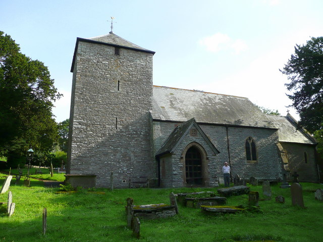
St. Maelog's church, Llandefaelog Viewed from the south-west.
265:
51° 58′ 53″ N, 3° 24′ 30″ W
215:
51° 58′ 52″ N, 3° 24′ 31″ W
454:
Add a one-line explanation of what this file represents
1185:
110:
90:
Commons is a freely licensed media file repository.
623:
Creative
Commons Attribution-ShareAlike 2.0 Generic
56:(640 × 480 pixels, file size: 86 KB, MIME type:
423:https://creativecommons.org/licenses/by-sa/2.0
71:
429:Creative Commons Attribution-Share Alike 2.0
347:
8:
825:
761:
389:– to copy, distribute and transmit the work
1203:
1095:
450:
1178:The following other wikis use this file:
1052:1ea084ad1d564776061e78fb4a69b74b93ff484d
713:https://www.geograph.org.uk/photo/927002
537:https://www.geograph.org.uk/profile/8569
1205:
1155:
1050:
1034:
1016:
1000:
979:
963:
942:
926:
905:
889:
849:
833:
785:
769:
690:
674:
656:
640:
620:
604:
584:
568:
501:
485:
468:
465:
446:
439:
258:
208:
287:View this and other nearby images on:
237:View this and other nearby images on:
7:
334:and is licensed for reuse under the
1158:Grade II* listed buildings in Powys
1084:
370:Attribution-Share Alike 2.0 Generic
358:
353:
338:Attribution-ShareAlike 2.0 license.
1196:
459:
453:
344:
321:
120:
103:
49:
458:
198:St. Maelog's church, Llandefaelog
179:St. Maelog's church, Llandefaelog
772:coordinates of the point of view
444:
400:Under the following conditions:
365:This file is licensed under the
357:
352:
346:
314:
293:
279:
271:
243:
229:
221:
70:
31:
21:
441:
196:Jonathan Billinger /
177:Jonathan Billinger /
121:
46:No higher resolution available.
14:
693:file available on the internet
440:
322:This image was taken from the
26:
1:
836:coordinates of depicted place
36:
743:Geograph Britain and Ireland
515:object of statement has role
466:Items portrayed in this file
851:51°58'52.75"N, 3°24'29.52"W
787:51°58'51.74"N, 3°24'30.96"W
270:
220:
1227:
1182:Usage on www.wikidata.org
414:same or compatible license
1085:
16:
721:geograph.org.uk image ID
443:
380:
77:This is a file from the
1142:
1121:04:07, 22 February 2011
168:required by the license
152:
141:
134:
131:
113:
81:. Information from its
328:this photograph's page
299:51.981320; -3.408200
249:51.981040; -3.408600
84:description page there
1064:determination method
395:– to adapt the work
551:Jonathan Billinger
545:author name string
377:Jonathan Billinger
332:Jonathan Billinger
157:Jonathan Billinger
1214:
1213:
1174:Global file usage
1163:Llandyfaelog Fach
1146:
827:
763:
607:copyright license
452:
343:
342:
326:collection. See
304:
303:
254:
253:
203:
202:
171:
99:
98:
79:Wikimedia Commons
32:Global file usage
1218:
1204:
1133:
1073:
1068:
984:
947:
910:
873:
872:
867:
809:
808:
803:
745:
740:
730:
725:
715:
710:
706:described at URL
571:copyright status
552:
549:
539:
534:
524:
519:
436:
433:
430:
427:
424:
416:as the original.
378:
367:Creative Commons
361:
360:
356:
355:
350:
349:
336:Creative Commons
324:Geograph project
318:
311:
300:
297:
283:
282:
276:
275:
274:
268:
267:
256:
250:
247:
233:
232:
226:
225:
224:
218:
217:
206:
165:
137:
125:
117:
111:
95:
74:
73:
67:
61:
59:
1226:
1225:
1221:
1220:
1219:
1217:
1216:
1215:
1192:
1172:
1154:
1147:
1139:
1131:
1087:
1086:
1083:
1082:
1081:
1080:
1079:
1078:
1077:
1076:
1075:
1074:
1069:
1066:
1057:
1056:
1055:
1053:
1043:
1042:
1041:
1039:
1028:
1027:
1026:
1025:
1024:
1023:
1022:
1021:
1019:
1009:
1008:
1007:
1005:
994:
993:
992:
991:
990:
989:
988:
987:
985:
982:
972:
971:
970:
968:
957:
956:
955:
954:
953:
952:
951:
950:
948:
945:
935:
934:
933:
931:
920:
919:
918:
917:
916:
915:
914:
913:
911:
908:
898:
897:
896:
894:
883:
882:
881:
880:
879:
878:
877:
876:
875:
874:
870:
868:
865:
856:
855:
854:
852:
842:
841:
840:
838:
819:
818:
817:
816:
815:
814:
813:
812:
811:
810:
806:
804:
801:
792:
791:
790:
788:
778:
777:
776:
774:
755:
754:
753:
752:
751:
750:
749:
748:
747:
746:
741:
738:
732:
731:
726:
723:
717:
716:
711:
708:
699:
698:
697:
695:
683:
682:
681:
679:
668:
667:
666:
665:
664:
663:
662:
661:
659:
649:
648:
647:
645:
634:
633:
632:
631:
630:
629:
628:
627:
625:
613:
612:
611:
609:
598:
597:
596:
595:
594:
593:
592:
591:
589:
577:
576:
575:
573:
562:
561:
560:
559:
558:
557:
556:
555:
554:
553:
550:
547:
541:
540:
535:
532:
526:
525:
520:
517:
508:
507:
506:
504:
494:
493:
492:
490:
479:
478:
477:
476:
475:
473:
457:
456:
455:
438:
437:
434:
431:
428:
425:
422:
421:
379:
376:
373:
362:
339:
309:
298:
272:
263:
262:
259:Object location
248:
222:
213:
212:
209:Camera location
204:
193:
186:
174:
147:geograph.org.uk
127:
115:
108:
101:
100:
89:
88:
87:is shown below.
63:
57:
55:
48:
47:
12:
11:
5:
1224:
1222:
1212:
1211:
1208:
1195:
1191:
1190:
1189:
1188:
1176:
1175:
1171:
1170:
1165:
1160:
1152:
1151:
1150:
1145:
1144:
1141:
1137:
1134:
1128:
1123:
1118:
1114:
1113:
1110:
1107:
1104:
1101:
1098:
1091:
1090:
1062:
1061:
1060:
1059:
1058:
1054:
1051:
1049:
1048:
1047:
1046:
1045:
1044:
1040:
1035:
1033:
1032:
1031:
1030:
1029:
1020:
1017:
1015:
1014:
1013:
1012:
1011:
1010:
1006:
1001:
999:
998:
997:
996:
995:
986:
980:
978:
977:
976:
975:
974:
973:
969:
964:
962:
961:
960:
959:
958:
949:
943:
941:
940:
939:
938:
937:
936:
932:
927:
925:
924:
923:
922:
921:
912:
906:
904:
903:
902:
901:
900:
899:
895:
890:
888:
887:
886:
885:
884:
861:
860:
859:
858:
857:
853:
850:
848:
847:
846:
845:
844:
843:
839:
834:
832:
831:
830:
829:
823:
797:
796:
795:
794:
793:
789:
786:
784:
783:
782:
781:
780:
779:
775:
770:
768:
767:
766:
765:
759:
734:
733:
719:
718:
704:
703:
702:
701:
700:
696:
691:
689:
688:
687:
686:
685:
684:
680:
677:source of file
675:
673:
672:
671:
670:
669:
660:
658:15 August 2008
657:
655:
654:
653:
652:
651:
650:
646:
641:
639:
638:
637:
636:
635:
626:
621:
619:
618:
617:
616:
615:
614:
610:
605:
603:
602:
601:
600:
599:
590:
585:
583:
582:
581:
580:
579:
578:
574:
569:
567:
566:
565:
564:
563:
543:
542:
528:
527:
513:
512:
511:
510:
509:
505:
502:
500:
499:
498:
497:
496:
495:
491:
486:
484:
483:
482:
481:
480:
474:
469:
467:
464:
463:
462:
461:
460:
449:
448:
445:
442:
420:
419:
418:
417:
407:
398:
397:
396:
390:
383:You are free:
374:
364:
363:
345:
341:
340:
319:
308:
305:
302:
301:
291:
285:
260:
252:
251:
241:
235:
210:
201:
200:
194:
191:
188:
187:
182:
175:
172:
160:
159:
154:
150:
149:
143:
139:
138:
136:15 August 2008
133:
129:
128:
118:
109:
107:
104:
102:
97:
96:
75:
65:
64:
45:
41:
40:
39:
34:
29:
24:
19:
13:
10:
9:
6:
4:
3:
2:
1223:
1209:
1206:
1202:
1199:
1193:
1187:
1184:
1183:
1181:
1180:
1179:
1173:
1169:
1166:
1164:
1161:
1159:
1156:
1148:
1140:
1135:
1129:
1127:
1124:
1122:
1119:
1116:
1115:
1111:
1108:
1105:
1102:
1099:
1097:
1096:
1094:
1088:
1072:
1065:
1038:
1004:
967:
930:
893:
864:
837:
800:
773:
744:
737:
729:
722:
714:
707:
694:
678:
644:
624:
608:
588:
572:
546:
538:
531:
523:
516:
489:
472:
426:CC BY-SA 2.0
415:
411:
408:
405:
402:
401:
399:
394:
391:
388:
385:
384:
382:
381:
375:Attribution:
371:
368:
351:
337:
333:
329:
325:
320:
317:
313:
312:
306:
296:
292:
290:
289:OpenStreetMap
286:
284:
266:
261:
257:
246:
242:
240:
239:OpenStreetMap
236:
234:
216:
211:
207:
199:
195:
190:
189:
185:
181: /
180:
176:
169:
164:
162:
161:
158:
155:
151:
148:
144:
140:
130:
124:
119:
112:
105:
93:
86:
85:
80:
76:
69:
68:
62:
53:
44:
38:
35:
33:
30:
28:
25:
23:
20:
18:
15:
1200:
1197:
1177:
1092:
1089:File history
522:photographer
409:
403:
392:
386:
331:
269:
219:
197:
184:CC BY-SA 2.0
178:
122:
92:You can help
82:
50:
22:File history
1138:GeographBot
587:copyrighted
410:share alike
404:attribution
163:Attribution
114:Description
1207:_error
1149:File usage
1130:640 × 480
1106:Dimensions
1018:image/jpeg
1003:media type
503:some value
58:image/jpeg
27:File usage
1186:Q17738580
1103:Thumbnail
1100:Date/Time
892:data size
643:inception
307:Licensing
192:InfoField
173:InfoField
123:English:
1194:Metadata
1037:checksum
736:operator
447:Captions
393:to remix
387:to share
372:license.
37:Metadata
1132:(86 KB)
1117:current
1112:Comment
907:88,147
863:heading
822:heading
799:heading
758:heading
488:creator
471:depicts
451:English
106:Summary
54:
929:height
871:degree
826:degree
807:degree
762:degree
728:927002
277:
227:
153:Author
142:Source
1071:SHA-1
983:pixel
966:width
946:pixel
145:From
1109:User
981:640
944:480
909:byte
435:true
432:true
132:Date
17:File
869:45
805:45
530:URL
1067::
866::
802::
739::
724::
709::
548::
533::
518::
1210:0
170:)
166:(
94:.
60:)
Text is available under the Creative Commons Attribution-ShareAlike License. Additional terms may apply.
_heading:45.00&language=en)
_heading:45.00&language=en)
