395:
328:
278:
320:
270:
342:
292:
363:
401:
406:
72:
890:"}},"text\/plain":{"en":{"":"heading"}}},"{\"value\":{\"amount\":\"+270\",\"unit\":\"http:\\\/\\\/www.wikidata.org\\\/entity\\\/Q28390\"},\"type\":\"quantity\"}":{"text\/html":{"en":{"P7787":"270
826:"}},"text\/plain":{"en":{"":"heading"}}},"{\"value\":{\"amount\":\"+270\",\"unit\":\"http:\\\/\\\/www.wikidata.org\\\/entity\\\/Q28390\"},\"type\":\"quantity\"}":{"text\/html":{"en":{"P7787":"270
1062:
822:
43:
261:
453:– You must give appropriate credit, provide a link to the license, and indicate if changes were made. You may do so in any reasonable manner, but not in any way that suggests the licensor endorses you or your use.
83:
51:
887:
823:
1097:
1061:
1056:
198:
42:
758:
688:
652:
533:
335:
285:
973:
778:
370:
1228:
This file contains additional information, probably added from the digital camera or scanner used to create or digitize it.
460:
1072:
615:
993:
957:
928:
901:
864:
837:
786:
742:
636:
608:
595:
580:
1135:
1190:
801:
771:
708:
672:
553:
517:
357:
1079:== Summary == {{Information |Description=St. Mary's Church, Holton St. Mary |Source=From ; transferd by
416:
1231:
If the file has been modified from its original state, some details may not fully reflect the modified file.
459:– If you remix, transform, or build upon the material, you must distribute your contributions under the
377:
on the
Geograph website for the photographer's contact details. The copyright on this image is owned by
413:
115:
894:"}},"text\/plain":{"en":{"P7787":"270 degree"}}}}": -->
830:"}},"text\/plain":{"en":{"P7787":"270 degree"}}}}": -->
91:
230:
110:
808:
793:
587:
214:
1102:
341:
291:
382:
78:
1107:
1080:
275:
157:
325:
187:
172:
168:
362:
148:
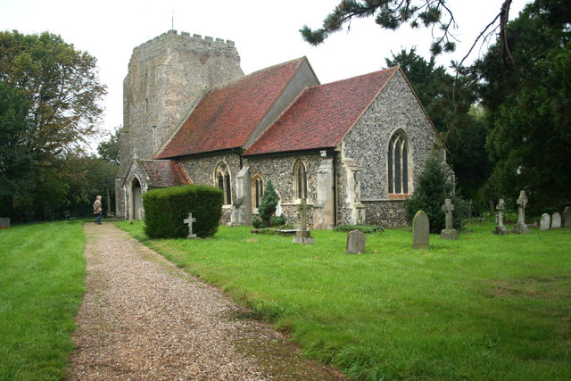
St Mary's parish church, Holton St Mary, Suffolk, seen from the southeast
1083:
using [http://toolserver.org/~magnus/geograph_org2commons.php geograph_
374:
52:
St._Mary's_Church,_Holton_St._Mary_-_geograph.org.uk_-_305700.jpg
1215:
1191:
1029:
Click on a date/time to view the file as it appeared at that time.
138:
St. Mary's Church, Holton St. Mary - geograph.org.uk - 305700.jpg
327:
277:
262:
51° 59′ 28.62″ N, 0° 59′ 51.51″ E
176:
302:
252:
66:
1155:
1125:
1185:
1175:
1165:
1145:
312:
51° 59′ 28.8″ N, 0° 59′ 50″ E
501:
Add a one-line explanation of what this file represents
1205:
1200:
205:
Creative
Commons Attribution Share-alike license 2.0
132:
104:
90:
Commons is a freely licensed media file repository.
689:
Creative
Commons Attribution-ShareAlike 2.0 Generic
56:(640 × 427 pixels, file size: 102 KB, MIME type:
470:https://creativecommons.org/licenses/by-sa/2.0
71:
476:Creative Commons Attribution-Share Alike 2.0
394:
8:
891:
827:
436:– to copy, distribute and transmit the work
1233:
1031:
497:
1118:The following other wikis use this file:
243:Jurek and Trish Sienkiewicz /
224:Jurek and Trish Sienkiewicz /
809:https://www.geograph.org.uk/photo/305700
588:https://www.geograph.org.uk/profile/6540
1235:
1095:
1007:
991:
971:
955:
915:
899:
851:
835:
756:
740:
722:
706:
686:
670:
650:
634:
567:
551:
531:
515:
512:
493:
486:
305:
255:
334:View this and other nearby images on:
284:View this and other nearby images on:
1098:Grade II* listed buildings in Babergh
1093:The following 3 pages use this file:
7:
381:and is licensed for reuse under the
1020:
417:Attribution-Share Alike 2.0 Generic
405:
400:
385:Attribution-ShareAlike 2.0 license.
245:St. Mary's Church, Holton St. Mary
226:St. Mary's Church, Holton St. Mary
1226:
1212:Usage on zh-min-nan.wikipedia.org
506:
500:
391:
368:
142:
108:
103:
49:
505:
838:coordinates of the point of view
491:
447:Under the following conditions:
412:This file is licensed under the
404:
399:
393:
361:
340:
326:
318:
290:
276:
268:
70:
31:
21:
1074:File Upload Bot (Magnus Manske)
488:
143:
46:No higher resolution available.
14:
759:file available on the internet
487:
369:This image was taken from the
26:
1:
902:coordinates of depicted place
853:51°59'28.622"N, 0°59'51.511"E
36:
779:Geograph Britain and Ireland
609:object of statement has role
513:Items portrayed in this file
317:
267:
1152:Usage on lld.wikipedia.org
1122:Usage on ceb.wikipedia.org
917:51°59'28.82"N, 0°59'49.56"E
602:Jurek and Trish Sienkiewicz
424:Jurek and Trish Sienkiewicz
379:Jurek and Trish Sienkiewicz
188:Jurek and Trish Sienkiewicz
1257:
1197:Usage on www.wikidata.org
1182:Usage on sv.wikipedia.org
1172:Usage on pl.wikipedia.org
1162:Usage on nl.wikipedia.org
1142:Usage on fr.wikipedia.org
1132:Usage on fa.wikipedia.org
461:same or compatible license
1021:
16:
787:geograph.org.uk image ID
490:
427:
77:This is a file from the
1078:
215:required by the license
193:
183:
163:
156:
153:
135:
81:. Information from its
375:this photograph's page
346:51.991340; 0.997100
296:51.991284; 0.997642
84:description page there
958:location of creation
177:geograph_org2commons
442:– to adapt the work
109:This is a photo of
1057:23:44, 27 May 2009
596:author name string
1244:
1243:
1114:Global file usage
1086:
893:
829:
724:22 September 2006
673:copyright license
534:Church of St Mary
499:
390:
389:
373:collection. See
351:
350:
301:
300:
250:
249:
218:
202:
199:Reusing this file
171:; transferred by
158:22 September 2006
125:
124:
99:
98:
79:Wikimedia Commons
32:Global file usage
1248:
1234:
1069:
939:
938:
933:
875:
874:
869:
811:
806:
802:described at URL
796:
791:
781:
776:
637:copyright status
618:
613:
603:
600:
590:
585:
483:
480:
477:
474:
471:
463:as the original.
425:
414:Creative Commons
408:
407:
403:
402:
397:
396:
383:Creative Commons
371:Geograph project
365:
358:
347:
344:
330:
329:
323:
322:
321:
315:
314:
303:
297:
294:
280:
279:
273:
272:
271:
265:
264:
253:
212:
196:
159:
147:
139:
133:
118:
105:
95:
74:
73:
67:
61:
59:
1256:
1255:
1251:
1250:
1249:
1247:
1246:
1245:
1222:
1216:Holton St. Mary
1186:Holton St. Mary
1176:Holton St. Mary
1166:Holton St. Mary
1156:Holton St. Mary
1126:Holton St. Mary
1112:
1087:
1075:
1067:
1023:
1022:
1019:
1018:
1017:
1016:
1015:
1014:
1013:
1012:
1010:
1000:
999:
998:
996:
985:
984:
983:
982:
981:
980:
979:
978:
976:
974:Holton St. Mary
964:
963:
962:
960:
949:
948:
947:
946:
945:
944:
943:
942:
941:
940:
936:
934:
931:
922:
921:
920:
918:
908:
907:
906:
904:
885:
884:
883:
882:
881:
880:
879:
878:
877:
876:
872:
870:
867:
858:
857:
856:
854:
844:
843:
842:
840:
821:
820:
819:
818:
817:
816:
815:
814:
813:
812:
807:
804:
798:
797:
792:
789:
783:
782:
777:
774:
765:
764:
763:
761:
749:
748:
747:
745:
734:
733:
732:
731:
730:
729:
728:
727:
725:
715:
714:
713:
711:
700:
699:
698:
697:
696:
695:
694:
693:
691:
679:
678:
677:
675:
664:
663:
662:
661:
660:
659:
658:
657:
655:
643:
642:
641:
639:
628:
627:
626:
625:
624:
623:
622:
621:
620:
619:
614:
611:
605:
604:
601:
598:
592:
591:
586:
583:
574:
573:
572:
570:
560:
559:
558:
556:
545:
544:
543:
542:
541:
540:
539:
538:
536:
524:
523:
522:
520:
504:
503:
502:
485:
484:
481:
478:
475:
472:
469:
468:
426:
423:
420:
409:
386:
356:
345:
319:
310:
309:
306:Object location
295:
269:
260:
259:
256:Camera location
251:
240:
233:
221:
169:geograph.org.uk
149:
137:
130:
120:
114:
111:listed building
101:
100:
89:
88:
87:is shown below.
63:
57:
55:
48:
47:
12:
11:
5:
1254:
1252:
1242:
1241:
1238:
1225:
1221:
1220:
1219:
1218:
1210:
1209:
1208:
1203:
1195:
1194:
1193:
1188:
1180:
1179:
1178:
1170:
1169:
1168:
1160:
1159:
1158:
1150:
1149:
1148:
1146:Holton St Mary
1140:
1139:
1138:
1136:هولتون سنت مری
1130:
1129:
1128:
1116:
1115:
1111:
1110:
1105:
1103:Holton St Mary
1100:
1091:
1090:
1085:
1084:
1077:
1073:
1070:
1064:
1059:
1054:
1050:
1049:
1046:
1043:
1040:
1037:
1034:
1027:
1026:
1011:
1008:
1006:
1005:
1004:
1003:
1002:
1001:
997:
992:
990:
989:
988:
987:
986:
977:
972:
970:
969:
968:
967:
966:
965:
961:
956:
954:
953:
952:
951:
950:
927:
926:
925:
924:
923:
919:
916:
914:
913:
912:
911:
910:
909:
905:
900:
898:
897:
896:
895:
889:
863:
862:
861:
860:
859:
855:
852:
850:
849:
848:
847:
846:
845:
841:
836:
834:
833:
832:
831:
825:
800:
799:
785:
784:
770:
769:
768:
767:
766:
762:
757:
755:
754:
753:
752:
751:
750:
746:
743:source of file
741:
739:
738:
737:
736:
735:
726:
723:
721:
720:
719:
718:
717:
716:
712:
707:
705:
704:
703:
702:
701:
692:
687:
685:
684:
683:
682:
681:
680:
676:
671:
669:
668:
667:
666:
665:
656:
651:
649:
648:
647:
646:
645:
644:
640:
635:
633:
632:
631:
630:
629:
607:
606:
594:
593:
579:
578:
577:
576:
575:
571:
568:
566:
565:
564:
563:
562:
561:
557:
552:
550:
549:
548:
547:
546:
537:
532:
530:
529:
528:
527:
526:
525:
521:
516:
514:
511:
510:
509:
508:
507:
496:
495:
492:
489:
467:
466:
465:
464:
454:
445:
444:
443:
437:
430:You are free:
421:
411:
410:
392:
388:
387:
366:
355:
352:
349:
348:
338:
332:
307:
299:
298:
288:
282:
257:
248:
247:
241:
238:
235:
234:
229:
222:
219:
207:
206:
203:
191:
190:
185:
181:
180:
165:
161:
160:
155:
151:
150:
140:
131:
129:
126:
123:
122:
102:
97:
96:
75:
65:
64:
45:
41:
40:
39:
34:
29:
24:
19:
13:
10:
9:
6:
4:
3:
2:
1253:
1239:
1236:
1232:
1229:
1223:
1217:
1214:
1213:
1211:
1207:
1204:
1202:
1199:
1198:
1196:
1192:
1189:
1187:
1184:
1183:
1181:
1177:
1174:
1173:
1171:
1167:
1164:
1163:
1161:
1157:
1154:
1153:
1151:
1147:
1144:
1143:
1141:
1137:
1134:
1133:
1131:
1127:
1124:
1123:
1121:
1120:
1119:
1113:
1109:
1106:
1104:
1101:
1099:
1096:
1094:
1088:
1082:
1076:
1071:
1065:
1063:
1060:
1058:
1055:
1052:
1051:
1047:
1044:
1041:
1038:
1035:
1033:
1032:
1030:
1024:
995:
975:
959:
930:
903:
866:
839:
810:
803:
795:
788:
780:
773:
760:
744:
710:
690:
674:
654:
638:
617:
610:
597:
589:
582:
555:
535:
519:
473:CC BY-SA 2.0
462:
458:
455:
452:
449:
448:
446:
441:
438:
435:
432:
431:
429:
428:
422:Attribution:
418:
415:
398:
384:
380:
376:
372:
367:
364:
360:
359:
353:
343:
339:
337:
336:OpenStreetMap
333:
331:
313:
308:
304:
293:
289:
287:
286:OpenStreetMap
283:
281:
263:
258:
254:
246:
242:
237:
236:
232:
228: /
227:
223:
216:
211:
209:
208:
204:
200:
195:
192:
189:
186:
182:
178:
174:
170:
166:
162:
152:
146:
141:
134:
127:
121:
117:
112:
107:
106:
93:
86:
85:
80:
76:
69:
68:
62:
53:
44:
38:
35:
33:
30:
28:
25:
23:
20:
18:
15:
1230:
1227:
1117:
1092:
1028:
1025:File history
616:photographer
456:
450:
439:
433:
378:
316:
266:
244:
231:CC BY-SA 2.0
225:
144:
92:You can help
82:
50:
22:File history
1108:Nat Flatman
1081:User:oxyman
653:copyrighted
457:share alike
451:attribution
210:Attribution
173:User:oxyman
136:Description
1237:_error
1089:File usage
1066:640 × 427
1042:Dimensions
1009:image/jpeg
994:media type
569:some value
194:Permission
58:image/jpeg
27:File usage
1206:Q17534506
1039:Thumbnail
1036:Date/Time
709:inception
354:Licensing
239:InfoField
220:InfoField
145:English:
1224:Metadata
1201:Q2557152
1068:(102 KB)
772:operator
494:Captions
440:to remix
434:to share
419:license.
37:Metadata
1053:current
1048:Comment
929:heading
888:heading
865:heading
824:heading
554:creator
518:depicts
498:English
128:Summary
116:1351596
113:number
54:
937:degree
892:degree
873:degree
828:degree
794:305700
324:
274:
184:Author
175:using
164:Source
167:From
1045:User
935:270
871:270
482:true
479:true
154:Date
17:File
581:URL
932::
868::
805::
790::
775::
612::
599::
584::
1240:0
217:)
213:(
201:)
197:(
179:.
119:.
94:.
60:)
Text is available under the Creative Commons Attribution-ShareAlike License. Additional terms may apply.
_region:GB-GBN_heading:270.00&language=en)
