355:
288:
238:
1087:
280:
230:
302:
252:
323:
361:
366:
72:
831:"}},"text\/plain":{"en":{"":"heading"}}},"{\"value\":{\"amount\":\"+0\",\"unit\":\"http:\\\/\\\/www.wikidata.org\\\/entity\\\/Q28390\"},\"type\":\"quantity\"}":{"text\/html":{"en":{"P7787":"0
767:"}},"text\/plain":{"en":{"":"heading"}}},"{\"value\":{\"amount\":\"+0\",\"unit\":\"http:\\\/\\\/www.wikidata.org\\\/entity\\\/Q28390\"},\"type\":\"quantity\"}":{"text\/html":{"en":{"P7787":"0
933:
827:
221:
43:
969:
950:== {{int:filedesc}} == {{Information |description={{en|1=St. Mary's Potsgrove - southern side A side view, from the south, of this lovely little church in the very quiet village of Potsgrove. The view from the west can be seen here
Informati
83:
51:
413:– You must give appropriate credit, provide a link to the license, and indicate if changes were made. You may do so in any reasonable manner, but not in any way that suggests the licensor endorses you or your use.
127:
126:
St. Mary's
Potsgrove - southern side A side view, from the south, of this lovely little church in the very quiet village of Potsgrove. The view from the west can be seen here
828:
764:
964:
997:
1241:
932:
927:
42:
665:
629:
593:
295:
245:
700:
1272:
979:
330:
1135:
This file contains additional information, probably added from the digital camera or scanner used to create or digitize it.
420:
556:
869:
842:
805:
778:
708:
649:
577:
549:
536:
521:
736:
693:
678:
613:
494:
477:
317:
131:
376:
1138:
If the file has been modified from its original state, some details may not fully reflect the modified file.
960:
The following pages on the
English Knowledge (XXG) use this file (pages on other projects are not listed):
1325:
419:– If you remix, transform, or build upon the material, you must distribute your contributions under the
337:
on the
Geograph website for the photographer's contact details. The copyright on this image is owned by
943:
373:
1361:
835:"}},"text\/plain":{"en":{"P7787":"0 degree"}}}}": -->
771:"}},"text\/plain":{"en":{"P7787":"0 degree"}}}}": -->
91:
190:
1447:
715:
685:
528:
174:
1007:
1037:
301:
251:
1429:
1343:
1299:
1164:
1157:
342:
78:
970:
List of churches preserved by the
Churches Conservation Trust in the East of England
1457:
1204:
1371:
142:
132:
http://www.british-history.ac.uk/report.asp?compid=42457&strquery=potsgrove
1184:
285:
235:
974:
163:
153:
1467:
1174:
1147:
322:
1088:Список церквей в Восточной Англии, сохранённых Фондом сохранения церквей
52:
St._Mary's_Potsgrove_-_southern_side_-_geograph.org.uk_-_370570.jpg
334:
900:
Click on a date/time to view the file as it appeared at that time.
116:
St. Mary's
Potsgrove - southern side - geograph.org.uk - 370570.jpg
287:
237:
1122:
262:
212:
66:
272:
51° 57′ 32.3″ N, 0° 36′ 59″ W
222:
51° 57′ 31.6″ N, 0° 36′ 59″ W
1067:
1017:
461:
Add a one-line explanation of what this file represents
1097:
1077:
1057:
1047:
1027:
1112:
1107:
110:
90:
Commons is a freely licensed media file repository.
630:
Creative
Commons Attribution-ShareAlike 2.0 Generic
56:(640 × 468 pixels, file size: 192 KB, MIME type:
1366:Flash did not fire, compulsory flash suppression
430:https://creativecommons.org/licenses/by-sa/2.0
71:
436:Creative Commons Attribution-Share Alike 2.0
354:
8:
832:
768:
396:– to copy, distribute and transmit the work
130:Information on the church and village here
1140:
965:Grade II* listed buildings in Bedfordshire
902:
457:
990:The following other wikis use this file:
686:https://www.geograph.org.uk/photo/370570
529:https://www.geograph.org.uk/profile/3546
1475:
1465:
1455:
1445:
1437:
1427:
1419:
1411:
1403:
1395:
1387:
1379:
1369:
1359:
1351:
1341:
1333:
1323:
1315:
1307:
1297:
1289:
1281:
1270:
1262:
1254:
1246:
1236:
1228:
1220:
1212:
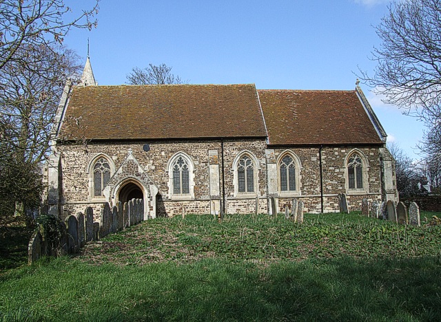
1201:
1193:
1182:
1172:
1162:
1152:
962:
856:
840:
792:
776:
750:
734:
663:
647:
627:
611:
591:
575:
508:
492:
475:
472:
453:
446:
265:
215:
1242:Digital Camera FinePix S9600 Ver1.00
294:View this and other nearby images on:
244:View this and other nearby images on:
1142:
7:
341:and is licensed for reuse under the
205:St. Mary's Potsgrove - southern side
186:St. Mary's Potsgrove - southern side
891:
377:Attribution-Share Alike 2.0 Generic
365:
360:
345:Attribution-ShareAlike 2.0 license.
1133:
1119:Usage on zh-min-nan.wikipedia.org
466:
460:
351:
328:
120:
103:
49:
465:
1195:Date and time of data generation
980:St Mary's Church, Potsgrove
779:coordinates of the point of view
451:
407:Under the following conditions:
372:This file is licensed under the
364:
359:
353:
321:
300:
286:
278:
250:
236:
228:
70:
31:
21:
448:
121:
46:No higher resolution available.
14:
1169:1/340 sec (0.0029411764705882)
666:file available on the internet
447:
329:This image was taken from the
26:
1:
843:coordinates of depicted place
36:
701:Geograph Britain and Ireland
550:object of statement has role
473:Items portrayed in this file
1397:Focal plane resolution unit
1283:Date and time of digitizing
1064:Usage on lld.wikipedia.org
1014:Usage on ceb.wikipedia.org
1004:Usage on arz.wikipedia.org
858:51°57'32.26"N, 0°36'59.40"W
794:51°57'31.61"N, 0°36'59.40"W
1497:
1408:One-chip color area sensor
1104:Usage on www.wikidata.org
1094:Usage on tr.wikipedia.org
1084:Usage on ru.wikipedia.org
1074:Usage on nl.wikipedia.org
1054:Usage on it.wikipedia.org
1044:Usage on fr.wikipedia.org
1034:Usage on fa.wikipedia.org
1024:Usage on cy.wikipedia.org
994:Usage on ar.wikipedia.org
421:same or compatible license
277:
227:
1248:File change date and time
892:
16:
1389:Focal plane Y resolution
1381:Focal plane X resolution
709:geograph.org.uk image ID
450:
387:
77:This is a file from the
1413:Custom image processing
949:
203:Rob Farrow /
184:Rob Farrow /
175:required by the license
159:
148:
141:
138:
113:
81:. Information from its
1477:Subject distance range
1291:Image compression mode
335:this photograph's page
306:51.958960; -0.616500
256:51.958780; -0.616500
84:description page there
1335:Maximum land aperture
1222:Horizontal resolution
928:21:29, 4 January 2011
1286:12:03, 14 March 2007
1251:12:03, 14 March 2007
1198:12:03, 14 March 2007
998:بتسغروف (بيدفوردشير)
1256:Y and C positioning
1230:Vertical resolution
1144:Camera manufacturer
402:– to adapt the work
1439:Scene capture type
1434:Auto white balance
537:author name string
1484:
1483:
986:Global file usage
953:
834:
770:
614:copyright license
459:
350:
349:
333:collection. See
311:
310:
261:
260:
210:
209:
178:
99:
98:
79:Wikimedia Commons
32:Global file usage
1488:
1264:Exposure Program
1141:
940:
880:
879:
874:
816:
815:
810:
718:
713:
703:
698:
688:
683:
679:described at URL
578:copyright status
559:
554:
544:
541:
531:
526:
443:
440:
437:
434:
431:
423:as the original.
385:
374:Creative Commons
368:
367:
363:
362:
357:
356:
343:Creative Commons
331:Geograph project
325:
318:
307:
304:
290:
289:
283:
282:
281:
275:
274:
263:
257:
254:
240:
239:
233:
232:
231:
225:
224:
213:
172:
144:
125:
117:
111:
95:
74:
73:
67:
61:
59:
1496:
1495:
1491:
1490:
1489:
1487:
1486:
1485:
1338:3 APEX (f/2.83)
1317:APEX brightness
1158:FinePix S9600
1129:
984:
961:
954:
946:
938:
894:
893:
890:
889:
888:
887:
886:
885:
884:
883:
882:
881:
877:
875:
872:
863:
862:
861:
859:
849:
848:
847:
845:
826:
825:
824:
823:
822:
821:
820:
819:
818:
817:
813:
811:
808:
799:
798:
797:
795:
785:
784:
783:
781:
762:
761:
760:
759:
758:
757:
756:
755:
753:
743:
742:
741:
739:
728:
727:
726:
725:
724:
723:
722:
721:
720:
719:
714:
711:
705:
704:
699:
696:
690:
689:
684:
681:
672:
671:
670:
668:
656:
655:
654:
652:
641:
640:
639:
638:
637:
636:
635:
634:
632:
620:
619:
618:
616:
605:
604:
603:
602:
601:
600:
599:
598:
596:
584:
583:
582:
580:
569:
568:
567:
566:
565:
564:
563:
562:
561:
560:
555:
552:
546:
545:
542:
539:
533:
532:
527:
524:
515:
514:
513:
511:
501:
500:
499:
497:
486:
485:
484:
483:
482:
480:
464:
463:
462:
445:
444:
441:
438:
435:
432:
429:
428:
386:
383:
380:
369:
346:
316:
305:
279:
270:
269:
266:Object location
255:
229:
220:
219:
216:Camera location
211:
200:
193:
181:
154:geograph.org.uk
134:
115:
108:
101:
100:
89:
88:
87:is shown below.
63:
57:
55:
48:
47:
12:
11:
5:
1494:
1492:
1482:
1481:
1478:
1474:
1473:
1470:
1464:
1463:
1460:
1454:
1453:
1450:
1444:
1443:
1440:
1436:
1435:
1432:
1426:
1425:
1422:
1418:
1417:
1416:Normal process
1414:
1410:
1409:
1406:
1405:Sensing method
1402:
1401:
1398:
1394:
1393:
1390:
1386:
1385:
1382:
1378:
1377:
1374:
1368:
1367:
1364:
1358:
1357:
1354:
1350:
1349:
1346:
1340:
1339:
1336:
1332:
1331:
1328:
1322:
1321:
1318:
1314:
1313:
1310:
1306:
1305:
1302:
1296:
1295:
1292:
1288:
1287:
1284:
1280:
1279:
1276:
1269:
1268:
1267:Normal program
1265:
1261:
1260:
1257:
1253:
1252:
1249:
1245:
1244:
1239:
1235:
1234:
1231:
1227:
1226:
1223:
1219:
1218:
1215:
1211:
1210:
1207:
1200:
1199:
1196:
1192:
1191:
1188:
1181:
1180:
1177:
1171:
1170:
1167:
1161:
1160:
1155:
1151:
1150:
1145:
1132:
1128:
1127:
1126:
1125:
1117:
1116:
1115:
1110:
1102:
1101:
1100:
1092:
1091:
1090:
1082:
1081:
1080:
1072:
1071:
1070:
1062:
1061:
1060:
1052:
1051:
1050:
1042:
1041:
1040:
1032:
1031:
1030:
1022:
1021:
1020:
1012:
1011:
1010:
1002:
1001:
1000:
988:
987:
983:
982:
977:
972:
967:
959:
958:
957:
952:
951:
948:
944:
941:
935:
930:
925:
921:
920:
917:
914:
911:
908:
905:
898:
897:
868:
867:
866:
865:
864:
860:
857:
855:
854:
853:
852:
851:
850:
846:
841:
839:
838:
837:
836:
830:
804:
803:
802:
801:
800:
796:
793:
791:
790:
789:
788:
787:
786:
782:
777:
775:
774:
773:
772:
766:
754:
751:
749:
748:
747:
746:
745:
744:
740:
735:
733:
732:
731:
730:
729:
707:
706:
692:
691:
677:
676:
675:
674:
673:
669:
664:
662:
661:
660:
659:
658:
657:
653:
650:source of file
648:
646:
645:
644:
643:
642:
633:
628:
626:
625:
624:
623:
622:
621:
617:
612:
610:
609:
608:
607:
606:
597:
592:
590:
589:
588:
587:
586:
585:
581:
576:
574:
573:
572:
571:
570:
548:
547:
535:
534:
520:
519:
518:
517:
516:
512:
509:
507:
506:
505:
504:
503:
502:
498:
493:
491:
490:
489:
488:
487:
481:
476:
474:
471:
470:
469:
468:
467:
456:
455:
452:
449:
427:
426:
425:
424:
414:
405:
404:
403:
397:
390:You are free:
381:
371:
370:
352:
348:
347:
326:
315:
312:
309:
308:
298:
292:
267:
259:
258:
248:
242:
217:
208:
207:
201:
198:
195:
194:
189:
182:
179:
167:
166:
161:
157:
156:
150:
146:
145:
140:
136:
135:
118:
109:
107:
104:
102:
97:
96:
75:
65:
64:
45:
41:
40:
39:
34:
29:
24:
19:
13:
10:
9:
6:
4:
3:
2:
1493:
1479:
1476:
1471:
1469:
1466:
1461:
1459:
1456:
1451:
1449:
1446:
1441:
1438:
1433:
1431:
1430:White balance
1428:
1424:Auto exposure
1423:
1421:Exposure mode
1420:
1415:
1412:
1407:
1404:
1399:
1396:
1391:
1388:
1383:
1380:
1375:
1373:
1370:
1365:
1363:
1360:
1355:
1352:
1347:
1345:
1344:Metering mode
1342:
1337:
1334:
1329:
1327:
1326:Exposure bias
1324:
1319:
1316:
1311:
1309:APEX aperture
1308:
1303:
1301:
1300:Shutter speed
1298:
1293:
1290:
1285:
1282:
1277:
1274:
1271:
1266:
1263:
1258:
1255:
1250:
1247:
1243:
1240:
1238:Software used
1237:
1232:
1229:
1224:
1221:
1216:
1213:
1208:
1206:
1202:
1197:
1194:
1189:
1186:
1183:
1178:
1176:
1173:
1168:
1166:
1165:Exposure time
1163:
1159:
1156:
1153:
1149:
1146:
1143:
1139:
1136:
1130:
1124:
1121:
1120:
1118:
1114:
1111:
1109:
1106:
1105:
1103:
1099:
1096:
1095:
1093:
1089:
1086:
1085:
1083:
1079:
1076:
1075:
1073:
1069:
1066:
1065:
1063:
1059:
1056:
1055:
1053:
1049:
1046:
1045:
1043:
1039:
1036:
1035:
1033:
1029:
1026:
1025:
1023:
1019:
1016:
1015:
1013:
1009:
1006:
1005:
1003:
999:
996:
995:
993:
992:
991:
985:
981:
978:
976:
973:
971:
968:
966:
963:
955:
947:
942:
936:
934:
931:
929:
926:
923:
922:
918:
915:
912:
909:
906:
904:
903:
901:
895:
871:
844:
807:
780:
752:14 March 2007
738:
717:
710:
702:
695:
687:
680:
667:
651:
631:
615:
595:
579:
558:
551:
538:
530:
523:
496:
479:
433:CC BY-SA 2.0
422:
418:
415:
412:
409:
408:
406:
401:
398:
395:
392:
391:
389:
388:
382:Attribution:
378:
375:
358:
344:
340:
336:
332:
327:
324:
320:
319:
313:
303:
299:
297:
296:OpenStreetMap
293:
291:
273:
268:
264:
253:
249:
247:
246:OpenStreetMap
243:
241:
223:
218:
214:
206:
202:
197:
196:
192:
188: /
187:
183:
176:
171:
169:
168:
165:
162:
158:
155:
151:
147:
143:14 March 2007
137:
133:
129:
124:
119:
112:
105:
93:
86:
85:
80:
76:
69:
68:
62:
53:
44:
38:
35:
33:
30:
28:
25:
23:
20:
18:
15:
1480:Distant view
1353:Light source
1205:focal length
1154:Camera model
1137:
1134:
989:
899:
896:File history
557:photographer
416:
410:
399:
393:
338:
276:
226:
204:
191:CC BY-SA 2.0
185:
122:
92:You can help
82:
50:
22:File history
1372:Color space
1214:Orientation
945:GeographBot
594:copyrighted
417:share alike
411:attribution
170:Attribution
114:Description
1458:Saturation
956:File usage
937:640 × 468
913:Dimensions
543:Rob Farrow
510:some value
384:Rob Farrow
339:Rob Farrow
164:Rob Farrow
58:image/jpeg
27:File usage
1468:Sharpness
1185:ISO speed
1123:Potsgrove
1098:Potsgrove
1078:Potsgrove
1068:Potsgrove
1058:Potsgrove
1048:Potsgrove
1028:Potsgrove
1018:Potsgrove
975:Potsgrove
910:Thumbnail
907:Date/Time
737:inception
314:Licensing
199:InfoField
180:InfoField
123:English:
1448:Contrast
1442:Standard
1259:Co-sited
1175:F-number
1148:FUJIFILM
1131:Metadata
1113:Q7594406
1108:Q1519701
939:(192 KB)
694:operator
454:Captions
400:to remix
394:to share
379:license.
37:Metadata
1356:Unknown
1348:Pattern
1275:version
1038:پاتزگرو
1008:بتسجروف
924:current
919:Comment
870:heading
829:heading
806:heading
765:heading
495:creator
478:depicts
458:English
106:Summary
54:
1462:Normal
1452:Normal
1233:72 dpi
1225:72 dpi
1217:Normal
1209:6.8 mm
1187:rating
878:degree
833:degree
814:degree
769:degree
716:370570
284:
234:
160:Author
149:Source
128:370576
1392:4,482
1384:4,482
1362:Flash
1203:Lens
1179:f/4.5
152:From
1376:sRGB
1320:8.26
1304:8.43
1273:Exif
916:User
442:true
439:true
139:Date
17:File
1312:4.3
1278:2.2
522:URL
1190:80
876:0
873::
812:0
809::
712::
697::
682::
553::
540::
525::
1472:3
1400:3
1330:0
1294:2
177:)
173:(
94:.
60:)
Text is available under the Creative Commons Attribution-ShareAlike License. Additional terms may apply.
_heading:0.00&language=en)
_heading:0.00&language=en)
