366:
299:
249:
291:
241:
313:
263:
334:
372:
377:
72:
842:"}},"text\/plain":{"en":{"":"heading"}}},"{\"value\":{\"amount\":\"+247\",\"unit\":\"http:\\\/\\\/www.wikidata.org\\\/entity\\\/Q28390\"},\"type\":\"quantity\"}":{"text\/html":{"en":{"P7787":"247
778:"}},"text\/plain":{"en":{"":"heading"}}},"{\"value\":{\"amount\":\"+247\",\"unit\":\"http:\\\/\\\/www.wikidata.org\\\/entity\\\/Q28390\"},\"type\":\"quantity\"}":{"text\/html":{"en":{"P7787":"247
774:
282:
43:
232:
424:– You must give appropriate credit, provide a link to the license, and indicate if changes were made. You may do so in any reasonable manner, but not in any way that suggests the licensor endorses you or your use.
83:
51:
839:
775:
169:
710:
640:
604:
306:
256:
760:
341:
1025:
This file contains additional information, probably added from the digital camera or scanner used to create or digitize it.
431:
954:
943:
938:
539:
42:
880:
853:
816:
789:
723:
694:
588:
560:
547:
532:
753:
738:
660:
624:
505:
488:
328:
387:
1028:
If the file has been modified from its original state, some details may not fully reflect the modified file.
430:– If you remix, transform, or build upon the material, you must distribute your contributions under the
348:
on the
Geograph website for the photographer's contact details. The copyright on this image is owned by
384:
846:"}},"text\/plain":{"en":{"P7787":"247 degree"}}}}": -->
782:"}},"text\/plain":{"en":{"P7787":"247 degree"}}}}": -->
91:
201:
961:== Summary == {{Information |Description=St. Peter's, Copdock |Source=From ; transferd by
745:
730:
567:
185:
312:
262:
353:
78:
962:
246:
128:
296:
139:
158:
143:
333:
979:
345:
911:
Click on a date/time to view the file as it appeared at that time.
1012:
298:
248:
233:
52° 01′ 54.14″ N, 1° 05′ 24.08″ E
147:
273:
223:
66:
283:
52° 01′ 54″ N, 1° 05′ 22″ E
52:
St._Peter's,_Copdock_-_geograph.org.uk_-_1309447.jpg
472:
Add a one-line explanation of what this file represents
1007:
997:
176:
Creative
Commons Attribution Share-alike license 2.0
116:
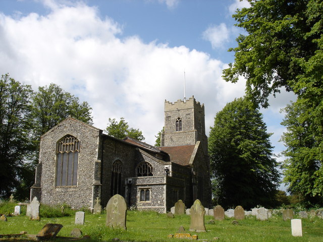
St. Peter's, Copdock - geograph.org.uk - 1309447.jpg
110:
90:
Commons is a freely licensed media file repository.
641:
Creative
Commons Attribution-ShareAlike 2.0 Generic
56:(640 × 480 pixels, file size: 104 KB, MIME type:
441:https://creativecommons.org/licenses/by-sa/2.0
71:
447:Creative Commons Attribution-Share Alike 2.0
365:
8:
843:
779:
407:– to copy, distribute and transmit the work
1030:
913:
468:
990:The following other wikis use this file:
746:https://www.geograph.org.uk/photo/1309447
568:https://www.geograph.org.uk/profile/9025
1032:
977:
867:
851:
803:
787:
708:
692:
674:
658:
638:
622:
602:
586:
519:
503:
486:
483:
464:
457:
276:
226:
305:View this and other nearby images on:
255:View this and other nearby images on:
7:
352:and is licensed for reuse under the
975:The following page uses this file:
902:
388:Attribution-Share Alike 2.0 Generic
376:
371:
356:Attribution-ShareAlike 2.0 license.
1023:
477:
471:
362:
339:
103:
49:
476:
790:coordinates of the point of view
462:
418:Under the following conditions:
383:This file is licensed under the
375:
370:
364:
332:
311:
297:
289:
261:
247:
239:
70:
31:
21:
956:File Upload Bot (Magnus Manske)
459:
46:No higher resolution available.
14:
711:file available on the internet
458:
340:This image was taken from the
26:
1:
854:coordinates of depicted place
36:
761:Geograph Britain and Ireland
533:object of statement has role
484:Items portrayed in this file
288:
238:
805:52°1'54.138"N, 1°5'24.079"E
1054:
1004:Usage on sv.wikipedia.org
994:Usage on pl.wikipedia.org
432:same or compatible license
903:
869:52°1'54.01"N, 1°5'22.20"E
16:
724:geograph.org.uk image ID
461:
398:
77:This is a file from the
960:
186:required by the license
164:
154:
134:
127:
124:
113:
81:. Information from its
346:this photograph's page
317:52.031670; 1.089500
267:52.031705; 1.090022
84:description page there
1013:Copdock and Washbrook
214:Oxymoron /
195:Oxymoron /
216:St. Peter's, Copdock
197:St. Peter's, Copdock
148:geograph_org2commons
120:St. Peter's, Copdock
413:– to adapt the work
939:23:12, 27 May 2009
548:author name string
1041:
1040:
986:Global file usage
968:
845:
781:
625:copyright license
470:
361:
360:
344:collection. See
322:
321:
272:
271:
221:
220:
189:
173:
170:Reusing this file
142:; transferred by
99:
98:
79:Wikimedia Commons
32:Global file usage
1045:
1031:
951:
891:
890:
885:
827:
826:
821:
763:
758:
748:
743:
739:described at URL
733:
728:
589:copyright status
570:
565:
555:
552:
542:
537:
454:
451:
448:
445:
442:
434:as the original.
396:
385:Creative Commons
379:
378:
374:
373:
368:
367:
354:Creative Commons
342:Geograph project
336:
329:
318:
315:
301:
300:
294:
293:
292:
286:
285:
274:
268:
265:
251:
250:
244:
243:
242:
236:
235:
224:
183:
167:
130:
117:
111:
95:
74:
73:
67:
61:
59:
1053:
1052:
1048:
1047:
1046:
1044:
1043:
1042:
1019:
984:
969:
957:
949:
905:
904:
901:
900:
899:
898:
897:
896:
895:
894:
893:
892:
888:
886:
883:
874:
873:
872:
870:
860:
859:
858:
856:
837:
836:
835:
834:
833:
832:
831:
830:
829:
828:
824:
822:
819:
810:
809:
808:
806:
796:
795:
794:
792:
773:
772:
771:
770:
769:
768:
767:
766:
765:
764:
759:
756:
750:
749:
744:
741:
735:
734:
729:
726:
717:
716:
715:
713:
701:
700:
699:
697:
686:
685:
684:
683:
682:
681:
680:
679:
677:
667:
666:
665:
663:
652:
651:
650:
649:
648:
647:
646:
645:
643:
631:
630:
629:
627:
616:
615:
614:
613:
612:
611:
610:
609:
607:
595:
594:
593:
591:
580:
579:
578:
577:
576:
575:
574:
573:
572:
571:
566:
563:
557:
556:
553:
550:
544:
543:
538:
535:
526:
525:
524:
522:
512:
511:
510:
508:
497:
496:
495:
494:
493:
491:
475:
474:
473:
456:
455:
452:
449:
446:
443:
440:
439:
397:
394:
391:
380:
357:
327:
316:
290:
281:
280:
277:Object location
266:
240:
231:
230:
227:Camera location
222:
211:
204:
192:
140:geograph.org.uk
115:
108:
101:
100:
89:
88:
87:is shown below.
63:
57:
55:
48:
47:
12:
11:
5:
1051:
1049:
1039:
1038:
1035:
1022:
1018:
1017:
1016:
1015:
1010:
1002:
1001:
1000:
988:
987:
983:
982:
973:
972:
967:
966:
959:
955:
952:
946:
941:
936:
932:
931:
928:
925:
922:
919:
916:
909:
908:
879:
878:
877:
876:
875:
871:
868:
866:
865:
864:
863:
862:
861:
857:
852:
850:
849:
848:
847:
841:
815:
814:
813:
812:
811:
807:
804:
802:
801:
800:
799:
798:
797:
793:
788:
786:
785:
784:
783:
777:
752:
751:
737:
736:
722:
721:
720:
719:
718:
714:
709:
707:
706:
705:
704:
703:
702:
698:
695:source of file
693:
691:
690:
689:
688:
687:
678:
675:
673:
672:
671:
670:
669:
668:
664:
659:
657:
656:
655:
654:
653:
644:
639:
637:
636:
635:
634:
633:
632:
628:
623:
621:
620:
619:
618:
617:
608:
603:
601:
600:
599:
598:
597:
596:
592:
587:
585:
584:
583:
582:
581:
559:
558:
546:
545:
531:
530:
529:
528:
527:
523:
520:
518:
517:
516:
515:
514:
513:
509:
504:
502:
501:
500:
499:
498:
492:
487:
485:
482:
481:
480:
479:
478:
467:
466:
463:
460:
438:
437:
436:
435:
425:
416:
415:
414:
408:
401:You are free:
392:
382:
381:
363:
359:
358:
337:
326:
323:
320:
319:
309:
303:
278:
270:
269:
259:
253:
228:
219:
218:
212:
209:
206:
205:
200:
193:
190:
178:
177:
174:
162:
161:
156:
152:
151:
136:
132:
131:
126:
122:
121:
118:
109:
107:
104:
102:
97:
96:
75:
65:
64:
45:
41:
40:
39:
34:
29:
24:
19:
13:
10:
9:
6:
4:
3:
2:
1050:
1036:
1033:
1029:
1026:
1020:
1014:
1011:
1009:
1006:
1005:
1003:
999:
996:
995:
993:
992:
991:
985:
981:
978:
976:
970:
964:
958:
953:
947:
945:
942:
940:
937:
934:
933:
929:
926:
923:
920:
917:
915:
914:
912:
906:
882:
855:
818:
791:
762:
755:
747:
740:
732:
725:
712:
696:
662:
642:
626:
606:
590:
569:
562:
549:
541:
534:
507:
490:
444:CC BY-SA 2.0
433:
429:
426:
423:
420:
419:
417:
412:
409:
406:
403:
402:
400:
399:
393:Attribution:
389:
386:
369:
355:
351:
347:
343:
338:
335:
331:
330:
324:
314:
310:
308:
307:OpenStreetMap
304:
302:
284:
279:
275:
264:
260:
258:
257:OpenStreetMap
254:
252:
234:
229:
225:
217:
213:
208:
207:
203:
199: /
198:
194:
187:
182:
180:
179:
175:
171:
166:
163:
160:
157:
153:
149:
145:
141:
137:
133:
123:
119:
112:
105:
93:
86:
85:
80:
76:
69:
68:
62:
53:
44:
38:
35:
33:
30:
28:
25:
23:
20:
18:
15:
1027:
1024:
989:
974:
910:
907:File history
540:photographer
427:
421:
410:
404:
349:
287:
237:
215:
202:CC BY-SA 2.0
196:
92:You can help
82:
50:
22:File history
963:User:oxyman
676:18 May 2009
605:copyrighted
428:share alike
422:attribution
181:Attribution
144:User:oxyman
129:18 May 2009
114:Description
1034:_error
971:File usage
948:640 × 480
924:Dimensions
521:some value
165:Permission
58:image/jpeg
27:File usage
921:Thumbnail
918:Date/Time
661:inception
325:Licensing
210:InfoField
191:InfoField
1021:Metadata
965:using .
950:(104 KB)
754:operator
554:Oxymoron
465:Captions
411:to remix
405:to share
395:Oxymoron
390:license.
350:Oxymoron
159:Oxymoron
37:Metadata
1008:Copdock
998:Copdock
980:Copdock
935:current
930:Comment
881:heading
840:heading
817:heading
776:heading
731:1309447
506:creator
489:depicts
469:English
106:Summary
54:
889:degree
844:degree
825:degree
780:degree
295:
245:
155:Author
146:using
135:Source
138:From
927:User
887:247
823:247
453:true
450:true
125:Date
17:File
561:URL
884::
820::
757::
742::
727::
564::
551::
536::
1037:0
188:)
184:(
172:)
168:(
150:.
94:.
60:)
Text is available under the Creative Commons Attribution-ShareAlike License. Additional terms may apply.
_region:GB-GBN_heading:247.00&language=en)
