370:
303:
253:
43:
295:
245:
317:
267:
338:
376:
381:
91:
882:"}},"text\/plain":{"en":{"":"heading"}}},"{\"value\":{\"amount\":\"+22\",\"unit\":\"http:\\\/\\\/www.wikidata.org\\\/entity\\\/Q28390\"},\"type\":\"quantity\"}":{"text\/html":{"en":{"P7787":"22
695:"}},"text\/plain":{"en":{"":"heading"}}},"{\"value\":{\"amount\":\"+22\",\"unit\":\"http:\\\/\\\/www.wikidata.org\\\/entity\\\/Q28390\"},\"type\":\"quantity\"}":{"text\/html":{"en":{"P7787":"22
984:
878:
236:
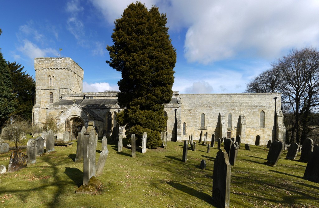
1001:== {{int:filedesc}} == {{Information |description={{en|1=St Andrew's Church, Hartburn When the vestry was repaired of dry rot in 1966, a line of skeletons was found buried just beneath the floor. They were dated between 966 and 1166 AD http://ads.ahds.ac.
428:– You must give appropriate credit, provide a link to the license, and indicate if changes were made. You may do so in any reasonable manner, but not in any way that suggests the licensor endorses you or your use.
57:
53:
47:
102:
70:
145:
St Andrew's Church, Hartburn When the vestry was repaired of dry rot in 1966, a line of skeletons was found buried just beneath the floor. They were dated between 966 and 1166 AD
1068:
879:
692:
1015:
983:
978:
61:
42:
778:
644:
608:
310:
260:
865:
798:
1173:
345:
1126:
This file contains additional information, probably added from the digital camera or scanner used to create or digitize it.
435:
571:
920:
893:
849:
806:
762:
733:
706:
592:
564:
549:
536:
821:
791:
664:
628:
509:
492:
332:
1020:
391:
1129:
If the file has been modified from its original state, some details may not fully reflect the modified file.
434:– If you remix, transform, or build upon the material, you must distribute your contributions under the
352:
on the
Geograph website for the photographer's contact details. The copyright on this image is owned by
994:
388:
886:"}},"text\/plain":{"en":{"P7787":"22 degree"}}}}": -->
699:"}},"text\/plain":{"en":{"P7787":"22 degree"}}}}": -->
146:
110:
205:
828:
813:
556:
189:
1058:
316:
266:
357:
97:
157:
1166:
300:
1138:
1038:
178:
168:
250:
337:
1078:
349:
1148:
1048:
951:
Click on a date/time to view the file as it appeared at that time.
302:
252:
277:
227:
147:
http://ads.ahds.ac.uk/catalogue/search/fr.cfm?rcn=NSMR03-10451
85:
1113:
135:
St Andrew's Church, Hartburn - geograph.org.uk - 1752816.jpg
287:
55° 10′ 06.1″ N, 1° 51′ 36″ W
237:
55° 10′ 05.2″ N, 1° 51′ 36″ W
476:
Add a one-line explanation of what this file represents
1103:
1088:
1098:
129:
109:
Commons is a freely licensed media file repository.
645:
Creative
Commons Attribution-ShareAlike 2.0 Generic
75:(1,024 × 667 pixels, file size: 231 KB, MIME type:
445:https://creativecommons.org/licenses/by-sa/2.0
90:
451:Creative Commons Attribution-Share Alike 2.0
369:
8:
883:
696:
411:– to copy, distribute and transmit the work
1131:
1059:Grade I listed buildings in Northumberland
1016:Grade I listed buildings in Northumberland
953:
472:
1031:The following other wikis use this file:
829:https://www.geograph.org.uk/photo/1752816
557:https://www.geograph.org.uk/profile/32242
1182:
1171:
1161:
1153:
1143:
1013:
907:
891:
863:
847:
776:
760:
720:
704:
678:
662:
642:
626:
606:
590:
523:
507:
490:
487:
468:
461:
280:
230:
309:View this and other nearby images on:
259:View this and other nearby images on:
1133:
1011:The following 2 pages use this file:
7:
356:and is licensed for reuse under the
942:
392:Attribution-Share Alike 2.0 Generic
380:
375:
360:Attribution-ShareAlike 2.0 license.
1124:
1110:Usage on zh-min-nan.wikipedia.org
481:
475:
366:
343:
139:
122:
68:
480:
1187:29eb83305ccd00608de47a2e702d1cff
1155:Date and time of data generation
707:coordinates of the point of view
466:
422:Under the following conditions:
387:This file is licensed under the
379:
374:
368:
336:
315:
301:
293:
265:
251:
243:
89:
31:
21:
463:
140:
14:
1039:Hartburn (kapital sa distrito)
779:file available on the internet
462:
344:This image was taken from the
26:
1:
894:coordinates of depicted place
36:
799:Geograph Britain and Ireland
565:object of statement has role
488:Items portrayed in this file
220:St Andrew's Church, Hartburn
201:St Andrew's Church, Hartburn
1085:Usage on lld.wikipedia.org
1055:Usage on dag.wikipedia.org
1035:Usage on ceb.wikipedia.org
292:
242:
1204:
1095:Usage on www.wikidata.org
1075:Usage on fr.wikipedia.org
1065:Usage on fa.wikipedia.org
1045:Usage on cy.wikipedia.org
909:55°10'6.13"N, 1°51'35.64"W
436:same or compatible license
218:Andrew Curtis /
199:Andrew Curtis /
1079:Hartburn (Northumberland)
943:
16:
1049:Hartburn, Northumberland
1021:Hartburn, Northumberland
807:geograph.org.uk image ID
722:55°10'5.2"N, 1°51'36.0"W
465:
402:
96:This is a file from the
1000:
190:required by the license
174:
163:
156:
153:
132:
100:. Information from its
866:Panasonic Lumix DMC-G1
350:this photograph's page
321:55.168370; -1.859900
271:55.168100; -1.860000
103:description page there
46:Size of this preview:
1069:هارتبرن، نورثآمبرلند
1158:18:05, 14 March 2010
1135:Camera manufacturer
979:00:28, 6 March 2011
417:– to adapt the work
52:Other resolutions:
537:author name string
62:1,024 × 667 pixels
1191:
1190:
1027:Global file usage
1004:
885:
698:
629:copyright license
474:
365:
364:
348:collection. See
326:
325:
276:
275:
225:
224:
193:
118:
117:
98:Wikimedia Commons
32:Global file usage
1195:
1132:
991:
931:
930:
925:
831:
826:
822:described at URL
816:
811:
801:
796:
744:
743:
738:
593:copyright status
574:
569:
559:
554:
544:
541:
458:
455:
452:
449:
446:
438:as the original.
400:
389:Creative Commons
383:
382:
378:
377:
372:
371:
358:Creative Commons
346:Geograph project
340:
333:
322:
319:
305:
304:
298:
297:
296:
290:
289:
278:
272:
269:
255:
254:
248:
247:
246:
240:
239:
228:
187:
159:
144:
136:
130:
114:
93:
92:
86:
80:
78:
65:
58:640 × 417 pixels
54:320 × 208 pixels
48:800 × 521 pixels
1203:
1202:
1198:
1197:
1196:
1194:
1193:
1192:
1184:Unique image ID
1120:
1025:
1005:
997:
989:
945:
944:
941:
940:
939:
938:
937:
936:
935:
934:
933:
932:
928:
926:
923:
914:
913:
912:
910:
900:
899:
898:
896:
877:
876:
875:
874:
873:
872:
871:
870:
868:
856:
855:
854:
852:
841:
840:
839:
838:
837:
836:
835:
834:
833:
832:
827:
824:
818:
817:
812:
809:
803:
802:
797:
794:
785:
784:
783:
781:
769:
768:
767:
765:
754:
753:
752:
751:
750:
749:
748:
747:
746:
745:
741:
739:
736:
727:
726:
725:
723:
713:
712:
711:
709:
690:
689:
688:
687:
686:
685:
684:
683:
681:
671:
670:
669:
667:
656:
655:
654:
653:
652:
651:
650:
649:
647:
635:
634:
633:
631:
620:
619:
618:
617:
616:
615:
614:
613:
611:
599:
598:
597:
595:
584:
583:
582:
581:
580:
579:
578:
577:
576:
575:
570:
567:
561:
560:
555:
552:
546:
545:
542:
539:
530:
529:
528:
526:
516:
515:
514:
512:
501:
500:
499:
498:
497:
495:
479:
478:
477:
460:
459:
456:
453:
450:
447:
444:
443:
401:
398:
395:
384:
361:
331:
320:
294:
285:
284:
281:Object location
270:
244:
235:
234:
231:Camera location
226:
215:
208:
196:
169:geograph.org.uk
149:
134:
127:
120:
119:
108:
107:
106:is shown below.
82:
76:
74:
67:
66:
51:
12:
11:
5:
1201:
1199:
1189:
1188:
1185:
1181:
1180:
1177:
1170:
1169:
1164:
1160:
1159:
1156:
1152:
1151:
1146:
1142:
1141:
1136:
1123:
1119:
1118:
1117:
1116:
1108:
1107:
1106:
1101:
1093:
1092:
1091:
1083:
1082:
1081:
1073:
1072:
1071:
1063:
1062:
1061:
1053:
1052:
1051:
1043:
1042:
1041:
1029:
1028:
1024:
1023:
1018:
1009:
1008:
1003:
1002:
999:
995:
992:
986:
981:
976:
972:
971:
968:
965:
962:
959:
956:
949:
948:
919:
918:
917:
916:
915:
911:
908:
906:
905:
904:
903:
902:
901:
897:
892:
890:
889:
888:
887:
881:
869:
864:
862:
861:
860:
859:
858:
857:
853:
848:
846:
845:
844:
843:
842:
820:
819:
805:
804:
790:
789:
788:
787:
786:
782:
777:
775:
774:
773:
772:
771:
770:
766:
763:source of file
761:
759:
758:
757:
756:
755:
732:
731:
730:
729:
728:
724:
721:
719:
718:
717:
716:
715:
714:
710:
705:
703:
702:
701:
700:
694:
682:
679:
677:
676:
675:
674:
673:
672:
668:
663:
661:
660:
659:
658:
657:
648:
643:
641:
640:
639:
638:
637:
636:
632:
627:
625:
624:
623:
622:
621:
612:
607:
605:
604:
603:
602:
601:
600:
596:
591:
589:
588:
587:
586:
585:
563:
562:
548:
547:
535:
534:
533:
532:
531:
527:
524:
522:
521:
520:
519:
518:
517:
513:
508:
506:
505:
504:
503:
502:
496:
491:
489:
486:
485:
484:
483:
482:
471:
470:
467:
464:
442:
441:
440:
439:
429:
420:
419:
418:
412:
405:You are free:
396:
386:
385:
367:
363:
362:
341:
330:
327:
324:
323:
313:
307:
282:
274:
273:
263:
257:
232:
223:
222:
216:
213:
210:
209:
204:
197:
194:
182:
181:
176:
172:
171:
165:
161:
160:
155:
151:
150:
137:
128:
126:
123:
121:
116:
115:
94:
84:
83:
45:
41:
40:
39:
34:
29:
24:
19:
13:
10:
9:
6:
4:
3:
2:
1200:
1186:
1183:
1178:
1175:
1172:
1168:
1165:
1163:Software used
1162:
1157:
1154:
1150:
1147:
1144:
1140:
1137:
1134:
1130:
1127:
1121:
1115:
1112:
1111:
1109:
1105:
1102:
1100:
1097:
1096:
1094:
1090:
1087:
1086:
1084:
1080:
1077:
1076:
1074:
1070:
1067:
1066:
1064:
1060:
1057:
1056:
1054:
1050:
1047:
1046:
1044:
1040:
1037:
1036:
1034:
1033:
1032:
1026:
1022:
1019:
1017:
1014:
1012:
1006:
998:
993:
987:
985:
982:
980:
977:
974:
973:
969:
966:
963:
960:
957:
955:
954:
952:
946:
922:
895:
867:
851:
850:captured with
830:
823:
815:
808:
800:
793:
780:
764:
735:
708:
680:14 March 2010
666:
646:
630:
610:
594:
573:
566:
558:
551:
543:Andrew Curtis
538:
511:
494:
448:CC BY-SA 2.0
437:
433:
430:
427:
424:
423:
421:
416:
413:
410:
407:
406:
404:
403:
399:Andrew Curtis
397:Attribution:
393:
390:
373:
359:
355:
354:Andrew Curtis
351:
347:
342:
339:
335:
334:
328:
318:
314:
312:
311:OpenStreetMap
308:
306:
288:
283:
279:
268:
264:
262:
261:OpenStreetMap
258:
256:
238:
233:
229:
221:
217:
212:
211:
207:
203: /
202:
198:
191:
186:
184:
183:
180:
179:Andrew Curtis
177:
173:
170:
166:
162:
158:14 March 2010
152:
148:
143:
138:
131:
124:
112:
105:
104:
99:
95:
88:
87:
81:
72:
71:Original file
63:
59:
55:
49:
44:
38:
35:
33:
30:
28:
25:
23:
20:
18:
15:
1145:Camera model
1128:
1125:
1030:
1010:
988:1,024 × 667
950:
947:File history
572:photographer
431:
425:
414:
408:
353:
291:
241:
219:
206:CC BY-SA 2.0
200:
141:
111:You can help
101:
69:
22:File history
996:GeographBot
609:copyrighted
432:share alike
426:attribution
185:Attribution
133:Description
1167:Picasa 3.0
1007:File usage
964:Dimensions
525:some value
77:image/jpeg
27:File usage
1139:Panasonic
1104:Q17527870
961:Thumbnail
958:Date/Time
665:inception
329:Licensing
214:InfoField
195:InfoField
142:English:
1122:Metadata
1114:Hartburn
1099:Q2581975
1089:Hartburn
990:(231 KB)
792:operator
469:Captions
415:to remix
409:to share
394:license.
37:Metadata
1176:version
975:current
970:Comment
921:heading
880:heading
814:1752816
734:heading
693:heading
510:creator
493:depicts
473:English
125:Summary
73:
1149:DMC-G1
929:degree
884:degree
742:degree
697:degree
299:
249:
175:Author
164:Source
167:From
1174:Exif
967:User
457:true
454:true
154:Date
17:File
1179:2.1
927:22
740:22
550:URL
924::
825::
810::
795::
737::
568::
553::
540::
60:|
56:|
50:.
192:)
188:(
113:.
79:)
64:.
Text is available under the Creative Commons Attribution-ShareAlike License. Additional terms may apply.
_heading:22.00&language=en)
_heading:22.00&language=en)
