370:
303:
253:
295:
245:
317:
267:
338:
376:
381:
72:
901:"}},"text\/plain":{"en":{"":"heading"}}},"{\"value\":{\"amount\":\"+22\",\"unit\":\"http:\\\/\\\/www.wikidata.org\\\/entity\\\/Q28390\"},\"type\":\"quantity\"}":{"text\/html":{"en":{"P7787":"22
680:"}},"text\/plain":{"en":{"":"heading"}}},"{\"value\":{\"amount\":\"+22\",\"unit\":\"http:\\\/\\\/www.wikidata.org\\\/entity\\\/Q28390\"},\"type\":\"quantity\"}":{"text\/html":{"en":{"P7787":"22
897:
286:
236:
43:
428:– You must give appropriate credit, provide a link to the license, and indicate if changes were made. You may do so in any reasonable manner, but not in any way that suggests the licensor endorses you or your use.
1020:== {{int:filedesc}} == {{Information |description={{en|1=St Andrew, Chaddleworth Grade 1 listed building erected in the 11th century.}} |date=2002 |source=From |author=[http://www.geograph.org.uk/
1044:
83:
51:
898:
677:
1062:
1039:
763:
663:
627:
508:
310:
260:
884:
783:
345:
1170:
This file contains additional information, probably added from the digital camera or scanner used to create or digitize it.
1002:
997:
435:
42:
562:
939:
912:
868:
791:
747:
718:
691:
611:
583:
570:
555:
834:
806:
776:
647:
528:
492:
332:
391:
1173:
If the file has been modified from its original state, some details may not fully reflect the modified file.
434:– If you remix, transform, or build upon the material, you must distribute your contributions under the
352:
on the
Geograph website for the photographer's contact details. The copyright on this image is owned by
1013:
388:
115:
1072:
905:"}},"text\/plain":{"en":{"P7787":"22 degree"}}}}": -->
684:"}},"text\/plain":{"en":{"P7787":"22 degree"}}}}": -->
91:
205:
110:
813:
798:
590:
189:
316:
266:
357:
78:
1034:
300:
250:
178:
168:
337:
157:
349:
1082:
148:
Church of
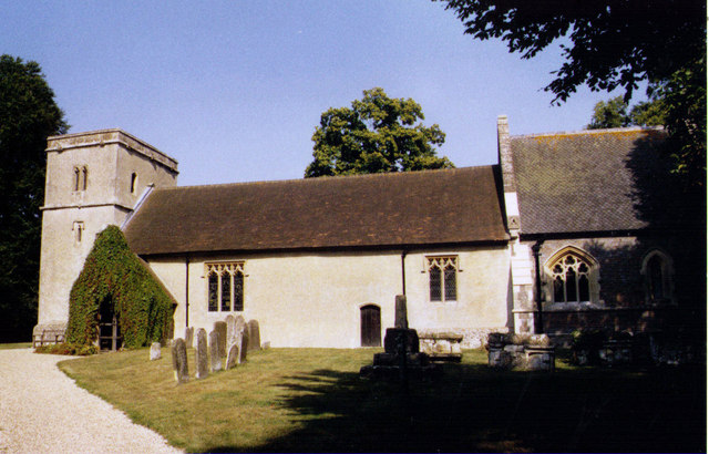
England parish church of St Andrew, Chaddleworth, Berkshire
970:
Click on a date/time to view the file as it appeared at that time.
1157:
302:
252:
277:
227:
66:
1045:
List of church restorations and alterations by G. E. Street
1112:
1132:
1122:
1102:
1092:
287:
51° 29′ 57″ N, 1° 24′ 32″ W
237:
51° 29′ 56″ N, 1° 24′ 32″ W
476:
Add a one-line explanation of what this file represents
138:
St Andrew, Chaddleworth - geograph.org.uk - 1538204.jpg
52:
St_Andrew,_Chaddleworth_-_geograph.org.uk_-_1538204.jpg
1147:
1142:
132:
104:
90:
Commons is a freely licensed media file repository.
664:
Creative
Commons Attribution-ShareAlike 2.0 Generic
56:(640 × 410 pixels, file size: 87 KB, MIME type:
445:https://creativecommons.org/licenses/by-sa/2.0
71:
451:Creative Commons Attribution-Share Alike 2.0
369:
8:
902:
681:
411:– to copy, distribute and transmit the work
1175:
972:
472:
1055:The following other wikis use this file:
814:https://www.geograph.org.uk/photo/1538204
591:https://www.geograph.org.uk/profile/40664
1177:
1032:
926:
910:
882:
866:
848:
832:
761:
745:
705:
689:
661:
645:
625:
609:
542:
526:
506:
490:
487:
468:
461:
280:
230:
309:View this and other nearby images on:
259:View this and other nearby images on:
1040:Grade I listed buildings in Berkshire
1030:The following 3 pages use this file:
7:
356:and is licensed for reuse under the
961:
392:Attribution-Share Alike 2.0 Generic
380:
375:
360:Attribution-ShareAlike 2.0 license.
1168:
1154:Usage on zh-min-nan.wikipedia.org
481:
475:
366:
343:
142:
108:
103:
49:
480:
692:coordinates of the point of view
466:
422:Under the following conditions:
387:This file is licensed under the
379:
374:
368:
336:
315:
301:
293:
265:
251:
243:
70:
31:
21:
463:
143:
46:No higher resolution available.
14:
764:file available on the internet
462:
344:This image was taken from the
26:
1:
913:coordinates of depicted place
36:
784:Geograph Britain and Ireland
556:object of statement has role
488:Items portrayed in this file
1109:Usage on lld.wikipedia.org
1079:Usage on ceb.wikipedia.org
1069:Usage on arz.wikipedia.org
928:51°29'56.87"N, 1°24'31.68"W
707:51°29'56.22"N, 1°24'32.40"W
292:
242:
1199:
1139:Usage on www.wikidata.org
1129:Usage on tr.wikipedia.org
1119:Usage on pl.wikipedia.org
1099:Usage on fr.wikipedia.org
1089:Usage on cy.wikipedia.org
1059:Usage on ar.wikipedia.org
436:same or compatible license
962:
218:Michael FORD /
199:Michael FORD /
16:
792:geograph.org.uk image ID
465:
402:
77:This is a file from the
1083:Chaddleworth (distrito)
1019:
220:St Andrew, Chaddleworth
201:St Andrew, Chaddleworth
190:required by the license
174:
163:
156:
153:
135:
81:. Information from its
350:this photograph's page
321:51.499130; -1.408800
271:51.498950; -1.409000
84:description page there
869:location of creation
1063:تشددلورته (باركشير)
998:07:35, 3 March 2011
509:Church of St Andrew
417:– to adapt the work
109:This is a photo of
571:author name string
1186:
1185:
1051:Global file usage
1023:
904:
683:
648:copyright license
474:
365:
364:
348:collection. See
326:
325:
276:
275:
225:
224:
193:
125:
124:
99:
98:
79:Wikimedia Commons
32:Global file usage
1190:
1176:
1010:
950:
949:
944:
816:
811:
807:described at URL
801:
796:
786:
781:
729:
728:
723:
612:copyright status
593:
588:
578:
575:
565:
560:
458:
455:
452:
449:
446:
438:as the original.
400:
389:Creative Commons
383:
382:
378:
377:
372:
371:
358:Creative Commons
346:Geograph project
340:
333:
322:
319:
305:
304:
298:
297:
296:
290:
289:
278:
272:
269:
255:
254:
248:
247:
246:
240:
239:
228:
187:
159:
147:
139:
133:
118:
105:
95:
74:
73:
67:
61:
59:
1198:
1197:
1193:
1192:
1191:
1189:
1188:
1187:
1164:
1049:
1024:
1016:
1008:
964:
963:
960:
959:
958:
957:
956:
955:
954:
953:
952:
951:
947:
945:
942:
933:
932:
931:
929:
919:
918:
917:
915:
896:
895:
894:
893:
892:
891:
890:
889:
887:
875:
874:
873:
871:
860:
859:
858:
857:
856:
855:
854:
853:
851:
841:
840:
839:
837:
826:
825:
824:
823:
822:
821:
820:
819:
818:
817:
812:
809:
803:
802:
797:
794:
788:
787:
782:
779:
770:
769:
768:
766:
754:
753:
752:
750:
739:
738:
737:
736:
735:
734:
733:
732:
731:
730:
726:
724:
721:
712:
711:
710:
708:
698:
697:
696:
694:
675:
674:
673:
672:
671:
670:
669:
668:
666:
654:
653:
652:
650:
639:
638:
637:
636:
635:
634:
633:
632:
630:
618:
617:
616:
614:
603:
602:
601:
600:
599:
598:
597:
596:
595:
594:
589:
586:
580:
579:
576:
573:
567:
566:
561:
558:
549:
548:
547:
545:
535:
534:
533:
531:
520:
519:
518:
517:
516:
515:
514:
513:
511:
499:
498:
497:
495:
479:
478:
477:
460:
459:
456:
453:
450:
447:
444:
443:
401:
398:
395:
384:
361:
331:
320:
294:
285:
284:
281:Object location
270:
244:
235:
234:
231:Camera location
226:
215:
208:
196:
169:geograph.org.uk
149:
137:
130:
120:
114:
111:listed building
101:
100:
89:
88:
87:is shown below.
63:
57:
55:
48:
47:
12:
11:
5:
1196:
1194:
1184:
1183:
1180:
1167:
1163:
1162:
1161:
1160:
1152:
1151:
1150:
1145:
1137:
1136:
1135:
1127:
1126:
1125:
1117:
1116:
1115:
1107:
1106:
1105:
1097:
1096:
1095:
1087:
1086:
1085:
1077:
1076:
1075:
1067:
1066:
1065:
1053:
1052:
1048:
1047:
1042:
1037:
1028:
1027:
1022:
1021:
1018:
1014:
1011:
1005:
1000:
995:
991:
990:
987:
984:
981:
978:
975:
968:
967:
938:
937:
936:
935:
934:
930:
927:
925:
924:
923:
922:
921:
920:
916:
911:
909:
908:
907:
906:
900:
888:
885:West Berkshire
883:
881:
880:
879:
878:
877:
876:
872:
867:
865:
864:
863:
862:
861:
852:
849:
847:
846:
845:
844:
843:
842:
838:
833:
831:
830:
829:
828:
827:
805:
804:
790:
789:
775:
774:
773:
772:
771:
767:
762:
760:
759:
758:
757:
756:
755:
751:
748:source of file
746:
744:
743:
742:
741:
740:
717:
716:
715:
714:
713:
709:
706:
704:
703:
702:
701:
700:
699:
695:
690:
688:
687:
686:
685:
679:
667:
662:
660:
659:
658:
657:
656:
655:
651:
646:
644:
643:
642:
641:
640:
631:
626:
624:
623:
622:
621:
620:
619:
615:
610:
608:
607:
606:
605:
604:
582:
581:
569:
568:
554:
553:
552:
551:
550:
546:
543:
541:
540:
539:
538:
537:
536:
532:
527:
525:
524:
523:
522:
521:
512:
507:
505:
504:
503:
502:
501:
500:
496:
491:
489:
486:
485:
484:
483:
482:
471:
470:
467:
464:
442:
441:
440:
439:
429:
420:
419:
418:
412:
405:You are free:
396:
386:
385:
367:
363:
362:
341:
330:
327:
324:
323:
313:
307:
282:
274:
273:
263:
257:
232:
223:
222:
216:
213:
210:
209:
204:
197:
194:
182:
181:
176:
172:
171:
165:
161:
160:
155:
151:
150:
140:
131:
129:
126:
123:
122:
102:
97:
96:
75:
65:
64:
45:
41:
40:
39:
34:
29:
24:
19:
13:
10:
9:
6:
4:
3:
2:
1195:
1181:
1178:
1174:
1171:
1165:
1159:
1156:
1155:
1153:
1149:
1146:
1144:
1141:
1140:
1138:
1134:
1131:
1130:
1128:
1124:
1121:
1120:
1118:
1114:
1111:
1110:
1108:
1104:
1101:
1100:
1098:
1094:
1091:
1090:
1088:
1084:
1081:
1080:
1078:
1074:
1071:
1070:
1068:
1064:
1061:
1060:
1058:
1057:
1056:
1050:
1046:
1043:
1041:
1038:
1036:
1033:
1031:
1025:
1017:
1012:
1006:
1004:
1001:
999:
996:
993:
992:
988:
985:
982:
979:
976:
974:
973:
971:
965:
941:
914:
886:
870:
836:
815:
808:
800:
793:
785:
778:
765:
749:
720:
693:
665:
649:
629:
613:
592:
585:
572:
564:
557:
530:
510:
494:
448:CC BY-SA 2.0
437:
433:
430:
427:
424:
423:
421:
416:
413:
410:
407:
406:
404:
403:
397:Attribution:
393:
390:
373:
359:
355:
351:
347:
342:
339:
335:
334:
328:
318:
314:
312:
311:OpenStreetMap
308:
306:
288:
283:
279:
268:
264:
262:
261:OpenStreetMap
258:
256:
238:
233:
229:
221:
217:
212:
211:
207:
203: /
202:
198:
191:
186:
184:
183:
180:
177:
173:
170:
166:
162:
152:
146:
141:
134:
127:
121:
117:
112:
107:
106:
93:
86:
85:
80:
76:
69:
68:
62:
53:
44:
38:
35:
33:
30:
28:
25:
23:
20:
18:
15:
1172:
1169:
1158:Chaddleworth
1133:Chaddleworth
1123:Chaddleworth
1113:Chaddleworth
1103:Chaddleworth
1093:Chaddleworth
1054:
1035:Chaddleworth
1029:
969:
966:File history
577:Michael FORD
563:photographer
431:
425:
414:
408:
399:Michael FORD
354:Michael FORD
353:
291:
241:
219:
206:CC BY-SA 2.0
200:
179:Michael FORD
144:
92:You can help
82:
50:
22:File history
1015:GeographBot
628:copyrighted
432:share alike
426:attribution
185:Attribution
136:Description
1179:_error
1026:File usage
1007:640 × 410
983:Dimensions
544:some value
58:image/jpeg
27:File usage
1148:Q17528621
1073:تشددلورته
980:Thumbnail
977:Date/Time
835:inception
329:Licensing
214:InfoField
195:InfoField
145:English:
1166:Metadata
1143:Q3061250
777:operator
469:Captions
415:to remix
409:to share
394:license.
37:Metadata
1009:(87 KB)
994:current
989:Comment
940:heading
899:heading
799:1538204
719:heading
678:heading
529:creator
493:depicts
473:English
128:Summary
116:1210713
113:number
54:
948:degree
903:degree
727:degree
682:degree
299:
249:
175:Author
164:Source
167:From
986:User
850:2002
457:true
454:true
158:2002
154:Date
17:File
946:22
725:22
584:URL
943::
810::
795::
780::
722::
587::
574::
559::
1182:0
192:)
188:(
119:.
94:.
60:)
Text is available under the Creative Commons Attribution-ShareAlike License. Additional terms may apply.
_heading:22.00&language=en)
_heading:22.00&language=en)
