366:
299:
249:
291:
241:
313:
263:
334:
372:
377:
72:
842:"}},"text\/plain":{"en":{"":"heading"}}},"{\"value\":{\"amount\":\"+22\",\"unit\":\"http:\\\/\\\/www.wikidata.org\\\/entity\\\/Q28390\"},\"type\":\"quantity\"}":{"text\/html":{"en":{"P7787":"22
778:"}},"text\/plain":{"en":{"":"heading"}}},"{\"value\":{\"amount\":\"+22\",\"unit\":\"http:\\\/\\\/www.wikidata.org\\\/entity\\\/Q28390\"},\"type\":\"quantity\"}":{"text\/html":{"en":{"P7787":"22
774:
282:
232:
43:
424:– You must give appropriate credit, provide a link to the license, and indicate if changes were made. You may do so in any reasonable manner, but not in any way that suggests the licensor endorses you or your use.
83:
51:
839:
775:
169:
676:
640:
604:
306:
256:
726:
341:
1114:
This file contains additional information, probably added from the digital camera or scanner used to create or digitize it.
431:
988:
539:
909:
880:
853:
816:
789:
704:
660:
588:
560:
547:
532:
977:
972:
747:
719:
689:
624:
505:
488:
42:
328:
387:
1117:
If the file has been modified from its original state, some details may not fully reflect the modified file.
430:– If you remix, transform, or build upon the material, you must distribute your contributions under the
348:
on the
Geograph website for the photographer's contact details. The copyright on this image is owned by
384:
846:"}},"text\/plain":{"en":{"P7787":"22 degree"}}}}": -->
782:"}},"text\/plain":{"en":{"P7787":"22 degree"}}}}": -->
91:
201:
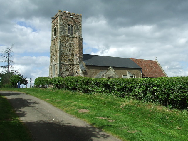
995:== Summary == {{Information |Description=St Botolph's Church |Source=From ; transferd by
711:
696:
567:
185:
1051:
312:
262:
353:
78:
996:
246:
128:
1013:
296:
158:
143:
139:
333:
345:
945:
Click on a date/time to view the file as it appeared at that time.
298:
248:
233:
52° 40′ 11.58″ N, 0° 26′ 35.48″ E
147:
273:
223:
66:
283:
52° 40′ 13″ N, 0° 26′ 37″ E
1071:
1031:
1091:
1081:
1061:
1041:
472:
Add a one-line explanation of what this file represents
52:
St_Botolph's_Church_-_geograph.org.uk_-_806348.jpg
1101:
176:
Creative
Commons Attribution Share-alike license 2.0
110:
90:
Commons is a freely licensed media file repository.
641:
Creative
Commons Attribution-ShareAlike 2.0 Generic
116:St Botolph's Church - geograph.org.uk - 806348.jpg
56:(640 × 480 pixels, file size: 84 KB, MIME type:
441:https://creativecommons.org/licenses/by-sa/2.0
71:
447:Creative Commons Attribution-Share Alike 2.0
365:
8:
843:
779:
407:– to copy, distribute and transmit the work
1119:
947:
468:
1024:The following other wikis use this file:
697:https://www.geograph.org.uk/photo/806348
568:https://www.geograph.org.uk/profile/6337
1121:
1011:
923:
907:
867:
851:
803:
787:
761:
745:
674:
658:
638:
622:
602:
586:
519:
503:
486:
483:
464:
457:
276:
226:
305:View this and other nearby images on:
255:View this and other nearby images on:
7:
352:and is licensed for reuse under the
1009:The following page uses this file:
936:
388:Attribution-Share Alike 2.0 Generic
376:
371:
356:Attribution-ShareAlike 2.0 license.
1112:
477:
471:
362:
339:
103:
49:
476:
790:coordinates of the point of view
462:
418:Under the following conditions:
383:This file is licensed under the
375:
370:
364:
332:
311:
297:
289:
261:
247:
239:
70:
31:
21:
990:File Upload Bot (Magnus Manske)
459:
46:No higher resolution available.
14:
677:file available on the internet
458:
340:This image was taken from the
26:
1:
854:coordinates of depicted place
805:52°40'11.575"N, 0°26'35.484"E
36:
727:Geograph Britain and Ireland
533:object of statement has role
484:Items portrayed in this file
1068:Usage on lld.wikipedia.org
1028:Usage on ceb.wikipedia.org
869:52°40'13.33"N, 0°26'37.32"E
288:
238:
1143:
1098:Usage on www.wikidata.org
1088:Usage on pl.wikipedia.org
1078:Usage on nl.wikipedia.org
1058:Usage on fr.wikipedia.org
1048:Usage on fa.wikipedia.org
1038:Usage on cy.wikipedia.org
432:same or compatible license
937:
16:
705:geograph.org.uk image ID
461:
398:
214:Keith Evans /
195:Keith Evans /
77:This is a file from the
994:
186:required by the license
164:
154:
134:
127:
124:
113:
81:. Information from its
973:20:57, 25 October 2009
346:this photograph's page
317:52.670370; 0.443700
267:52.669882; 0.443190
84:description page there
148:geograph_org2commons
413:– to adapt the work
216:St Botolph's Church
197:St Botolph's Church
120:St Botolph's Church
548:author name string
1130:
1129:
1020:Global file usage
1002:
845:
781:
625:copyright license
470:
361:
360:
344:collection. See
322:
321:
272:
271:
221:
220:
189:
173:
170:Reusing this file
142:; transferred by
99:
98:
79:Wikimedia Commons
32:Global file usage
1134:
1120:
985:
891:
890:
885:
827:
826:
821:
729:
724:
714:
709:
699:
694:
690:described at URL
589:copyright status
570:
565:
555:
552:
542:
537:
454:
451:
448:
445:
442:
434:as the original.
396:
385:Creative Commons
379:
378:
374:
373:
368:
367:
354:Creative Commons
342:Geograph project
336:
329:
318:
315:
301:
300:
294:
293:
292:
286:
285:
274:
268:
265:
251:
250:
244:
243:
242:
236:
235:
224:
183:
167:
130:
117:
111:
95:
74:
73:
67:
61:
59:
1142:
1141:
1137:
1136:
1135:
1133:
1132:
1131:
1108:
1018:
1003:
991:
983:
939:
938:
935:
934:
933:
932:
931:
930:
929:
928:
926:
916:
915:
914:
912:
901:
900:
899:
898:
897:
896:
895:
894:
893:
892:
888:
886:
883:
874:
873:
872:
870:
860:
859:
858:
856:
837:
836:
835:
834:
833:
832:
831:
830:
829:
828:
824:
822:
819:
810:
809:
808:
806:
796:
795:
794:
792:
773:
772:
771:
770:
769:
768:
767:
766:
764:
754:
753:
752:
750:
739:
738:
737:
736:
735:
734:
733:
732:
731:
730:
725:
722:
716:
715:
710:
707:
701:
700:
695:
692:
683:
682:
681:
679:
667:
666:
665:
663:
652:
651:
650:
649:
648:
647:
646:
645:
643:
631:
630:
629:
627:
616:
615:
614:
613:
612:
611:
610:
609:
607:
595:
594:
593:
591:
580:
579:
578:
577:
576:
575:
574:
573:
572:
571:
566:
563:
557:
556:
553:
550:
544:
543:
538:
535:
526:
525:
524:
522:
512:
511:
510:
508:
497:
496:
495:
494:
493:
491:
475:
474:
473:
456:
455:
452:
449:
446:
443:
440:
439:
397:
394:
391:
380:
357:
327:
316:
290:
281:
280:
277:Object location
266:
240:
231:
230:
227:Camera location
222:
211:
204:
192:
140:geograph.org.uk
115:
108:
101:
100:
89:
88:
87:is shown below.
63:
57:
55:
48:
47:
12:
11:
5:
1140:
1138:
1128:
1127:
1124:
1111:
1107:
1106:
1105:
1104:
1096:
1095:
1094:
1086:
1085:
1084:
1076:
1075:
1074:
1066:
1065:
1064:
1056:
1055:
1054:
1046:
1045:
1044:
1036:
1035:
1034:
1022:
1021:
1017:
1016:
1007:
1006:
1001:
1000:
993:
989:
986:
980:
975:
970:
966:
965:
962:
959:
956:
953:
950:
943:
942:
927:
924:
922:
921:
920:
919:
918:
917:
913:
908:
906:
905:
904:
903:
902:
879:
878:
877:
876:
875:
871:
868:
866:
865:
864:
863:
862:
861:
857:
852:
850:
849:
848:
847:
841:
815:
814:
813:
812:
811:
807:
804:
802:
801:
800:
799:
798:
797:
793:
788:
786:
785:
784:
783:
777:
765:
762:
760:
759:
758:
757:
756:
755:
751:
746:
744:
743:
742:
741:
740:
718:
717:
703:
702:
688:
687:
686:
685:
684:
680:
675:
673:
672:
671:
670:
669:
668:
664:
661:source of file
659:
657:
656:
655:
654:
653:
644:
639:
637:
636:
635:
634:
633:
632:
628:
623:
621:
620:
619:
618:
617:
608:
603:
601:
600:
599:
598:
597:
596:
592:
587:
585:
584:
583:
582:
581:
559:
558:
546:
545:
531:
530:
529:
528:
527:
523:
520:
518:
517:
516:
515:
514:
513:
509:
504:
502:
501:
500:
499:
498:
492:
487:
485:
482:
481:
480:
479:
478:
467:
466:
463:
460:
438:
437:
436:
435:
425:
416:
415:
414:
408:
401:You are free:
392:
382:
381:
363:
359:
358:
337:
326:
323:
320:
319:
309:
303:
278:
270:
269:
259:
253:
228:
219:
218:
212:
209:
206:
205:
200:
193:
190:
178:
177:
174:
162:
161:
156:
152:
151:
136:
132:
131:
126:
122:
121:
118:
109:
107:
104:
102:
97:
96:
75:
65:
64:
45:
41:
40:
39:
34:
29:
24:
19:
13:
10:
9:
6:
4:
3:
2:
1139:
1125:
1122:
1118:
1115:
1109:
1103:
1100:
1099:
1097:
1093:
1090:
1089:
1087:
1083:
1080:
1079:
1077:
1073:
1070:
1069:
1067:
1063:
1060:
1059:
1057:
1053:
1050:
1049:
1047:
1043:
1040:
1039:
1037:
1033:
1030:
1029:
1027:
1026:
1025:
1019:
1015:
1012:
1010:
1004:
998:
992:
987:
981:
979:
976:
974:
971:
968:
967:
963:
960:
957:
954:
951:
949:
948:
946:
940:
911:
882:
855:
818:
791:
749:
728:
721:
713:
706:
698:
691:
678:
662:
642:
626:
606:
590:
569:
562:
549:
541:
534:
507:
490:
444:CC BY-SA 2.0
433:
429:
426:
423:
420:
419:
417:
412:
409:
406:
403:
402:
400:
399:
393:Attribution:
389:
386:
369:
355:
351:
347:
343:
338:
335:
331:
330:
324:
314:
310:
308:
307:OpenStreetMap
304:
302:
284:
279:
275:
264:
260:
258:
257:OpenStreetMap
254:
252:
234:
229:
225:
217:
213:
208:
207:
203:
199: /
198:
194:
187:
182:
180:
179:
175:
171:
166:
163:
160:
157:
153:
149:
145:
141:
137:
133:
123:
119:
112:
105:
93:
86:
85:
80:
76:
69:
68:
62:
53:
44:
38:
35:
33:
30:
28:
25:
23:
20:
18:
15:
1116:
1113:
1023:
1008:
944:
941:File history
540:photographer
427:
421:
410:
404:
349:
287:
237:
215:
202:CC BY-SA 2.0
196:
92:You can help
82:
50:
22:File history
999:using . |Da
997:User:oxyman
763:18 May 2008
605:copyrighted
554:Keith Evans
428:share alike
422:attribution
395:Keith Evans
350:Keith Evans
181:Attribution
159:Keith Evans
144:User:oxyman
129:18 May 2008
114:Description
1123:_error
1092:Tottenhill
1082:Tottenhill
1072:Tottenhill
1062:Tottenhill
1042:Tottenhill
1032:Tottenhill
1014:Tottenhill
1005:File usage
982:640 × 480
958:Dimensions
925:image/jpeg
910:media type
521:some value
165:Permission
58:image/jpeg
27:File usage
955:Thumbnail
952:Date/Time
748:inception
325:Licensing
210:InfoField
191:InfoField
1110:Metadata
1102:Q2463894
720:operator
465:Captions
411:to remix
405:to share
390:license.
37:Metadata
1052:تاتنهیل
984:(84 KB)
969:current
964:Comment
881:heading
840:heading
817:heading
776:heading
506:creator
489:depicts
469:English
106:Summary
54:
889:degree
844:degree
825:degree
780:degree
712:806348
295:
245:
155:Author
146:using
135:Source
138:From
961:User
453:true
450:true
125:Date
17:File
887:22
823:22
561:URL
884::
820::
723::
708::
693::
564::
551::
536::
1126:0
188:)
184:(
172:)
168:(
150:.
94:.
60:)
Text is available under the Creative Commons Attribution-ShareAlike License. Additional terms may apply.
_region:GB-GBN_heading:22.00&language=en)
